Deception Island

img_0995_1

64d 41m 02.1s S, 62d 37m 40.1s W (WP175)
62d 58m 44.4s S, 60d 33m 27.1s W (WP180)

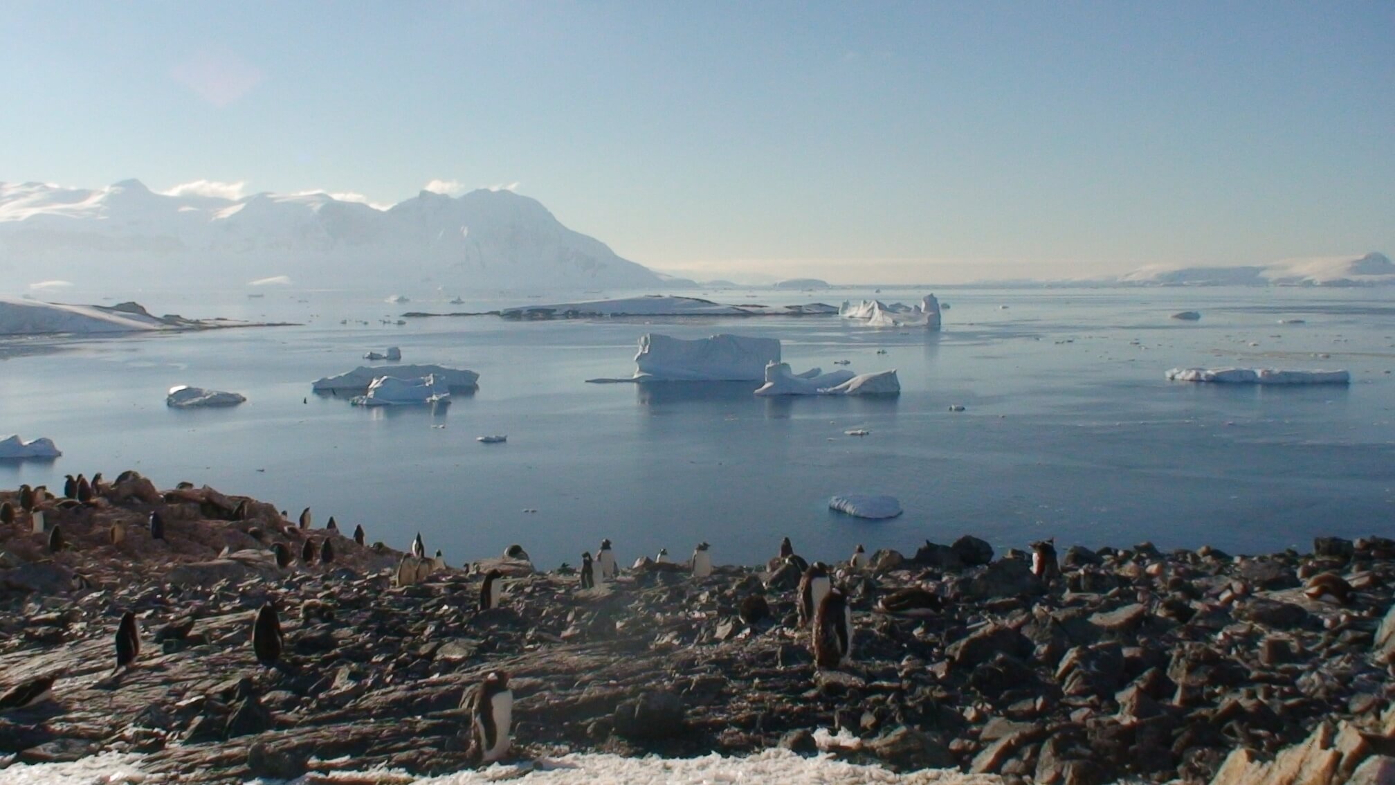
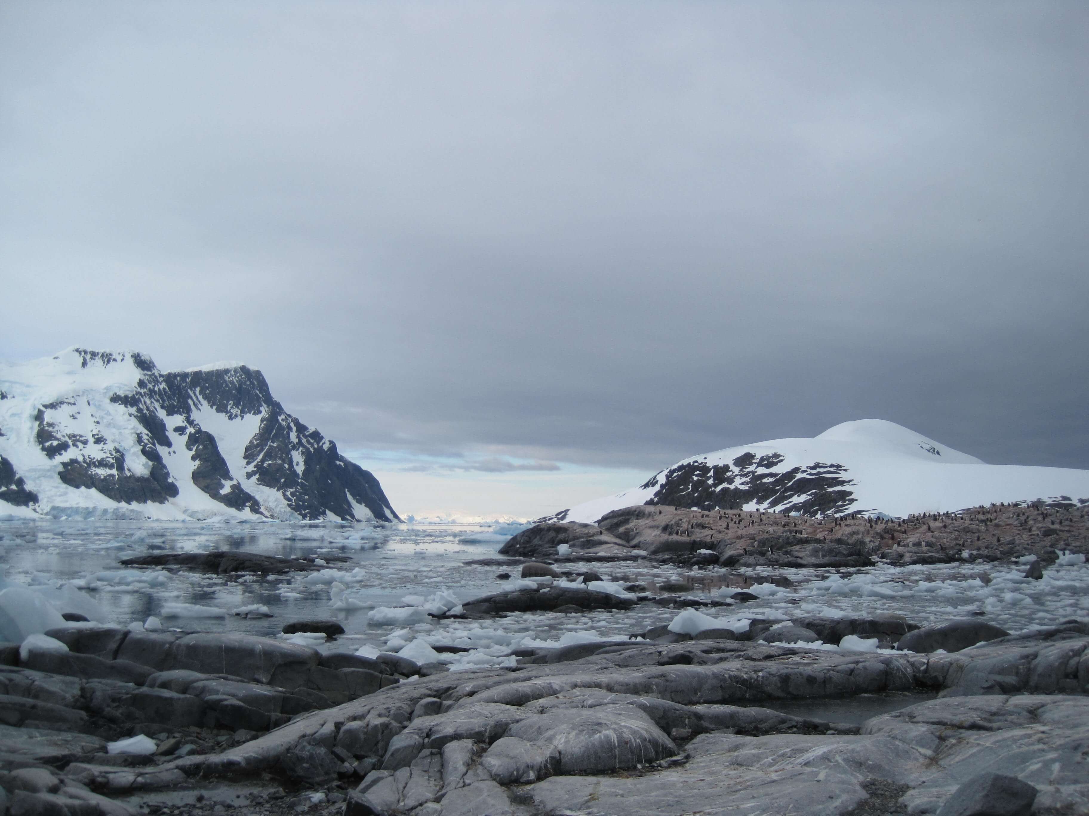
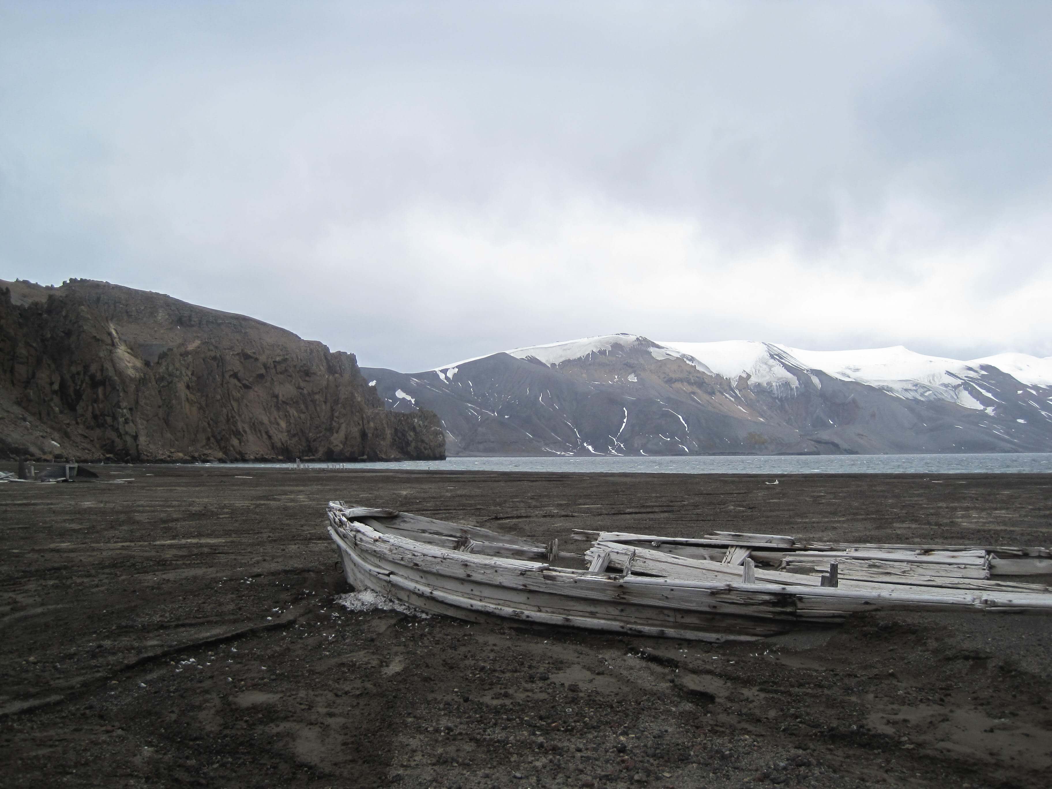
After three days of blue skies and bright sunlight, we finally experienced the grey and windy side of Antarctica (or technically, we were back in the south Shetland Islands). The weather changed which prevented us from doing some excursions to Hanna Pt on Livingston Island or Bailey Head on Deception Island, so we had to contend ourselves with visiting Telefon Bay and Whaler’s Bay in Deception Island.

It was snowing and windy, but the volcanic island (still active, the last eruption was in the 1990s) provided a change of scenery, being less ice-locked than most of the recent islands. Here, the red-brown-black volcanic rocks were more reminiscent of Mauna Kea (Hawaii) and Isabela Islands (Galapagos).

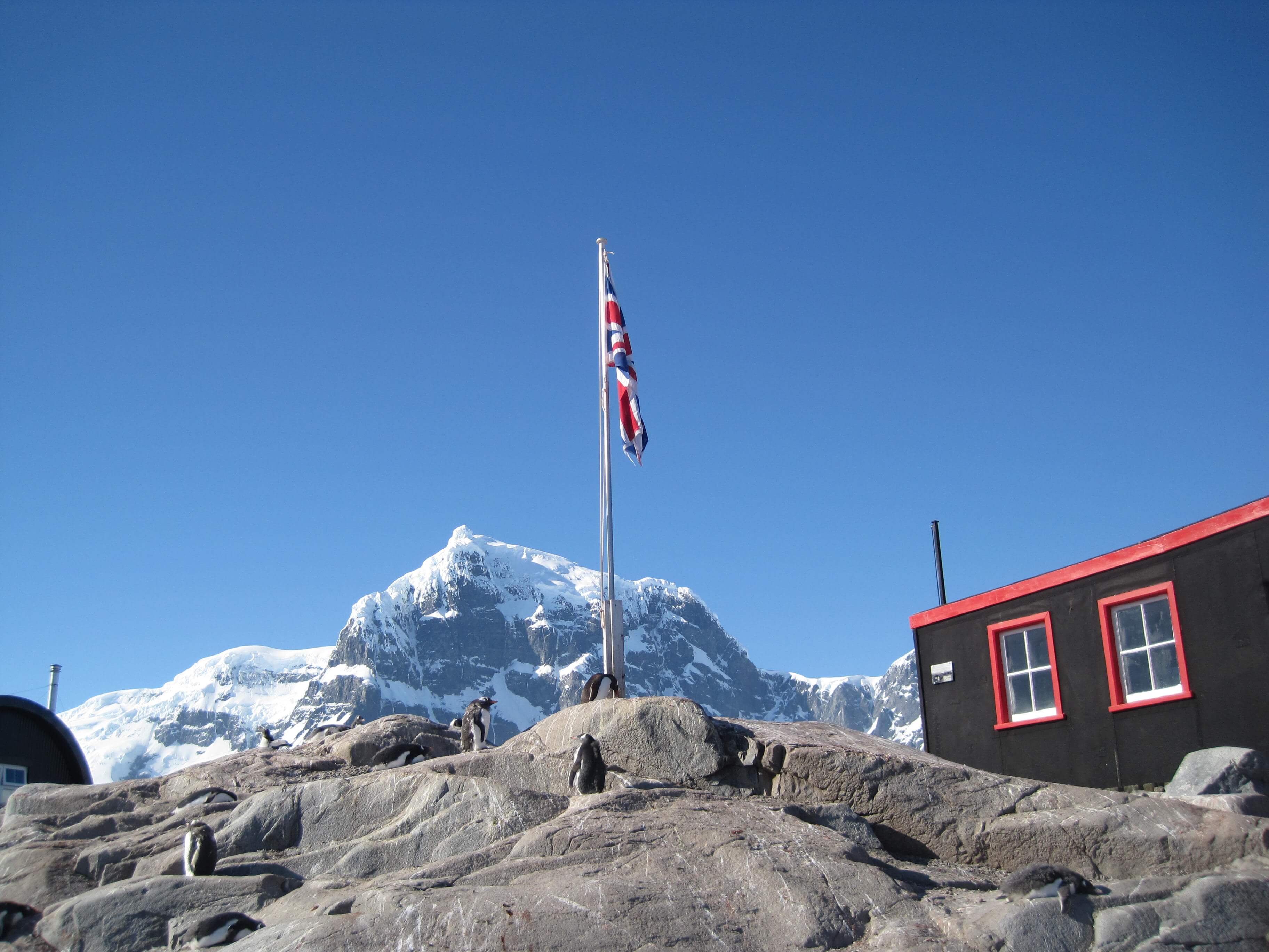
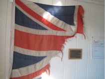
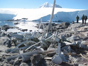
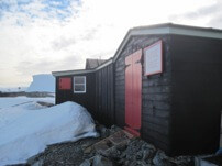
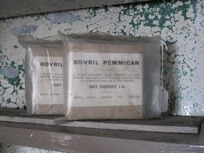
The remains of the old Norwegian & British Whaling station were fascinating to walk around. They are not being actively preserved, but are protected and allowed to decay per the elements. It was hard to imagine how hard life was for those whalers, living and working in a harsh climate, surrounded by decaying whale flesh, as the whales were processed for their blubber, oil and bones to bring back to the old world. Now the island has reverted back to being a desolate, bleak, place of natural beauty.

Cuverville Island

dsc03564_1

64d 41m 02.1s S, 62d 37m 40.1s W (WP168)

Peacefully situated in a bay off the Gerlache Strait & Errera Channel along the Danco Coast of the Antarctic Peninsula, we visited Cuverville Island. Gentoo penguins abound, and the bay was rich with several amazing and gigantic icebergs. We climbed to the top of the island  (mere 816 ft elevation) to take in the views.

Port Lockroy & Jougla Pt

img_0949_1

64d 49m 30.8s S, 63d 29m 43.1s W (WP162)

After our visit to Vernadsky, Argentine Islands (Wordie Hut), we were now essentially heading home, going north. Today we visited Port Lockroy, site of a former Whaling Station,  and UK’s Base A (during WWII) as part of Operation Tabarin and later the Falkland Islands Dependencies Survey, now a visitor center and historic site. Base A had been closed in 1961-1962. Again, like Wordie Hut, the main buildings (Bransfield House) have been restored and preserved with their original contents in tact or substituted with like-era items (for example, their radio experimentation for ionospheric studies, the Beastie, is not the actual one that was in use at Port Lockroy, but one of the same model and make.).

 It was a marvellous step back through time and a reminder of the roles humans have played and continue to play in this remote wilderness.

Samples from the inside of Port Lockroy, Base A

Jougla Pt, around the corner, we observed lots of Gentoo penguin chicks learning to swim, and observed at close range, nesting blue-eye shags. The beach was littered with a large collection of whale bones, large jaw bones, vertebrae and rib bones, all reminders of the whaling history of this region.

img_0950

A Gentoo penguin perched among the bones of a fine whale, Jougla Pt.

Vernadsky Base & Kimberly’s Furthest South

img_0859_1

65d 14m 46.8s S, 64d 15m 27.1s W (WP146)
65d 15m 04.2s S, 64d 15m 17.2s W (WP150)

Today would mark the furthest south for me on our voyage as we visited the active Ukrainian research base Vernadsky, active since 1996 when the Ukrainians had bought the station from the British. Vernadsky is the former Faraday station for British Antarctic Science. The Brits have since opened and continue to maintain two other permanent research stations on the Peninsular, Halley at 75deg S on the Weddell Sea coast and Rothera at 67deg S on Adelaide Island.

We learned Vernadsky is the home to 11 scientists & staff, 3 of which over-winter. Areas of research focus include meteorology, upper atmosphere studies, geophysics (Vernadsky has inherited over 70 years of magnetism research log, and has maintained and upgraded the magnetic observatory and continues to add to this unique science, resulting in one of the longest and the most continuous scientific datasets from the Antarctic), biology (studying seals and fish particularly during the winter) and glaciology (measuring the local ice cap movements). No astronomy, as the weather is pretty unpredictable and clear night skies are rare.

As this was a former British research station, we had the fortunate luck to be able to visit the inside of Wordie Hut (Argentine Islands), home to British researchers from 1947-1954 before Faraday was built. It has been preserved by the British Antarctic Trust and still contains canned goods, equipment and supplies just as they were left in the 1940s & 1950s.

img_0896_r


Pleneau Island

img_0832_1

65d 06m 09.1s S, 64d 02m 39.6s W (WP139)

We continued south to explore the Danco Coast part of the western edge of the Antarctic Peninsula, cruising through the picturesque narrow Lemaire Channel until we go to Pleneau Island and its calm bays where a “iceberg museum of sorts” could be found. Here was a large collection of “beached” icebergs, for which the elements of wind, water, freeze & melt took control creating a variety of unique shapes.

Among these amazing icebergs, we were treated to a rare sighting of over 200 crab-eater seals swimming together in formation. It was certainly a sight to see and reminded me what these waters might have been like hundreds of years ago before humans came to hunt the mighty whales. I took a lot of video to capture the fluid motion of these animals. For now, here are two snapshots.

dsc03466

dsc03460

We also were courted by a leopard seal, the king of these oceans, well fed due to the local Gentoo penguin rookery nearby.
 dsc03446
Pleneau Island itself was an interesting collection of large granite slabs, very different than any of the previous islands we had moored upon. It also spotted a nice areal coverage of pink algae that added to the many colours of the landscape.