Go West, Young Man, Woman and Prius!

July 27, 2017 Day 1
Boulder, Colorado to Hanksville, Utah (413 miles)

We really enjoyed our six years in Boulder, CO and made many friends there, so when moving day finally came, it was emotionally charged. Even on the day we were to set off on our road journey all our lovely neighbors kept stopping us to stay goodbye for the third and fourth time. As we drove away with a sad heart, and absorbing all the beauty of Boulder County, wondering if we can indeed return here to live some day, we just had to get on with our journey.

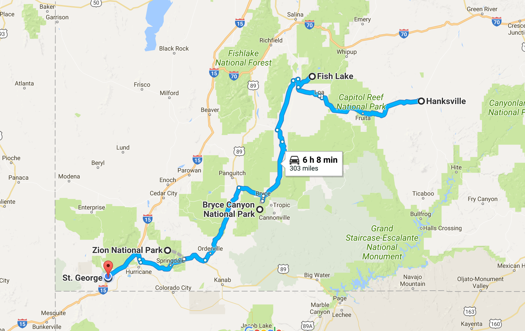
We had done this CO to CA drive three times now, two east and one west, and each of those times we choose the “northern route” via Salt Lake City, Utah. We learned the day before that our household belongings would not arrive on this weekend, but actually a week later, so we could actually try the “southern route” which would add another day unless we drove a lot more than 300 miles per day. So our destination was getting near Fish Lake, Utah on the first day. We made good time and took a chance to find accommodation in small Hanksville, Utah after passing a larger town Green Rivers, Utah.

July 28, 2017 Day 2
Hanskville to St George,Utah via Pando, Bryce and Zion (339 miles)

Pando, Latin, for “I Spread” is a single colony of quaking aspen trees located near Fish Lake, Utah. When we approached it felt as if we did not leave Colorado, and geologically speaking, we had been still on the Colorado Plateau. Seeing the hills dotted with aspen trees was just lovely. At this time of year they were a nice dark green. I can only imagine the colors of orange and yellow in the autumn and perhaps those quiet roads of north Utah would be packed with seasonal color hunters, like what happens to the Peak to Peak Highway in Colorado.

Route taken July 28, 2017

Pando is claimed to be the single largest oldest organism with identical genetics on earth. Whether it is as old as 80,000 years or at least since the last ice age 10,000 years ago, which wiped out a lot of many species, Pando was a delightful site to find.

Quaking Aspen near  Fish Lake, Utah

Getting there involved a wonderful drive through picturesque Capitol Reef National Park. We stopped a bit to admire wonderful petroglyphs (stone carved images) from the Puebloan ancestors.

Pictographs, Capitol Reef National Park

After Fish Lake, we looked at our progress and saw we had enough time to do a quick trip to see Bryce Canyon National Park. Robert had never been. I had visited it once back in 1998, which when I recalled that, I was humbled to realize that was nearly 20 years ago. Now with the height of the summer season and shuttle busses (which had not been part of the landscape 20 years ago), we did not know whether we could drive in at our own pace. We found we could and only manages less than 2 hours to see this natural beauty. Perhaps our shortest ever trip to a National Park. In any event, we knew we need to come back properly to do some of the lovely trails, perhaps best in winter where we can snowshoe the rim!

Beautiful Bryce vistas!

Our evening destination was St George near the southernmost tip of Utah, and we got a lovely ride through Zion National Park, although with daylight fading, we did not have enough time to take the shuttle to see the majority of the park, leaving that for another visit.

One highlight for me was driving through the narrow 1.1 mile Zion-Mount Carmel Tunnel, an impressive work of 1920 engineering. Of course the breathtaking scenery of the narrow roads winding through the canyon was amazing. I was driving so I only have the images in my mind.

Zion Arch after the Tunnel

July 29, 2017 Day 3
St George, Utah to Mammoth Lakes, CA via four states (432 miles)

We started our journey in Utah, then a bit into Arizona, followed by a Las Vega fly-by in Nevada, across the desolate Nevada high dessert (with army vehicles for colorful attention and what would appear to be abandoned air force bases and we learned later, nuclear test sites), and ended in Mammoth Lakes, California, 8000 feet, near the beautiful Yosemite National Park.

Route July 29, 2017

Beatty (pronounced BAY-dee), Utah was a quaint little town that broke our long journey north through Nevada after turning at Las Vegas. At 70 mph, it was less than a 2 hour drive from Nevada. We stopped at Mel’s Diner which was adorned with photos from the 1920s and 1940s illustrating its place in breaking the journey for passengers of old going to and from Las Vegas. Yet perhaps back then such a journey would have taken 5 or more hours and a restful break was indeed much warranted.


Mel’s Diner in Beatty, Utah

July 30, 2017 Day 4
Home James and Don’t Spare the Horses (300 miles)

Returning to our townhouse we moved away from over six years ago was the objective of the day. We had the choice of going over Tioga Pass and through Yosemite National Park, which we had done previously, or a different route, which according to Google, although more in mileage would actually be less time. We were intrigued. So waving goodby to Tioga, we drove past Mono Lake and experienced the Sonora Pass, the 2nd highest highway pass in the Sierra Nevada,.

Route July 30, 2017

The drive over Sonora was long and windy and very steep going east. Certainly kept my rally driving skills up to date. It would drop us in the central valley where along Highway 108 we could espy the nut and fruit trees, with what appears to be a lot of newly planted orchards.

We headed onto Highway 580 and noticed the Altamont Pass Wind Farm Ahad been upgraded to newer windmills, now adjacent to the forever dead-looking 1st generation wind farm.

Then we criss-crosse through Livermore proper and headed home along the picturesque backroads of Fremont and Union City onto the Dumbarton Bridge (which had a toll the took us by surprise) across the south bay onto the well worn Highway 101.

Then Mountain View came into view.

We arrived home. Our belongings we hope will arrive on the weekend. Many things have changed here in the bustling Silicon Valley, and yet, our townhouse smells and feels the same as we left it those many years ago.

The adventure continues….

Don’t Blink!

July 11, 2017

Well, that was a fascinating flight, and very different “feel” to it compared to the infrared astronomy SOFIA flights I have been on these past two weeks. First of all, we took off in the day time, and spend a good fraction of our time with the telescope door closed. Usually our flying observatory takes off at sunset to maximize our time in the dark skies. On Jul 10th we had a much different objective.

We were going to hunt the shadow of a Kuiper Belt Object 2014MU69 passing in front of a 15th magnitude star. It’s projected shadow path on Earth would be quite north of New Zealand and we needed a lot time to get there for the event, with enough fuel to return to Christchurch.

First we needed to get off the ground, and that had been riddled with weather gremlins. There was a forecast of extremely turbulent weather on our north outbound route that we could not fly around nor fly through. We had the possibility of flying under it, but the diversion would take up more fuel than per the nominal plan and there was a risk we might not have enough to get back home. The pilots were able to secure a reading from another pilot in the region who reported the turbulence reality was not that severe. This means we were good to go! However, this info gathering caused a delay of 15 minutes, which the flight plan could tolerate, yet those 15 minutes ate into the book-kept 30 minute margin. We were now to fly with a 15 minute adjustment to hit a point in time and space within 1 second. We were ready!

IMG_5691 
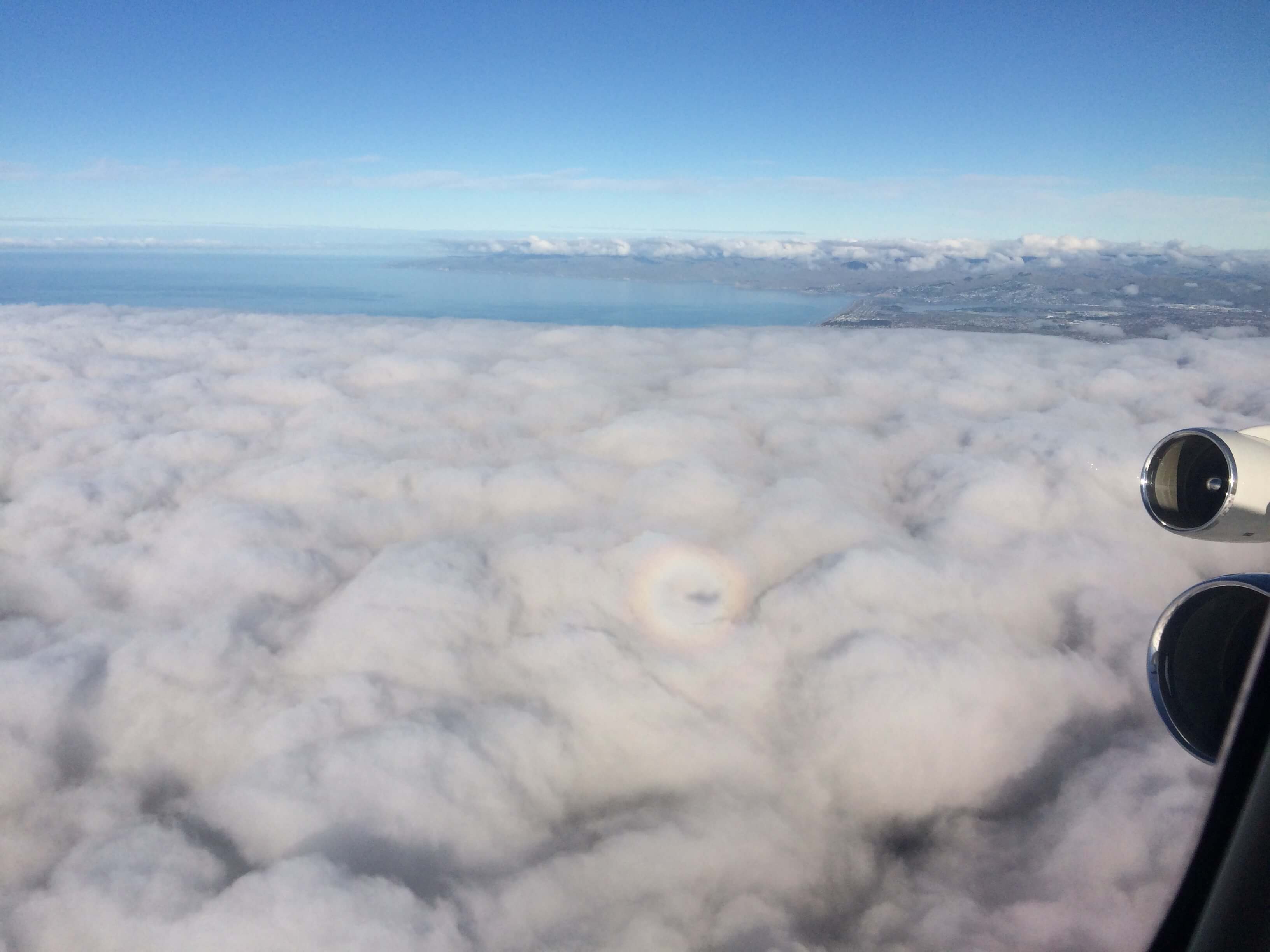
Catching SOFIA’s shadow after takeoff.

IMG_5717
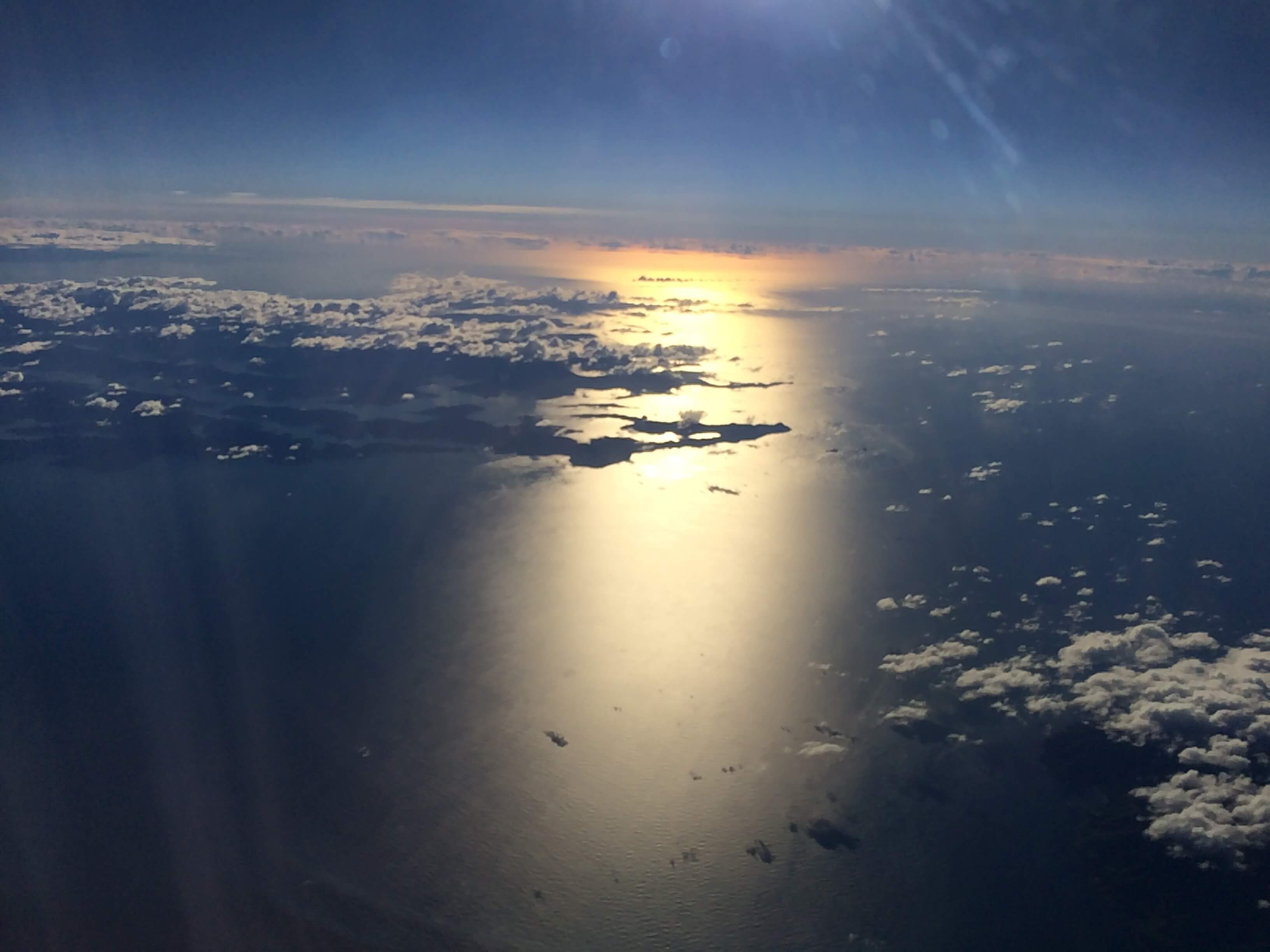
Uncommon view from SOFIA, having taken off before sunrise, flying now north of New Zealand’s North Island.

On the few hour wait for sunset, New Horizons team had time to go over the plan, recheck all the computations, etc. Most importantly they did some time tests to reconcile differences between UTC (Universal Time Coordinated) and GPS time. I had no idea there was a difference. The pilots will fly and adjust their timing using their GPS clock, but all the mission and science planning used UTC. GPS is not perturbed by leap seconds so it slowly drifts ahead of UTC. However GPS timing receivers put in the conversion factor to convert GPS time to UTC. We had to check that was being done. Also during the time check, we also consulted the WWVH, U.S. National Institute of Standards and Technology’s shortwave radio time signal station in Hawaii, on the radio. How best to spend idle time listing to beeps of a radio time signal!

IMG_5728
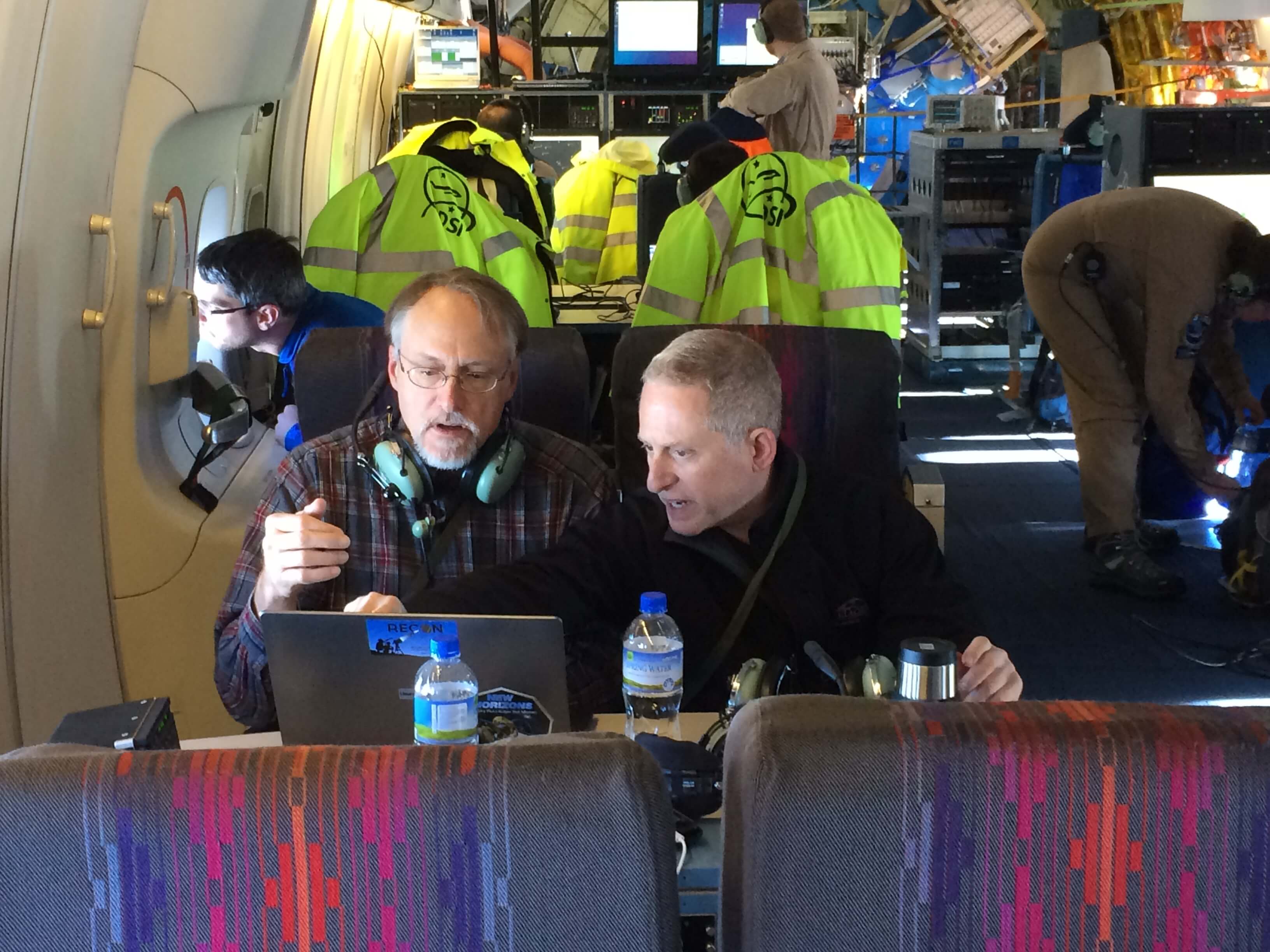
Marc Buie (left), lead scientist who computed the shadow predictions, brings Alan Stern (right), New Horizons mission Principle Investigator up to speed on the latest predictions.

IMG_5729
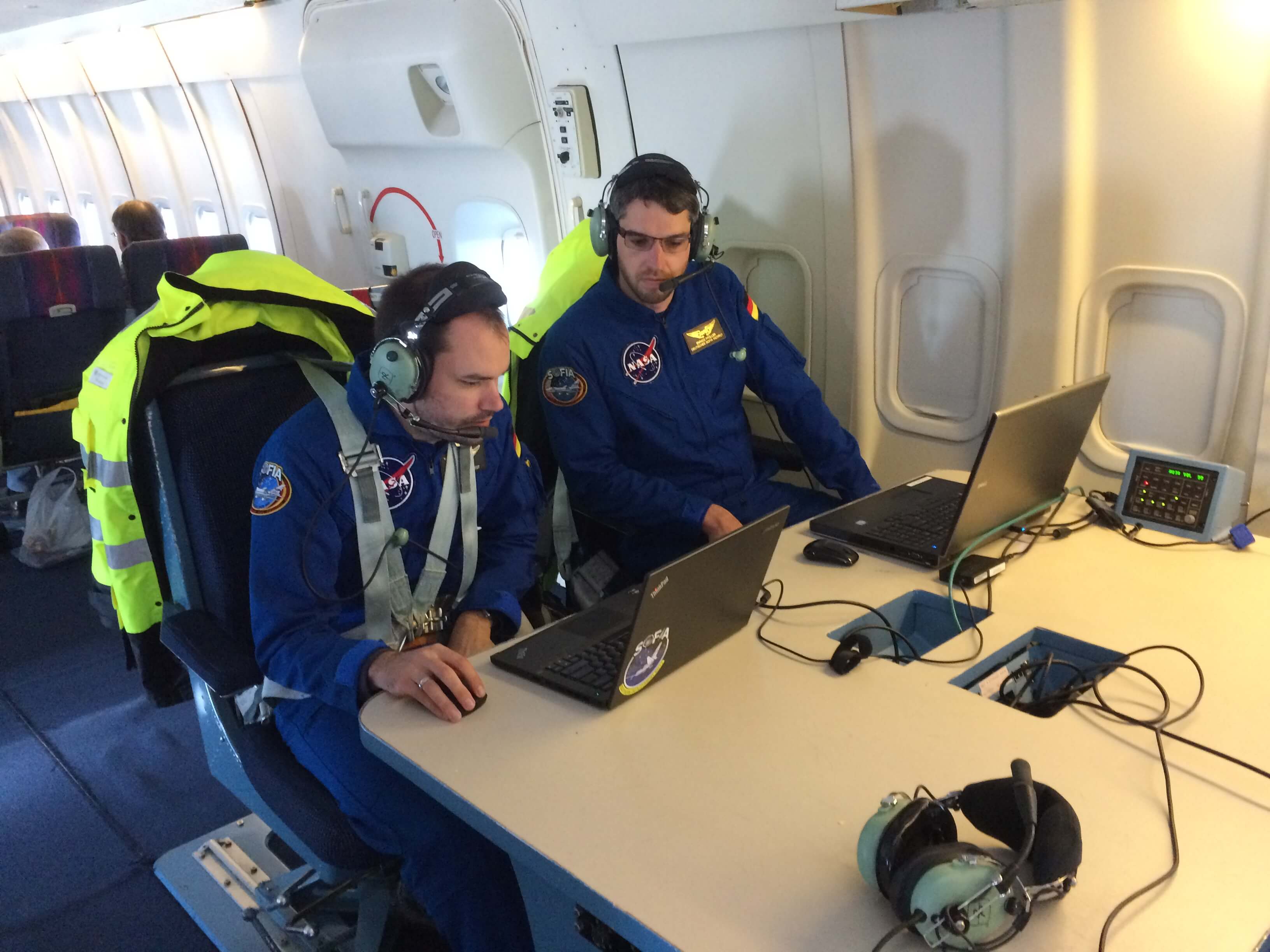
Manuel Wiedemann (left) and Enrico Pfueller (right), our instrument scientists who will operate run the high-speed photometer, get their equipment set up.

The flight plan had a short set up leg to confirm the signal to noise on the star, and then a “time holder” to allow for the pilots to speed up and slow down, and then it would be time for the occultation. The event time remained at 07:49:11 UTC with an interception position at Lat 16d24.2m S, Lon 175d2.4m W.

IMG_5639
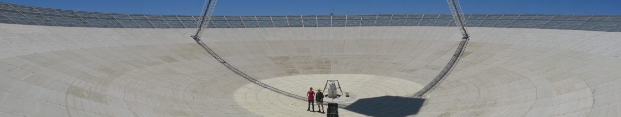
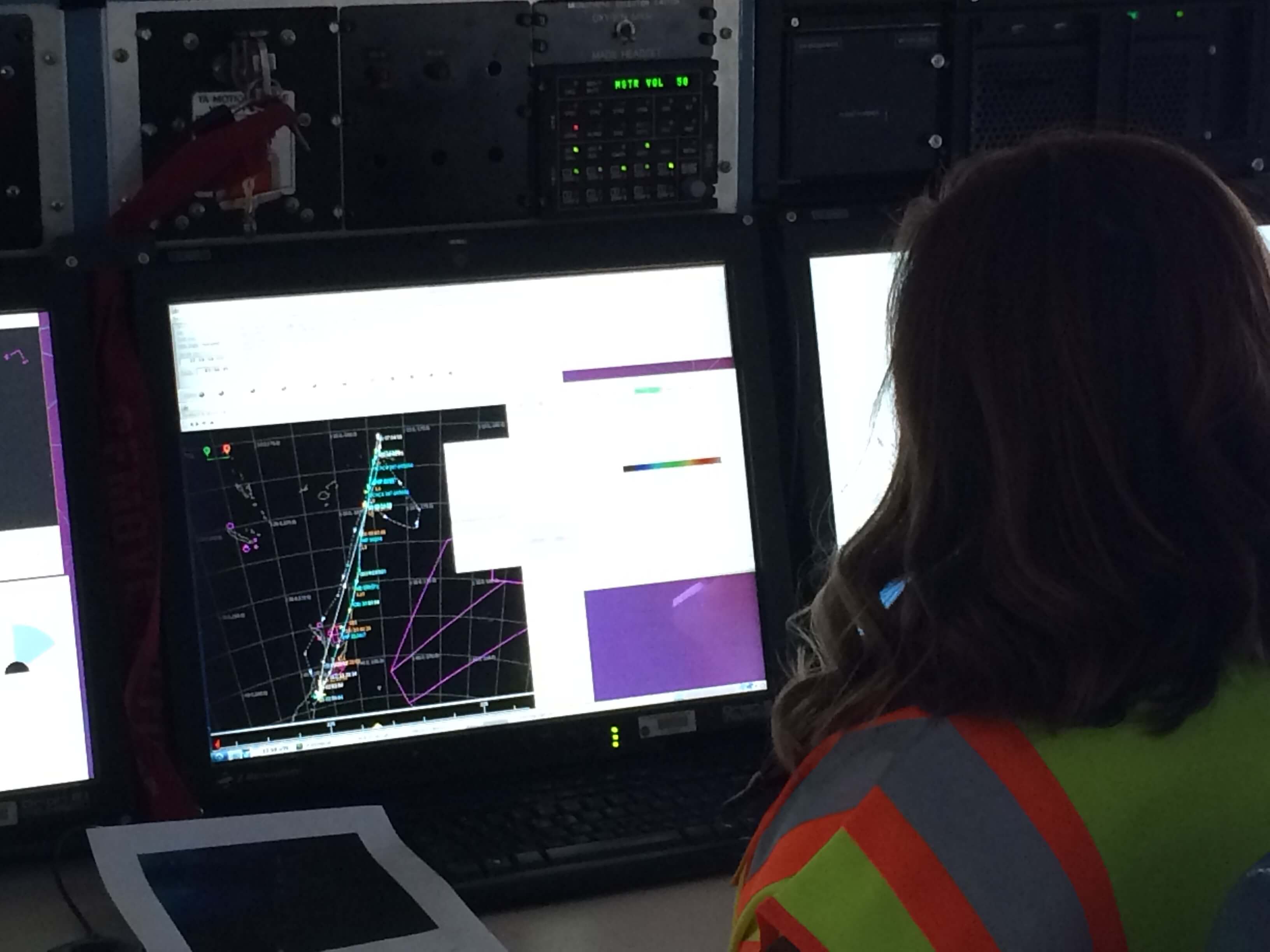
SOFIA flight path for the MU69 occultation flight displayed on the Mission Director’s Console.

The Flight Path for this occultation flight had us north of Tahiti and catching the occultation (marked by the anchor) on the return south to north leg.

IMG_5753
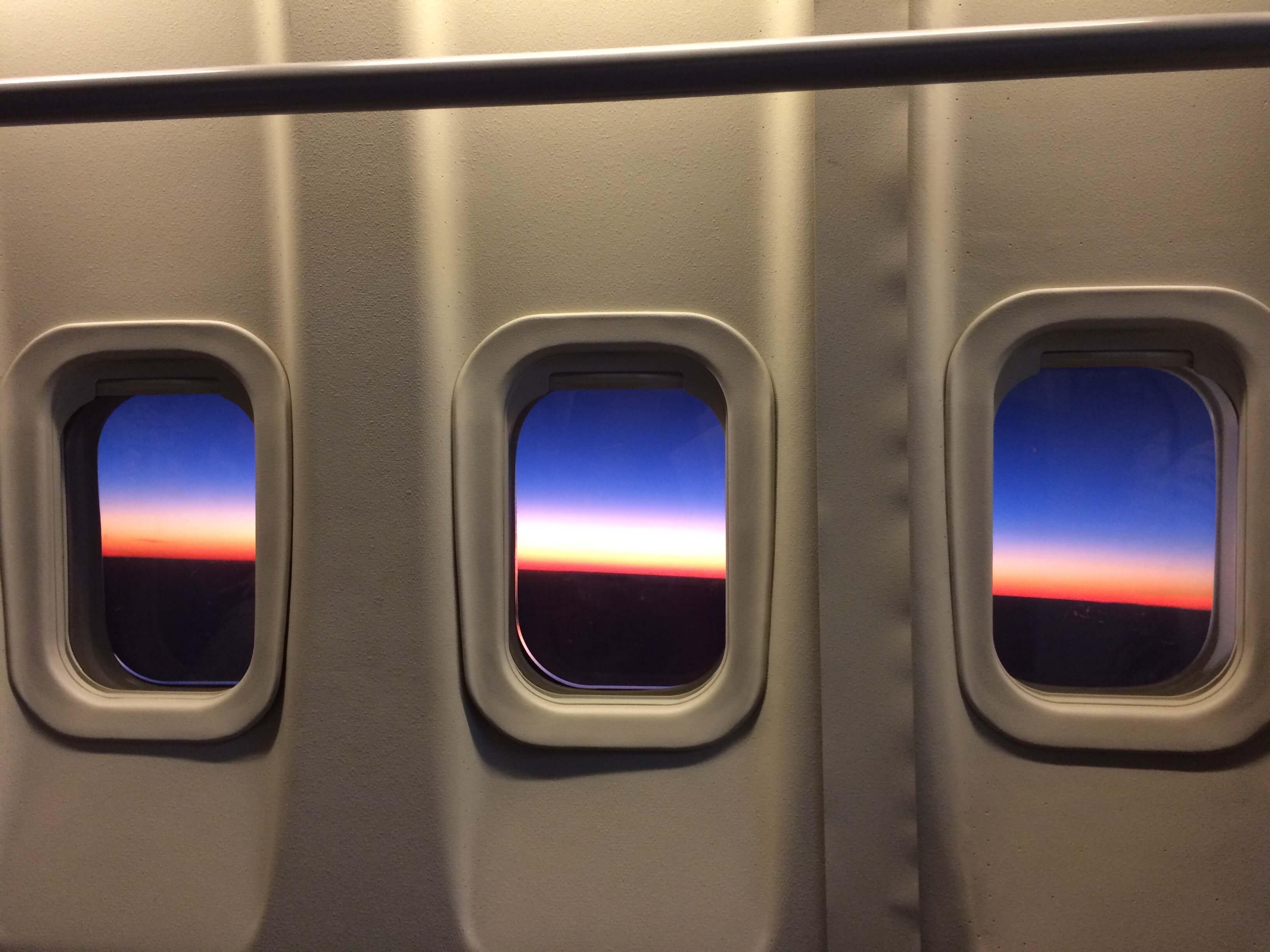
Sunset finally came.

Once the sun was down, the cavity door was opened, and the telescope began to cool down, we waited anxiously for when we could get a test image on the camera. We had an objective: we learned that on the occultation leg we had the opportunity to place a 9th magnitude star in the same small field of view to help with the data analysis (helps with pixel registration), but we did not know whether it would saturate under the observing conditions.

IMG_5761
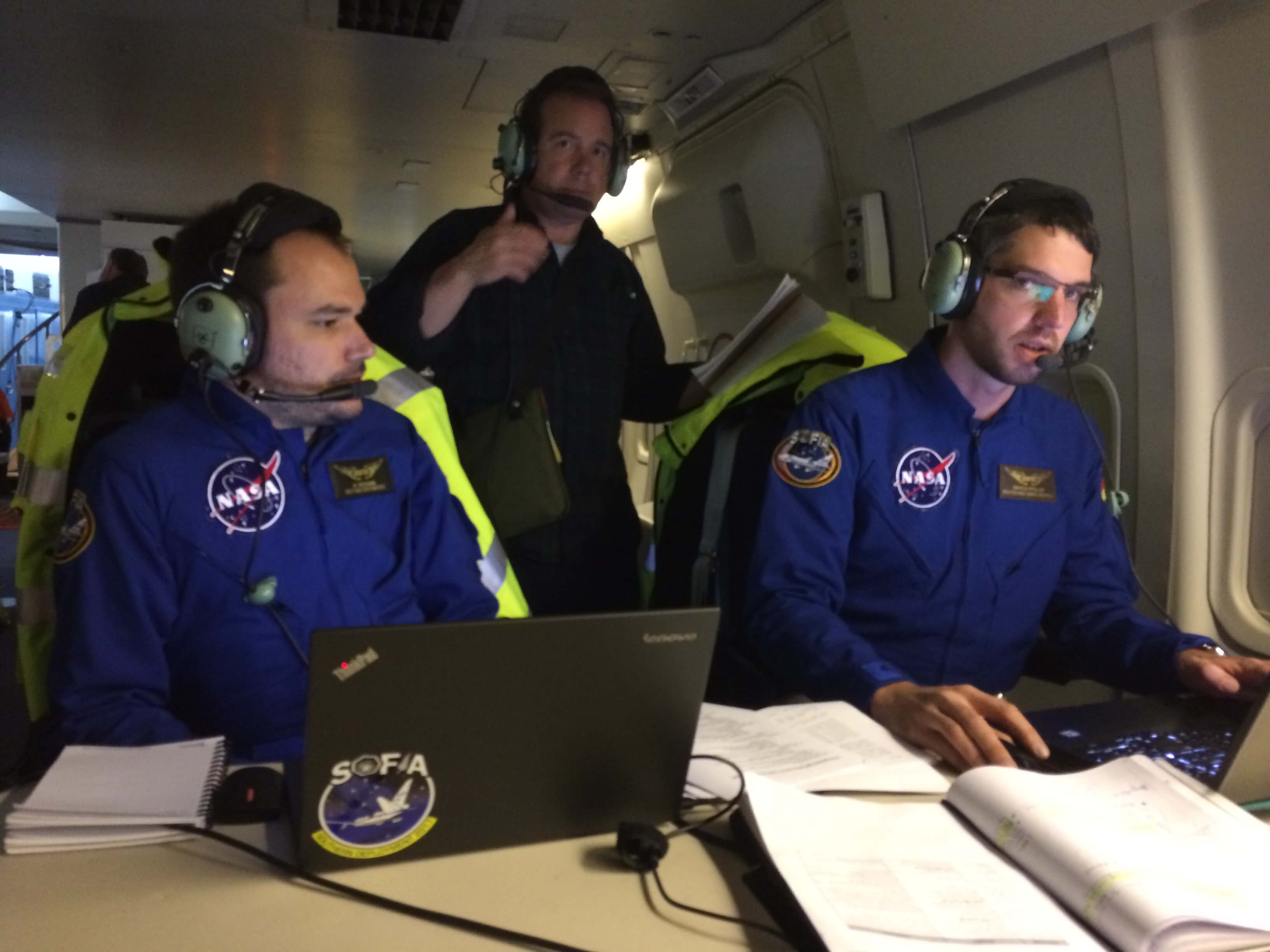
Manuel Wiedemann (seated, left) & Enrico Pfueller (seated, right) table) with Eliot Young (standing) after capturing the first test image and confirmed that the 9th magnitude star did not saturate. We also took a background measurement.

Then it was time for the pilots and Karina Leppik , the mission director, to do their coordination to get the plane to do a 180 degree turn and line us up for a interception at Lat 16d24.2m S, Lon 175d2.4m W at 07:49:11 UTC from 38,000 feet.

IMG_5766_mod
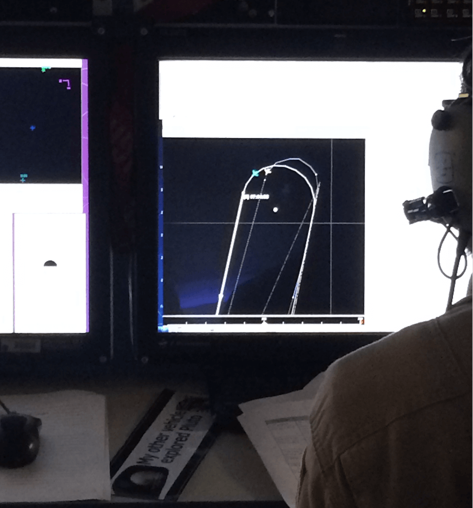
The turn into the occultation leg.

IMG_5774
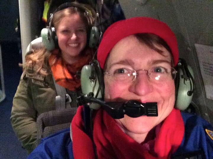
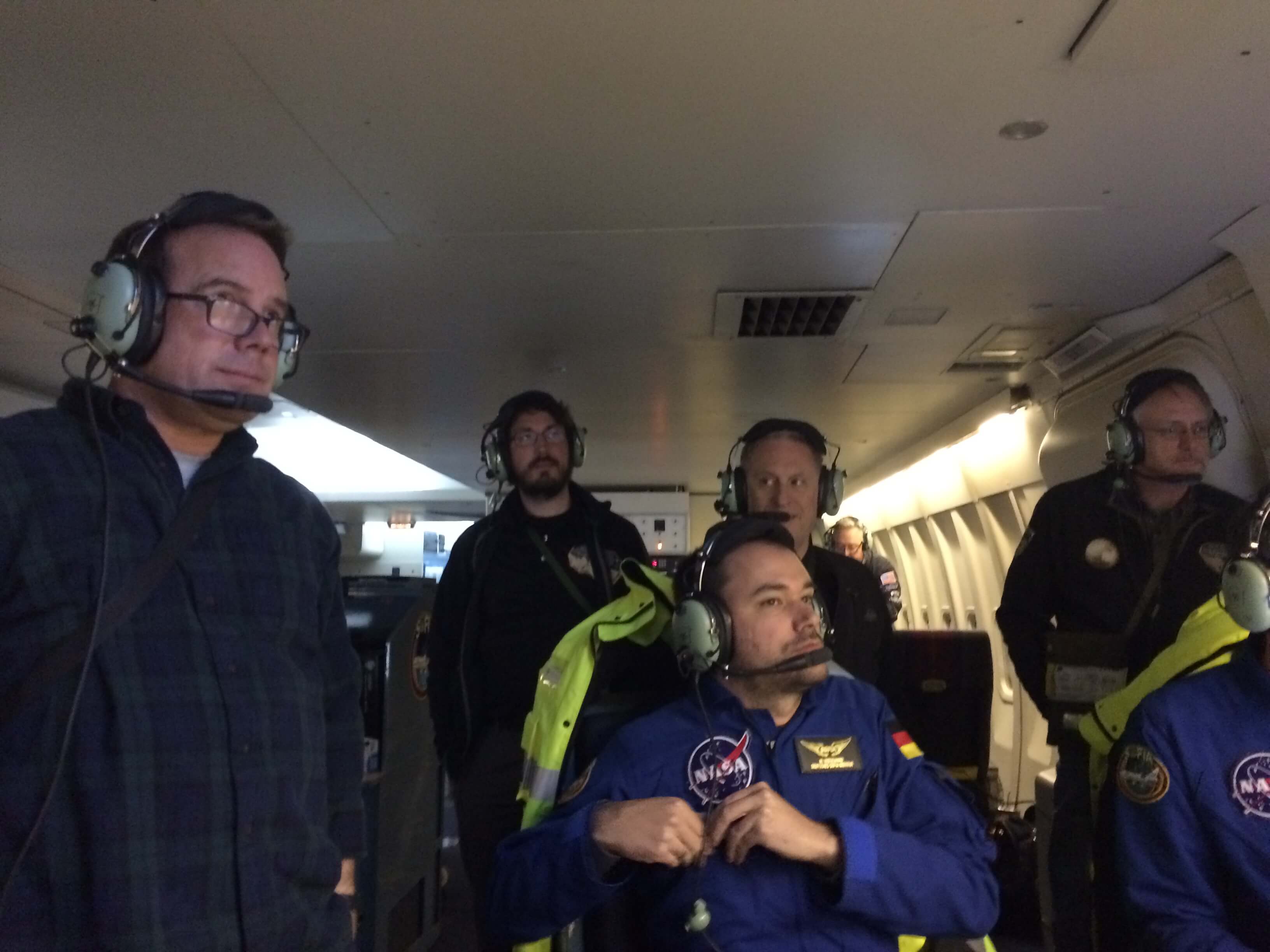
Expectant Astronomers. This picture was taken minutes before the event. From left to right, Eliot Young, Simon Porter, Manuel Wiedemann(sitting), Alan Stern, Marc Buie, and Enrico Pfueller(sitting/off screen).

The size of MU69 is unknown. The Hubble Space Telescope images only provide a visual magnitude. There is a degeneracy whether the object is large and dark, or small and highly reflective, as both combinations can provide the equivalent surface area sun reflectance we measure as a magnitude.

The rough range of this object has a diameter of 10 to 40 km. From a distance of 43.3 AU (or 6.5 billion km) away, the shadow projected on Earth has a size ~ 10-40 km. We wanted to hit the shadow center line. With the shadow moving across the earth at ~90,000 km/hr, the event would last 0.4-1.6 seconds. We were reading the camera at 20 frames per second, so the ‘dip’ would appear in 8 to 32 images.

We did not “see” the event in real time. I think I blinked!

Geometry with the full moon would cause additional challenges for the data. As seen in the full frame image below, which was taken specifically to help with subtracting out the background, the occultation star is the one in the bottom center with the bulls-eye (concentric circles) around it. The other brighter stars (marked with squares) are brighter reference stars. Oh how we wish the MU69 would have passed in front of one of them!

IMG_5777_mod
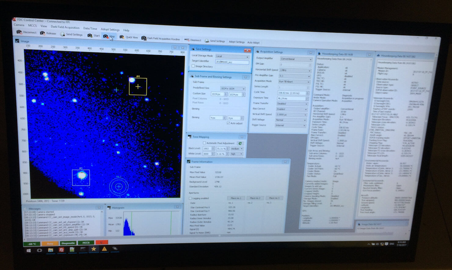
The occultation star is in the bottom middle, marked with the bulls-eye concentric circles. All eyes were on this star during this flight.

None the less, over 60,000 frames of images were taken spanning a continuous 50 minutes period centered about this <2 second event and samples the instability region around MU69. No loss of data. The camera did not blink, even if we did.

The flight’s excitement would continue with some telescope testing with simulated turbulence by pilots doing “speed brakes” and then it was watching the fog reports from Christchurch Airport. If the fog did not lift, we may have needed to divert to Auckland. This time those weather gods stayed kind and we landed safely at Christchurch shortly after midnight.

With data in hand, the SwRI scientists deplaned SOFIA, would catch a short nap, and then they would all be off to South America to start preparing for the 3rd of 3 occultations event by this MU69 on July 17th.

In summary, on July 10th, SOFIA delivered its mission and flew to a place in space above the Earth within 10 km and within 1 second of the target point. We had no clouds to deal with, just winds and the full moon. Winds were accommodated by guiding the airplane with heading and speed tweaks. The full moon provided a challenge, yet all the photometry tricks like scattered light images and reference stars, plus the normal bias, darks and flats, have been added to the toolbox.

We hunted.

We did not blink.

Now we wait…

….to learn what the New Horizons team finds.

Carpe Umbra

July 10, 2017

We have a very different type of science flight tonight, a timed-event. This time the science focus is getting the SOFIA aircraft to be located over a specific latitude and longitude on Earth at a certain elevation at a specific time. We are flying an occultation flight. SOFIA has done this twice before capturing the shadow of Pluto as its passed in front of a distant star and created a shadow that moved across Earth at 90,000 km/hr. And we have a upcoming Triton occultation event in October later this year.

Occultation: not a typical everyday word. In fact it turns out that the word occultation is not the same as an eclipse or a transit, which I learned only recently.

An occultation occurs only when a body completely hides another as seen by the observer. The verb to occult simply means to block out.  For this July 10th event, this body 2014MU69, a Kuiper Belt Object, is going to blockout a 15th magnitude background star.

A transit is when the body passing in front of the other body only partially blocks it (like Mercury transiting the Sun and all those “transiting exoplanets” that ground-based telescopes and Kepler have been discovering).

Finally, an eclipse occurs when one body passes into the shadow of another body and disappears at least partially.

So is the Aug 21st Solar Eclipse (who’s shadow path crosses North America) an eclipse? Well, it all depends on your viewpoint.

When the Moon blots out the Sun, the Earth, by falling into the Moon’s shadow, is eclipsed.  The Sun is not eclipsed. It is correct to say is the Moon has occulted the Sun.

Thus, August 21st perhaps is more correctly categorized as a solar occultation. On the flip side, all Lunar Eclipses are real Eclipses, the Moon disappears in the shadow of the Earth (the Moon dims due to the absence of light caused by the Earth’s shadow).

The event of July 10th had a predicted ground path as described here http://www.boulder.swri.edu/MU69_occ/july10.html.

On board SOFIA, we had Marc Buie and Simon Porter, the experts in the computing the path of 2014MU69 who were updating this exact timeline based on the most recent HST measurements of 2014MU69 (as of Jul 4th) just the day before flight.

IMG_5624

SwRI Scientists Simon Porter, Marc Buie, and Eliot Young will fly on SOFIA as Guest Observers to catch MU69’s shadow.

At the time of flight takeoff, SOFIA would be hunting a shadow center intercept time of 07:49:11 UTC with an interception position at Lat 16d24.2m S, Lon 175d2.4m W. The duration of the dip in the light curve would be extremely small, less than 2 seconds, as MU69 is a very tiny object (diameter is estimated to be between 10-40 km) a long way away (43 AU; or 10 AU past Pluto). A very challenging occultation to capture.

The flight planners and navigators aboard SOFIA can position the aircraft with the precision need for this measurement (within 10 km; and 1 second). I’m eager to witness first how this type of flight plan unfolds over the night.

Time to board!

IMG_5669-mod

To There and Back Again

July 8, 2017

Looking ahead my longest (3 week) trip to Christchurch was now 2/3rd over and the next week was looking pretty intense with science adventures, from the MU69 occultation flight on July 10th to the commissioning of a new capability at long-wavelengths that week. I realized I would only get one day off, and I took the advice of a colleague and booked a day return aboard the TranzAlpine, a 4.5 hr train ride from Christchurch on the east coast of the south Island to Greymouth on the west coast, and then 4.5 hrs back again. I truly lucked out with wonderful weather revealing beautiful scenery. Oh I must return to really explore this amazing countryside.

8:15am we departed Christchurch. My word! It looked so much like Cambridgeshire, England, with the flat grass fields, filled with sheep or the occasional herd of cows. These were the Canterbury Plains. The only odd thing on the landscape were these huge hedgerows. The commentary aboard the train mentioned they helped with wind-control. I just looked at these marvels and realized they had been growing (and also untouched) for a long time.

IMG_5540
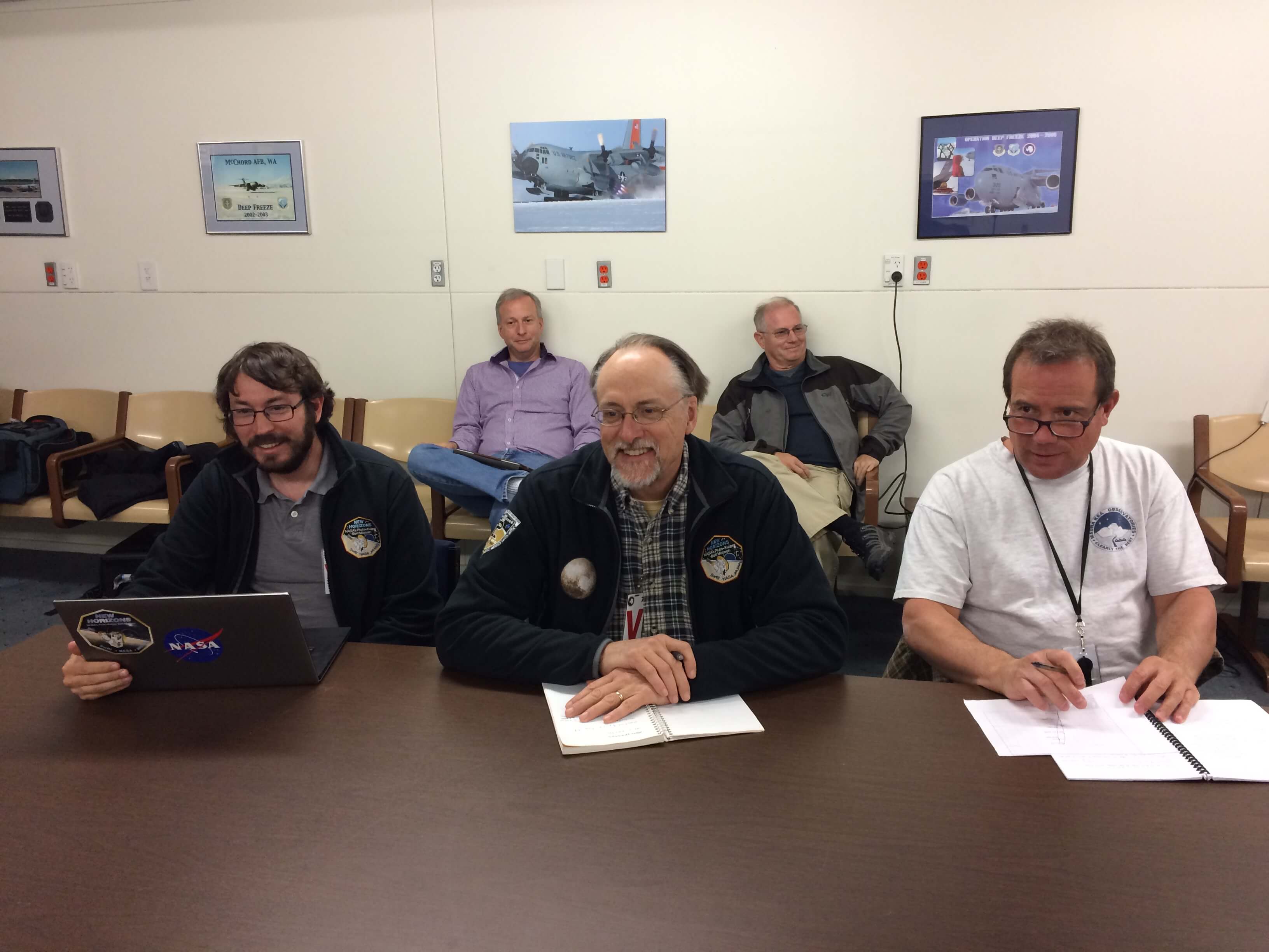
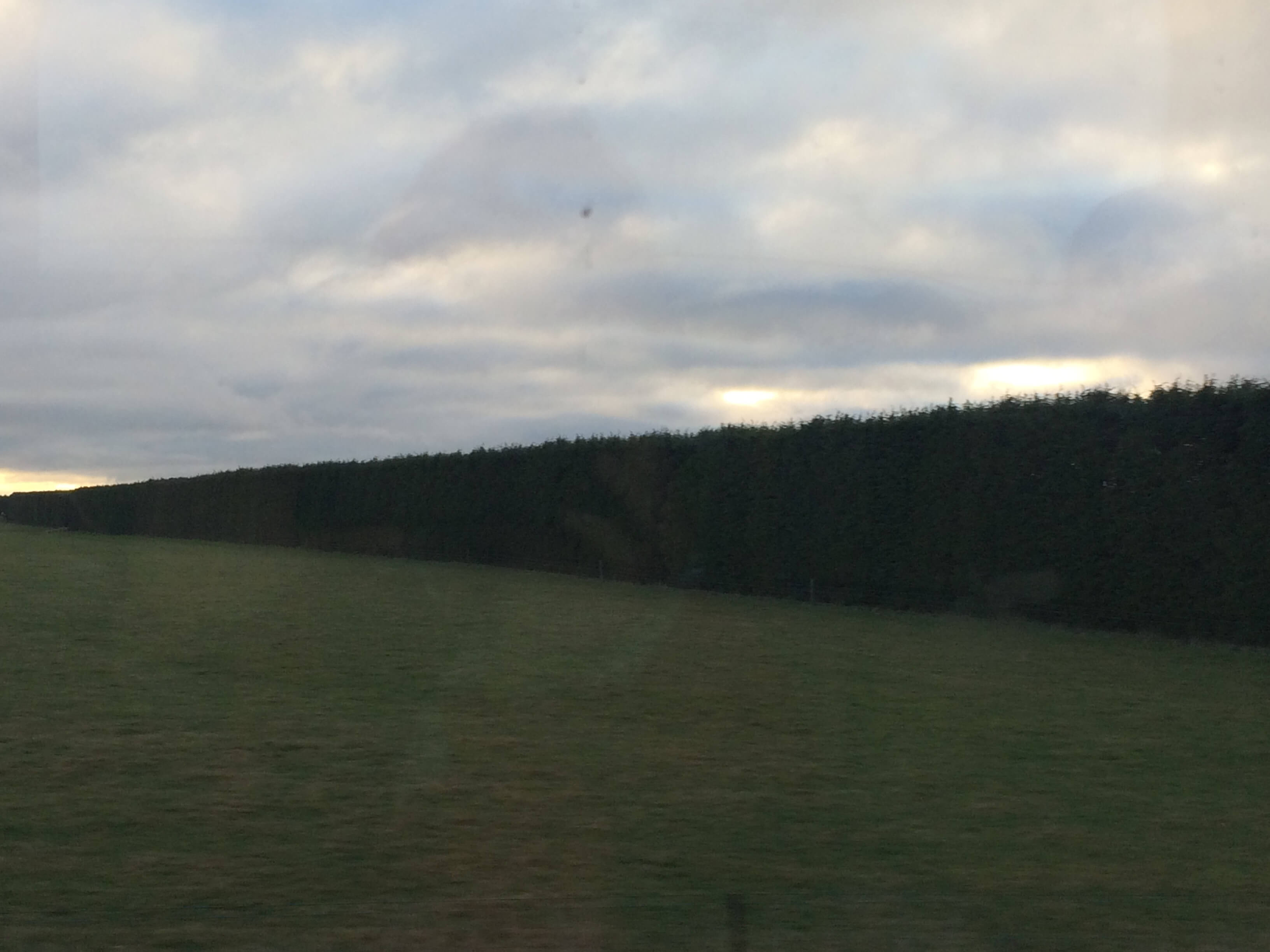
Giant Hedgerows along the Canterbury Plains.

Within an hour, we would be starting to see foothills as we approached the Southern Alps (Kā Tiritiri o te Moana).

P1080351-mod
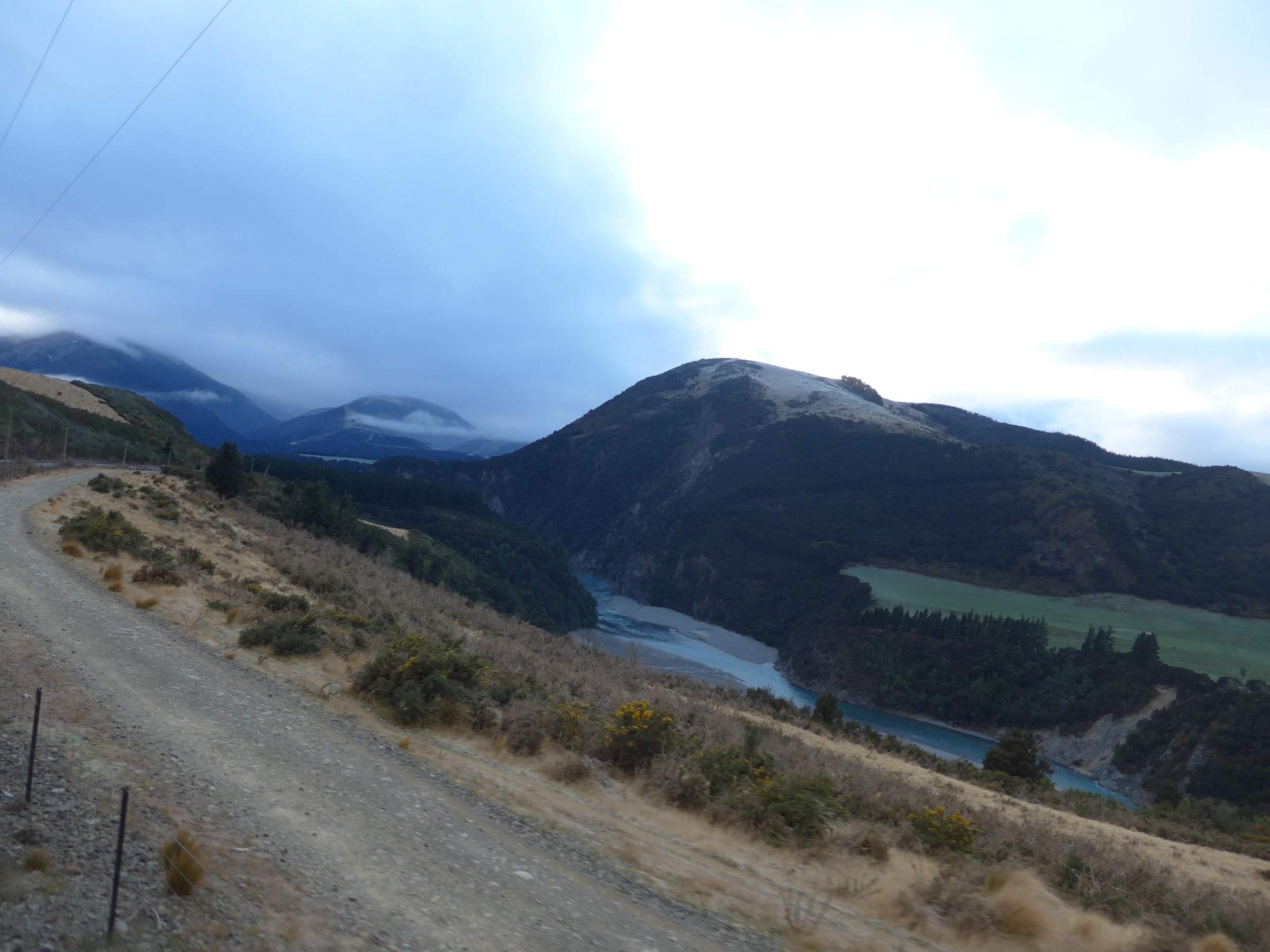
Views after leaving Darfield

P1080358-mod P1080364-mod

P1080371-mod
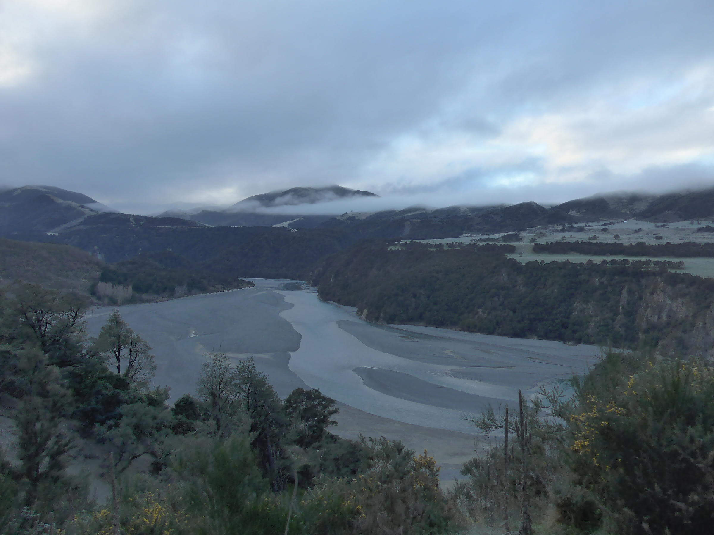
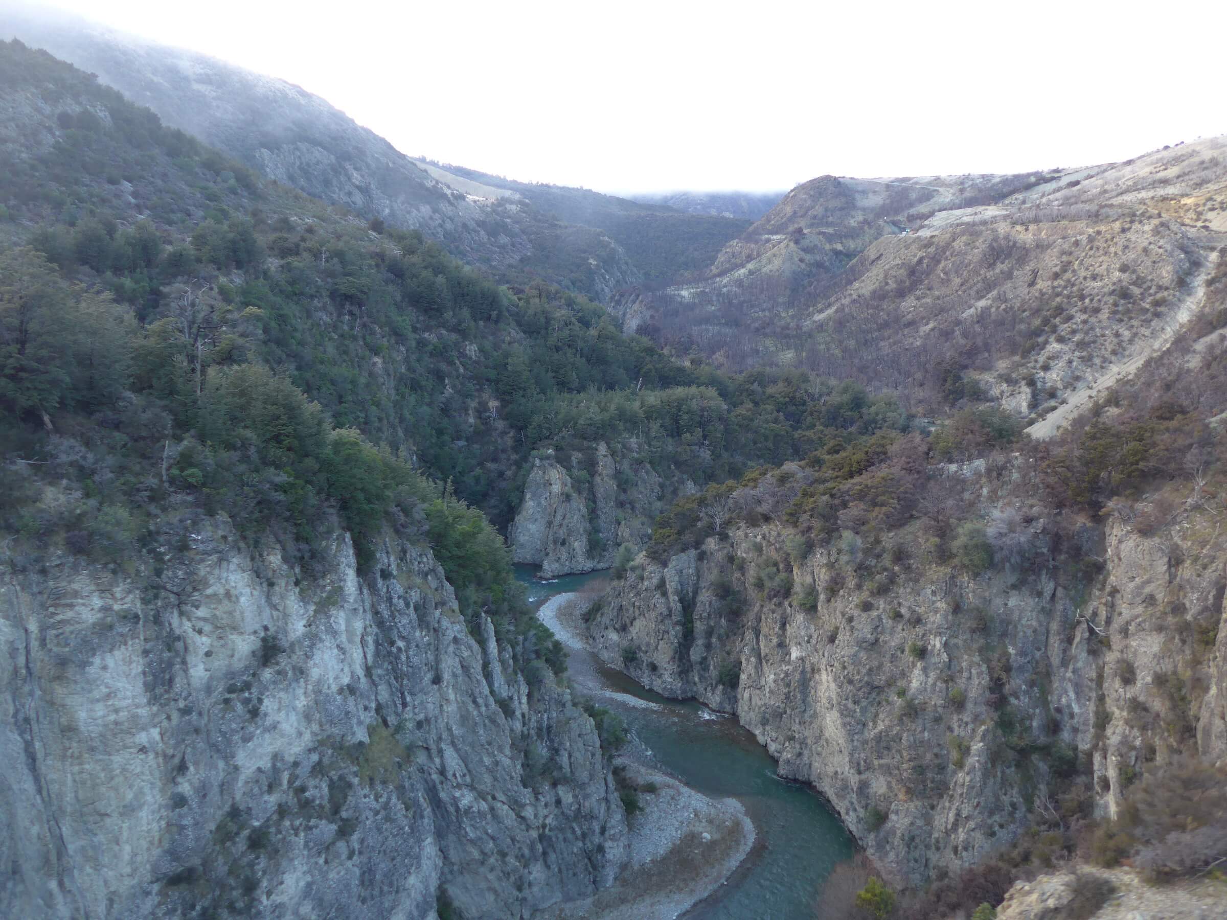
The Waimakariri River gorge

We continue climbing. At this point in the ride I have secured a spot in the open carriage to get unobstructed views (no glares). I was better equipped with my hat, scarf, fleeces and gloves than my fellow passengers who just sneaked out for a quick photo and then dashed back into the warm. I was just awestruck by the scenery as it evolved, and I knew a nice hot cup of tea awaited my return.

On this amazing train ride, we would nip in and out of narrow tunnels over lovely bridges.

P1080370-mod 
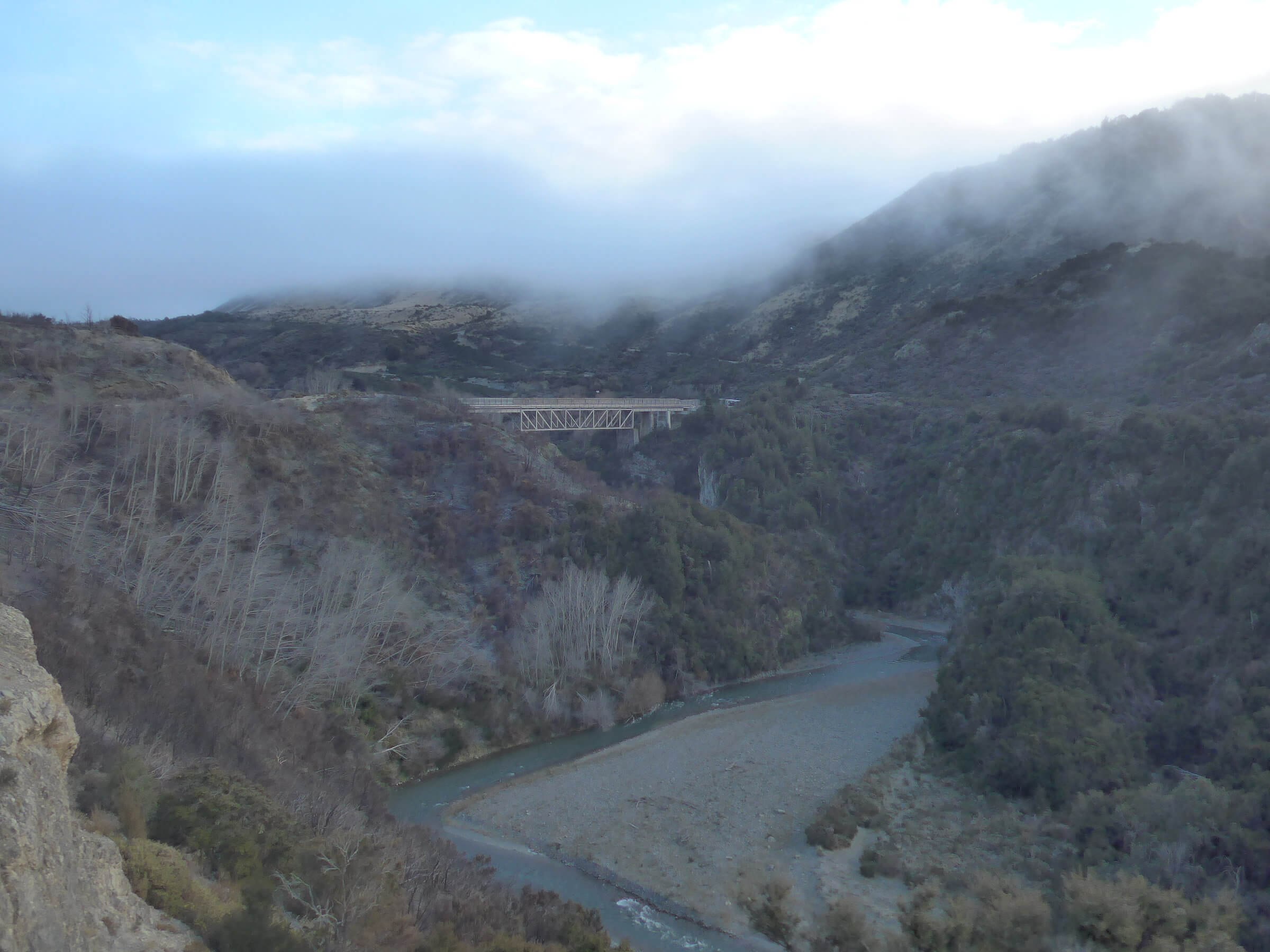
‘Staircase’, 73 metres above the river

P1080386-mod
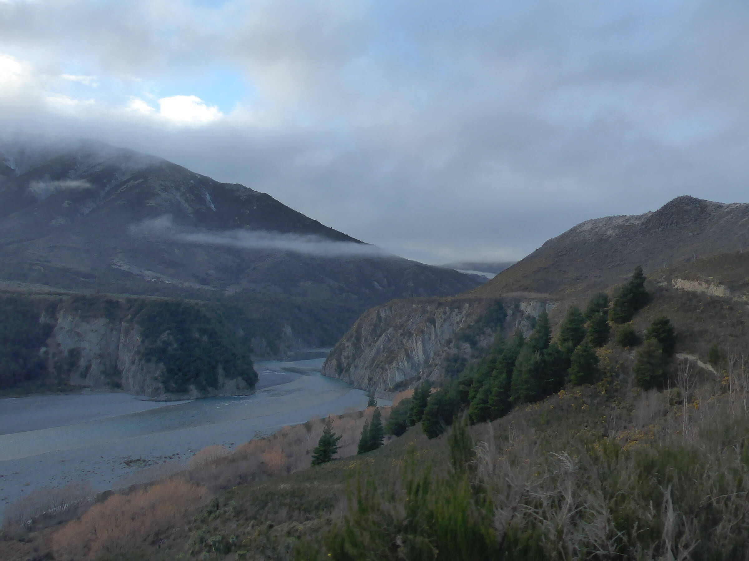
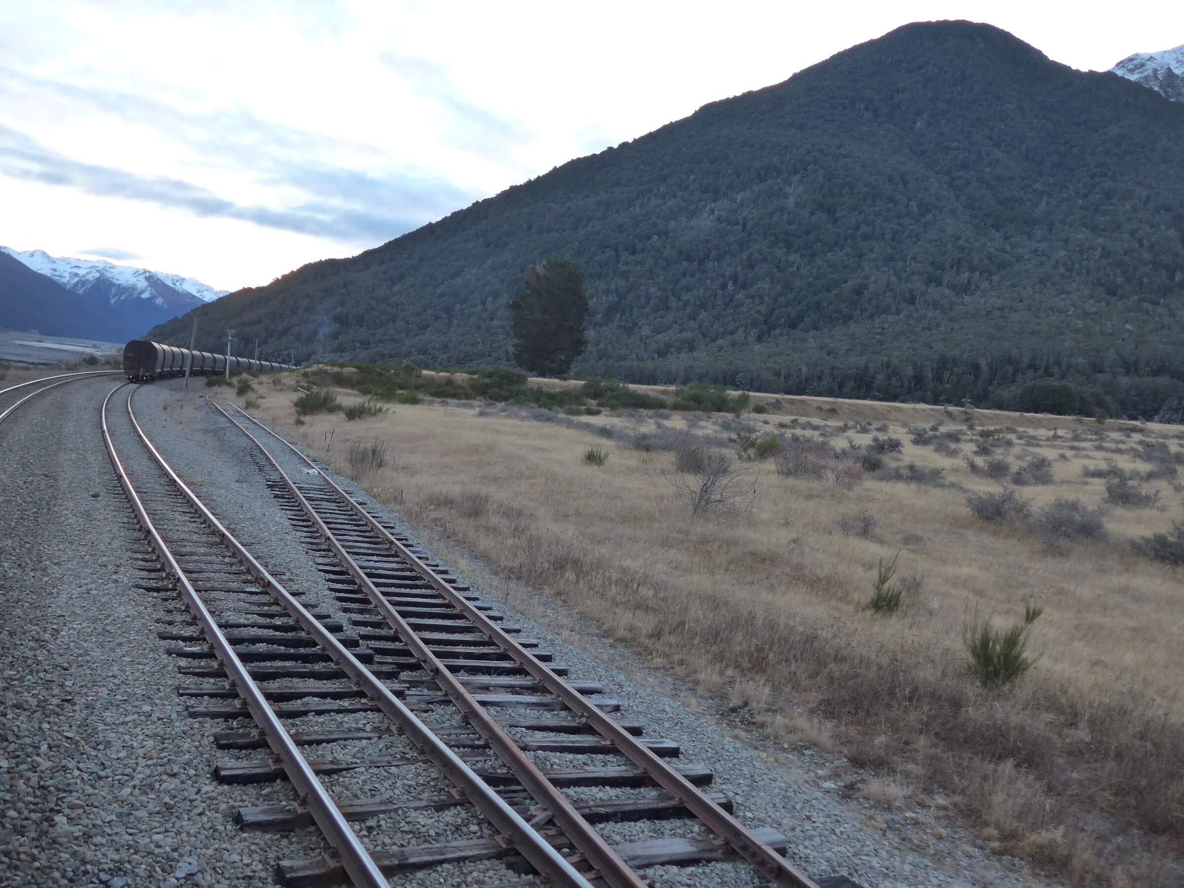
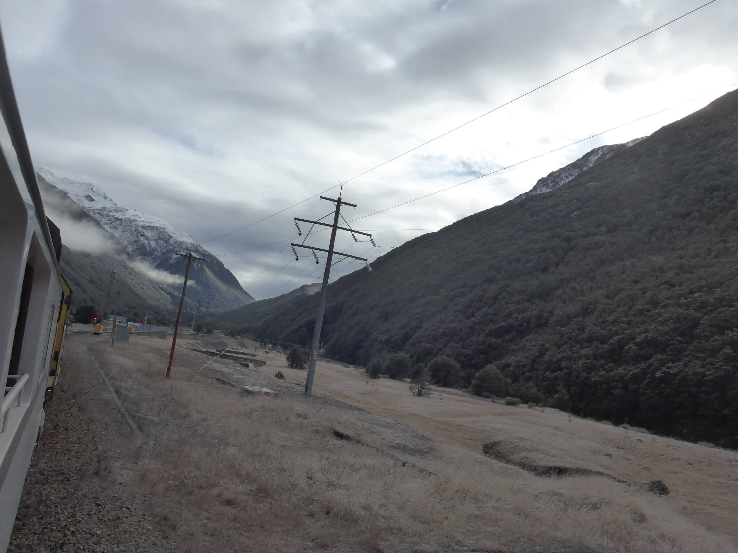
Grassy plateau with hills, as we neared the summit

By 10:40am we reached Arthur’s Pass (elevation 739 m) and drop off some passengers for a day’s walking in the National Park nearby.

P1080390-mod 
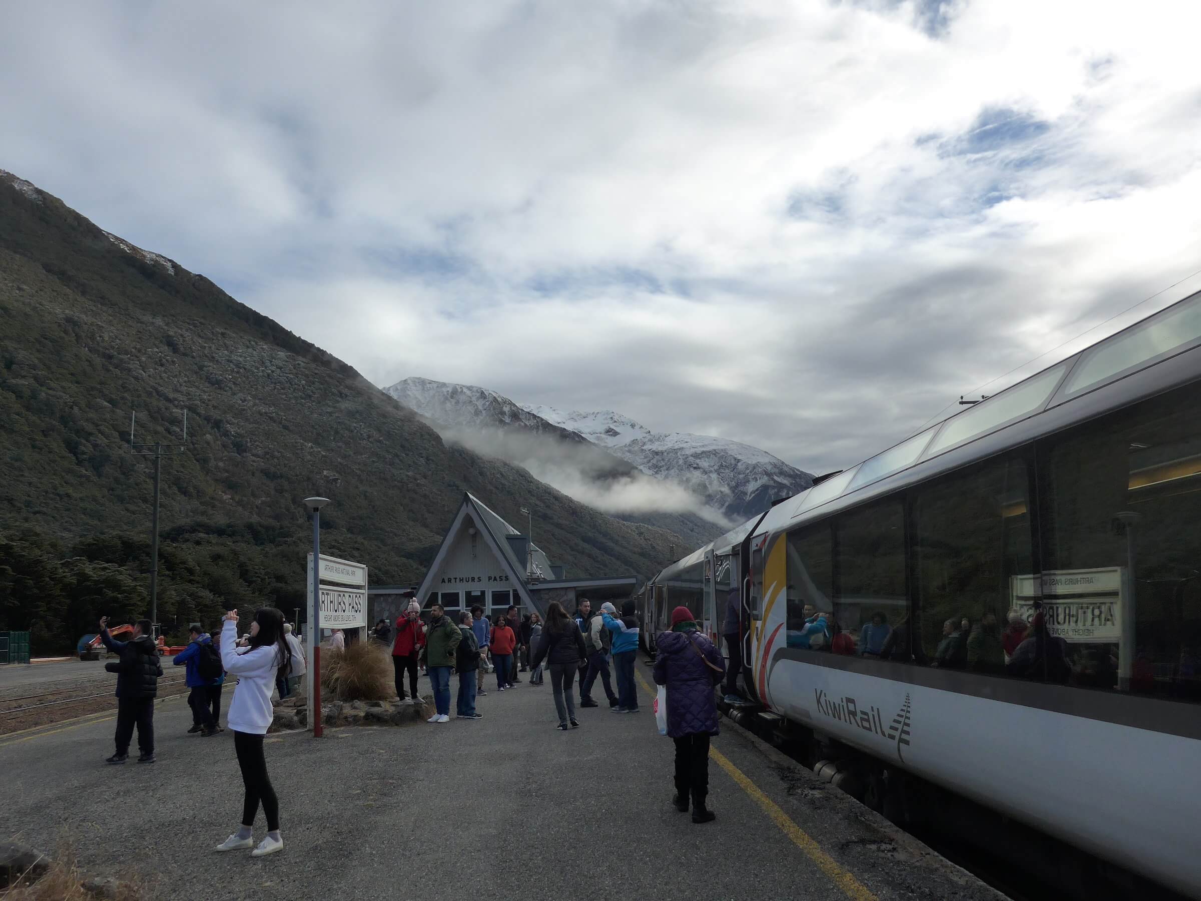
Train station at Arthur’s Pass

The train resumes its journey and they would close off the viewing gallery when it entered the Otira Tunnel, 8.6 kilometers in length, otherwise one would suffer from the diesel fumes. Apparently when they close off the train this week, the motion of the train acts like piston to push out any fumes.

P1080523-mod
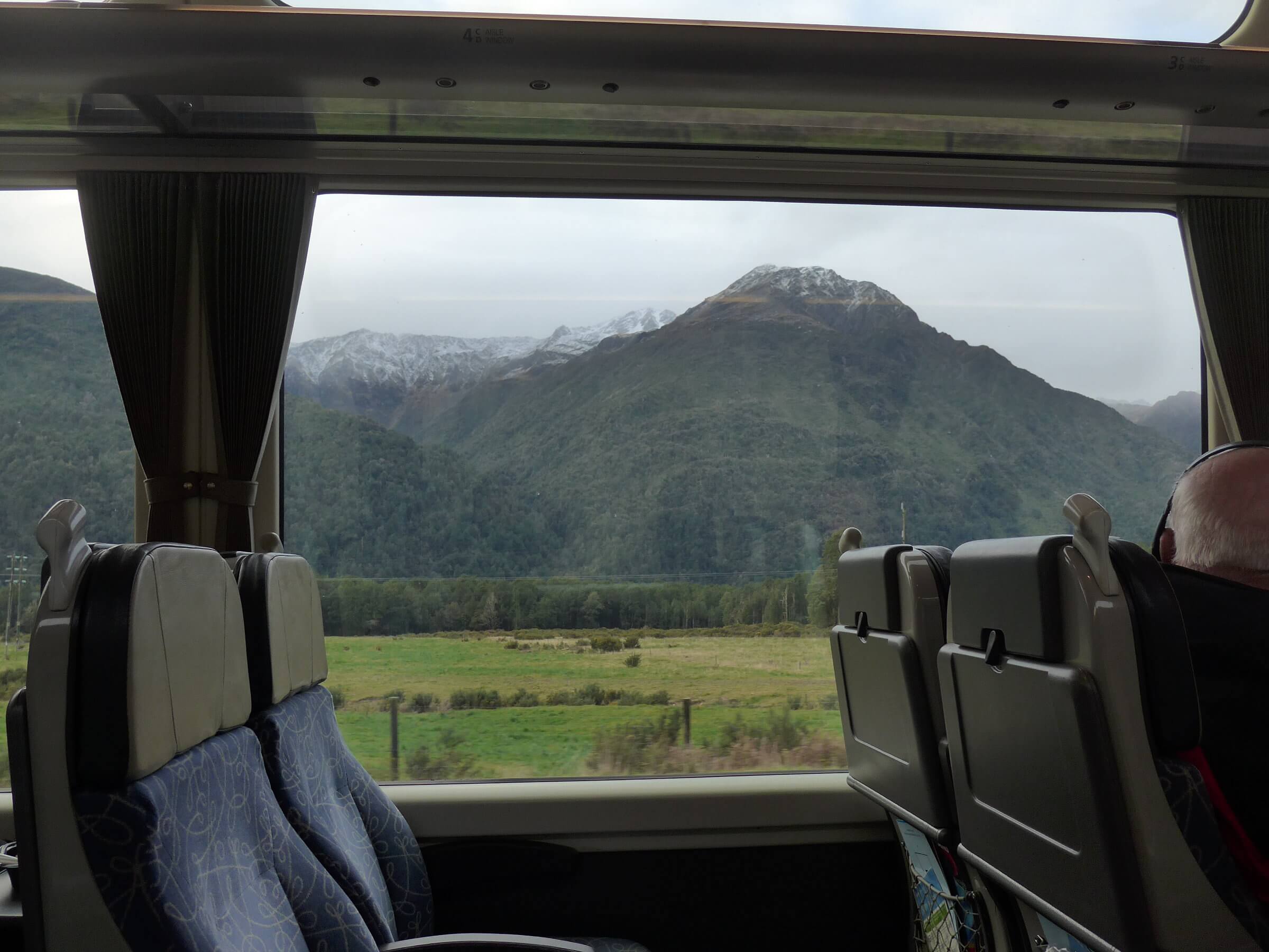
View from the viewing cab of the TranzAlpine rail
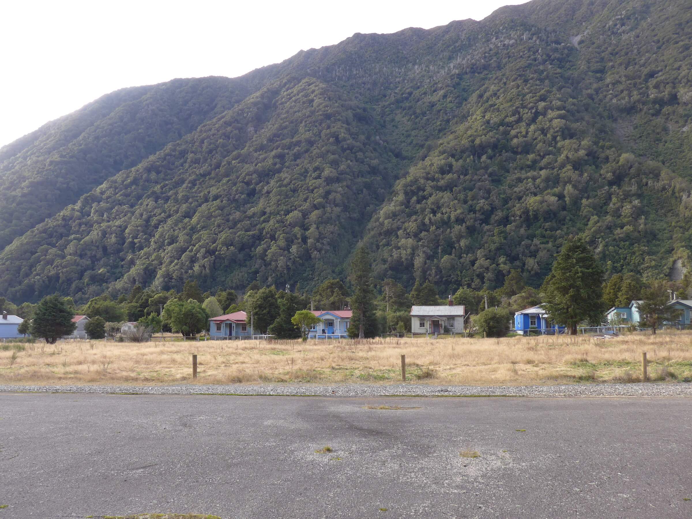
We slowed down but did not stop in the town of Otira, which described by the onboard commentary as getting over several meters of rain a year. Historically it was a key stagecoach town when crossing the Alps took many days. It also became a key railway town keeping the coal flowing from west to east.


P1080392-mod Otira

P1080400-mod
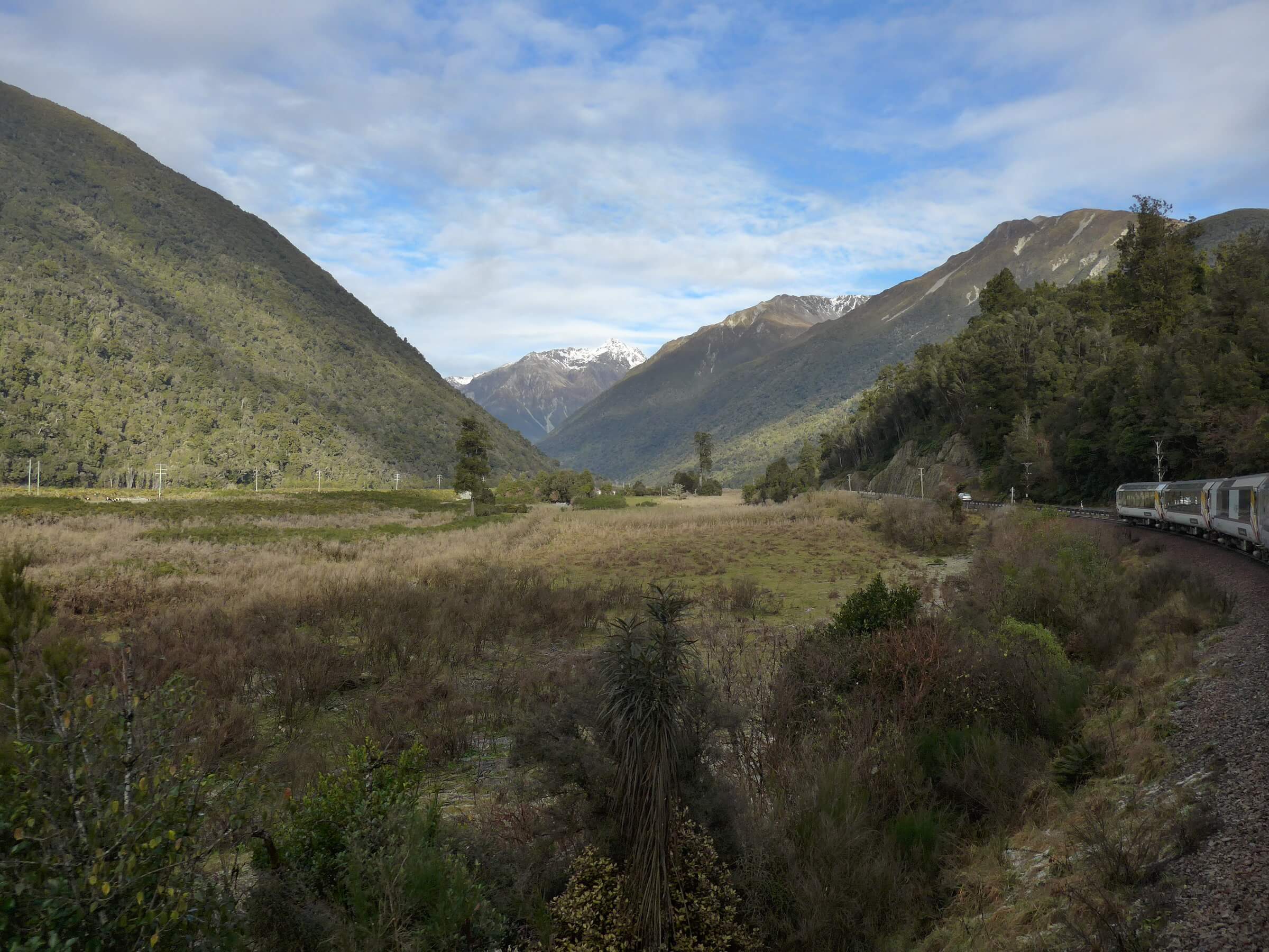
TransAlpine route west of Otira

We pull up to Moana (not the 2016 Disney film 🙂 ), a small town on the west coast region of the south island. A few passengers got off. The striking view of Lake Brunner with the hills in the background was very fine indeed.

P1080488-mod
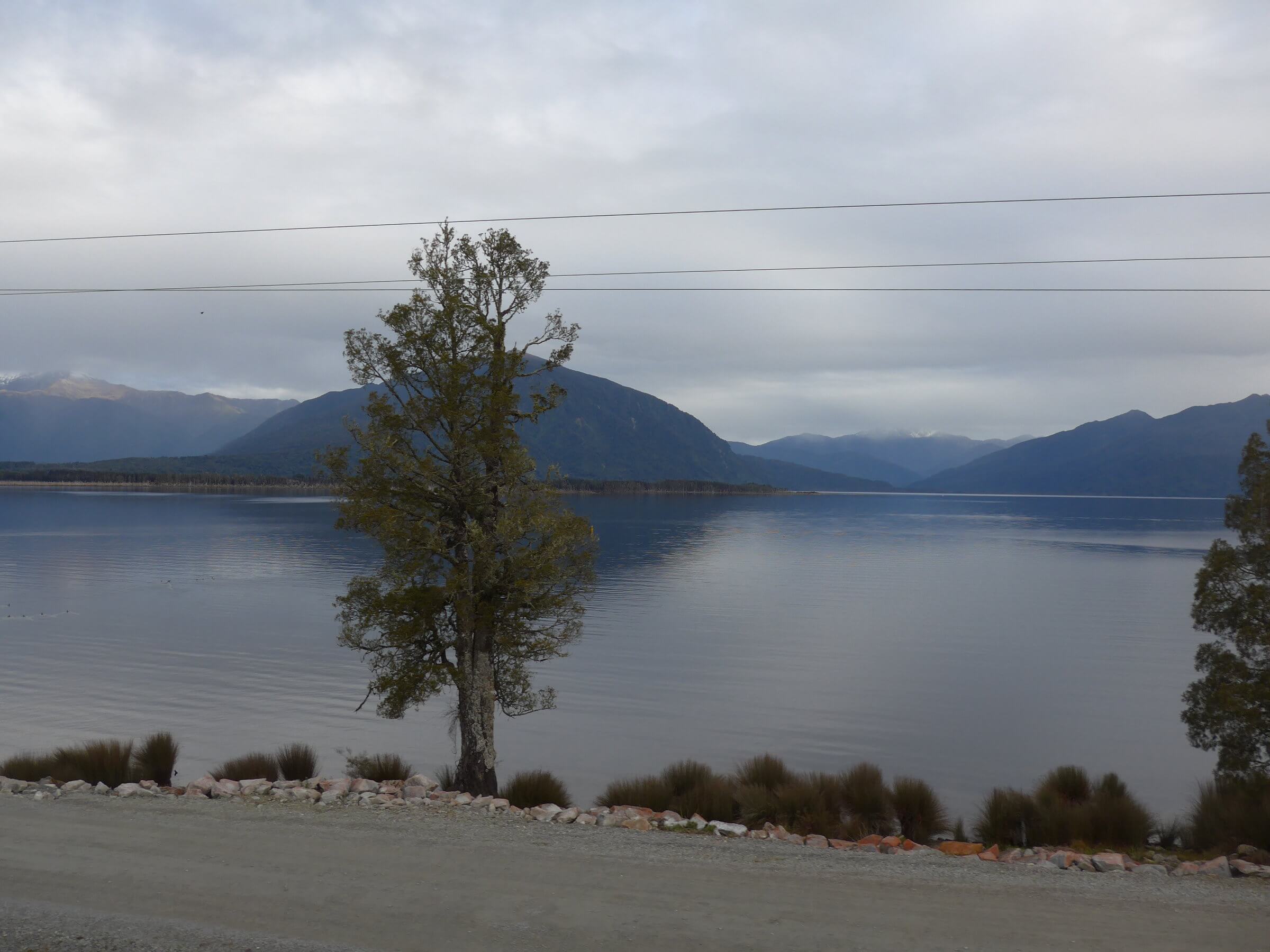
Lake Brunner near the town of Moana

P1080440-mod
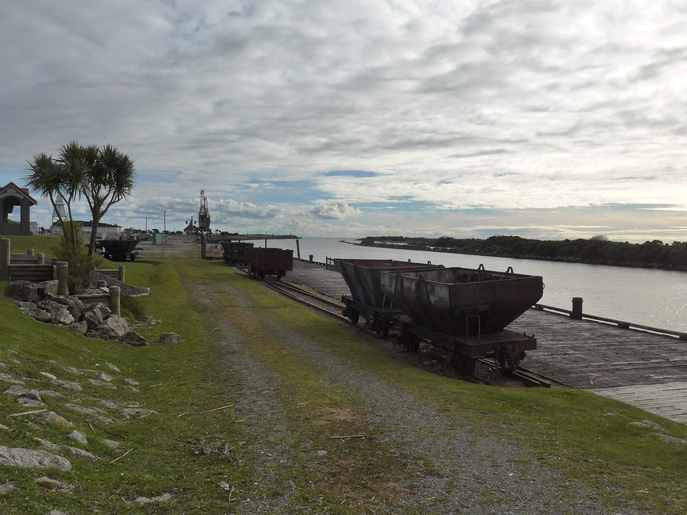
Glimpses of New Zealand’s coal culture, outside Greymouth

P1080476-modP1080547-mod
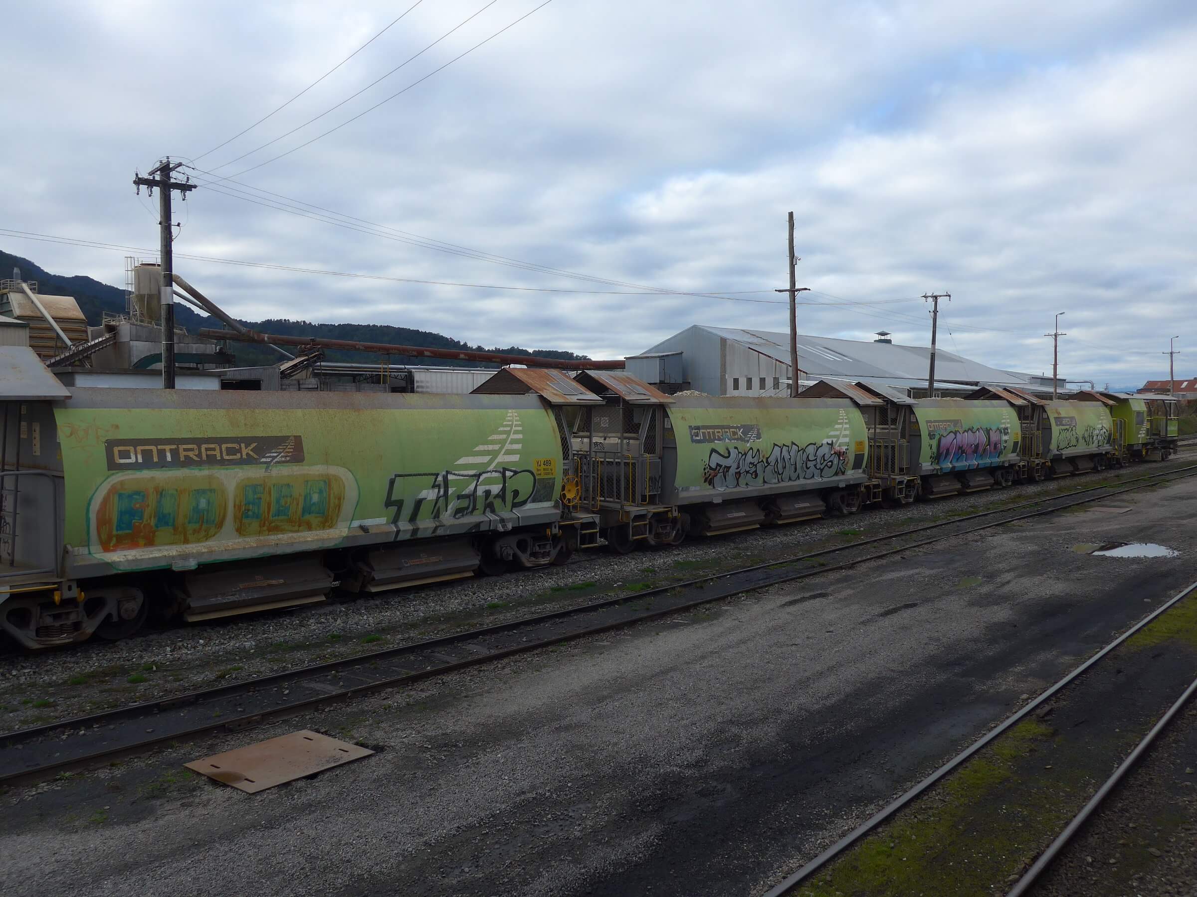
Coal trucks are a common sight along this route


P1080471-mod
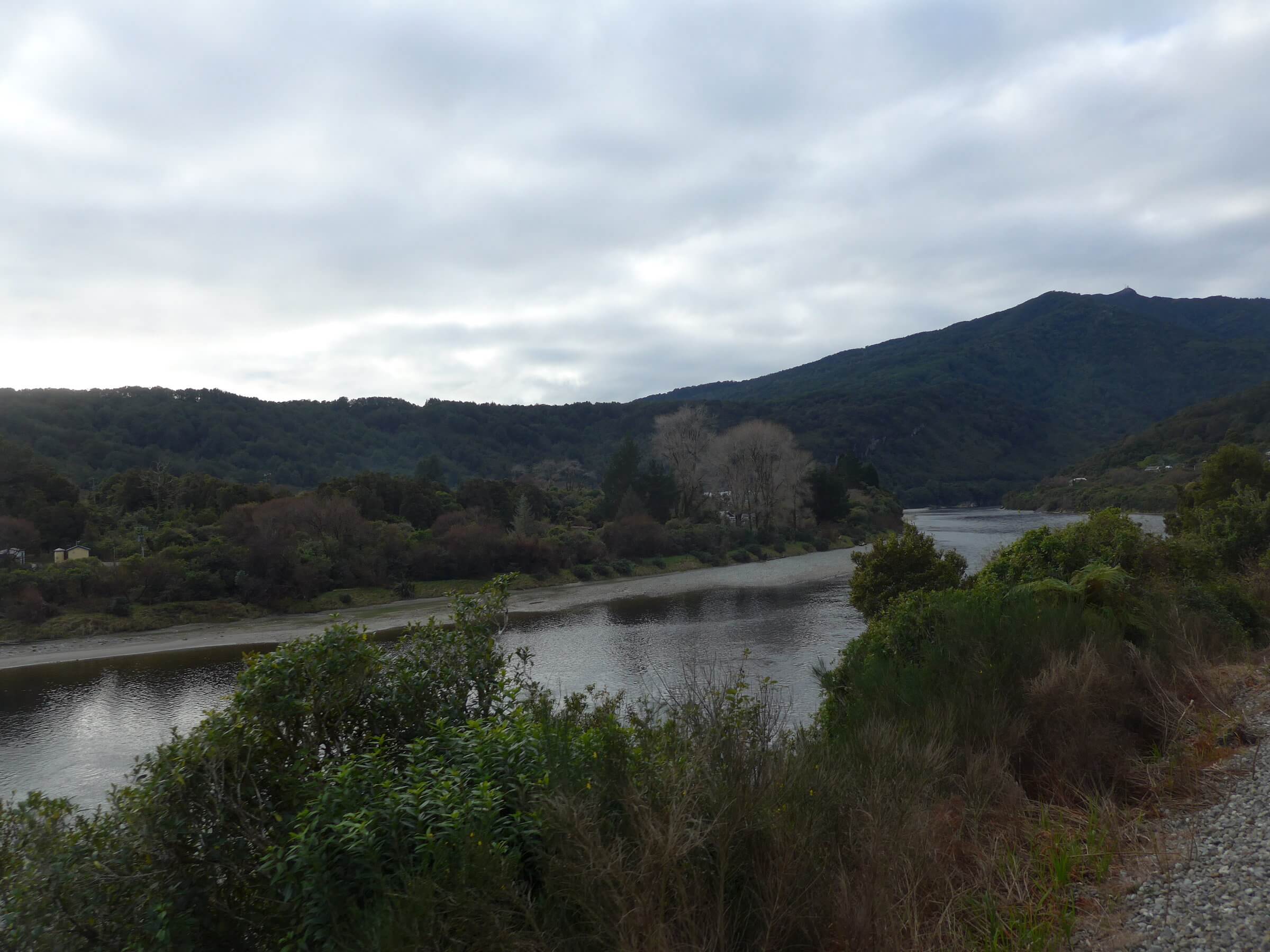
Views of the Grey River (Māwheranui), as we near Greymouth

The train reaches Greymouth, a town at the mouth of the Grey River, where we will stop for about 30 minutes to change engines and directions to head back over the mountains. Usually the schedule allows for an hour stop, but we had delays after crossing Arthur’s Pass that cost us minutes. Thus, I only got a tiny glimpse of this interesting coastal town.

P1080457-mod
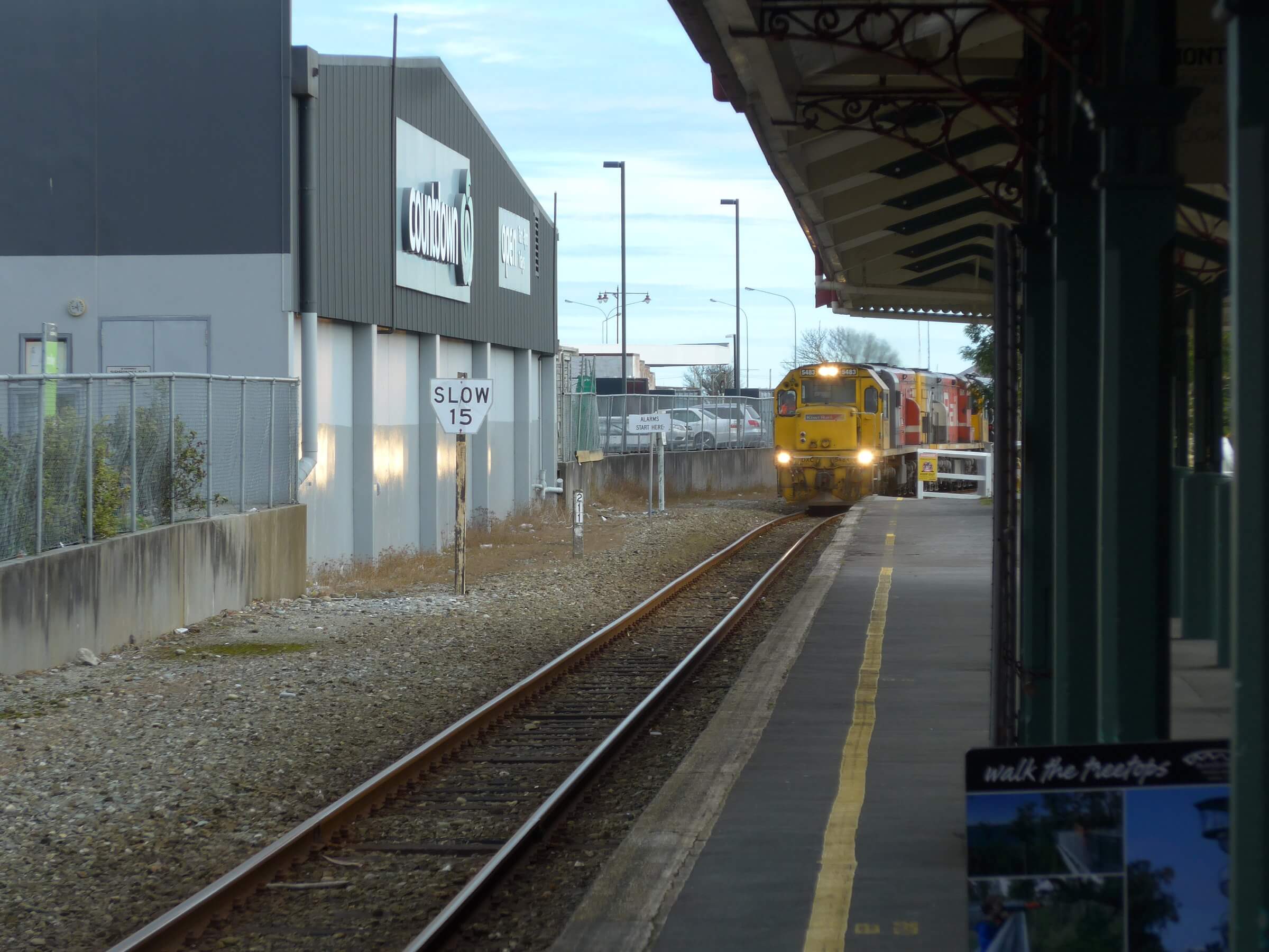
Train arriving into Greymouth to take us back to Christchurch

P1080533-mod
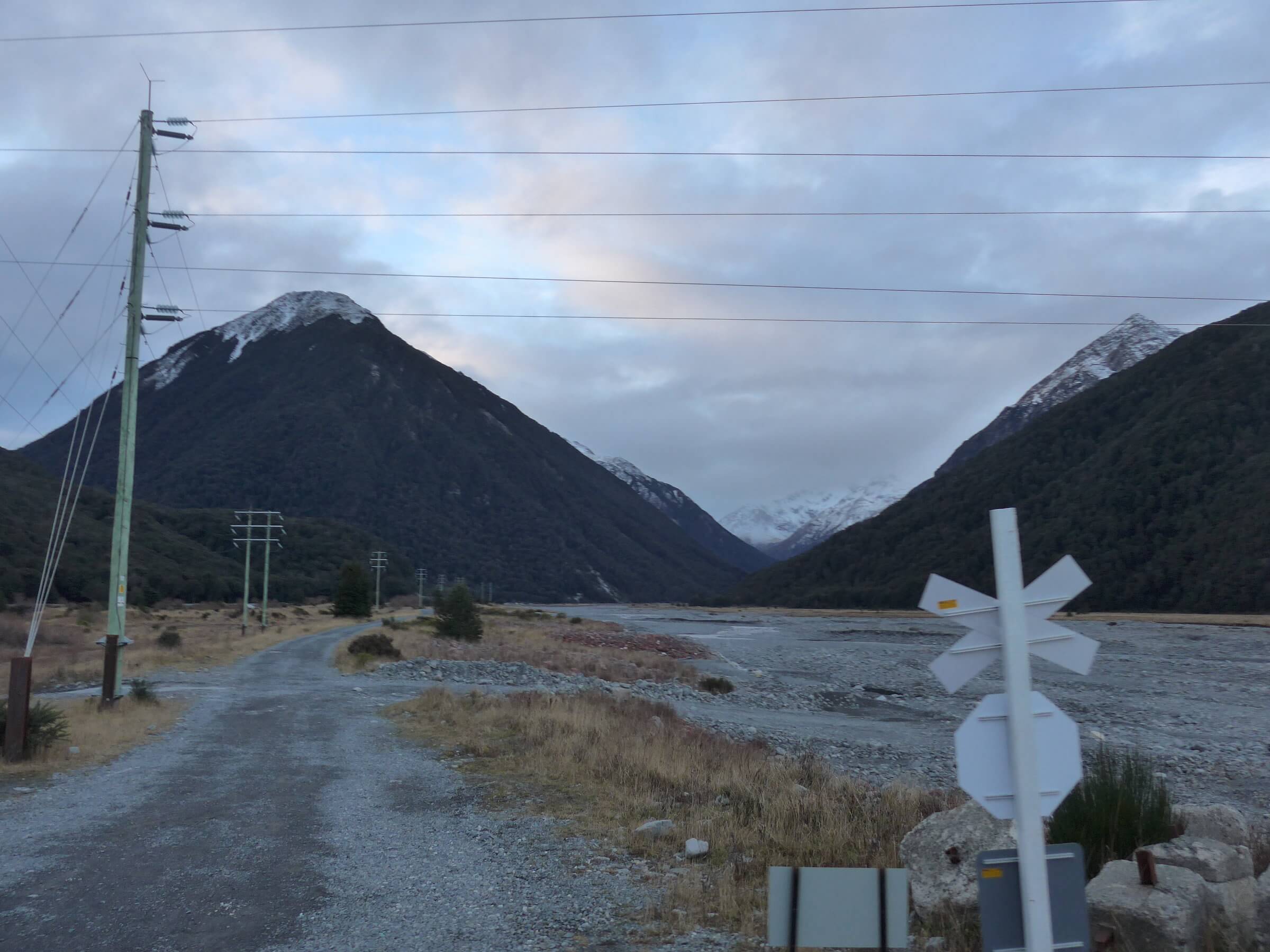
Reaching mountains again in afternoon sun, about 20 minutes to sunset
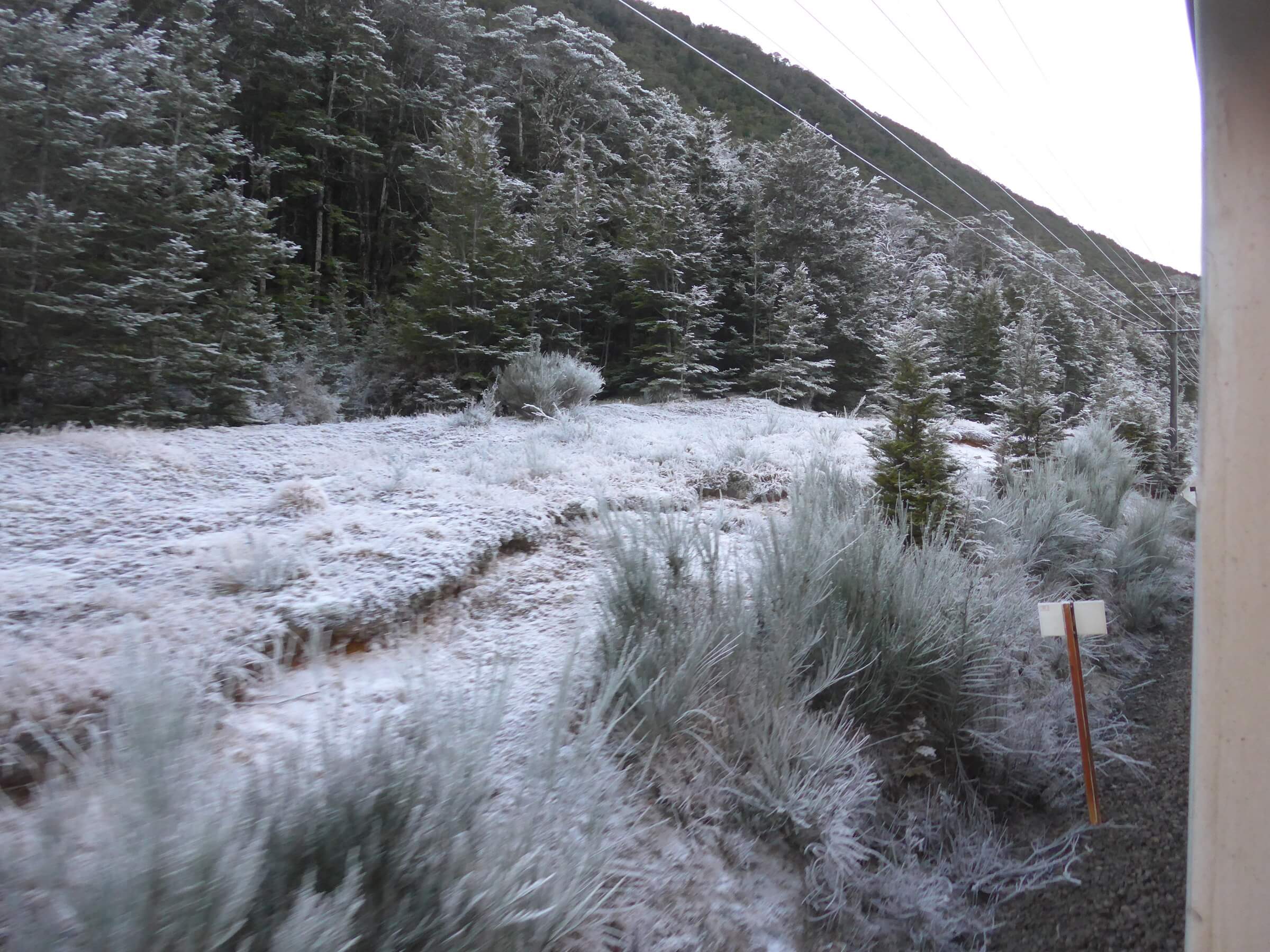
P1080541-modA touch of frost

The sun has set by 5pm and I spent the rest of the journey listening to the commentary about the geology of the area, especially referencing the confluence of three major plates on the Earth which made these amazing mountains through uplift, but also source of earthquakes. It was an amazing day out. I got only a brief taste of “To There and Back Again.” And “To There” I need to return properly someday.

P1080454-mod
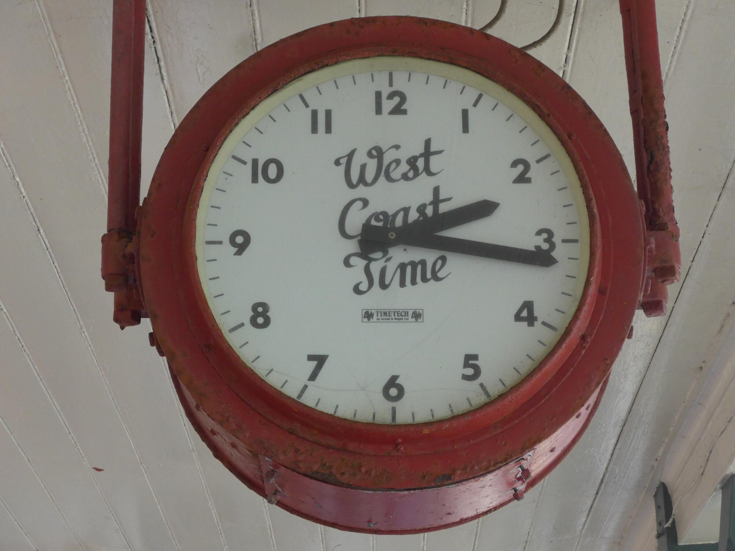
Spotted “West Coast Time” at the Greymouth train station

Be nebulous no more!

July 6, 2017

Last night’s flight aboard SOFIA had us peering into the chemistry of a range of planetary nebulae and large molecular clouds.

We first looked at N159 in the Large Magellanic Cloud (LMC), a neighbouring galaxy 170,000 light years away, moving away from us. N159 is a star forming region, a large cloud (over 150 light-years across) of gas where hot newborn massive stars are being born.

Next we repositioned the telescope to peek at the Tarantula Nebula, also known as 30 Doradus, a very active star formation region in the LMC. Supernova 1987A, which SOFIA will observe later this summer with an infrared camera, occurred in the outskirts of this Tarantula Nebula.

With SOFIA’s GREAT spectrometer, scientists were studying atomic oxygen in both star forming regions with the hope to better understand the physical properties of this unique regions in the LMC.

IMG_5457-mod
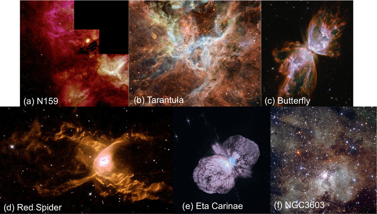
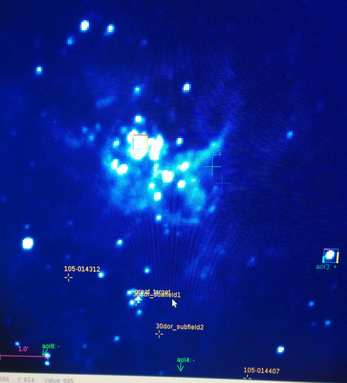
SOFIA’s focal plane imager (visible guide camera) with a 8’x8′ field of view centered on 30Doradus.

Our eyes turned towards the Butterfly Nebula, a planetary nebula in the constellation Scorpius. Unlike young-stellar objects and star-core clumps where we are trying to assess the chemistry of star formation, here we are studying planetary nebulae , part of stellar death. The Butterfly Nebula has a double-lobed structure: an area of active study of the kinematics (speed, interactions, shocks) of the gas and its makeup (ionized, atomic, molecular). On this flight, SOFIA did some mapping of this object in multiple atomic transitions.

Later we looked at the Red Spider Nebula in the constellation Sagittarius, another bi-polar (two lobed) planetary nebula like the Butterfly, but with immense wind speeds. For both planetary nebula, scientists are measuring two transition of neutral oxygen to assess what’s putting in the energy to make these beautiful structures. To first order the UV radiation from the central white dwarf should be enough, but the intensity and variety of atomic and ionized species implies there must be another source of energy. Hopefully these SOFIA observations can shed light on that mystery.

Eta Carinae is one of the most fascinating objects in the sky, a stellar system made up at least 2 stars (maybe more) which is has been undergoing dramatic changes, with documented brightness changes hundreds of years before. Being south of 60 degree South Latitude it is not at all viewable from the northern hemisphere and its bright enough to be a naked-eye object. One star in this system is hypothesized by many astronomers to explode as a supernovae in the near future. It is losing mass at an incredible rate. SOFIA will take inventory of ionized carbon in this object to confirm the presence of a cloud of material across it.

Last night, other areas of study for our flying astrochemistry observatory were to understand the role of hydrides (binary compound with hydrogen) in a massive star formation region plus mapping of the ionized gas near our galaxy’s central massive black hole.

It was a jammed-pack flight with a whole load of cool targets!

July5_Targets_numbered

Some of the exotic targets for SOFIA’s July 5th Flight (a) N159, (b) 30 Dor (Tarantula), (c) NGC6302 (Butterfly), (d) NGC6537 (Red Spider), (e) eta Carinae, (f) NGC3603 (stellar nursery). We were doing spectroscopy of these sources to better understand their dynamics.

Sources:
(a) https://www.spacetelescope.org/images/opo9923b/
(b) http://www.spacetelescope.org/images/heic0416a/
(c) http://hubblesite.org/image/2616/news_release/2009-25
(d) http://www.eso.org/public/images/eso1338a/
(e) http://hubblesite.org/image/430/news_release/1996-23
(f) http://www.eso.org/public/images/eso1005a/

It gets cold on these flights with the GREAT instrument, as they like to keep their electronics cool. I was armed with my flask of hot tea, many layers of fleece, thick socks, and hat, gloves and scarf. It did help that you could walk around a bit to stretch those legs, talk with different members of the crew, and think about the uniqueness of this amazing observatory flying high above planet Earth, coming home in the morning. Just in time for breakfast, and tea.

IMG_5478-mod

Kimberly all in her fleece, with Stefanie Milam (behind). Ready for landing after a science-filled flight.