King Penguins, Isla Martillo, Beagle Channel

dsc03660_1

54d 54m 15.9s S, 67d 22m 27.8s W (WP224)

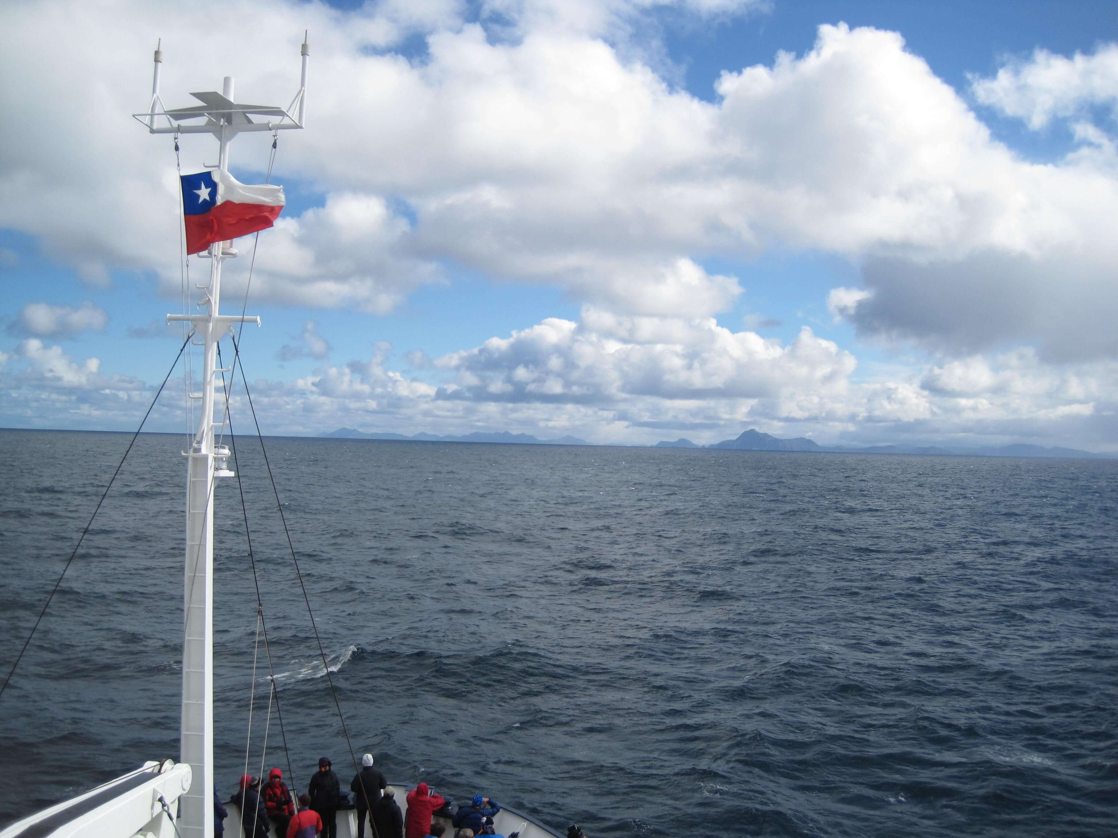
We explored the Beagle Channel (this time, by small boat) with our destination being Harberton Estancia, about 85km from Ushuaia today. It was pretty neat to once again be explorers, even if for a day. Our journey took us near Isla del Los Pajaros (Bird Island)

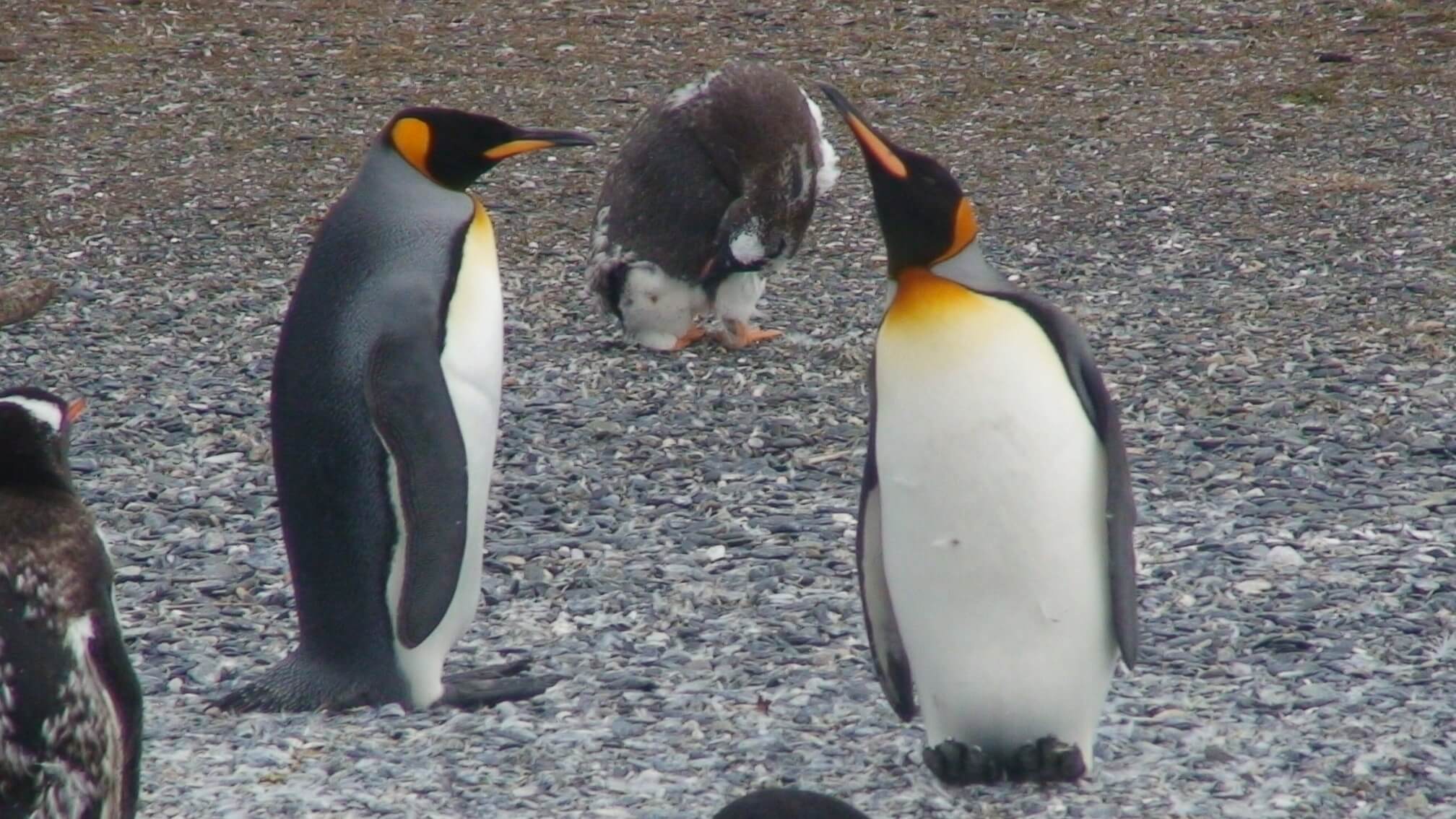
and Isla de los Lobos (Sea Lion Island) skirting us by the Faro les Eclaireus (lighthouse). Finally we neared Isla Martillo, where Magellanic Penguins have a strong rookery, with the occasional Gentoo population that have swum from colder places south on the Peninsula. There were also two King Penguins taking refuge here, although their homes really are much further south on the Peninsula. It was fun to take in the two new species of Penguins, the Magellanic and King, as we fondly remembered our time with the Gentoos, the Chinstraps and Adeles on the Peninsula.

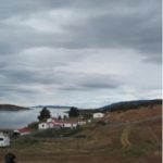
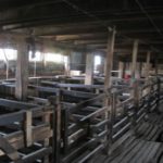
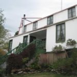
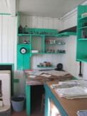
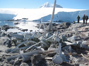
Harberton Estancia was a rather interesting place, still a working farm, but mainly today for the tourism trade (restaurant, tea shop and hotel). Their historic trades were in sheep wool (fleece) and a sawmill. Until the 1970s, the only way you could arrive at Harberton was by boat. The nearby museum and active biology research lab on whale bones was very good.

Cabo de Hornos

img_1027_1

56d 01m 54.3s S, 67d 13m 32.9s W, (WP206)
Turn around point, ~3 na. miles from coast

Due to the changes in the weather, we found ourselves returning back to South America faster than anticipated, giving us almost a half-day ahead of schedule. But as the port schedule is highly fixed, the Polar Pioneer captain was able to plan a route near Cape Horn to give us some views of the tip of South America. Because our boat disembarked from Ushuaia, Argentina, we would have been refused entry had we entered Chilean waters, so we had to view Cape Horn from as far as 3 nautical miles, the closest the Chilean gov’t would allow non-Chilean ships to pass. We had been experiencing a rather calm Drake Passage (at least calmer then our outbound trip) so I spent most of the trip enjoying the 360 degrees of water for the past two days.

It was fun to start seeing cormorants joining the albatrosses, as the cormorants need to be near land (have a range of 10-15km) before land was in sight. The winds were indeed westerly and it was quite the change in motion as we turned away from the winds and got blown eastward towards Argentina. Several ships cross the infamous Cape Horn, and traveling east to west against the winds would indeed give a rough ride for all.

Our trip ended way to early on February 28, 2012. Robert & I were back in Ushuaia on terra firma for a few days before we would return to the USA.

Deception Island

img_0995_1

64d 41m 02.1s S, 62d 37m 40.1s W (WP175)
62d 58m 44.4s S, 60d 33m 27.1s W (WP180)

After three days of blue skies and bright sunlight, we finally experienced the grey and windy side of Antarctica (or technically, we were back in the south Shetland Islands). The weather changed which prevented us from doing some excursions to Hanna Pt on Livingston Island or Bailey Head on Deception Island, so we had to contend ourselves with visiting Telefon Bay and Whaler’s Bay in Deception Island.

It was snowing and windy, but the volcanic island (still active, the last eruption was in the 1990s) provided a change of scenery, being less ice-locked than most of the recent islands. Here, the red-brown-black volcanic rocks were more reminiscent of Mauna Kea (Hawaii) and Isabela Islands (Galapagos).

The remains of the old Norwegian & British Whaling station were fascinating to walk around. They are not being actively preserved, but are protected and allowed to decay per the elements. It was hard to imagine how hard life was for those whalers, living and working in a harsh climate, surrounded by decaying whale flesh, as the whales were processed for their blubber, oil and bones to bring back to the old world. Now the island has reverted back to being a desolate, bleak, place of natural beauty.

Cuverville Island

dsc03564_1

64d 41m 02.1s S, 62d 37m 40.1s W (WP168)

Peacefully situated in a bay off the Gerlache Strait & Errera Channel along the Danco Coast of the Antarctic Peninsula, we visited Cuverville Island. Gentoo penguins abound, and the bay was rich with several amazing and gigantic icebergs. We climbed to the top of the island  (mere 816 ft elevation) to take in the views.

Port Lockroy & Jougla Pt

img_0949_1

64d 49m 30.8s S, 63d 29m 43.1s W (WP162)

After our visit to Vernadsky, Argentine Islands (Wordie Hut), we were now essentially heading home, going north. Today we visited Port Lockroy, site of a former Whaling Station,  and UK’s Base A (during WWII) as part of Operation Tabarin and later the Falkland Islands Dependencies Survey, now a visitor center and historic site. Base A had been closed in 1961-1962. Again, like Wordie Hut, the main buildings (Bransfield House) have been restored and preserved with their original contents in tact or substituted with like-era items (for example, their radio experimentation for ionospheric studies, the Beastie, is not the actual one that was in use at Port Lockroy, but one of the same model and make.).

 It was a marvellous step back through time and a reminder of the roles humans have played and continue to play in this remote wilderness.

Samples from the inside of Port Lockroy, Base A

Jougla Pt, around the corner, we observed lots of Gentoo penguin chicks learning to swim, and observed at close range, nesting blue-eye shags. The beach was littered with a large collection of whale bones, large jaw bones, vertebrae and rib bones, all reminders of the whaling history of this region.

img_0950

A Gentoo penguin perched among the bones of a fine whale, Jougla Pt.