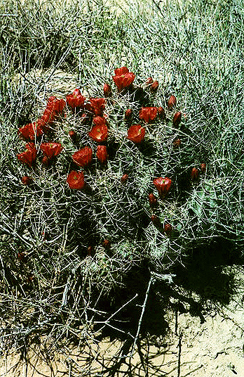
Blooming hedgehog
Chaco Canyon, May 2000
Last Updated: 14 July 2000
Blooming hedgehog
Chaco Canyon, May 2000
Hello all again,
I am writing from the hot lands of Tucson, AZ, again, but of course in a very cold A/C environment inside the astronomy department. I have returned after a 7.5 month stint in Boulder, Colorado, and returned in time to witness 100F (38C) weather. Ah, spring in the desert. June will be the month when the temps top 110F (43C) and my eyeballs will start to hurt again. :)
I had a blast out in Boulder, Colorado. It is a beautiful part of the USA. The locals will complain about the growing populace, supposedly refugees from the escalating costs of living in California, but it sure was a far cry from the crowded (stressed-out) East coast USA where I grew up. And Boulder has the best bike paths I have ever seen, really planned out from the start. Being a bike commuter I was in heaven. The paths are ideal for rollerblading, which I have recently have taken up... And well I welcome any hints on how to slow down or stop...
Working at Ball Aerospace was an interesting experience, and quite different than I what I expected. I cannot really fit all the insights that my mind has gained in a short journal entry, plus, it will bore most of you. All I know is that it was a great experience in the planning of my future career in space instrumentation.
I'll be here in Tucson only for a short while before I start a new job, more in tune with my near and long term career plans. I will be moving to that mecca of high cost living and crowded existence in the Bay area of Northern California, to work at NASA Ames Research Center. It's not really "northern" as since it is more in the middle of the state. It will be another interesting transition for me to adjust to new job demands, new living demands, and of course, new terrain to explore. I'll be off to California in September.
But my journal entry is more about my recent revisit to America's South West... hitting new sites compared to what I have experienced these past 3 years or so, in seeing this area. When I get my film developed, I will add another dimension to my descriptions. I also added a summary at the end of all the National Parks & Sites that I have seen, with links their journal entries, to entice future travelers among you to this very different aspect of the USA.
Enjoy! Send rain soon!
Love,
Kim
22 May 2000, Tucson, Arizona, USA
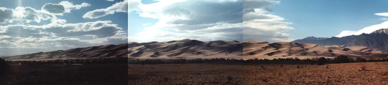
Great Sand Dunes National Monument, Colorado
A combination of wind, water, sand, and two mountain ranges made this *amazing*
site at the base of the 14,000 feet Sangre de Cristo mountains (San Luis Valley) in SE
Colorado. It is about 39
square miles (62 sq km) with dunes of pure sand amounting to over 700 feet (213m) in height, the
tallest dunes in North America.
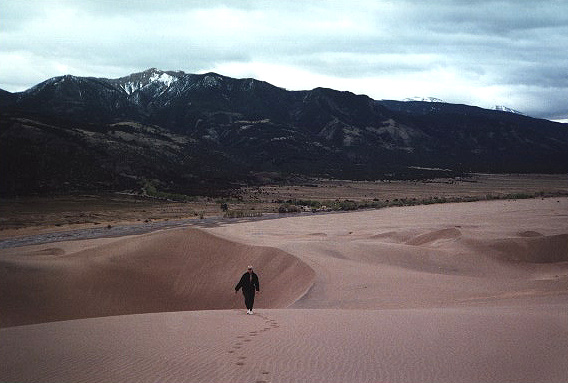
The largest sandbox ever. I had just recently seen "Laurence of Arabia" and my mind
was taken back to those magnificent desert scens as Doug and climbed a few hundred
feet of sand for the views.
They have done some rather neat hyperspectral imaging of the dunes from aircraft (with infrared instruments) to look at it structure & shape and determine its past and possibly predict its future. They reckon it is only about 10,000 years old.
It was such an eerie site, I questioned why this actually happened, and would I find sand dunes in other valleys... It really came down to the right combination of of wind, water, mountain ranges, and time...
The Rio Grande meandered through the San Luis Valley for centuries and carried the sand & other sediments and deposited them in its riverbed. Most of this sand was eroded bits of the San Juan Mountains (to the W-SW of the valley). Some of it was left over rock eroded by alpine glaciers during the Ice Age. The Rio Grande has since moved SW, but left behind its sand deposits. These great deposits of sand were exposed to strong winds blowing across passes (low areas in mountain chains) of the San Juan mountains to the NE, until the grains hit the steep Sangre de Cristo Mountains. For thousands of years, the winds piled up the sands against the based of the Sangre de Cristo Mountains.
When Doug and I hit the summit of one dune, the winds were blowing over 50mph. It was rather neat to see all the lighter sand blowing freely along the sand surface, making a layer of 'fuzzy air.' And watching the grains move to create ripple patterns on so many different scales. The ripple patterns actually tell you the average mean path of a particular sand grain (e.g, smaller/lighter ones go further for a set wind speed), so you can see separation of size & material, right before your eyes...
Our footprints were no longer to be seen after a few minutes during a wind storm. What I found fascinating, was that these dunes were 'rather wet,' like the sand near the ocean edge. It is believed that due to this moisture content that the dunes have not really moved much since they were formed. The moisture must come from the snow and rain.
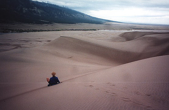
Doug tried to sled down a 200foot sand dune with a sled. He did okay, but the coefficient of friction was a wee bit too high. It must be a sight to go sledding on them when there is snow on the ground. Then again, it might be too icy... Oh if you go in the high summertime, watch out -- the sands supposedly reach 104F (40 C)! Doug and I wore shoes to help with the climb, although the sand felt so nice with bare feet....
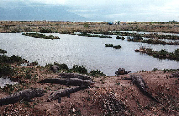
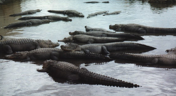
We stayed at the Sand Dunes for a day before turning west and re-exploring the lost civilizations of the Ancestral Puebloans... We ran into the Black Canyon of the Gunnison National Park en route, and took a lunch break there... but not after we visited the alligators...
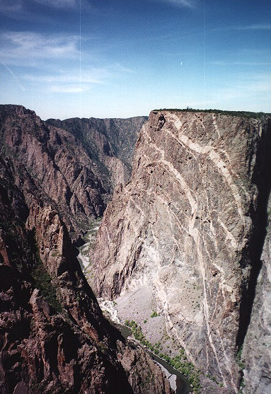
Black Canyon of the Gunnison National Park, Colorado
The Black Canyon of the Gunnison gets its name 'black' from its steep walls which rarely
let sunlight penetrate the depths of the canyon, carved out by the Colorado Gunnison River, which
later joins the Colorado River (the source of most of the water supply in the SW through a
special project). The canyon is 53 miles (85km) long, but the Park (used to be a National
Monument but Clinton recently made it a National Park -- it gets more money this way) only
contains the deepest, 12 miles (19km) of the canyon.
The vistor center had a nice movie about the early exploration of this area of the country by 'white men,' although this area had been in use by pre-historic man and later the Ute Native American Indian tribe. I personally found some of the video a bit tasteless as they focussed on the complaints by the 1800s Denver & Rio Grande Railroad surveyor explorers about how the canyon was a terrible barrier to overcome and the later attempts to tap the water from the Gunnison River for the Uncompahgre Valley. They figured out a way to build an irrigation tunnel to divert the water, and completed it in eight years. At its dedication in 1909, President Taft called it a 'notable engineering achievement of this or any time.' Hmmmm...
I guess one should be glad that the water from the diversion tunnel supports homes & businesses in the Umcompahgre Valley, and it took a lot of effort to get congress to protect the rest of the Black Canyon (1933 it became a National Monument). Otherwise, who knows what would have been tapped next!
I liked the painted wall the best. I hope my pictures come out as it shows how molten material under great pressure forced itself into cracks & joints of the base rock (canyon walls).
After Black Canyon, we ventured for two days at Mesa Verde in SW Colorado.
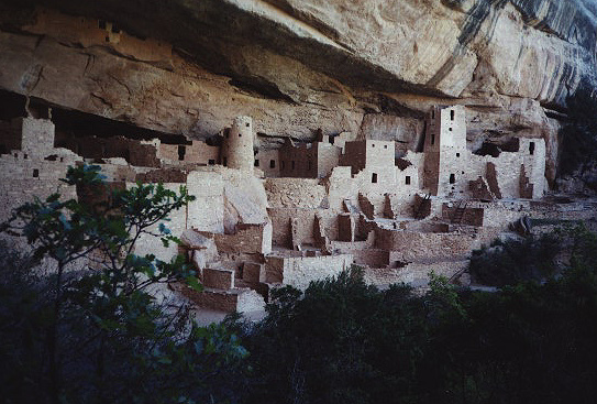
Mesa Verde National Park, Colorado
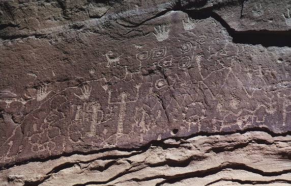
Now, if you back-track through some of my earlier journals, when Doug & I
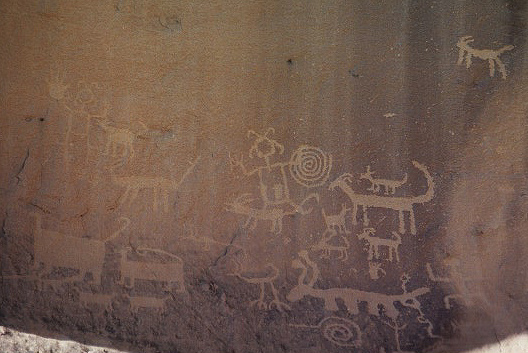
visited SE Utah and uncovered petroglyphs and ruins of the Ancestral Puebloans,
I was amazed by the sites we uncovered. First, the small ruins in Natural
Bridges, moving up to 1000 year old intact towers at Hovenweep National
Park, and even large complexes at Wupatki National Monument, NE AZ. Well, we
went a step bigger and more grandiose with Mesa Verde and Chaco Canyon (see
below). I wonder what will be next!
You might notice that I used the term Ancestral Puebloans above rather then the Anasazi. I learned on my trip that the term 'Anasazi' is a Navajo Indian word meaning 'ancient ones' or more correctly, 'ancient enemies.' It was a term used by archeologists to describe the people who lived in the four corner's region (SE Utah, SW Colorado, NE Arizona, NW New Mexico) 1000 years ago and who disappeared from the area after occupying for a few centuries due to unknown reasons. Decedents of these people are actually not Navajo, but rather members of the Pueblo Indian tribs such as Acoma, Zia, Zuni, Laguna, Cochiti, San Felipe, Santo Domingo, and Hopi. And these people, being related to the 'ancient enemies' have taken affront to the term 'anasazi,' and now these 'ancient enemies' are referred to as the Ancestral Puebloans or Ancestral Pueblo People. Doug & I, being instrument people and thus known for acronyms, affectionally called them the APPs. :)
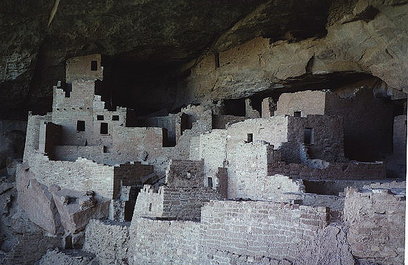
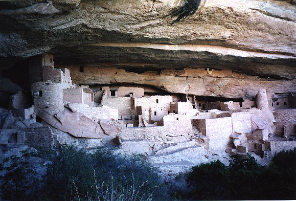
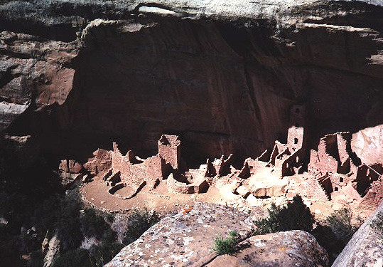
Mesa Verde (green table in Spanish for it look like one, but a bit tilted to the north -- that way it gets lots of sun) is best known for its 'cliff dwellings.' It is thought that the APPs, after living a few hundreds of years in the canyon floors & valleys, as in the Chaco culture (see below), decided to retreat to *their* ancestral dwellings sheltered by the steep cliff walls of the mesas. For some reason, they came to dwell in the cliffs between the late 1190 and early 1200s, only to ABANDON them again in *less than a hundred years* to migrate south. Why they came to live in the cliffs and leave quickly is still open to speculation. Other APP sites such as Chaco (see below) thrived for several hundreds of years, in comparison, concurrent with the Mesa Verde cliff dwellers.
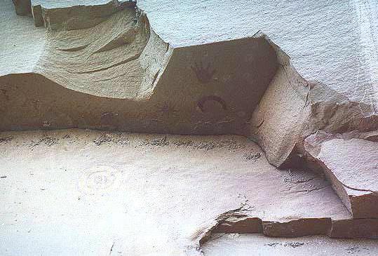
When you gaze upon these 'cliff dwellings,' you can find yourself amazed at how the APPs lived here, climbing up and down the sheer cliff walls to reach the mesa tops (they carved hand and toe holes into the rock and made wooden ladders), where some farming was done, or to the canyon bottom, where other harvesting and collection of water might have occured.
Cliff Palace is one of the most impressive ruin sites, with 217 rooms and 23 kivas. Oh, a kiva, if you don't know already is a modern Hopi word used when describing a subterranean ceremonial structure. They are common among the ruins of APP sites in the four corner regions. We do not know exactly what uses these kivas mainly had, but oral tradition suggests use of them for ceremonial and religious reasons.
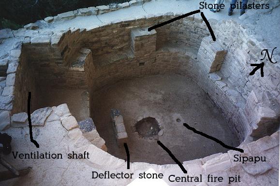
Doug & I saw many kivas and even climbed down into one at Cliff Palace. All kivas, more or less, follow similar construction methods, with 6 (sometime 8 for larger diameter) stone pilasters on the curved walls supporting a wooden roof made by alternating logs across the posts and covered with a top layer of mud. A benchlike shelf on which the pilasters rest might have provided storage area for pottery and other items. There is often a recess in the Southern end of the kivas and often there would be small rectangular niches in the kiva walls. The average size for a 6 pilaster kiva is about 15 feet (4.5m) in diameter, with height about 9 feet (2.7m).
There are two openings to the kiva, a central aperture through which fire smoke can escape and served as the entry way of person via a ladder, and a ventilation shaft at the South end of the kiva. This ventilation shaft drew in air into the kiva which was diverted via a deflector stone into the kiva and fed air to a central fire. As the smoke rose through the central hatchway, a partial vacuum was created inside the kiva which then drew fresh air into the kiva via this ventilation shaft. This circulation of fresh air made it an efficient ventilation system. Kinda neat, eh?
A small hole, located along the N-S axis, but always at the North end (the APPs were certainly observant of the cardinal points) represented the 'sipapu,' (pronounece SEE-pah-pooh) or the location where the spirit world entered the real world. Modern day Hopi kivas still possess the sipapu and their beliefs about entrances to the spirit world still hold true. About 50% of the kivas at Mesa Verde possessed the sipapu, and it was absent from 'great kivas' which we were later to encounter at Aztec and Chaco Canyon ruins (see below). As each major site contained several kivas, it was obvious that the kiva was very important to the ancestral Puebloans.
Since these cliff dwellings were constructed in great places protected from the elements, they have survived to the present day in very good condition. The most destructive element against them is water damage (besides human development) which can break down the sandstone and cause the building structures to crumble away. Thus, the park rangers make a big deal about keeping the sites dry and diverting run-off from the mesa tops above to preserve these structures.
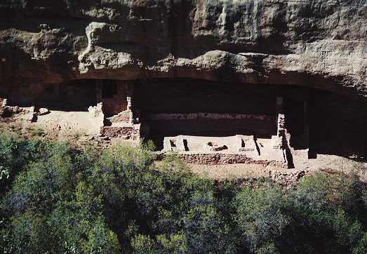
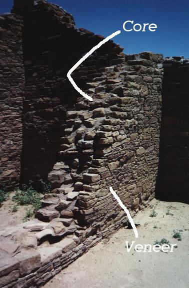
Mesa Verde also has a collection of ruins from the pre-cliff dwelling period, 600-1000 AD, and also some non-cliff ruins concurrent with the 1090-1200 AD period and out to 1300 AD before the final exodus of the APPs to the south. We learned about the precursor houses of 'pithouses ' (600 AD), and how it is thought that these partial subterranean houses might have evolved to the kivas of the height of the Great Pueblo Period (1100-1300 AD). After 'pithouses,' the APPs learned how to build houses of stone (900-1100 AD) and experimented with different masonry styles, with rather some good basic engineering skills in place (e.g., walls thicker at bottom & tapering to the top, walls thickened with a 'core' and a 'veneer' style, towers and underground passageways in between main buildings, supports beneath the walls dug into the earth). Certianly Mesa Verde was a prime site which attracted the APPs whether they chose the canyon floors, the mesa tops, or the cliff recesses in between.
Guess where the archeologists found most of the clues to tell us about these ancient dwellers? You would think it hard as since they disappeared from the area. Answer: In the garbage pits, called a midden, often just at the base of the cliff dwellings, or in the case of the mesa top/canyon floor houses, in mounds nearby. They even found bodies there, not out of disrespect but probably because it was easier to dump them in the midden than to dig graves on the solid hard ground. From excavations of the middens, scientists have learned a great deal about their diet, health (bad teeth problems, prone to arthritis & rheumatism), height (men: 5'4"-5'5'; women: 5'-5'1"), how they kept their hair (straight black,short for women), how they took care of their young, etc. There are always more questions than answers, and studies continue to piece together the story of these people, who left no written word.
We did not get to see all of the park as since they open up certain parts during the summer months. It was ironic since 'summer weather' was pretty much in place, but 'summer' begins Memorial Day (May 31st) for the gov't folks. Also, the park provides guided tours to the bigger cliff dwellings, Cliff Palace and Balcony House. We were only able to see Cliff Palace, missing the opening of Balcony House to the public by a few days. So it is a park with a must return in the summertime, but not in high summer! :)
Oh I was reading a little bit about the finding of the park, and I thought it was interesting. These cliff dwellings actually remained hidden from the early Spanish explorers, only to be stumbled upon by some cowboys in 1888. The cowboys sadly pillaged a lot of the artifacts but the buildings were kept in amazing shape. These cowboys then started holding tours and taking in money to show people the sites. Tourists came and took more ancient relics. Eventually a woman newspaper writer, Viginia McClurg, after seeing the ruins in 1892, was shocked at this behavior and led the lobbying to make it a National Park to preserve these ruins and the artifacts inside. Joining with another woman, Lucy Peabody, and also involving the Utes as since these ruins lie on their Reservation land, they eventually succeeded in persuading President Theodore (Teddy) Roosevelt to sign the bill and protect Mesa Verde (June 29, 1906). And this was at a time when women did not even have the vote, so one can imagine their struggle. Thank goodness women are persistent creatures, otherwise Mesa Verde would not be in as good shape as it is today! As for the cowboys.... But who am I to pass judgement. I just find these little tid bits of history fascinating.
A final note about the park. They say it is not highly visited, unlike Yellowstone and parks out in the crowded California and NE areas of the country, and thus not well supported by the income from visitors. Doug did not like how they had 'concessions' for camping and stores. I was new to this, but some National Parks hire companies to take over and maintain the campgrounds, stores, and other ultilities. Only some of the money you pay will reach the National Parks, unlike National Park 100% supported campgrounds/stores/etc., with the rest of the money going to the concession company. I found the facilities okay, but one wonders what does this do to 'our National Parks.' In British terms, they are becoming slightly 'privitized' as the National Park service cannot support themselves. I found that sad...
Aztec National Monument, New Mexico
This was a neat site just south of the Colorado- New Mexico border in the NW corner of New
Mexico. It was here that I learned about the 'great kiva,' and they had a reconstruction of one
which left me with many questions, most to be answered in the next few days in Chaco Canyon...
This type of kiva was different than the types I saw in Mesa Verde and the ones I remembered from
past trips to the area.
The ruins here were most impressive. This ancient Puebloan city is located about half way between Mesa Verde and Chaco Canyon, accessible by roads eminating from the Chaco Canyon center (about 50 miles (31 km) in length! and quite durable. These APPs were quite the engineers). The major ruins date from between 1050-1150 AD, when the community flourished, but habitation here started before that with the more nomadic ancestral Puebloan tribes who gathered and hunted in the valley. As since the Animas River flows into this valley where the Aztec ruins are located, the area was rich with cottonwoods & willows and farming lands. And, eventually, the APPs started collecting wood and building great houses.
It was a large complex, but they did not excavate the majority of the site. Ironically, they did this to better preserve the site, protecting it from wind and water damage, and of course, human damage. So as I walked through (these sites have paths that take you into/out of rooms, up onto good overlooks, etc. and are well maintained) the excavated 400(!) room site on the West side of the complex and read (you take these self guided tours) about the artifacts found in each room, I began to wonder what treasures remain hidden in the unexcavated ruins on the East side. All for modern & future science to uncover without 'uncovering.' It's so neat what airborne photography and modern imaging can do to determine what lies beneath.
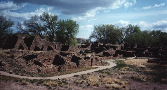
But I digress. I was indeed happy at these ruins. This site was the first of many 'great houses' in the area. Arenas containing hundreds of rooms and dozens of kivas and a great plaza where a community of a few hundred APPs lived, worked, ate, slept, talked, and dreamed. These palaces were three stories high on one side, two stories in other areas, with a variety of building techniques. As in the ruins of Mesa Verde, you can pick out where one mason took over from the next, or where the people decided to rebuild over existing structures for one reason or the next.
One final note about the great kiva at Aztec. It is a reconstructed kiva that you can walk into and visualize about the types of things that would be going on there. As I mentioned before, the term 'kiva' is taken from a modern Hopi word referring to places where ceremonies/rituals are held. Archeologists do not know exactly for what these circular underground (although in some cases in Chaco Canyon (see below) the kivas were above ground) rooms were used. They have yet to find animal bones in them, pretty much removing the 'kitchen' from an explantion, and have found artifacts of pottery and pipes within a few. All kivas, past and present, are holy to the Hopi peoples, and we treated our visit to the great kiva with the same respect.
Instead of having 6 (or 8) stone pillars supporting the roof, made of wood, the great kiva contained four tall support square pillars, each supported by four large limestone disks and composed of a mixture of stone, mortar, and wood. And instead of one antechamber, usually to the South, the great kiva would normally have two, one to North and one to the South. There would be a central firepit and a deflector for the ventilation shaft, but I did not see a sipapu. On the East and West sides of the central fire pit would be two large rectangular vats. It is thought that these formed 'foot drums' where pieces of wood/yucca/straw were placed to form a firm drum head, beat by the feet of several APPs. It is also suggested that these vats held seedlings when growing new crops, as done today with the Hopis. This great kiva at Aztec probably measured ~75 ft (22.9m) in diameter with height 25 ft (7.6m). The most common understanding is that the great kiva, compared to other 'smaller kivas' were used for community wide celebrations.
I was curious as to why the park was named Aztec Ruins. I learned that when the ruins had been found by early 'Anglo' settlers, people were amazed at the high quality work of stone age peoples who had lived, and thought these people must be related to the Aztec Indians of central Mexico. The Aztec, however, lived centuries *AFTER* the rise and fall of this Ancestral Pueblo town. The APPs did trade with the ancestral tribes living in present day California and Mexico, and that has been seen by influences in architecture and also artifacts such as macaw feathers (from Mexico), turquoise (from AZ/CA), and seashells (from CA).
After a short hop at Aztec, we entered the windy valley of Chaco Canyon, the center of the largest concentration of the APPs a thousand years ago.
Chaco Canyon National Historical Park, New Mexico
This site was amazing, to say the least! You have to travel over 20 miles of dirt road to get to the
park, so that dissuades several visitors, and also blesses the park with better conservation. It actually
is more accessible now than before. We arrived in 50mph++ winds so it was a challenge to put up a tent.
The site is also a protected night sky area and they have an observatory program there, where amateurs
look for supernovae and the like. On Friday and Saturday evenings they have public viewing. Doug & I stayed
over a Friday night, and ran out to the observatory,
but the moon was near full, so it was the dominant beast in the sky. Nonetheless, it
would be utterly impressive come new moon.
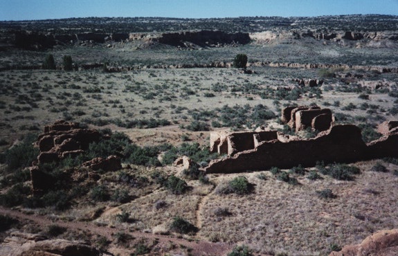
Unlike Mesa Verde, this park was welcoming to hikers. Most of the giant ruins were accessible by car, but they arranged some beautiful hikes along the mesa tops to outlying houses (usually not excavated to protect them from the elements) and for overlooks of the main complexes. In about two days, we saw neary 100% of the sites mentioned in the park brochure, but you can be sure there were a lot more undiscovered or undescribed locations of other additions to this vast network of public houses, roads, and ramps. A word about the ramps...these Chaco Canyon inhabitants created ramps to the tops of mesas, sometimes 100s of feet high, by hurling stone, mud, dirt, sand, etc. and packing it tight -- and remember these people had not invented the wheel!!!
The names of the complexes were quite intriguing, some named by early explorers using Navajo or Spanish names, others which have no translation. We ventured to smaller sites such as Hungo Pavi, Kim Kletso, Casa Chiquita, Pe�asco Blanco, Pueblo Alto & New Alto, then the large impressive 'cities' of Pueblo Bonito (my favourite!) and Chetro Ketl (Doug's favourite, and when there was more to discover we walked through Casa Rinconata, Tsin Kletsin, Una Vida, and Wijiji, most of these left unexcavated, but still most impressive sites due to their sheer size.
It was here I learned more about the great kiva, seen by my eyes for the first time at Aztec National Monument (see above), and these complexes had most impressive great kivas, notably the one at Casa Rinconada, which actually was a surprise in itself. It is a surprise since Casa Rinconada was realistically a small establishment, wtih 19 rooms and six normal kivas. The great kiva at Casa Rinconada was set atop a small hill nearby, overlooking several nearby villages and accessible by roads. Thus, one would come to Casa Rinconada for the community wide ceremony. I wonder what the local residents thought of that! We all have memories of some neighbor's party which got out of control. :)
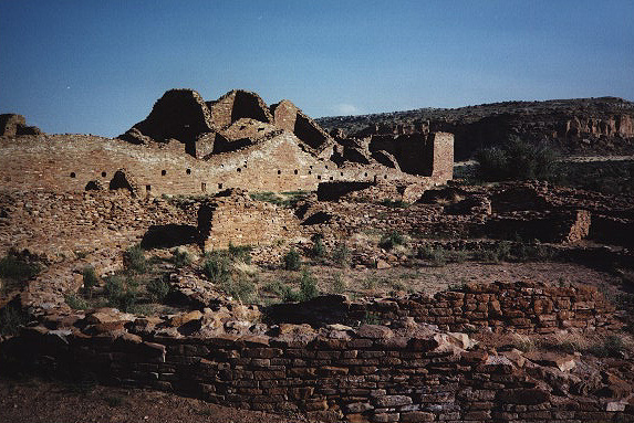
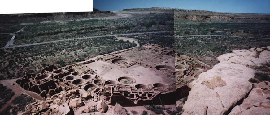
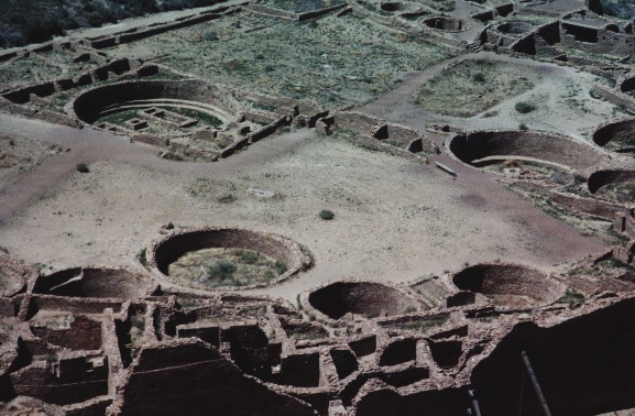
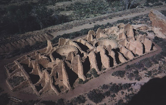
Of course I must say a few words about the two main sites of Chaco, Pueblo Bonito and Chetro Ketl. They are by far the largest complexes (called 'great houses'), built over hundreds of years over the 850-1150 AD period and were 'planned' from the outset with multi-storied construction, very large rooms, plazas, distinctive masonry, and subterranean 'great kivas.' Some structures had astronomical markers, to help determine the seasons due to the motions of the sun. The kivas, as I mentioned before, had internal markers orientated N-S, whereas their circular structure symbolized perhaps the sky (speculative, but why round when most of the rooms were rectangular, with the exception of the kivas and towers?).
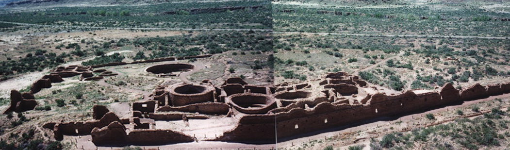
It is believed that these great houses served more for storage, trading and ceremonies rather than for habitation, and archeologists now estimate that about 100 people lived at Pueblo Bonito (this is compared to original estimates of 1000 people at Pueblo Bonito). Actually, from listening to the Park Rangers, no one really know how many people lived at Chaco, the estimates range from 4,000 to 30,000 people over the 850-1150 AD period, and Doug & I were told that if we were to come back in 10 years, a new number might be mentioned... :)
The great houses were definitely built well, and we today can view the remains, mostly intact, after 800 years because they were so well constructed. The APPs rebuilt over and over within the great houses, and there is this magnificent collection of kiva reconstruction at Chetro Ketl, with so many overlapping 'circles' of stone (i.e., the walls of the ruins of kivas), one would wonder if they had planned this from the outset.
These APPs were certainly very clever. Not only did they recognize the importance of roads and ramps, but they also built ridges and irrigation systems to capture runoff from heavy summer rains (the monsoon season, as we call it now from July-September). We saw evidence for this all over Chaco Canyon.
Chaco Canyon is a site not to be missed if you find yourself in NW New Mexico.
Very Large Array (VLA), Socorro, New Mexico
Swinging by Alberqueque, NM, we headed south towards Socorro, the home of the Very Large Array, an
array of 27, fifteen meter diameter, radio dishes. They are used in combinations to give a variety
of resolutions in the radio wavelengths, and are probably known to most of you as being in the
"Contact" film starring Jodi Foster. I had a good friend Bill K who was working as a telescope operator
at the VLA during the time of the movie filming, but sadly he was not able to meet the stars. I also
learned that astronomers never observe from the VLA, but just submit their observation requests and wait
til the data comes in the ftp site. I guess they got that wrong for Hollywood.
When we swung by, it looked like the arrays were in the most compact (higher sensitivity, lower resolution) configuration, which would mean they spread out to 0.4 miles (0.64 km) in radius. The largest configuration (lower sensitivity but higher resolution) has each arm going out to 19 miles (30 km). The 27 dishes are arranged in a Y with 9 dishes per arm. There is a 28th dish which is used as a spare. I found it easily when couting the dishes (it was easy with the close packed configuration). And it looked like they had one dish down during an observation (one dish pointed up whereas the others were all pointing at some point in the sky). And the telescopes are moved about on railroad tracks, similar to the setting in Lord's Bridge, in Cambridge, England.
They had a nice self-guided tour of the faclity, but it would have been nicer if there were a person to ask specific questions as your eyes tried to take in this really neat site. At one point our tour took us past the telescope operator. I am sure he was not too impressed seeing random people squishing their noses against the window to peer into the control room. Was this what it was like Bill?
Doug and I then headed into Arizona towards Tucson. If your travels ever take you to Morenci, AZ, you have to check out the largest open pit copper mine in the USA, run by Phelps Dodge. It looked a scene from the movie 'the Postman,' which I hear actually had parts filmed in Bisbee (near Tucson, and yes I have not yet visited it, but hope to do so this summer), where there is a mining pit. Doug & I were stunned as we watched mining trucks, whose *wheels* were TALLER than the cabs of a truck trailer. It was a pretty weird site. Plus the nearby town of Clifton, Arizona, where we suspect is the home of the miners, was a half ghost-town half alive community and had a monstrous metal gate to lock the town in. We wonder if that was for emergency reasons... I have never seen anything like it!
List of National Parks/Monuments & sites visited thus far in the Four Corner's Region
--Kimberly, May 24, 2000, Tucson, Arizona, USA