Journal Entry, May 2, 2003
Photos have been saved at lower resolution for faster download.
Click on each photo for a higher resolution image
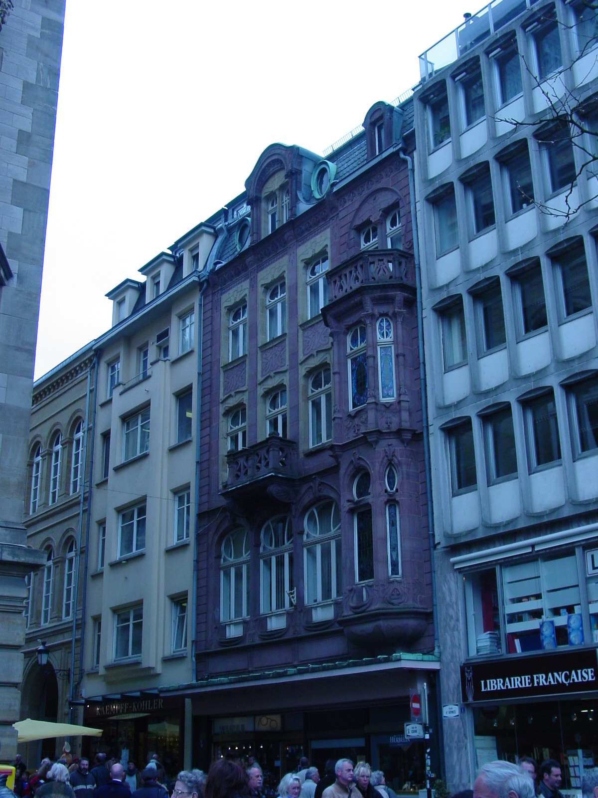
It is said that everyone, at some point in her life, tends to take in all of Europe in a weekĺs time. Well, "at least Americans do", as I have been jaded these past few weeks. So my recent European adventures, where I visited six new countries in ten days, counts as the "American-style" of "doing" Europe, perhaps just as casually as Americans and how they "do lunch." Then again, I have also been corrected that all young (and perhaps na´ve) Europeans themselves seem to do this trip, either Euro-railing (trains) or backpacking their way through cities, sleeping in hostels, and eating on the run, to get that "taste of Europe." So I consider this latest adventure of mine to be akin to hose experienced by those intrepid, and perhaps a bit crazy, modern-day young European explorers. Except, mine was in a 1960 Bentley, Rolls-Royce. Not mine, but that recently acquired by my enterprising Russian friend Volodja from my Cambridge years who presently lives in London.
|
|
|
|
|
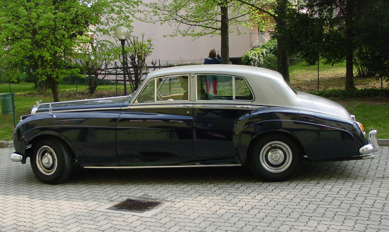
Bars, Volodjaĺs 1960 1st 8-cylinder Bentley, Model S2 with 6.2 liter/6230cc (engine volume) |
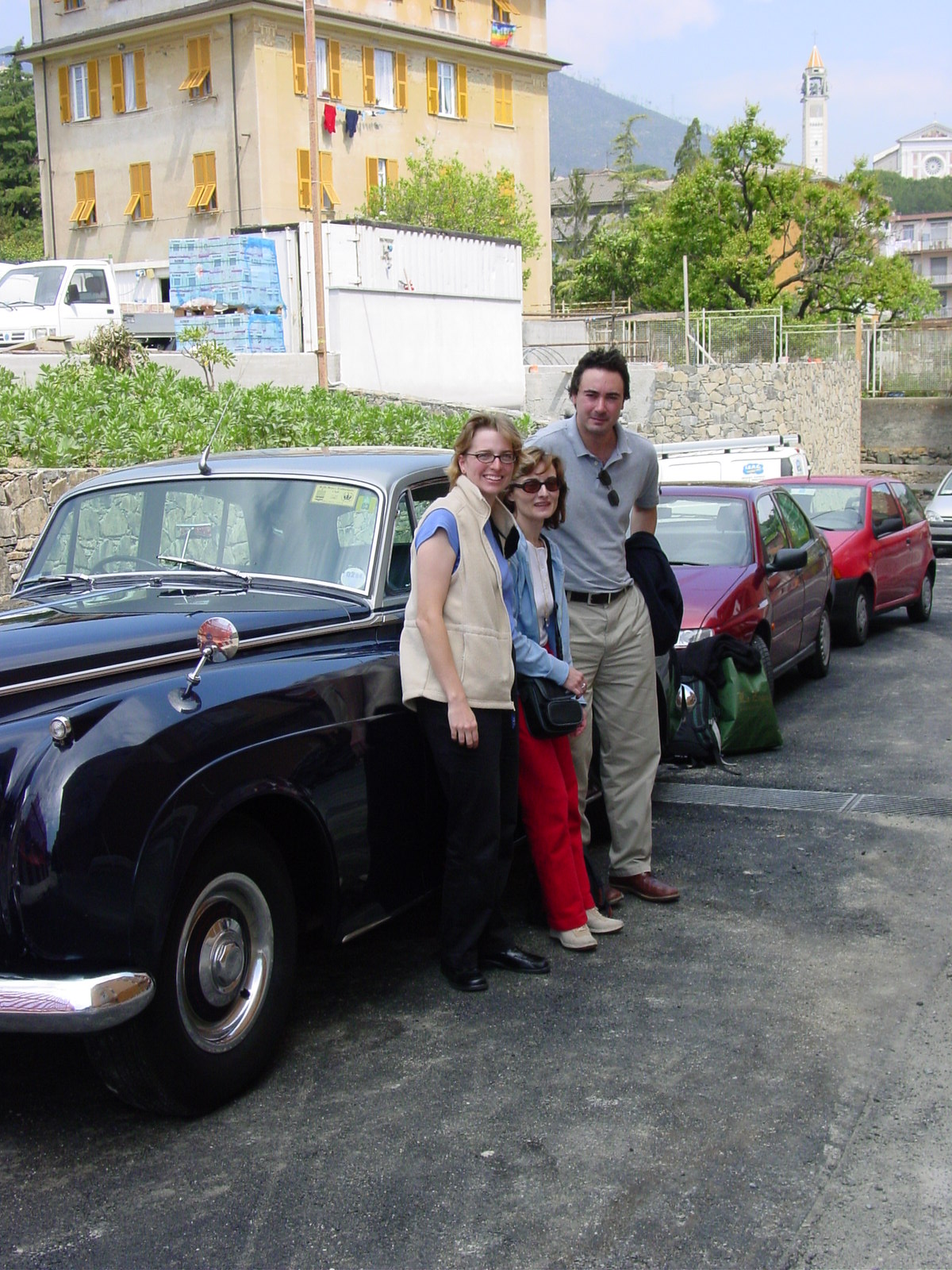
The out-bound trekkers, Kimberly, Luisa and Volodja at the end of the journey in Arenzano, Italy |
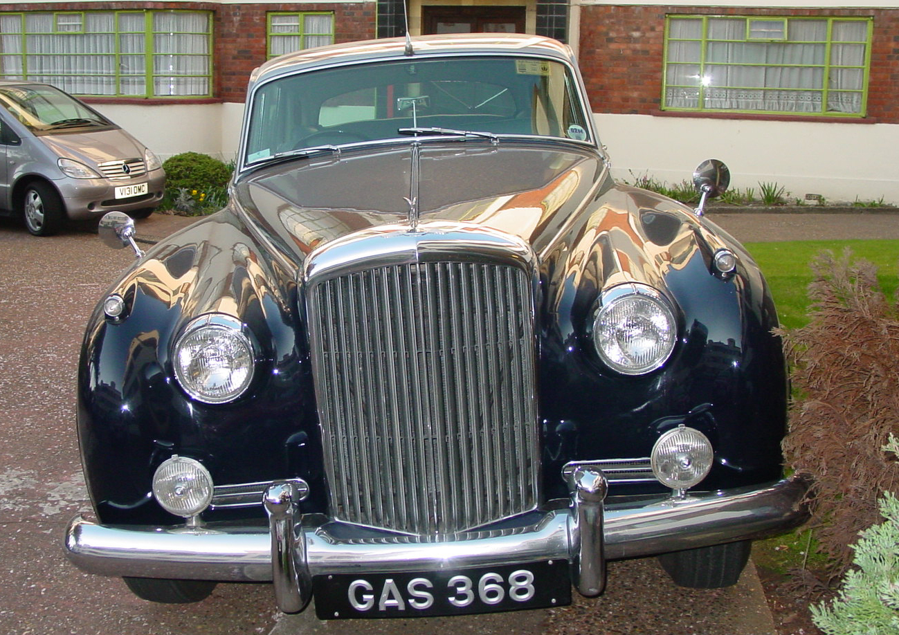
The proud 2-tonne Bentley in London, measuring over 5 meters in length and 2 meters in width. |
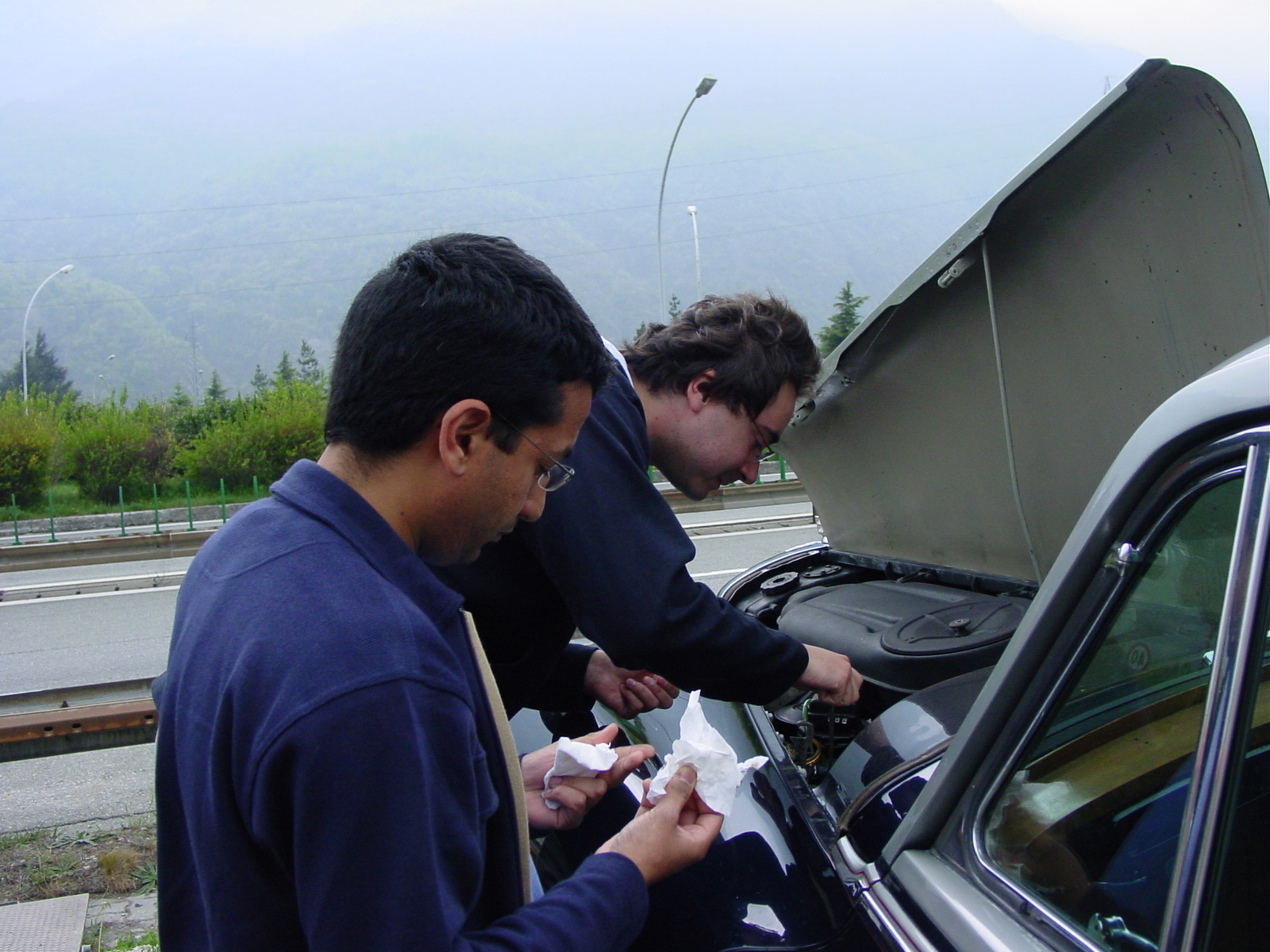
Return trekkers, Mukund & Volodja checking the oil, as Kimberly takes the action-shot. |
They call it "Continental Touring." Well, I will admit it was a comfortable ride, albeit a bit noisy when we hit speeds above 70 mph (113 kph) on the Autobahn, and had its occasional quirks. Quite an impressive feat for a 1960 beast to drive 1232 miles enroute [en-'rootĺ] from Wanstead, northeast suburb of London, UK to Arenzano, Italy (near Genoa in the province Liguria) in north-west Italy in 5 days, followed by the 'quickĺ route via France requiring a mere 815 miles traveled in 2 days. Yes, it was a "road trip," especially when Bars, the affectionate name given to my friend Volodjaĺs Bentley by his mum, required about 600 liters (156 US gallons, 132 Imperial gallons) of petrol and a tin of oil for the voyage. Ah, they donĺt make cars like the used to... :)
Update: 6/6/03 Our trusty steed, 'Bars' the Bentley, is actually the Russian word for snow leopard (which happens also to be my all-time favourite big cat). Bars was also the name of Volodja's dog during his younger years in Russia.
We, the three trekkers on the outbound voyage, Volodja, Luisa, and myself, were fortunate to be blessed with beautiful warm, sunny weather on our trip to Italy. On the flip side, poor Bentley did not have air conditioning and letĺs just say, the transport mechanisms tended to get a wee bit overheated after many non-stop miles driven, that it would make the inside a nice little oven, but at least you could not feel the bumps, as the car floated over-pretty much every nook and cranny in whatever countryĺs roads we were traveling (and the road conditions certainly varied from country to country). One funny observation is that Bars handled each countryĺs roads slightly different, the most amusing one is not liking the French roads where at approximately 73 mph, not 70, not 75 mph, but 73 mph, the Bentleyĺs wheels would get into resonance with the road and give us an unwanted massage, which certainly was not good for the suspension. But we had no other problem in the other 6 countries! How strange. Just one of those mysteries I guess.
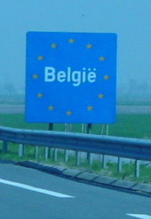
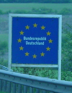
The objective was Italy, where our dear friend Luisa lives. How best to get there by car? Volodja decided, "first drive to the Channel, then cross, then head east, south, east, and then south again." This, mind you, is in the vacuum of the ever-windy motor-way system and removing all obstacles such as lakes, tunnels, mountains, and border patrols. After all, we were an American, a Russian, and an Italian traveling in a British car. Why be predictable? So in five days, we traveled from England (London), a wee bit of France (ferry docked at Calais), then on through Belgium, Luxembourg, Germany, Switzerland into fair Italia.
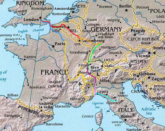
An overview of the outbound and return voyage, with some
signposts welcoming us to different countries.
Day 1 (red), Day 2 (orange), Day 3 (stayed in Heidelberg,
Germany), Day 4 (green), Day 5 (purple) , Day 6 (light purple), Days 7,8 (light
blue), Day 9 (yellow), Day 10 (blue)
17 April 2003 The Planning
Actually, kudos to Volodja for planning the adventure, along with supplying us with loads of maps, some with details, some without. All used pretty much during the trip, for each country adopted its own way of signposting motorways (some blue signs, other green sign), exits (some numbers, other with letters or place names), and petrol stations (especially those which have leaded gas or lead replacement petrol since the 1960 Bentley required adding lead replacement to unleaded gas).
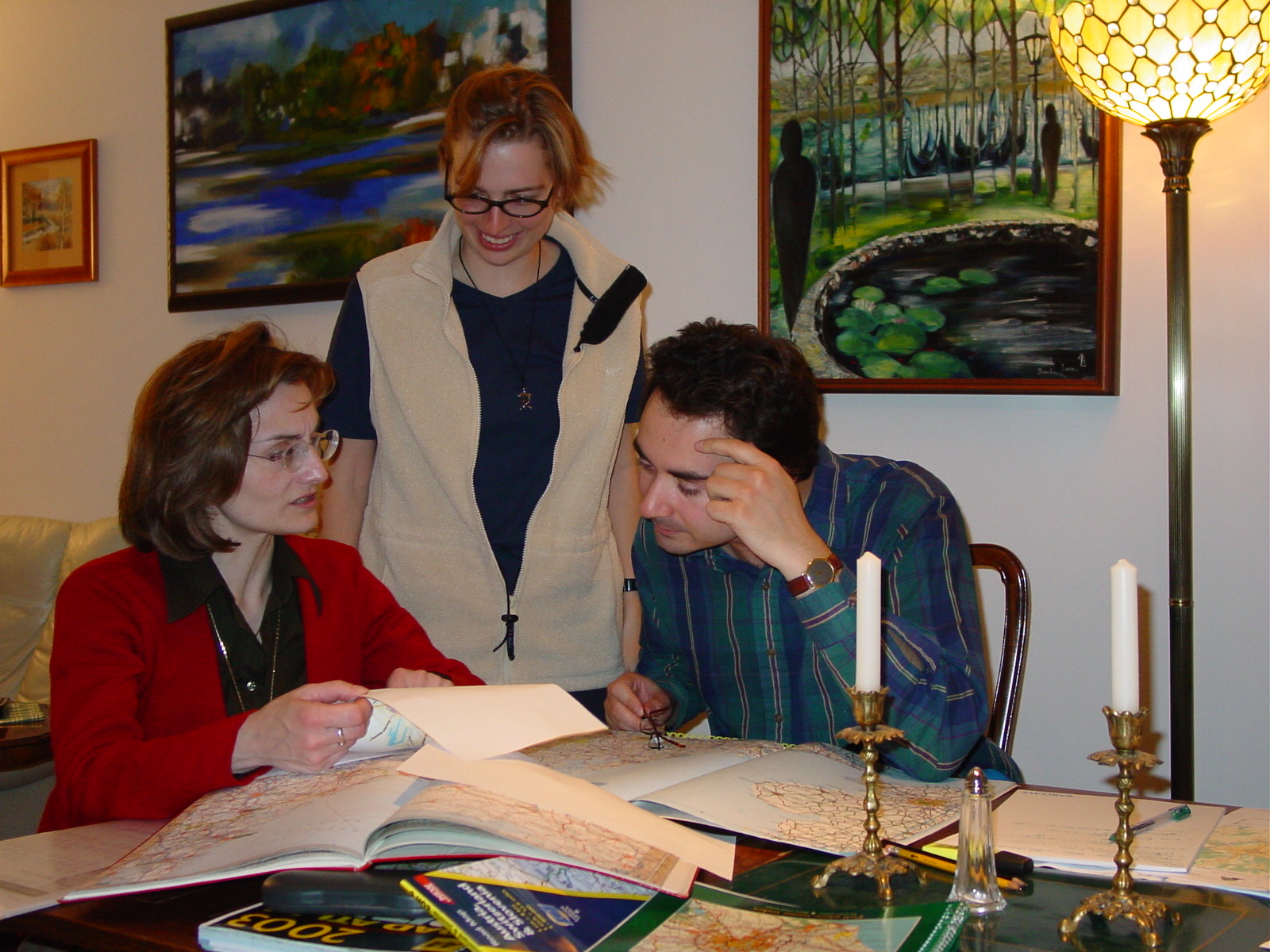
Luisa, Kim and Volodja plan the trip (don't we look serious?)
18 April 2003 (Day 1)
Geography: London->Dover->Calais, France->Brugge, Belgium->Luxembourg City, Luxembourg
Mileage: 348 mi (560 km) + ferry crossing distance (approximately 25 miles (40 km))
The long voyage south-east started with a long day, beginning at 730am UK time loading up Bars, and ending around 10pm Luxembourg time (1 hour ahead of UK), visiting four countries!
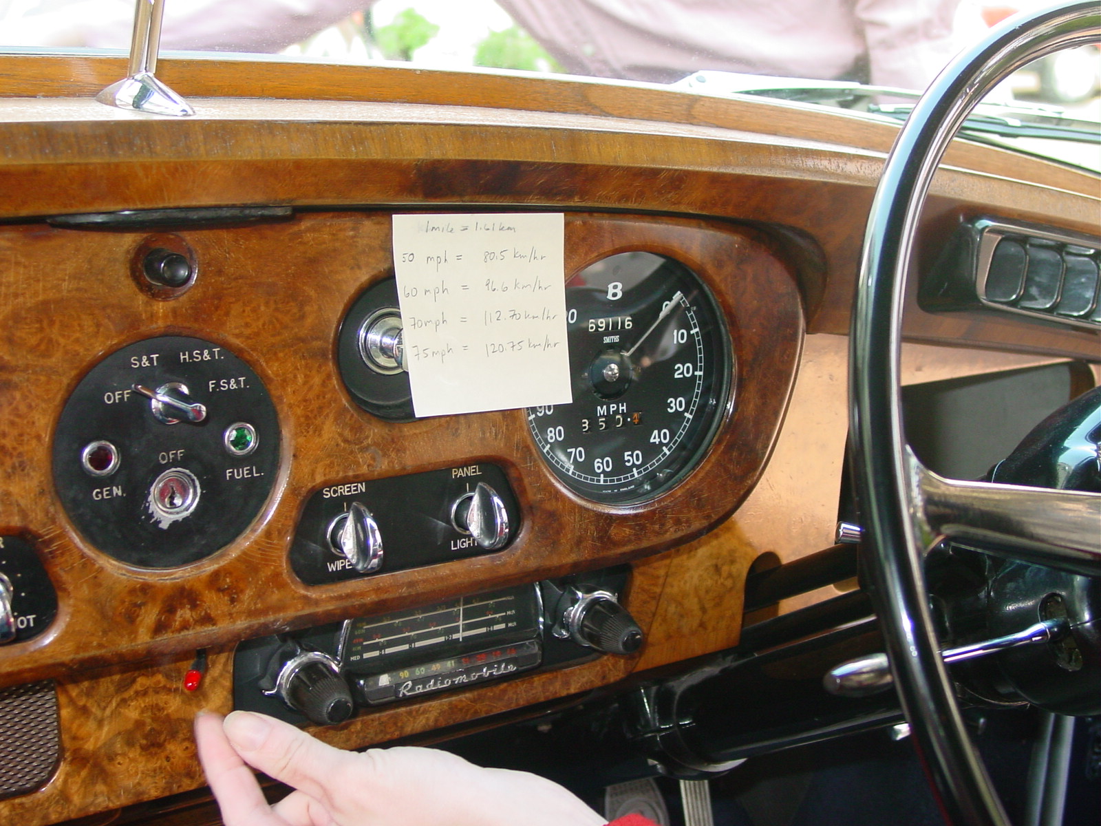
Preparing for the continental Europe driving speeds which are labeled in km/h, whereas the Bentley speedometer reads in miles per hour (mph). Also fun to learn along the trip were the unusual placement of knobs, buttons and flashing lights to turn on/off various thing, most of which, I must add, have not made it to the modern vehicle in the same positions, for better or worse.
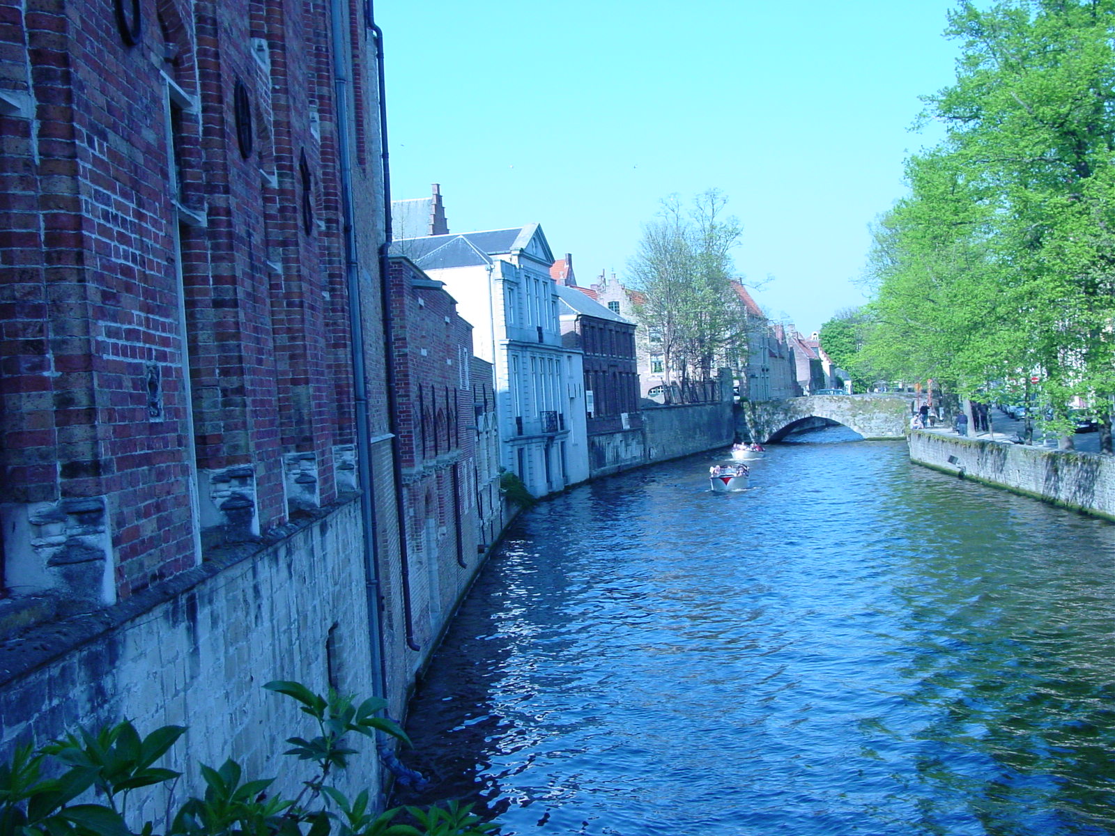
Brugge (Bruges), Belgium (B)
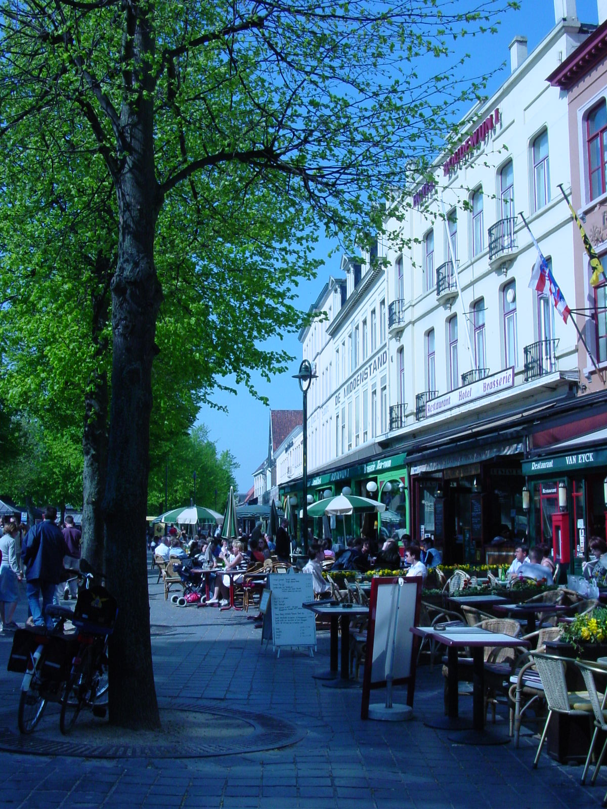
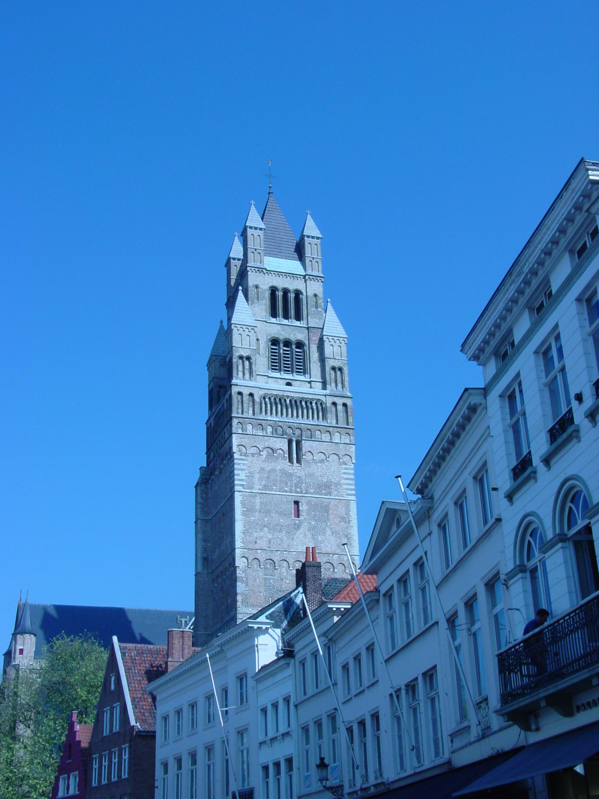
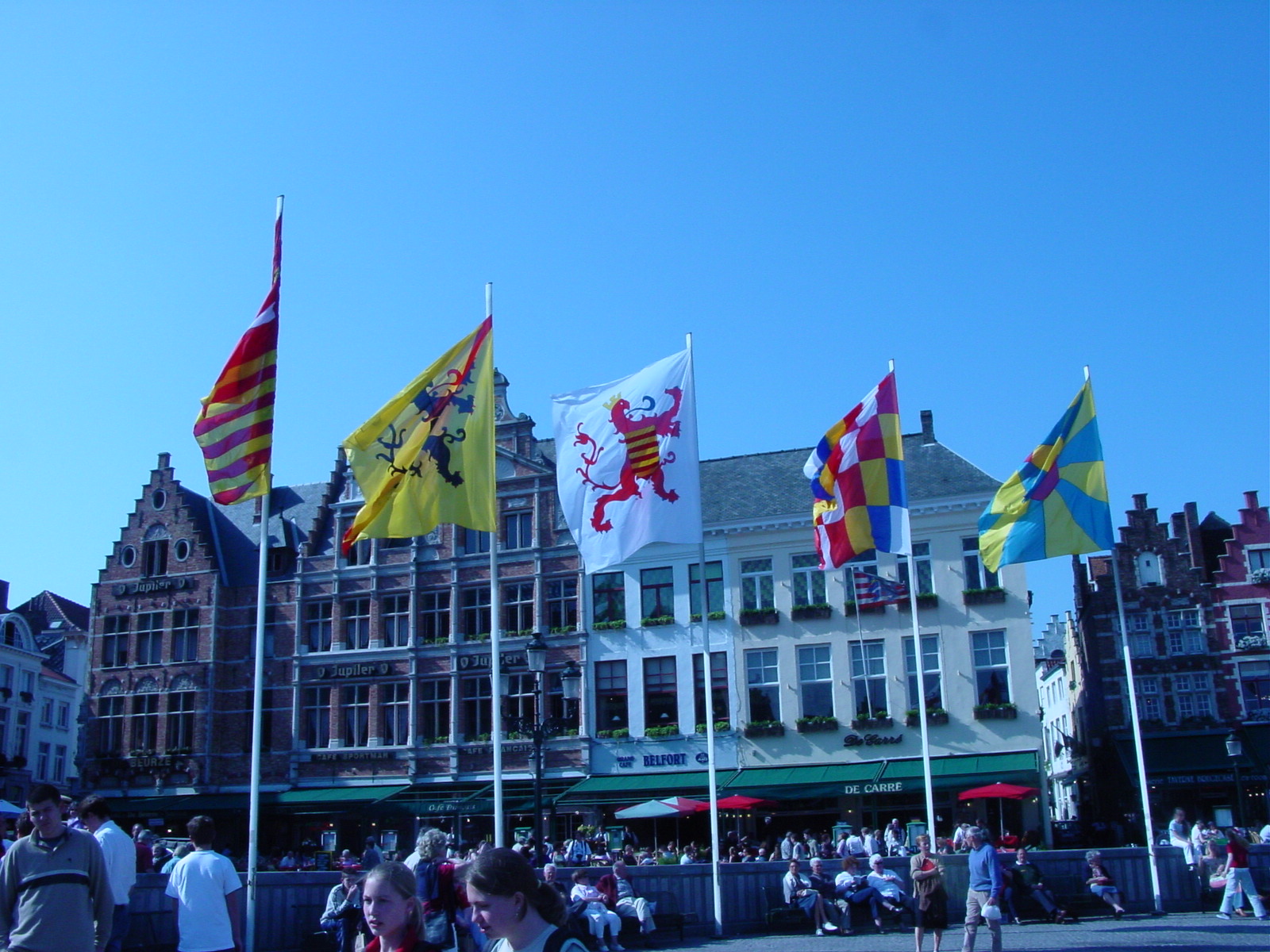
We actually spent less than an hour in France, as we dashed across the north-west corner of the country into Belgium, the country known for its beers and chocolates, I trying the latter (of course!) on the trip. Volodja and Luisa enjoyed a pint of the former when we stopped to picturesque medieval (12th-13th c) Brugge (Flemish version of Bruges), located in the north-west of the country. Brugge used to be an international cloth trade center during the 13th century, where it was, and still is known for its very fine lacework. Here are some beautiful photos!
Strolling through Medieval Brugge
|
|
|
|
|
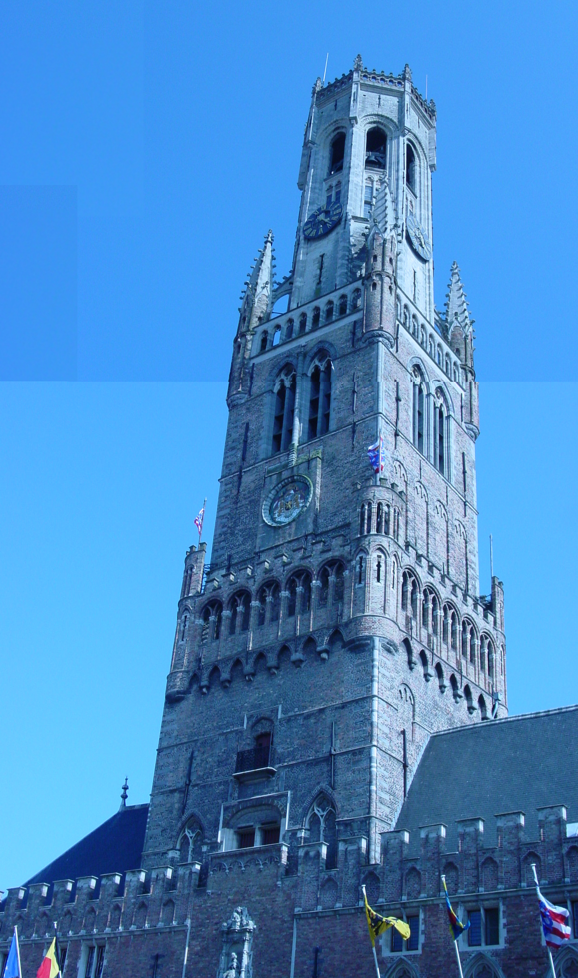
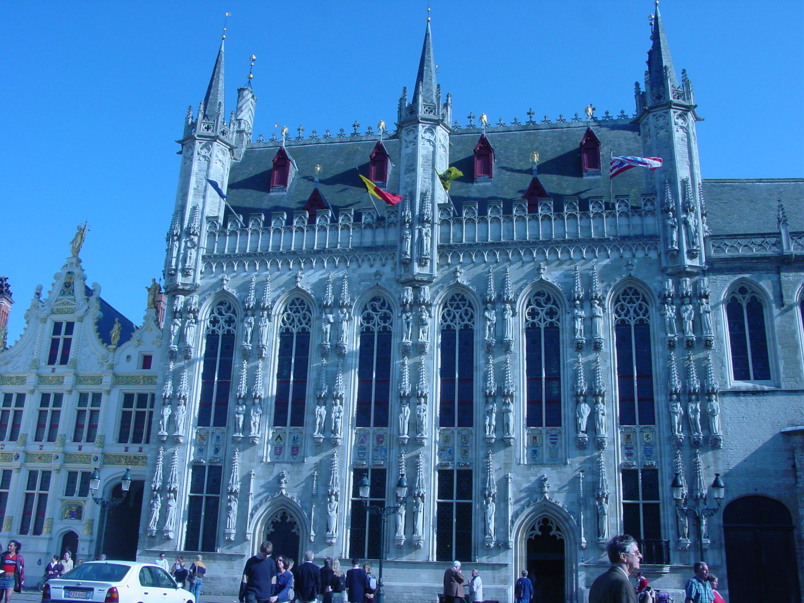
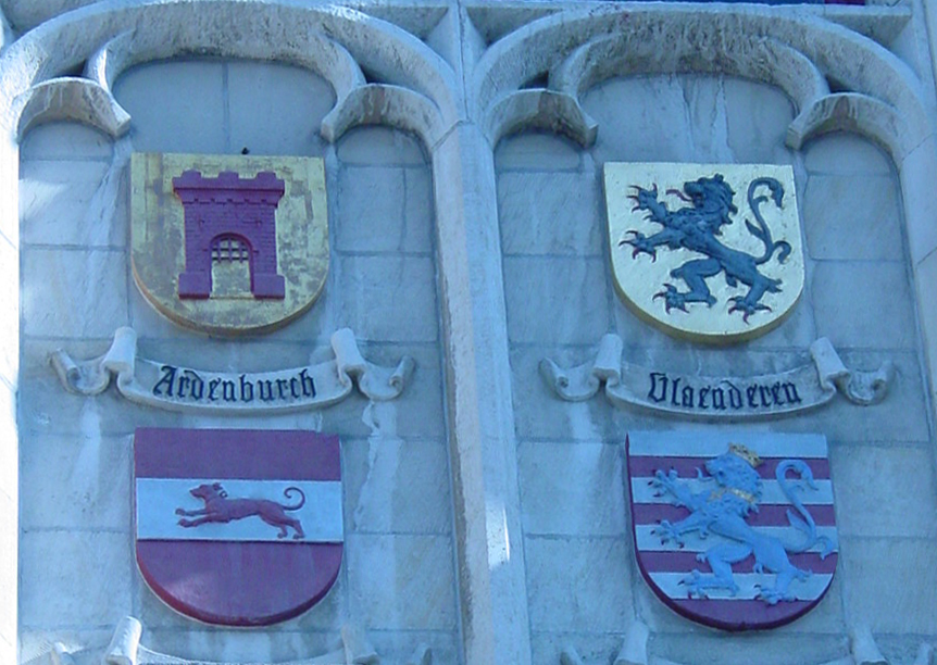
| City street in Brugge, Belgium | The tower from Church of Our Lady (Onze Lieve Vrouwekerk), Belgiumĺs' tallest spire (400 ft) (90 m) | Looking at the Markt, where medieval gabled houses line the 13th c market square. | Belgium, one of the "low countries" like Holland and Luxembourg, "low" because they are at low elevation. Here a canal in Brugge, fed from the River Dijver. | Medieval 13th c belfort (belfry) with its octagonal tower. Bruggeĺs medieval charter of rights is held here. |
|
|
|
|
|
|
|
|
|
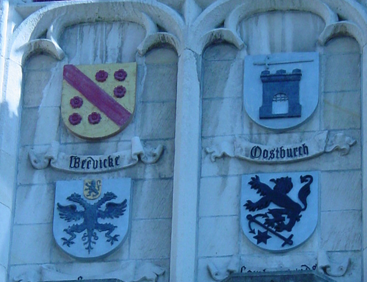
| Beautiful Bruggeĺs Stadhuis (town hall), built between 1376 and 1420. | Details from Stadhuis. Beautiful coats-of-arms of surrounding towns which had been subject to Bruggeĺs domination during the Middle Ages. | |
|
|
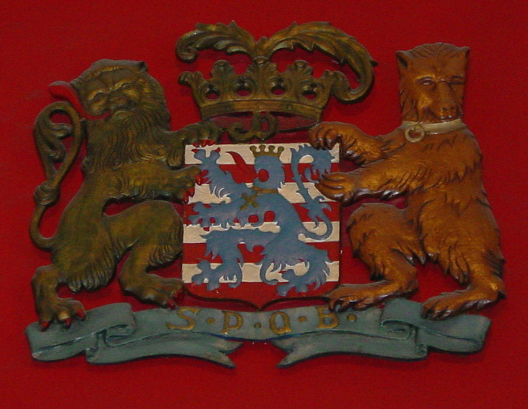
| Bruges coat-of-arms, with a blue lion, red nails, golden tongue on a red and white background, with lion and bear supporters. | Well, we did spend a lot of time in the car. I could not help but notice that the mileage signposts in Brussels would "fake me out", so to speak, consistently naming the furthest place at the top most position in the sign. Just another challenge for me, as role of navigator. |
19 April 2003 (Day 2)
Geography: Luxembourg->Triers, Germany->Mosel Valley->Heidelberg, Germany
Mileage: 302 miles (486 km)
Luxembourg City, Luxembourg (capital)
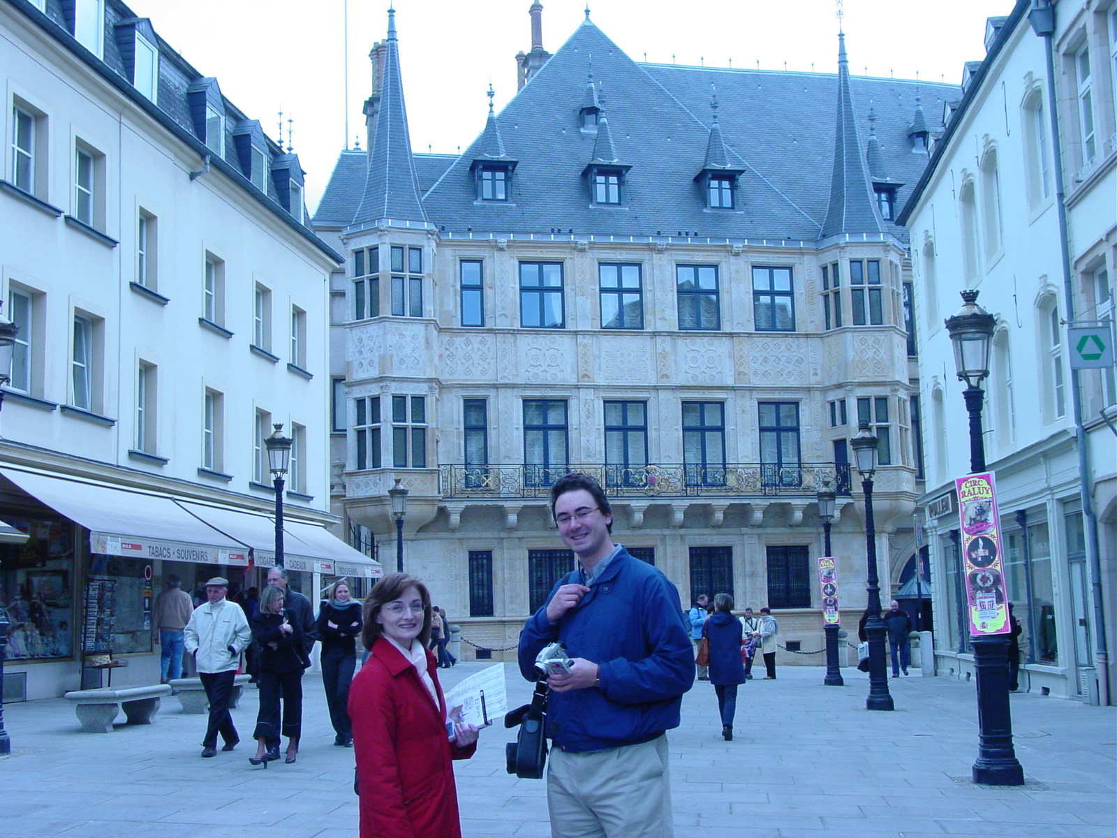
The country of Luxembourg is actual a duchy and constitutional monarchy, ruled by the present Grand Duke Henri. There are two cantons (provinces) which compose the 998 sq mile (2586 sq km) area of Luxembourg. The capital, Luxembourg City, where we spent the first night of our trip, is best known as an international finance center, and is set atop hills and cliffs above the Alzette and Petrusse valleys. The city itself was built upon the remains of a castle which occupied the site in 963 AD. The Palais Grand Ducal (Ducal Palace) is the official residence of the royal family since 1830, and parts of this building date from the 2nd half of the 16th century. On our second morning, after a rather German-esque breakfast of bread, cold ham/salami and cheese, and yoghurt, we wandered through the streets of Luxembourg.
A Glance at Luxembourg City
|
|
|
| Cathedral of Our Lady of Luxembourg |
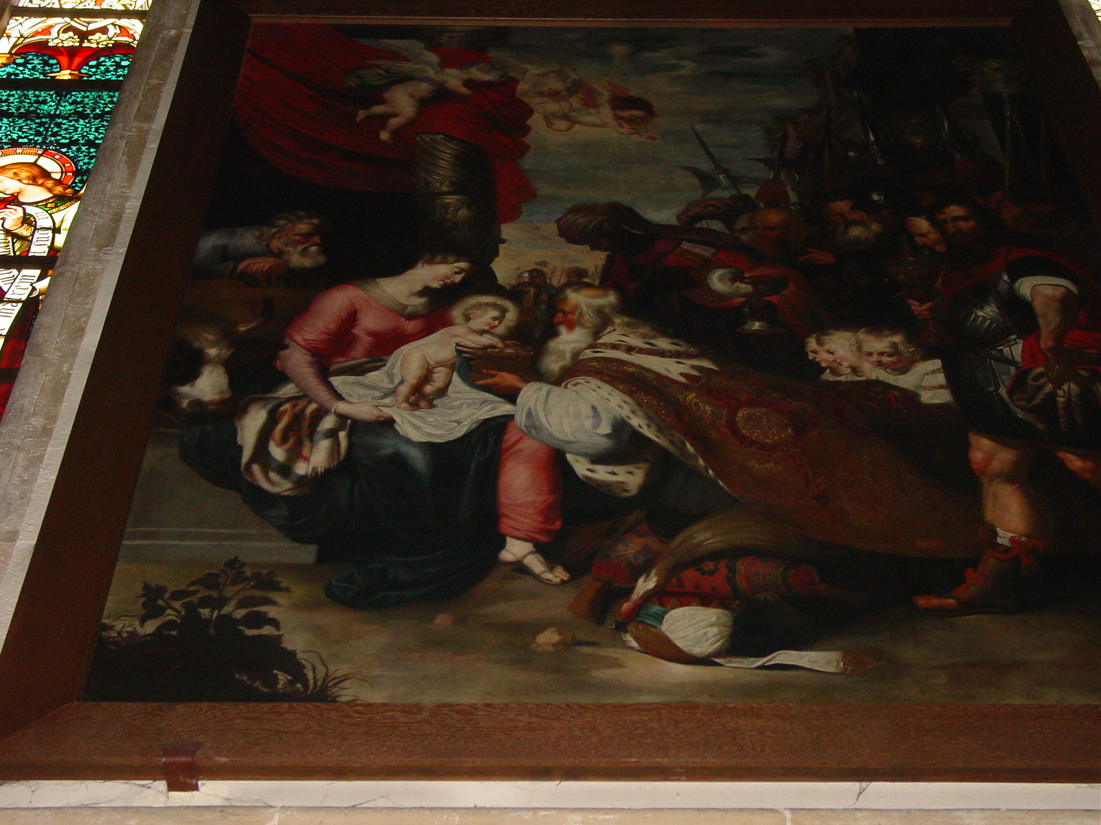
The adoration of the Magi (Rubens workshop), Cathedral of Our Lady of Luxembourg |
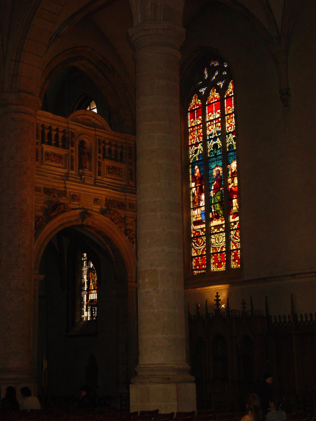
Stained glass windows by Emile Probst, Cathedral of Our Lady of Luxembourg |
|
|
|
|
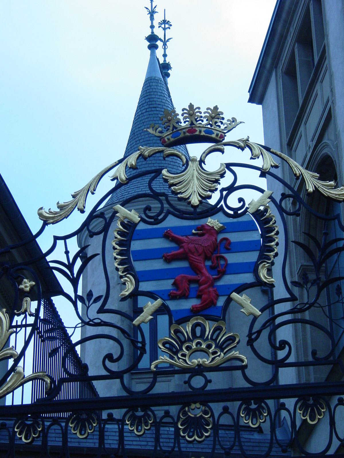
Luxembourg Coat of Arms, detail from Ducal Palace |
Ducal Palace, Luxembourg | Architecture in Luxembourg |
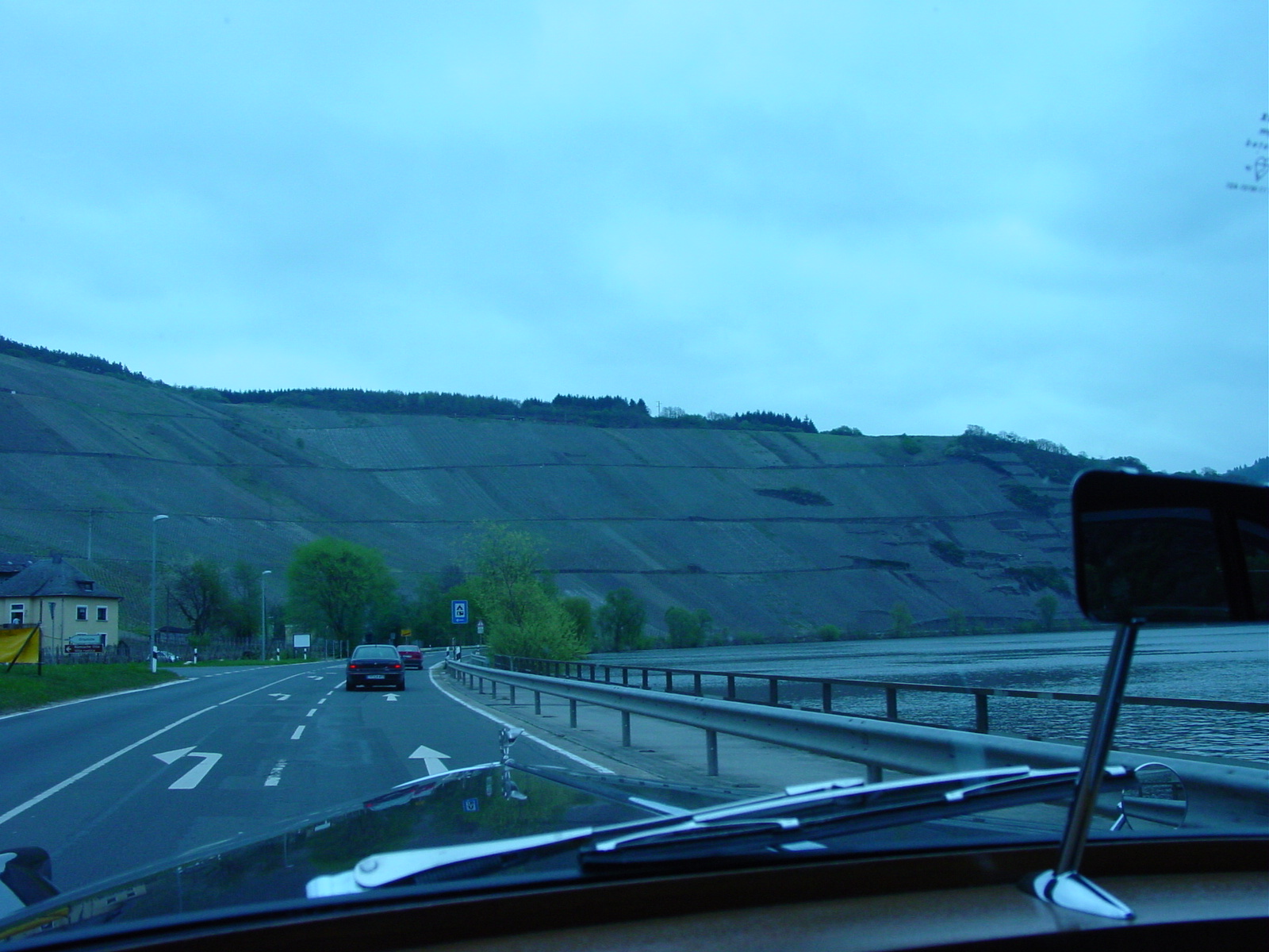
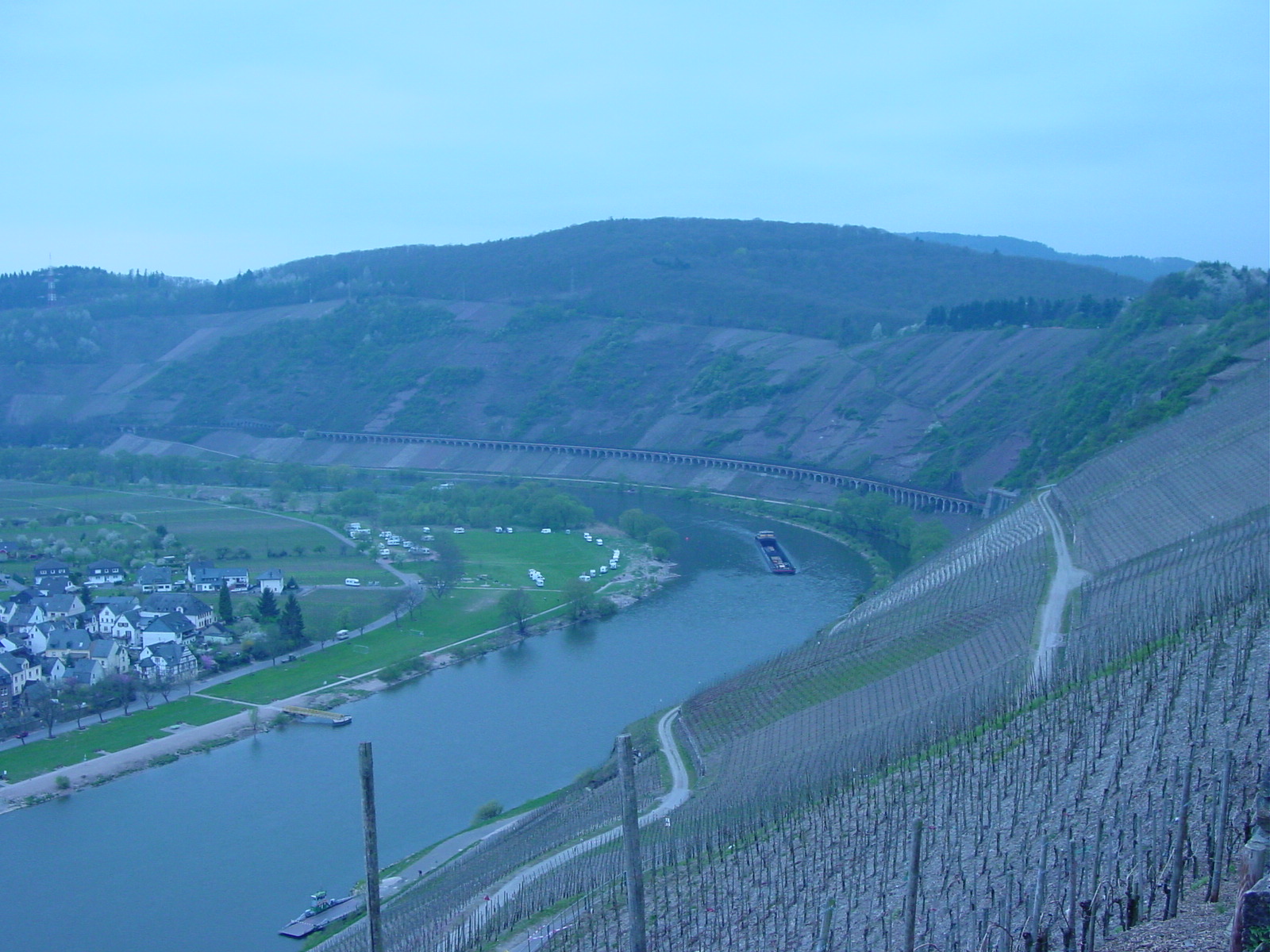
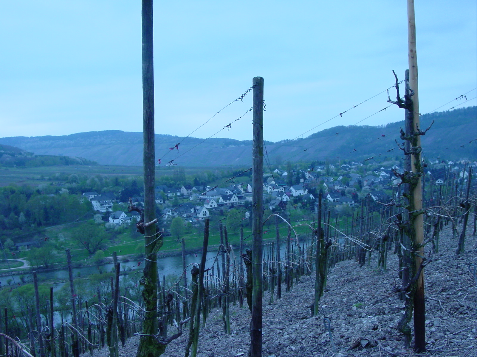
By mid-day, we were off to Deutschland (Germany) where we first made a slight detour towards the border town of Triers, where we saw some Roman remains of a bathhouse), and next took a scenic route along the Mosel River, a region where German wines are harvested. At this time of year (April), however, the vines were cut back dramatically and the scenery along the Mosel River was quite barren. As we wound our way through the Mosel Valley, where at each turn, a hilltop castle or castle ruin from centuries past greeted us from afar, what struck me the most was how the Germans were not daunted by the sloping hills to plant their vineyards. Both sides of the Mosel were lined with vineyards, stretching towards the sky in order to grasp even the slightest bit of sun. What a comparison to the lush gently rolling (and often flat) valleys of Californian wine country! Germany also greeted us with the largest percentage (so far) of open-jaws as the Bentley maneuvered slowly through the city streets.
Wines and Castles along the Mosel River
|
|
|
| Driving along the Mosel River, Germany | Mosel River, vineyards on the slopes | Very early in the season for wine. We saw some impressive German engineering to water these sloping wine crops. |
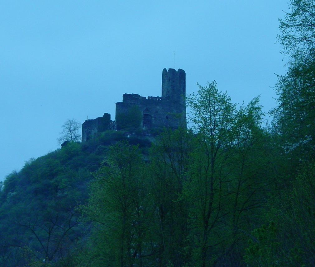
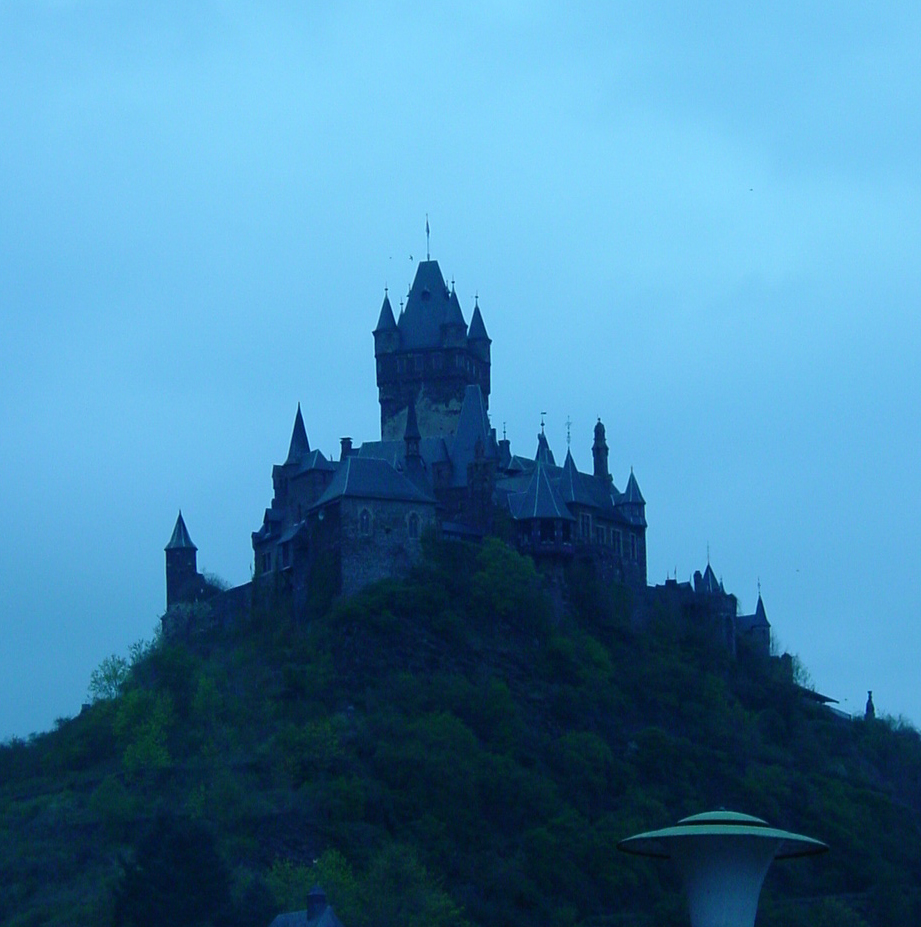
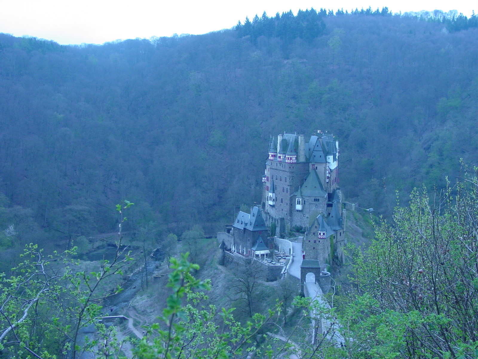
|
|
|
| Castles along Mosel River | Burg Eltz (15th century) castle, tucked away in the rolling hillsides. Sadly we reached it just at closing time, so I did not get a change to gander within. Itĺs a type of fairy tale castle to me. | |
Detail Burg Eltz, Rah!!!
20 April 2003 (Day 3)
Geography: Heidelberg, Germany
Mileage: 10 miles (16 km)
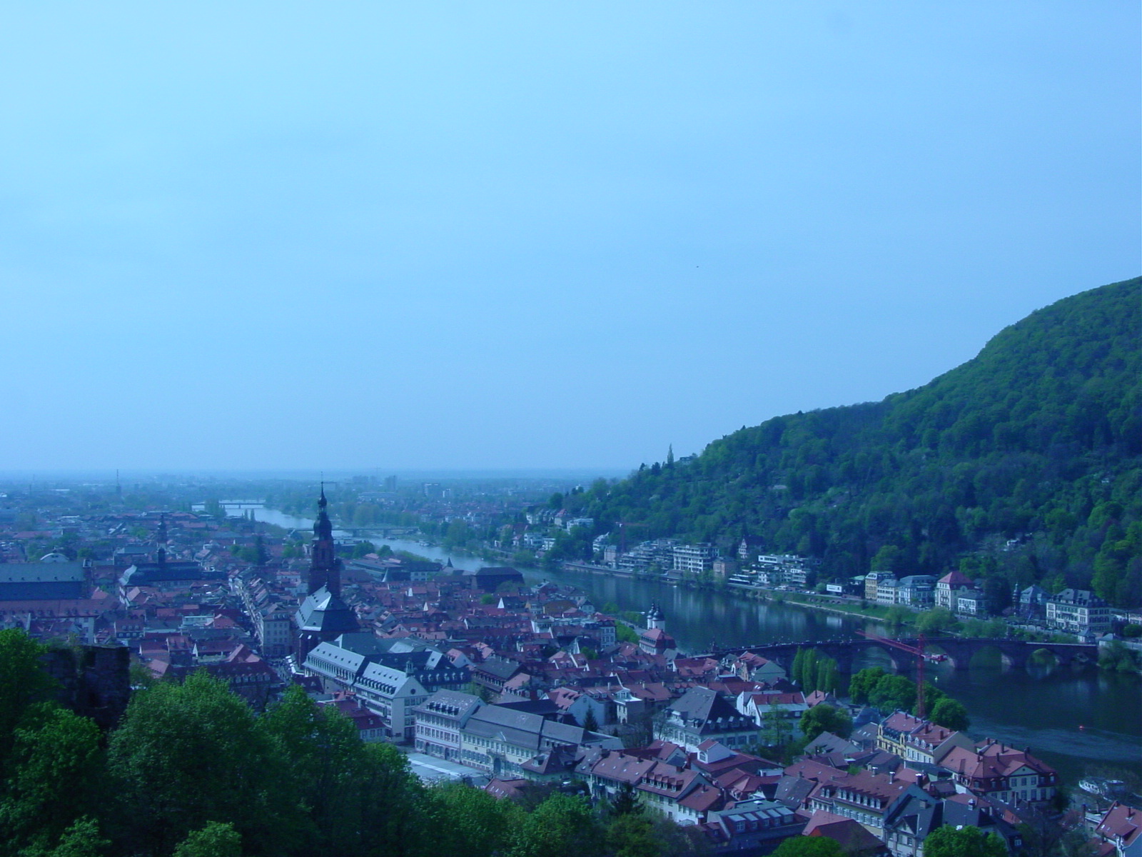
At the end of our second day driving, we found ourselves in a suburb outside Heidelberg, Boxbergung, where Volodjaĺs mom lives. After spending the night there, on Sunday, Easter Sunday, Luisa and I toured the city of Heidelberg, and Volodja went off to visit other relatives in the Heidelberg area. As an additional bonus, my dear friend Martina, fellow classmate from my Cambridge days, was visiting Heidelberg that same weekend. She grew up in the outskirts of Heidelberg and her parents live in a lovely village just outside the city. Luisa and I were able to rendezvous with Martina, her brother Dirk, and her parents, and enjoy a walk through their village after some tea, with the extra special treat of cherry trees in bloom.
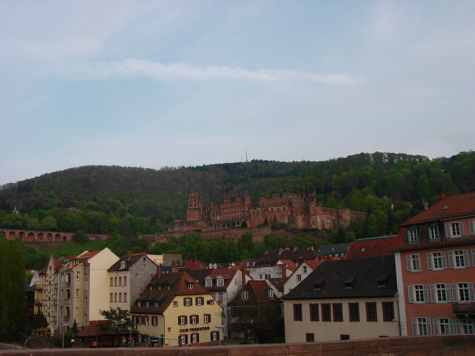
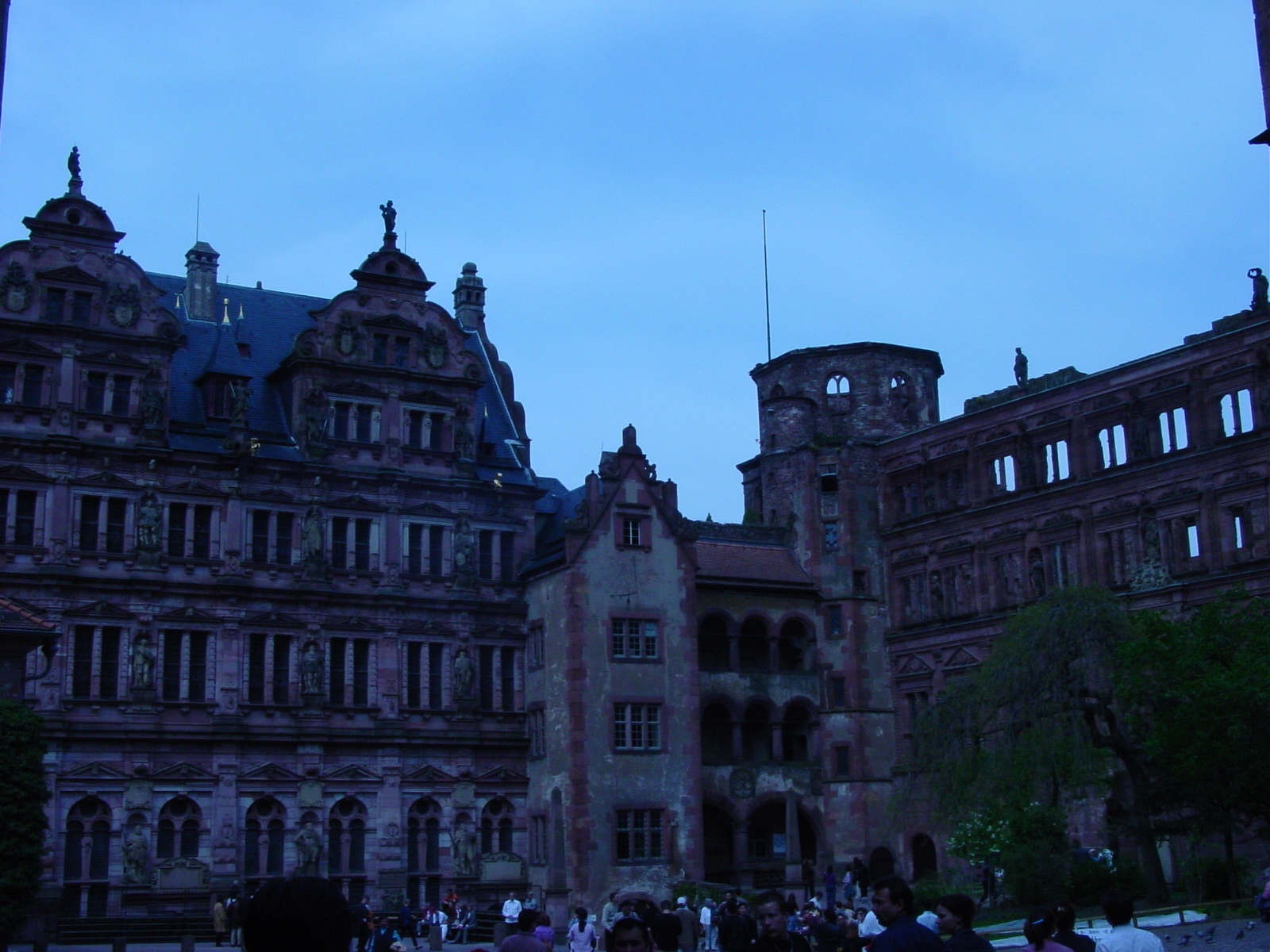
Heidelberg, along the Neckar River, I have been told, is the "most romantic city in Germany." Well, in this lightening fast tour of Germany, Iĺm not sure whether I can agree with that, since I did not see another city for comparison. But despite that, Heidelberg is indeed very picturesque, and spending a day was not enough to take in its rich architecture and history. Another place for me to return! The city is best known for its Schloss (Castle), which today is mainly in ruins after French raids in the 17th century during the war of Palatinate Succession.
I enjoyed walking through the Old Town, admiring the University and Museum buildings, and viewing the rolling hills of the Neckar Valley, beautifully preserved.
Heidelberg, along the River Neckar
The city of Heidelberg itself dates back to 1196, although I have read that the Romans had maintained a permanent camp in the nearby vicinity of todayĺs Heidelberg back in 80-260 AD. The castle ruins date back to the late 13th century, and the original settlement below the castle existed from the 14th century until 1743. Heidelberg also has a world renown University, which was founded in 1386 (even predates my beloved Jesus College, Cambridge (1496)), being the third university, after Prague and Vienna, to be founded in the entire German-speaking part of central Europe, and the oldest in modern-day Germany. The Universitaatsbibliothek (University Library) built 1901-05 and holds the largest book collection in Germany. It was closed on Easter Sunday so I could only admire the outside.
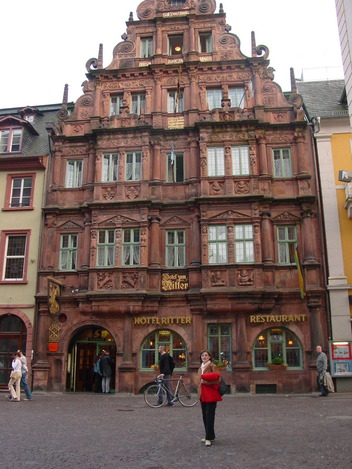
The city has seen several wars of possession in its history, as since Heidelberg was the capital of the German state (Palatinate) between 1225-1720. The most devastating to the city itself was in 1685, when King Louis XIV of France claimed that Heidelberg and its surroundings were to be inherited by his sister-in-law, Liselotte of the Palatinate who had been married to King Louisĺs brother. So King Louis felt the Palatinate should fall to France and instigated a war in 1688-89. How kind of him! The French captured Heidelberg during this time and destroyed the castle, town and even the villages and towns along the Rhine. If that was not enough, in 1693, the French troops returned and besieged the remains of Heidelberg once again, and now burning the town to the ground. Only one building, predating the French war damage, the Haus zum Ritter ("The Knightĺs House"), now the Hotel zum Ritter, exists intact today, erected in 1592 in Renaissance style. Peace with the French was achieved with the "Peace of Rijswijk" in 1697. Heidelberg ceased to be capital a result of a dispute between the Catholic Elector (ruler) and the Protestant population over use of the Heiliggeistkirche (Church of the Holy Spirit), and the capital moved to nearby Mannheim. Ah, those disputes! Heidelberg remaining surprising unscathed during WWII, but rumours told me it was because of some secret agreement. Nonetheless, todayĺs Heidelberg is a wonderful treat for the visitor!
When I walked through the streets of Heidelberg that Easter Sunday, admiring the 18th Baroque-style architecture, I was not aware of such a devastating history of the town, nor how the inhabitants decidedly rebuilt the town from the rubble.
Heidelberg Snapshots
|
|
|
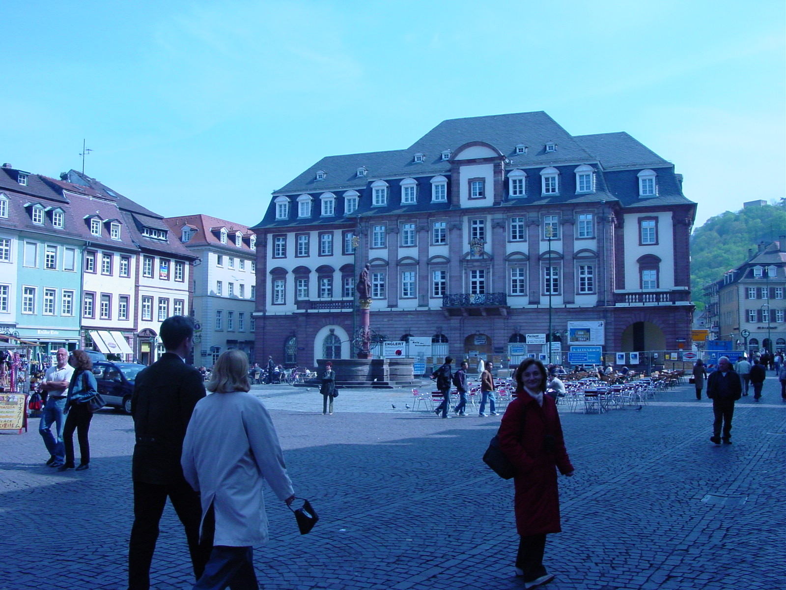
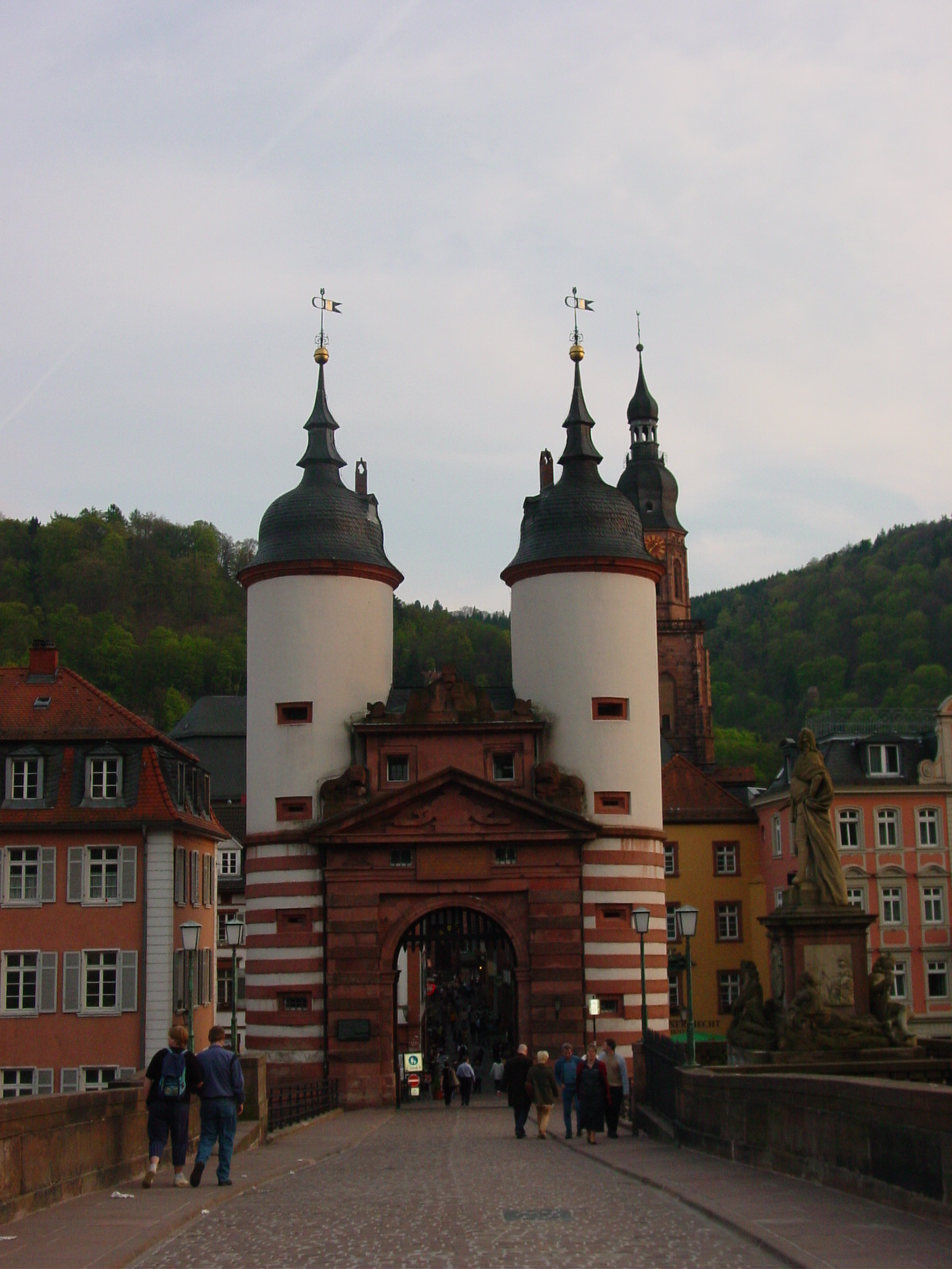
| Marktzplatz (Market Square), Hercules fountain (1701). In earlier centuries, this square was where the town criminals and witches were beheaded, burned or tortured! Eeek! | Gateway of Old Bridge, with tower of Heiliggeistkirche in the right background, and statue of Prince Electro Karl Theodore who had the bridge built in 1786-88. | Oldest (1592) building in Heidelberg, Hotel Zum Ritter, Only building to have survived the 17th c wars. |
The Castle at Heidelberg
|
|
|
|
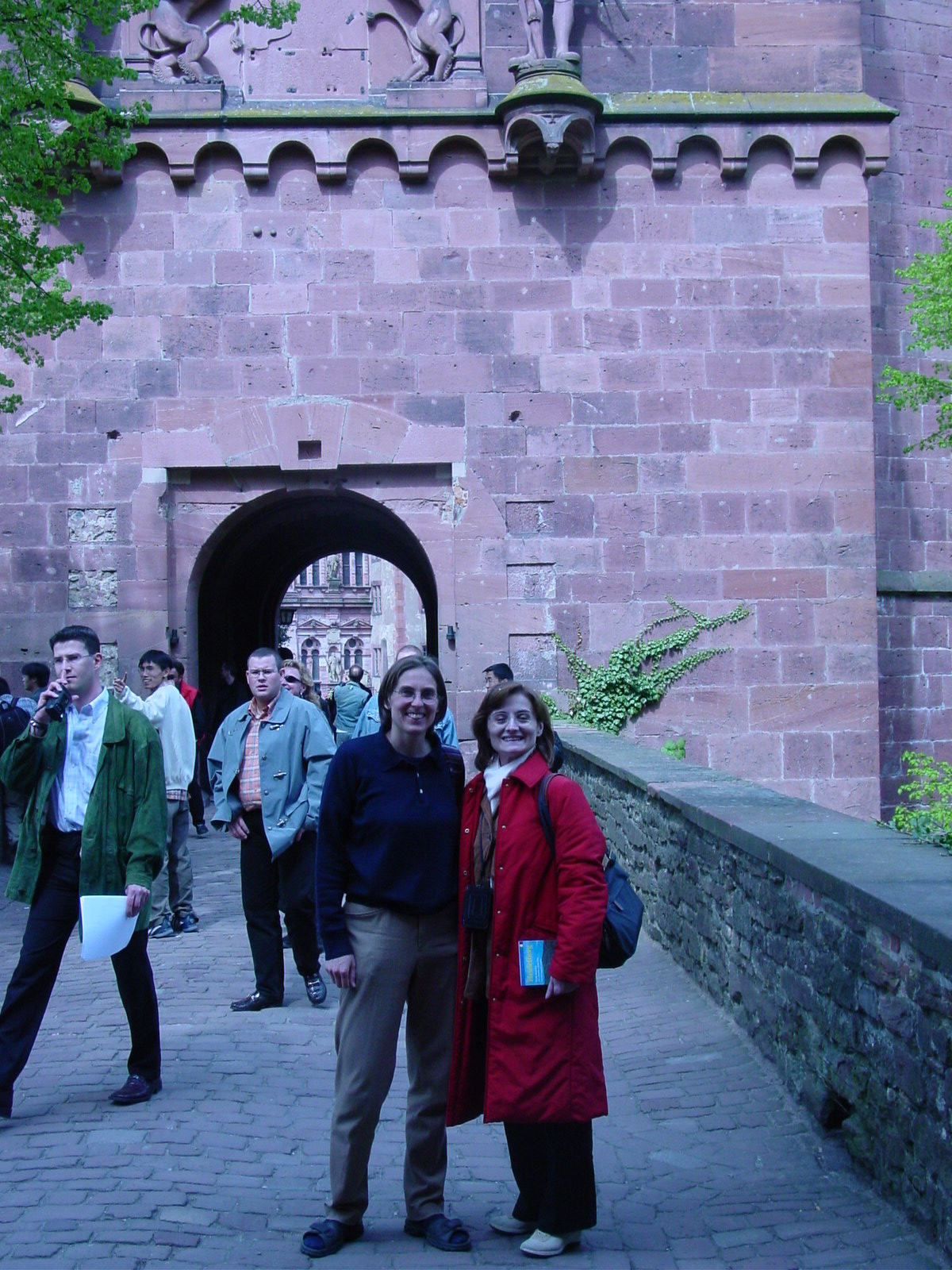
| View of Heidelberg Castle | Martina & Luisa, Gateway to Schloss, tallest building in the castle |
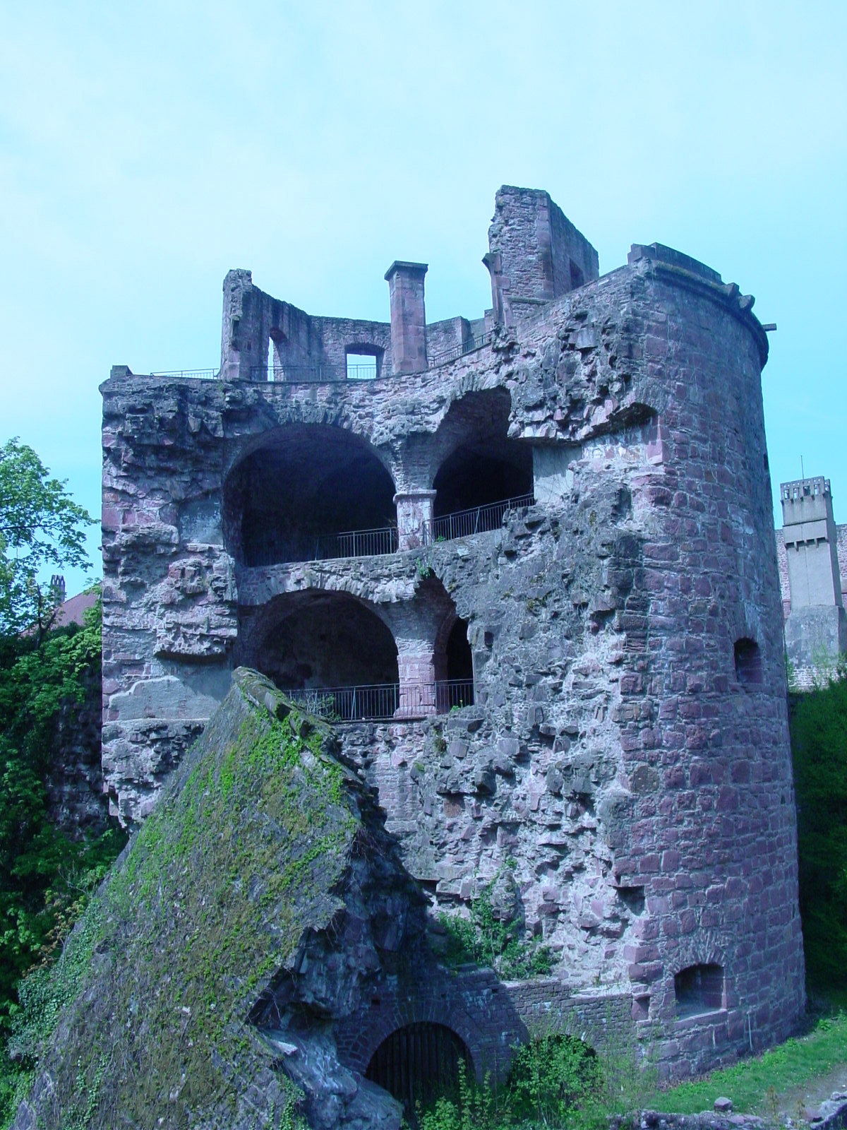
Exploded Krautturm (Herb Tower), or often called Powder
Tower (since gunpowder had bee stored there) built in 1460, but blown up by
the French in 1693. Look at the wall thickness -- 20 feet (6.5 meters) thick! |
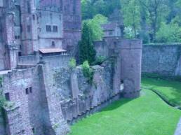
Schloss Heidelberg today in ruins, after French attack and subsequent fires since 1689 and 1693. |
|
|
|
|
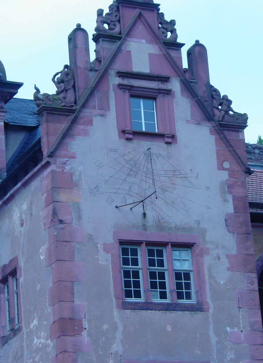
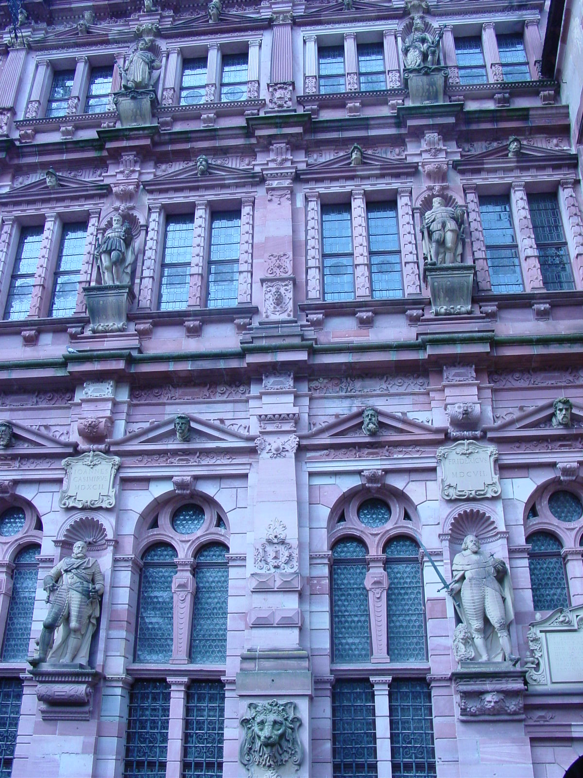
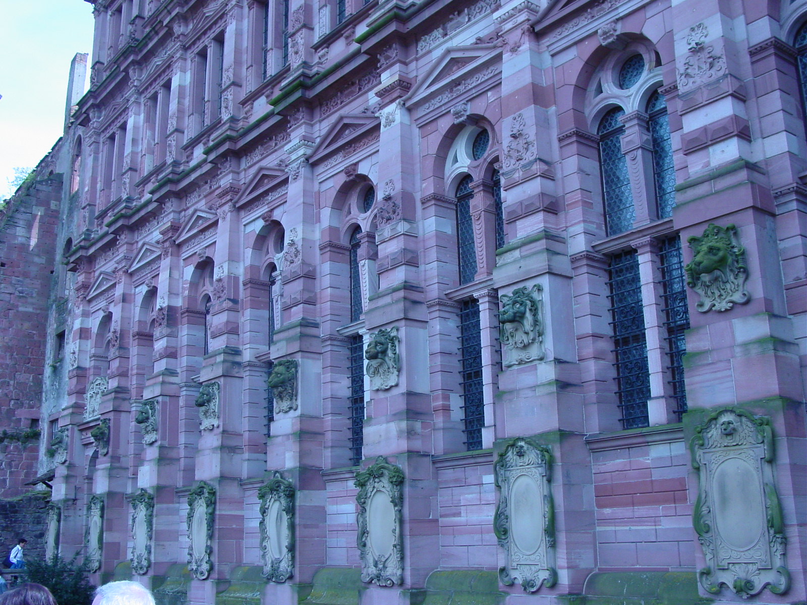
| (left) Friedrichsbau (Frederick Palace), started being built in 1601, remaining intact today, mainly because of restoration in the 19th century. (center) Clock Tower and Hall of Mirrors (1549). (right) Otheinrichsbau, a prime example of German Renaissance (16th c) architecture, sadly destroyed by fire in 1764. | Detail on the Clock Tower, a sundial. | Friedrichsbau, detail, showing 6 of the 16 statues of Princes, from the Wittelsbach dynasty and representative Ĺfathersĺ of the dynasty. | Other side of the Friedrichsbau (Frederick Palace), viewed from the great terrace. I noted that all the lions in this picture have different expressions! |
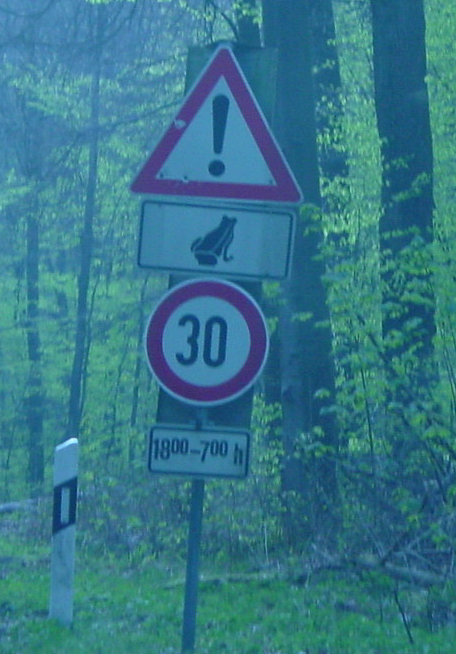
When visiting Martina and her family in nearby suburb south of the city, reached by driving through forest, we needed to travel very slowly because at this time of year (spring), there are travel restrictions to protect the native frog population who are breeding at this time of year. If you travel above 30 kph (19 mph), you risk getting your license revoked. Martina told me a funny story at how her dad tried to argue with the county magistrate to get out of a ticket, after, of course, he had driven a bit too fast for the sake of the frogs. He had argued, as a good physicist would do (his profession) that the probability of hitting a frog was less when we traveled at higher speed because he spent less time in the frog-occupied territory (and I think he actually did the calculation for the road in question), compared to limping along and increasing the number of opportunities to hit a frog. But I think he did not win his case. Note: From the sign above it looks like you can speed during the day (30 kph for 1800-700h, 6pm-7am), for I guess the frogs do not mate during the day and/or the visibility is such that you can swerve around them. I wonder if the frogs know about daylight savings time? What a country. :)
21 April 2003 (Day 4)
Geography: Heidelberg, Germany->Basel,Switzerland->Bern, Switzerland
Mileage: 216 miles (348 km)
After spending Easter Sunday in Heidelberg, the three of us, Luisa, Volodja and I, were joined by Volodjaĺs mom to gander into Switzerland (why not!) for the day. We passed through the Swiss border with relative ease, the Swiss having a border control, their not being part of the European Union. The patrol officers seemed more interested in taking our 30 Euros to pay for a one-year road usage (tax) rather than our passports. At least they took Euros, since the official currency of Switzerland is the Swiss Franc, but they returned change in Swiss Francs. Luckily (or not so) enough, the timing of this crazy one-day-per-country trip was such that all the countries we visited, except Switzerland, use the new Euro currency, adopted in 2002. I was a wee bit bummed since it would have been interesting to use Francs (France), Belgian Francs (Belgium), Luxembourg Francs (Luxembourg), Deutschmarks (Germany), Swiss Francs (Switzerland) and Lira (Italy) on this trip! But an accounting nightmare since I was doing the money bookkeeping for our trip. :)
Another factoid worth mentioning: As we drove through these various countries I could not help but notice the country codes attached to the license plates of cars, ranging from GB for Great Britain, I for Italy, D for Germany, LU for Luxembourg, F for France, and B for Belgium, but CH for Switzerland? CH actually stands for "Confederatio Helvetica," Latin for the Helvetica Confederation, Helvetica being one of the old Swiss tribes, and adopted for the official country code for Switzerland. I had often wondered where those web addresses ending in '.chĺ originated. Now I know.
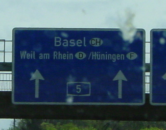
We entered Switzerland through Basel, an industrial town along the Rhine, located on the northernmost border of Switzerland, shared with both Germany and France. Where else could you find a signpost allowing you to choose among three countries? Even Luisa, our backseat observer exclaimed. "France on your right, Germany on your left, and mistletoes in sight everywhere." Switzerland has enjoyed ~800 years of peaceful democracy,ĺ Mukund says. And what have they got to show for it's cuckoo clock, Emmental cheese (we Americans call it "Swiss cheese" but the Swiss people produce a large variety of wonderful cheese which rarely reach our supermarkets), finance, and watchmaking.
Europeĺs 'three cornersĺ Switzerland (CH), Germany (D) or France (F)
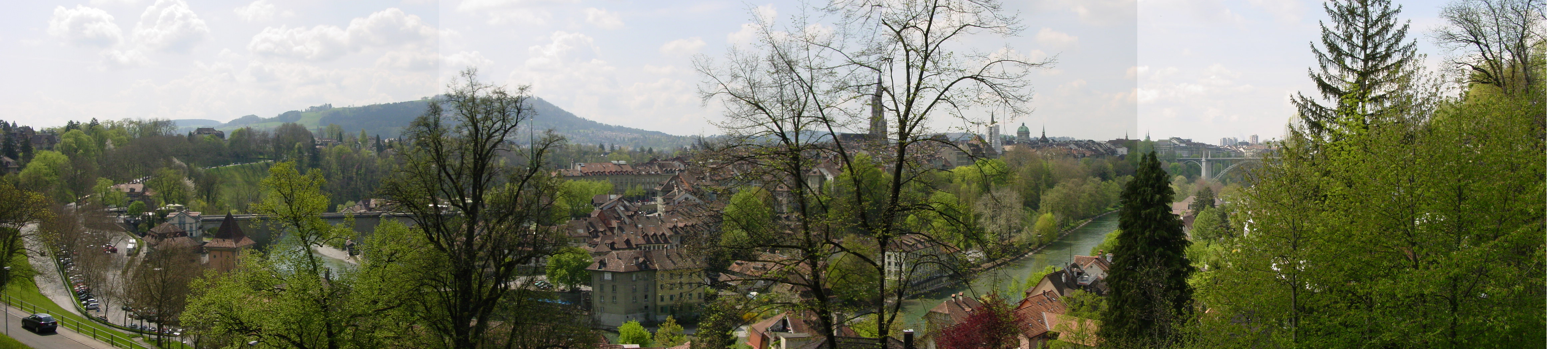
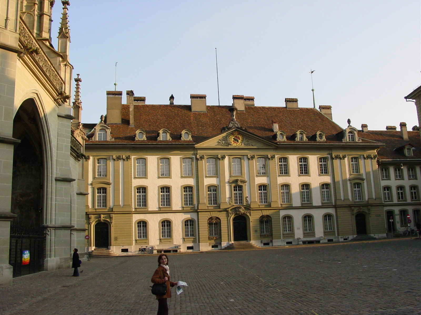
Switzerland is bordered by France (west), Germany (north), Austria & Lichtenstein (east) and Italy (south). Mountains make up 70% of Switzerlandĺs 41,285 sq mile area and there are four (!) national languages -- French, German, Italian and Romansch. On the second day in Switzerland, Luisa and I paid a short visit to their Parliament in the capital city Bern and learned that in the lower house, if you needed to speak, you needed to be both fluent in French and German, since there are no translators during sessions.
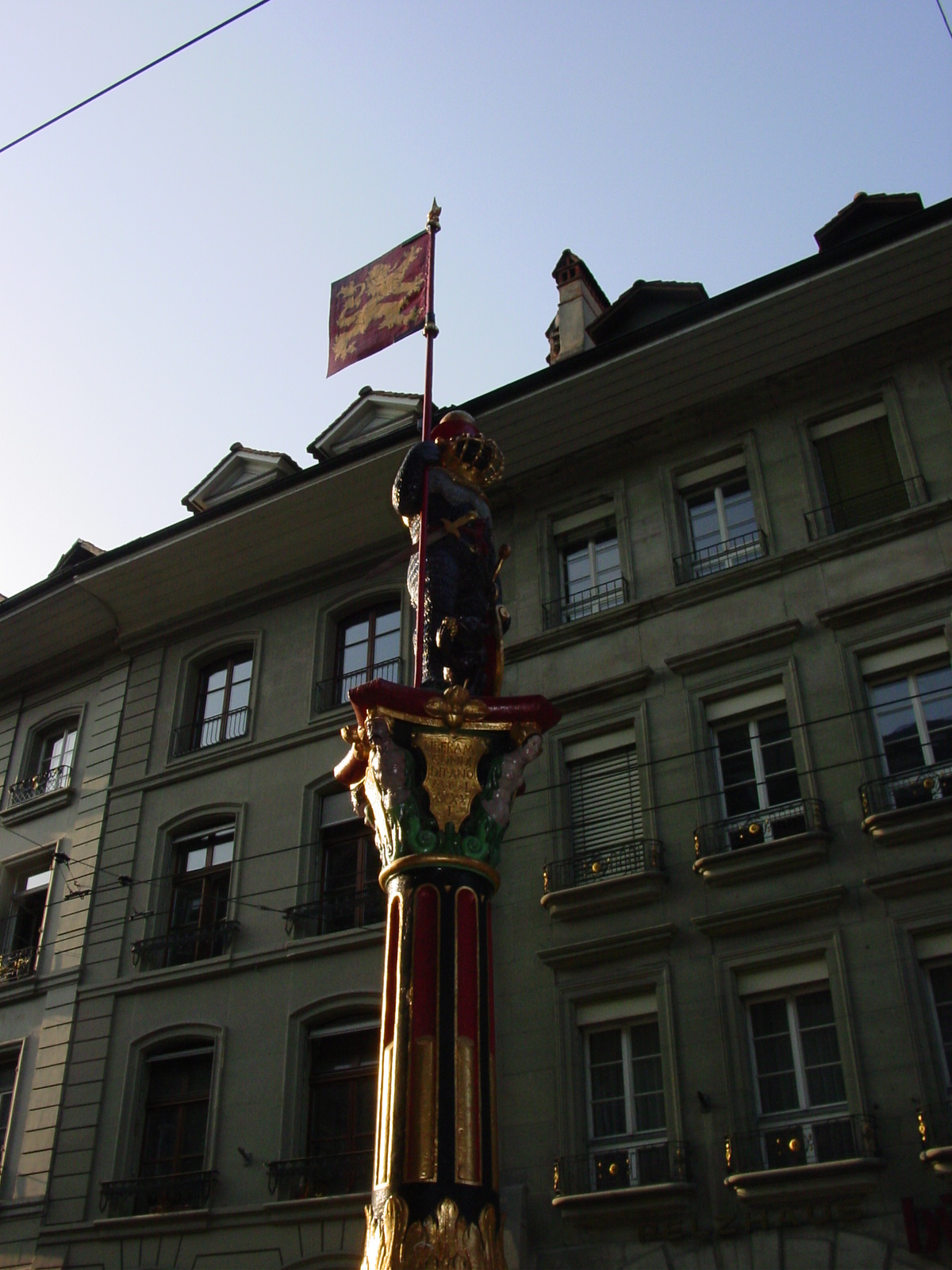
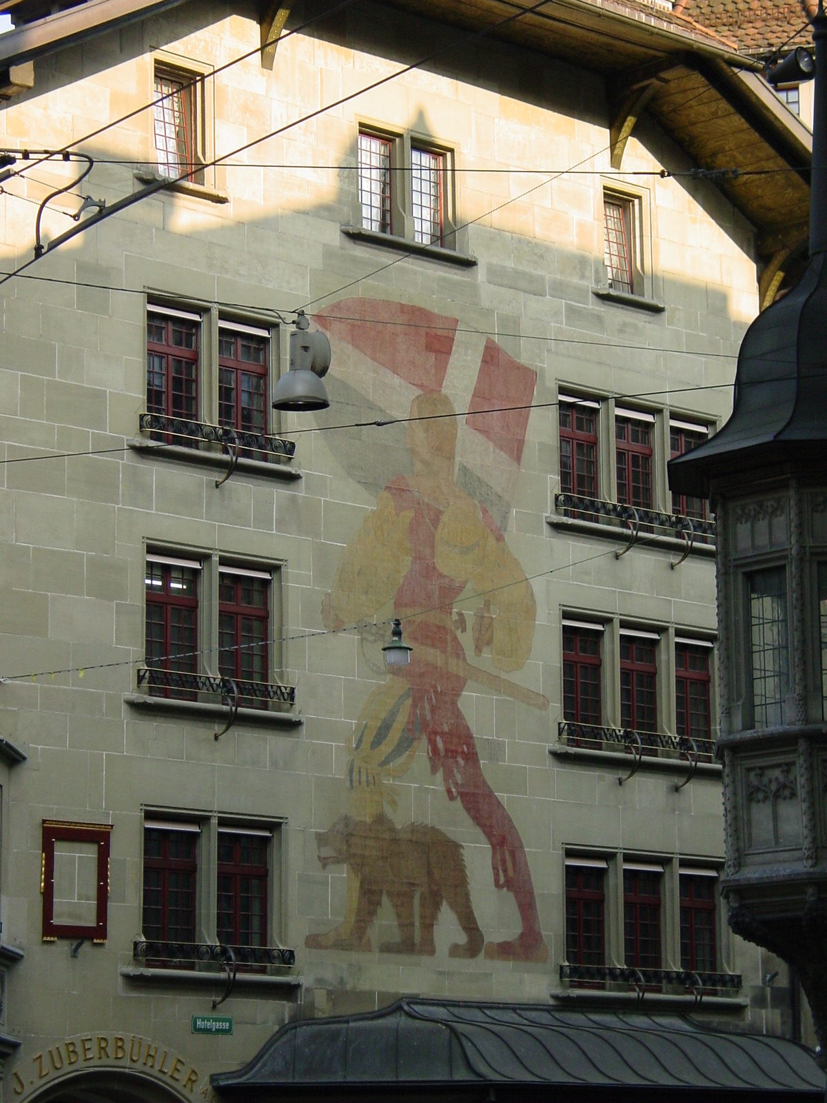
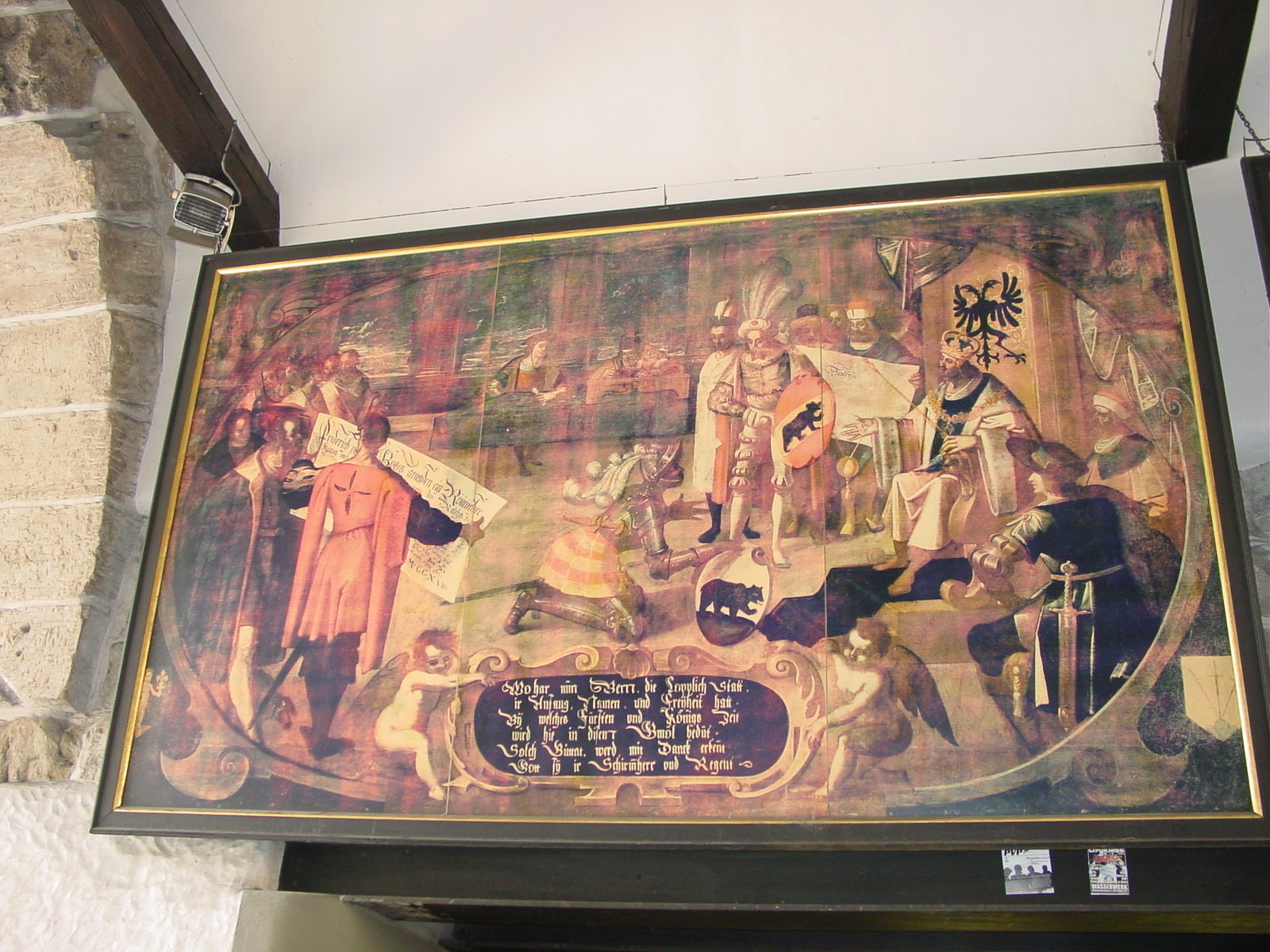
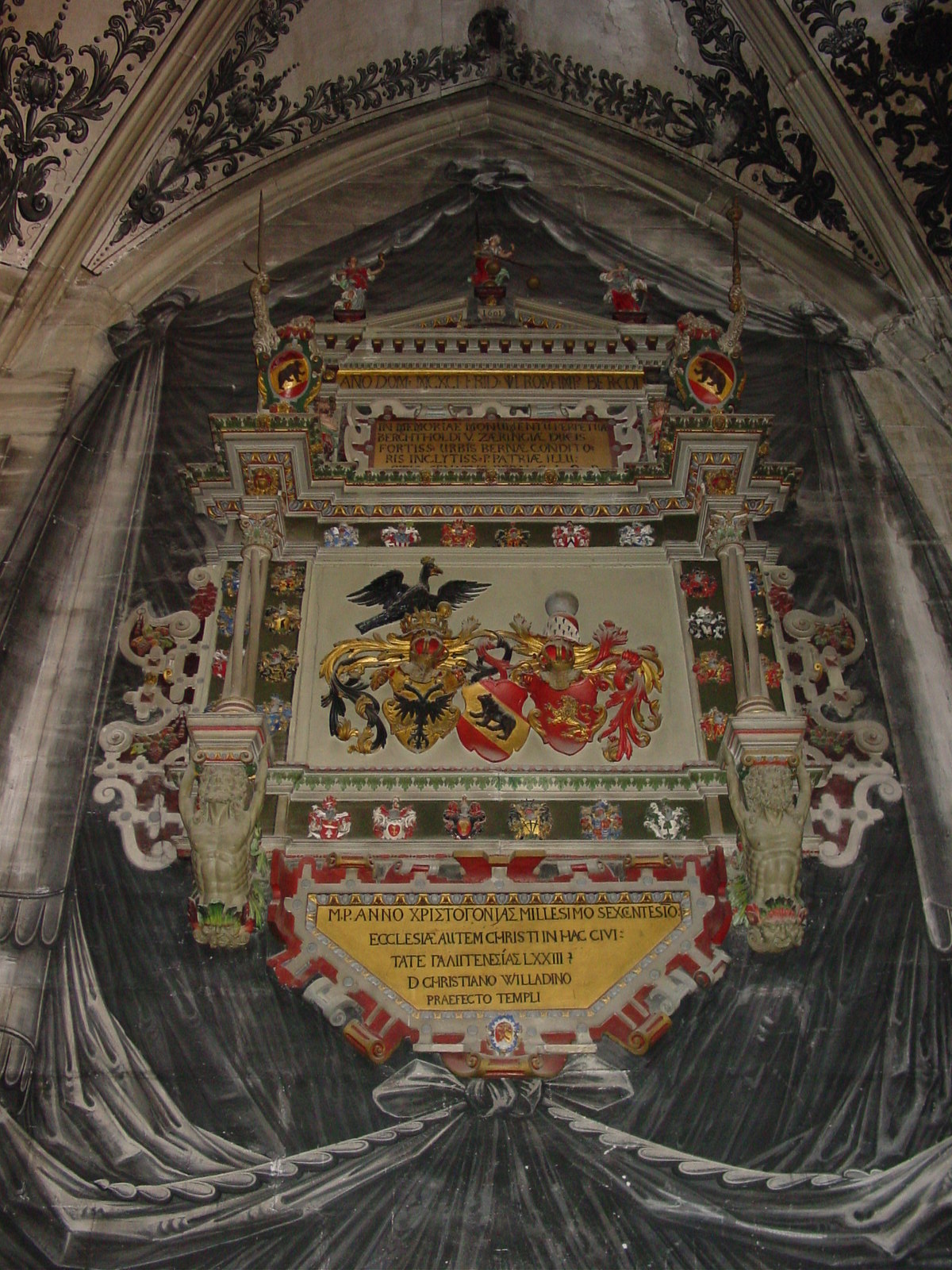
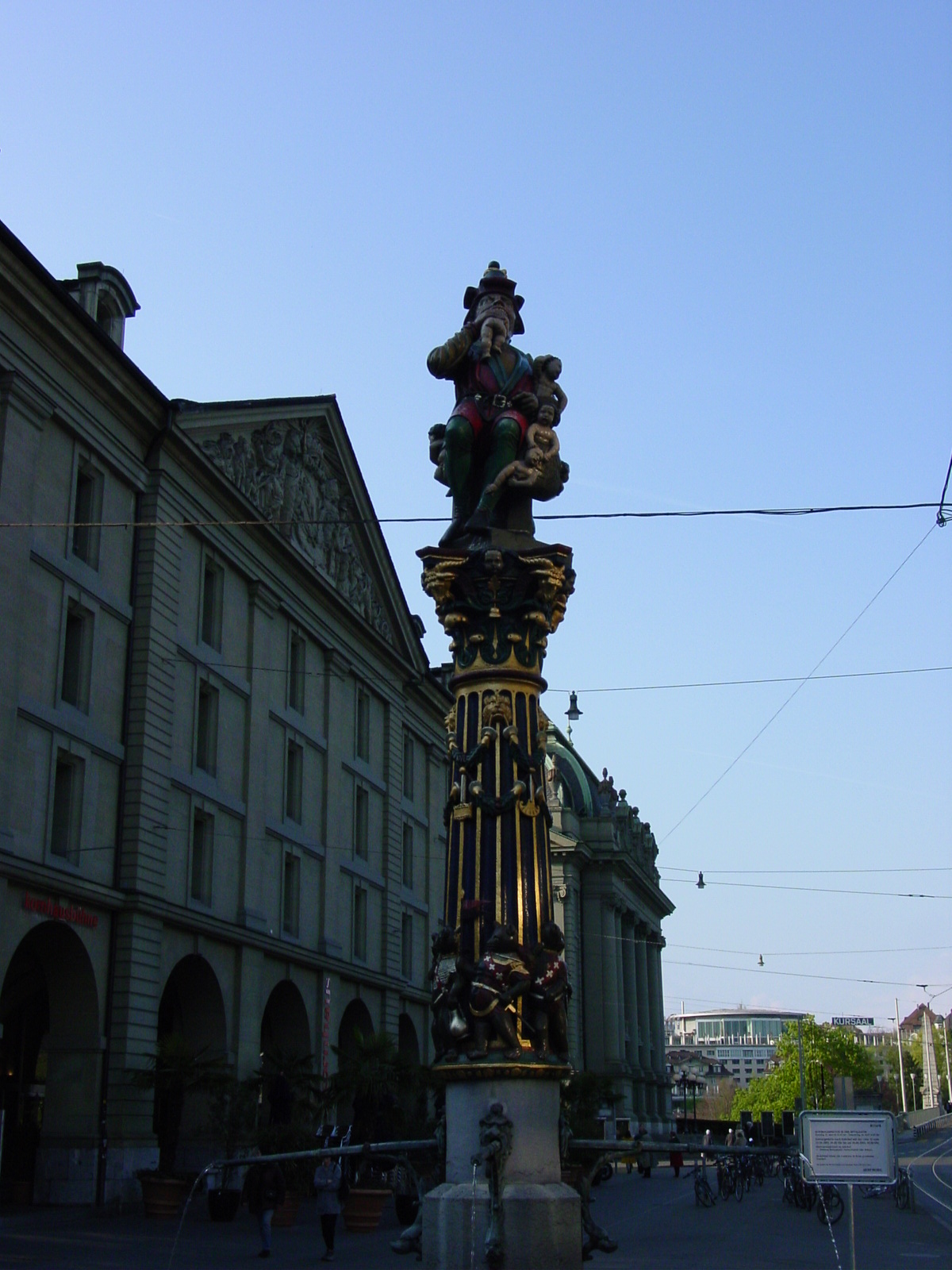
After passing briefly in Basel, we headed to the capital Bern, along the Aare River. Bern was founded at the end of the 12th century by the Duke of Zaehringen, Berthold V, and allegedly named after the first animal, a bear, killed in the forests, which had previously occupied the area. They even keep active bear-pits (Baerengraben) since the 1880s! Eeek! We saw lots of bear motifs (statues, frescos, emblems) throughout the city. Many fine Renaissance-style houses and covered arcades date from 16th-17th centuries.
Picturesque Bern, Swiss capital, along the Aare River
The Bears of Bern
|
|
|
|
| Bears! | Bears! Fresco of Duke of Zaehringen on house in Bern | Bears! Fresco on city wall, perhaps telling the story of the city founding | And more Bears! Cathedral, Bern, detail inside |
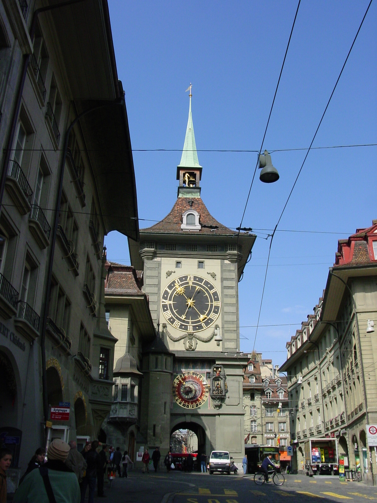
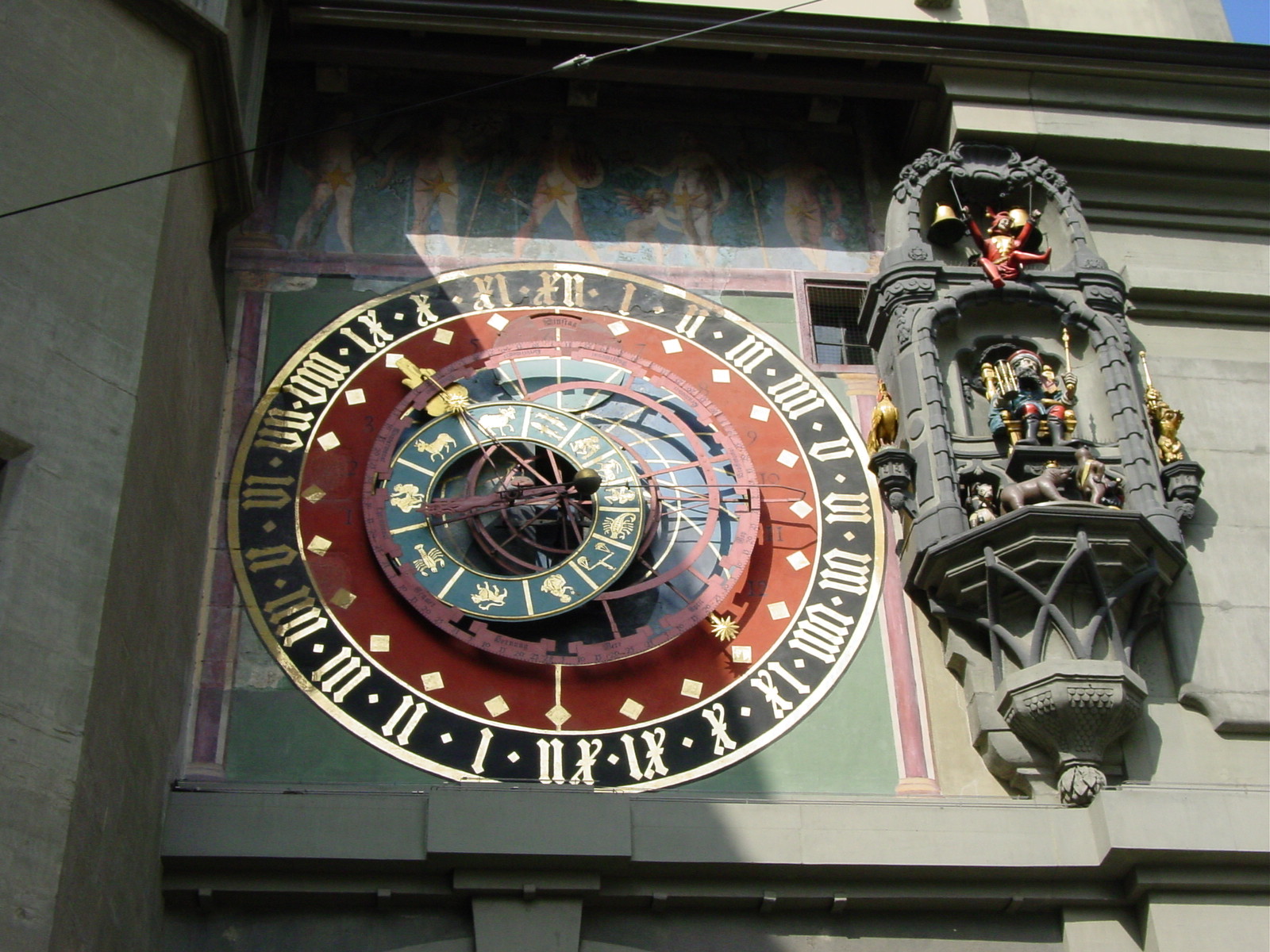
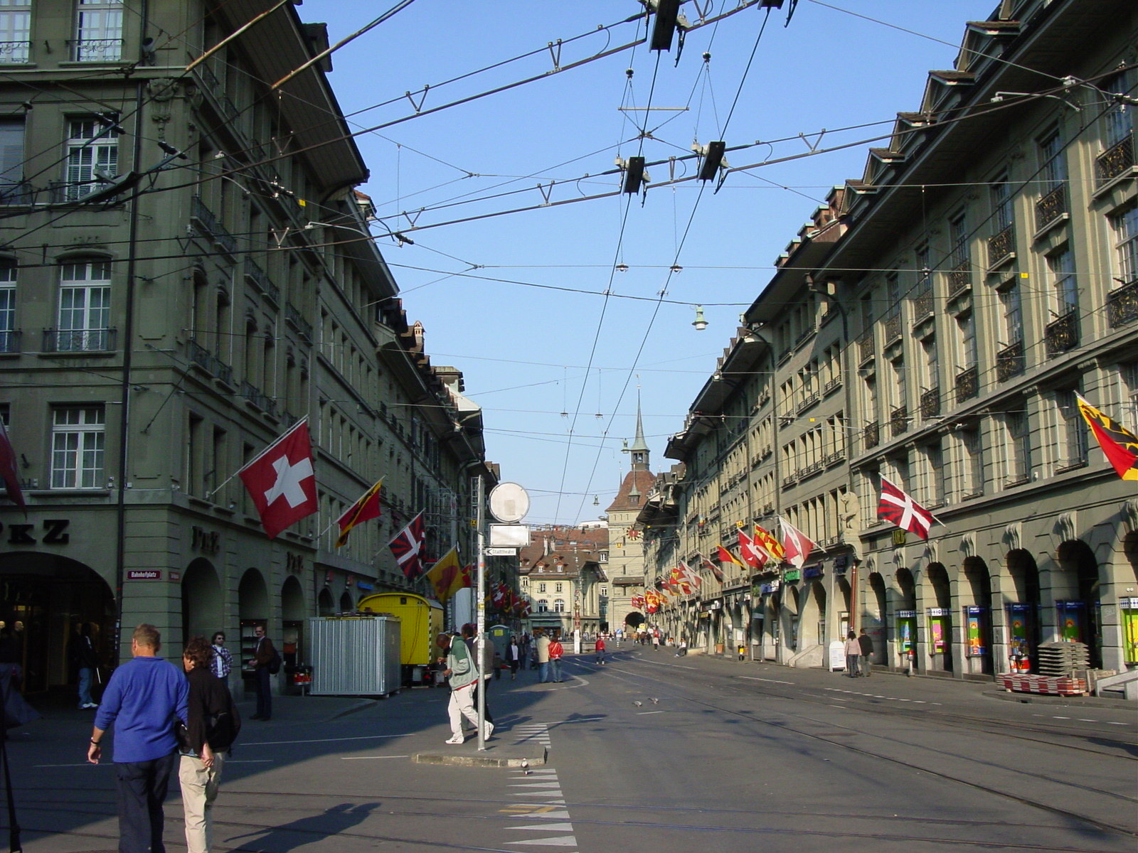
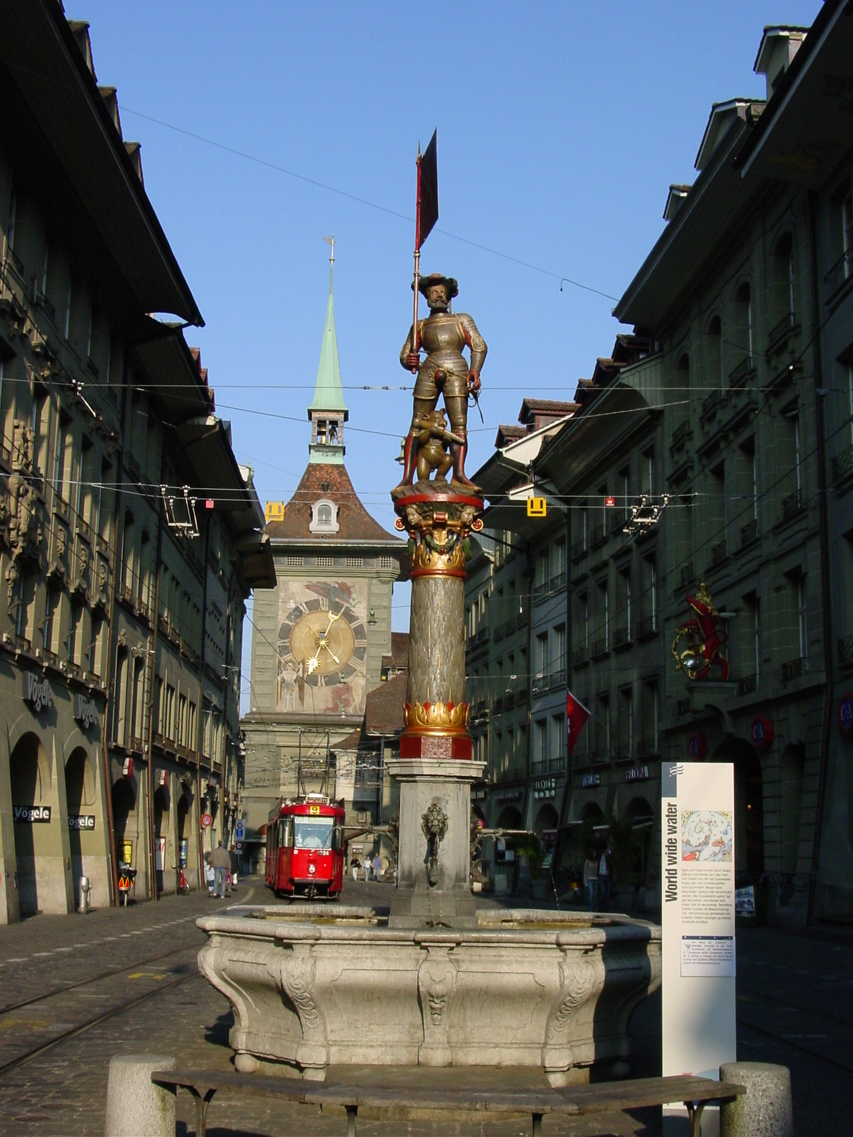
One of the most impressive buildings in the beige-coloured town (most of Bern is made from local sandstone), is the Clocktower at the junction of Kramgasse and Marktplatz, dates from 1530. On the hour, a set of figures, bears [of course], a jester, and a rooster move. In our short gander through the city, we were unable to view the motions first hand (another thing to return for!). Bernĺs historic center also boasts of eleven historic fountains, each of which depicts a famous historical or legendary figure (Moses, Duke of Zaehringen, and the child-eating Ogre (Kindlifresser) -- I do hope heĺs the latter [i.e., legendary]). :)
Bern Snapshots
|
|
|
|
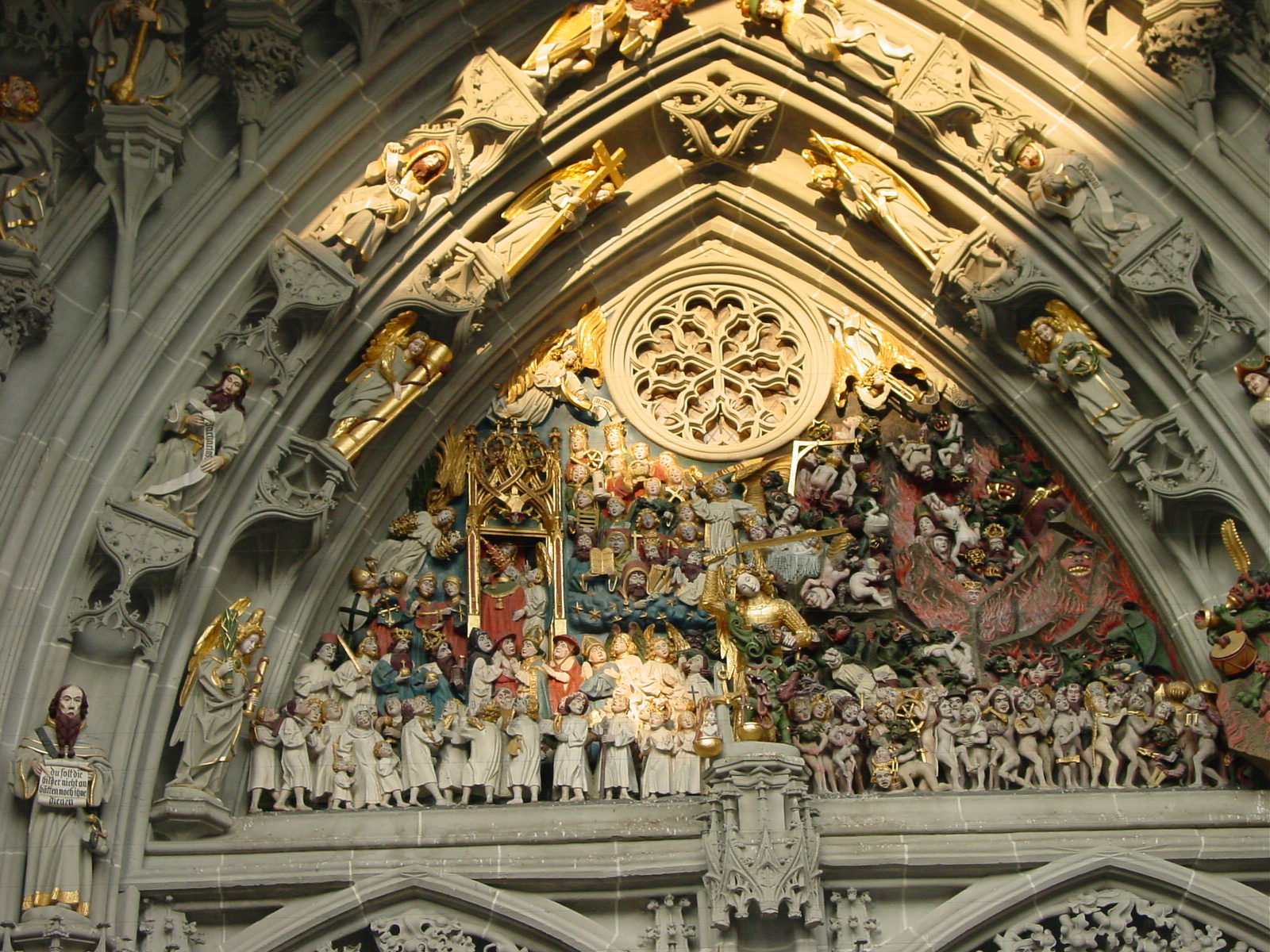
| View of Clock Tower from Kramstrasse, Bern | Detail, Clock Tower, Bern | Outside the Cathedral, Bern | Detail, Bern Cathedral, of "The Last Judgment", carved and painted stone |
|
|
|
|
| Looking down Bernĺs Marktgasse and Kramgasse, with their 16-17th century covered arcades and fountains. | Fountain of Duke of Zaehringen, founder of Bern. | Ogre fountain, with the ogre enjoying his feast on little children as the bears below dance with joy. Hmmmm... | |
Bernĺs cathedral, located on Meunstergasse, built in 15th century, is an example of later Gothic architecture. Its main portal shows "The Last Judgment," in carved painted stone (last third of the 15th century), where one pope is shown ascending to heave and another being cast into hell. The Cathedral was Catholic until the Reformation (early 1500s-mid 1600s), when many statues were thrown out, but the Catholic saints on the ceiling remained since they were too high up for removal, and the above-mentioned portal surprisingly remained untouched. As a final factoid on the Bern Cathedral, it boasts the highest spire (300 ft) (100m) in Switzerland, but alas, shorter than the tallest spire in Belgium we witnessed in Brugge the other day.
Fast Bern factoids: the chocolate Toblerone was first made in Bern in 1909 as well as the invention of Ovaltine. Ah, the Swiss know their chocolate!
22 April 2003 (Day 5)
Geography: Bern->Basel->St Gotthard Tunnel->Bellinzona, Switzerland->Oleggio, Italy
Mileage: 281 miles (452 km)
In the early hours of the day, before the long road to Italy, Luisa and I strolled through the medieval streets of Bern and visited the Bundeshaus (Capitol) home of Swiss Parliament. Here I learned that the sessions are carried out normally in both French and Germany, although any of the four languages (French, German, Italian, Romansch) can be used and that the modern-day Swiss Constitution was only adopted in 1848 and their parliament houses are modeled after US Congress, having one house with two representatives from each of the 23 provinces (cantons) similar to US Senate, and then a population-based representation per canton in the other house, similar to the US House of Representatives.
Although the guided tour of the Parliament buildings were fascinating, Luisa and I had to rush back to the hotel to restart our car trip again for we needed to return Volodjaĺs mom back to Basel to catch an afternoon train to Germany. And then retracing our steps and enjoying the rolling green Swiss countryside, and traveling through countless tunnel, we set off from Basel to cross the entire country of Switzerland in an afternoon. I was so amazed at the number of tunnels the Swiss built for the motorways to meander in and out of the Alps and the Alp foothills. It was as if the mountains were made from Swiss cheese, full of holes, if you could pardon my pun [I just couldnĺt resist. :)]
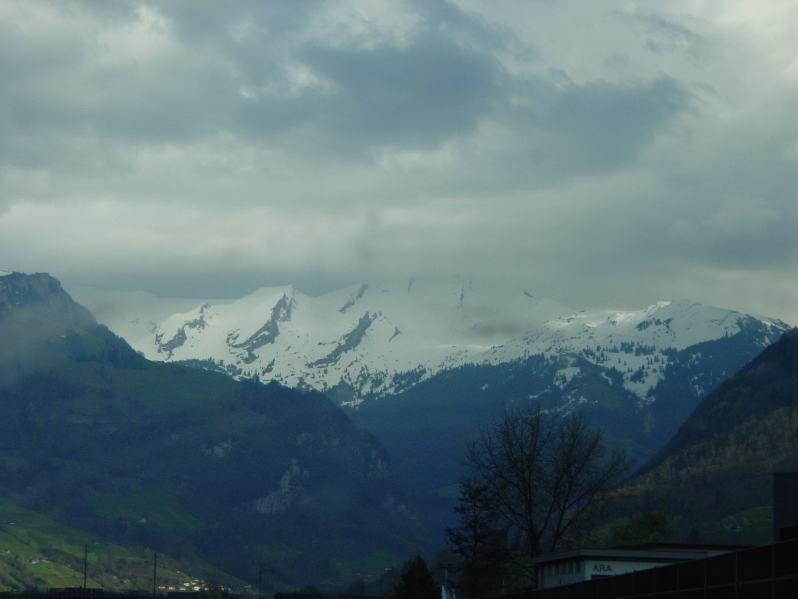
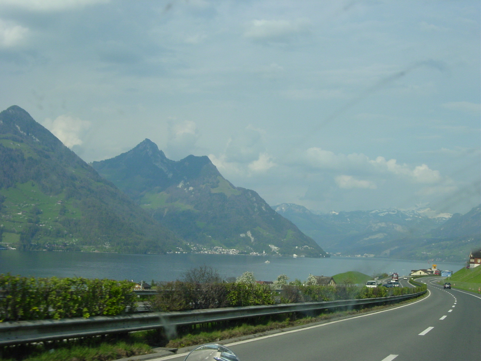
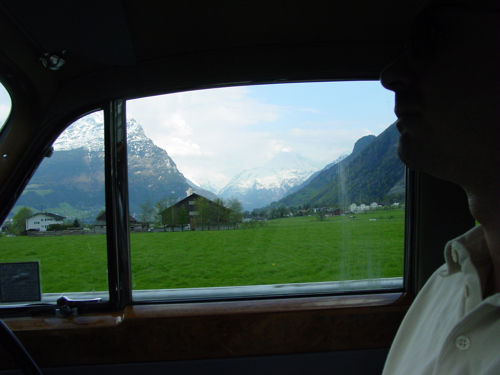
Late that night, we drove into Italy and arrived in Luisaĺs town of Oleggio, in north-west Italy. But the most amazing views on this trip came that afternoon, as we approached, entered and exited St Gotthard Tunnel (10 miles, 17 km long) through the Alps. Those mountains made the Rockies look like rolling hills.
Views of the Alps
|
|
|
| Viewing the Alps as we approach St Gotthard Pass near the Swiss-Italy border. | Vierwaldstaetter See (Lake) in Switzerland as we made our way south towards Italy. | Driving by the Alps in Switzerland, views after views. |
23 April 2003 (Day 6)
Geography: Oleggio->Arenzano, Italy
Mileage: 115 miles (185 km)
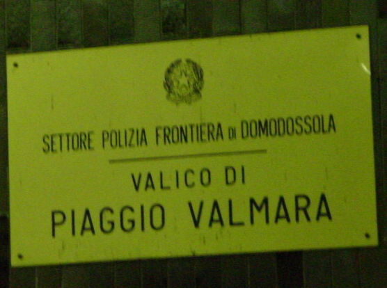
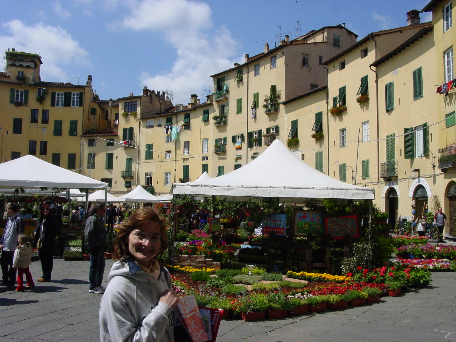
Welcome to Italy! After attempting to drive the Bentley along the narrow, car-filled streets of Oleggio, we came to realize that Luisaĺs plan of parking the Bentley at her parentĺs place in Arenzano, and using her small car, was the safest and wisest thing to do. Although we did not get to stay much in Luisaĺs home town of Oleggio, and missed meeting her sister (who luckily lives in the same town -- what a luxury since mine lives 3000 miles away), I got the feel of the small village, rich in history and character, where everyone knows pretty much everyone else, at least by sight. I think Luisa got a big kick out of being driven around in the Bentley among the local streets, and perhaps we provided a topic for that eveningĺs dinner conversation in the Oleggio households.:)
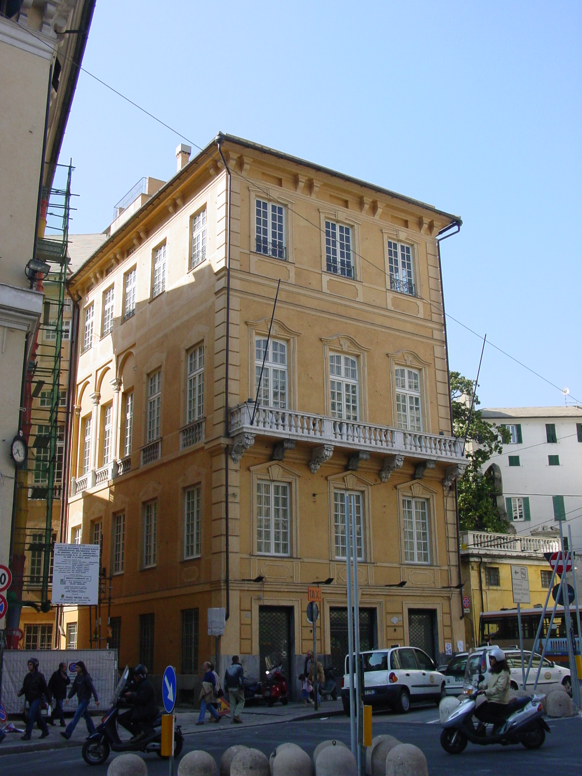
We drove our final 115 miles to the sea-side town of Arenzano, about 22 miles (35 km) west of Genoa, where Luisa grew up. Her parents greeted us with warm smiles and lots of great food. During my three days in Italy, I was able to nail down the eating habits of Italy, but never really mastered them when I was there. For my first Italian meal, it started with a typical Genovan dish, trofiette pasta with pesto sauce and focaccia (flat bread) on the side, also regional. For the record, Liguria, the region along the north-west coast, is often called the "Land of Pesto." The pasta dish was wonderful, but then it was followed with chicken and salad. I was not aware that in Italy, for the mail meal, eaten typically at lunchtime (1 or 2pm) has a first (Primo) AND a second (Segundo) course, the first being a starch (pasta, rice, polenta or grain soup) followed by a second course, mainly meat. So unknowing me had filled up on such wonderful pasta, but I was able to manage to enjoy the second course. Next, that course was soon followed by a sweet and then coffee. At this point, we were ready for a nap, which Luisaĺs parents gladly did, as is the custom also in Italy, although not as widespread as in Spain. We three, however, decided to hop a train to Genoa to explore that city. By doing so, my stomach had some time to digest the food as we wandered through an amazing city, whose narrow medieval streets, piazzas (squares) after piazzas, and churches on every street, not to mention the Cathedral (Il Duomo), gave me "information overload," to say the least.
So let me tell you a bit about Genoa before I bombard you with photos which will amaze you as this phase in my adventure started to tease me with new architectural forms I had never seen before and were to get immersed in during my three-day (oh too short!) visit to Italy.
Genoa (Genova), located on the north-west coast of Italy, along the Ligurian Sea, is a big commercial port city. It also has been a University town since 1634. A large fraction of the historic buildings in Genoa were under refurbishment since Genoa has been designated the "European City of Culture for 2004." However, Luisa could not tell me what this really "meant." Anyway, I sure need to return in 2004 to see these wonderful buildings in their full majesty, rather than letting my guidebooks and imagination fill in the dots. For an American, I guess the main notable item of Genoa is that it was the birthplace of Christopher Columbus (1451-1504), and a statue commemorating him is located conveniently outside Stazione Principe (Rail Station), our starting point in Genoa. Luisa then took us through, "old Genoa," marked by an amazing maze (literally!) of streets. Medieval (12-13th century) buildings actually used to be independent tall towers which were later joined to form this gridwork (maze) of tall long buildings along narrow streets, equally packed narrowly together (caruggi). I would have easily gotten lost without our guide.
On this trip, as I visited a small collection of Italian cities, I could not help by notice that the surnames of prominent ruling family (or families) over the centuries are commonplace knowledge and remembered in the names of piazzas (squares) and vias (streets). In Genoa, it would certainly be the Doria family, although Genoaĺs colorful history involves quarrels between the noble families Dorias, Grimaldis, and Spinolas. Besides the above-mentioned noble families quarrelling for control and the Genoese people surrendered many times to foreign governments in the 14th and 15th centuries, followed by being sacked by Spain and France in the 16th century, until stability came by liberation by Andrea Doria in 1528, who established a new constitution & reform for Genoa, which took some time for the diverse population of Genoa to accept. So todayĺs Genoa, still an active port and busy industrial city, certainly showed a diverse and complicated past, whose impact I could not grasp within our brief three hour visit.
To me, the most stunning aspects of Genoa, and the towns of Lucca and Pisa to come (the next day), were finding churches literally every 500 meters, large majestic Cathedrals (Duomos) and churches (Chiesas) with marble facades (fronts) (at least, although the Duomos would have their entire exterior made of marble!), and the use of shutters to close to block the sunlight (and, Luisa added, also for security at night). The outside of many Italian buildings were often in need of paint and repair, which to a newcomer, such as myself, made Italy look "tattier" than the other European cities I have now briefly visited. But, as Luisa informed me, exterior painting of such residences needs to be approved by the State, which is often a slow and costly investiture. But wonderful on the inside were these buildings, so beware the tourist! One must take a gander inside. As we walked along Via Garibaldi (Garibaldi Street, named after Italyĺs national hero Giuseppe Garibaldi (1807-82) who unified Italy in the 19th century), walking between Palazzo Rosso (Red Palace) and Palazzo Bianco (White Palace), you could gaze into the windows to see highly decorated rooms and ceilings, which truly appeared to have no equal.
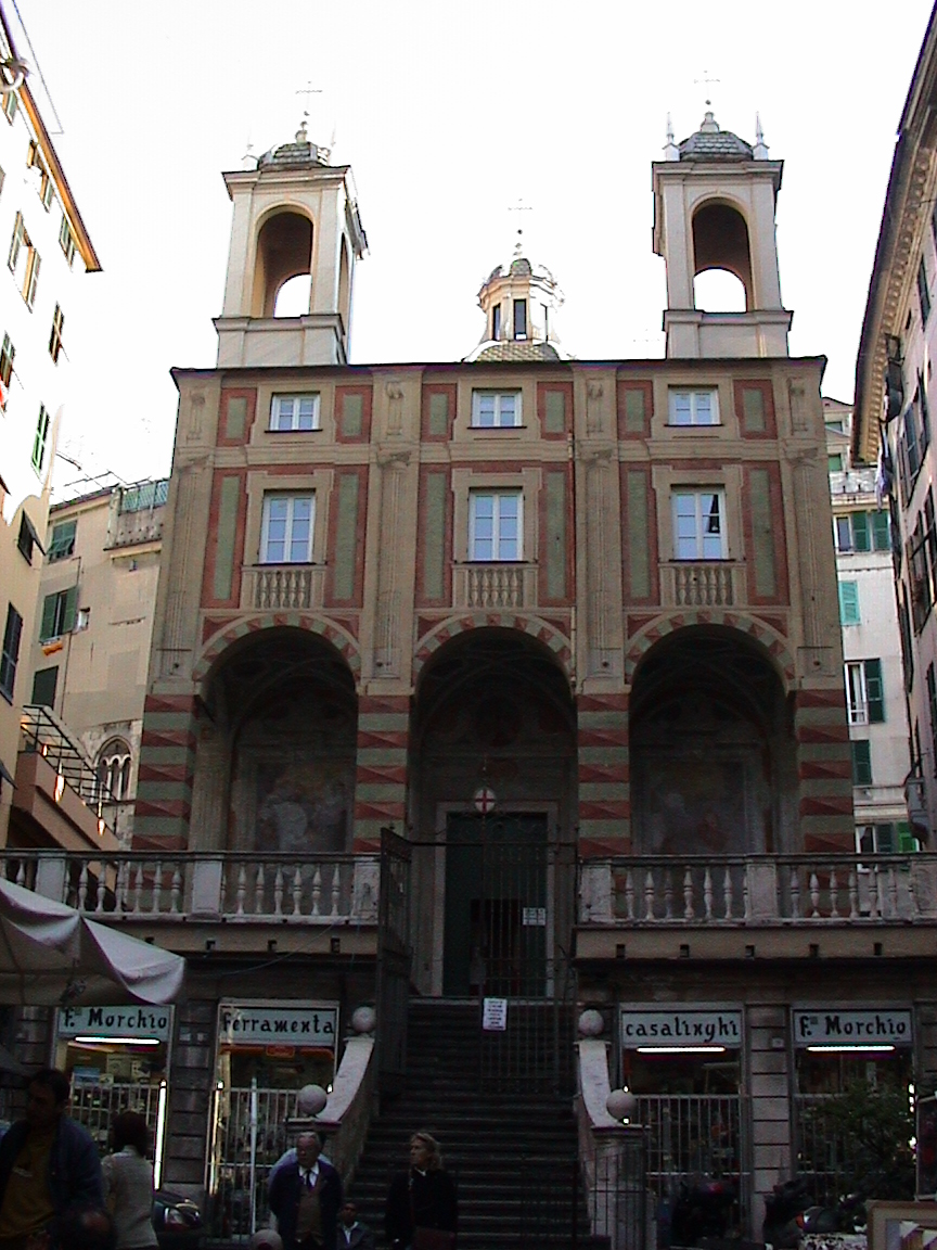
A taste of Medieval Genoa

|

|

|

|

|
| Statue of Christopher Columbus in Piazza Acquaverde, Genoa. | Looking down medieval walls of San Giovanni di Pre and Commenda (hostel), Genoa. | Gate to the Old City of Genoa (Porta dei Vacca). | Old city streets of Genoa, adorned with the city coat of arms (arms of St George, red cross on white) and lanterns. | Medieval street, very narrow. Just think of the gossip from the neighbours! |
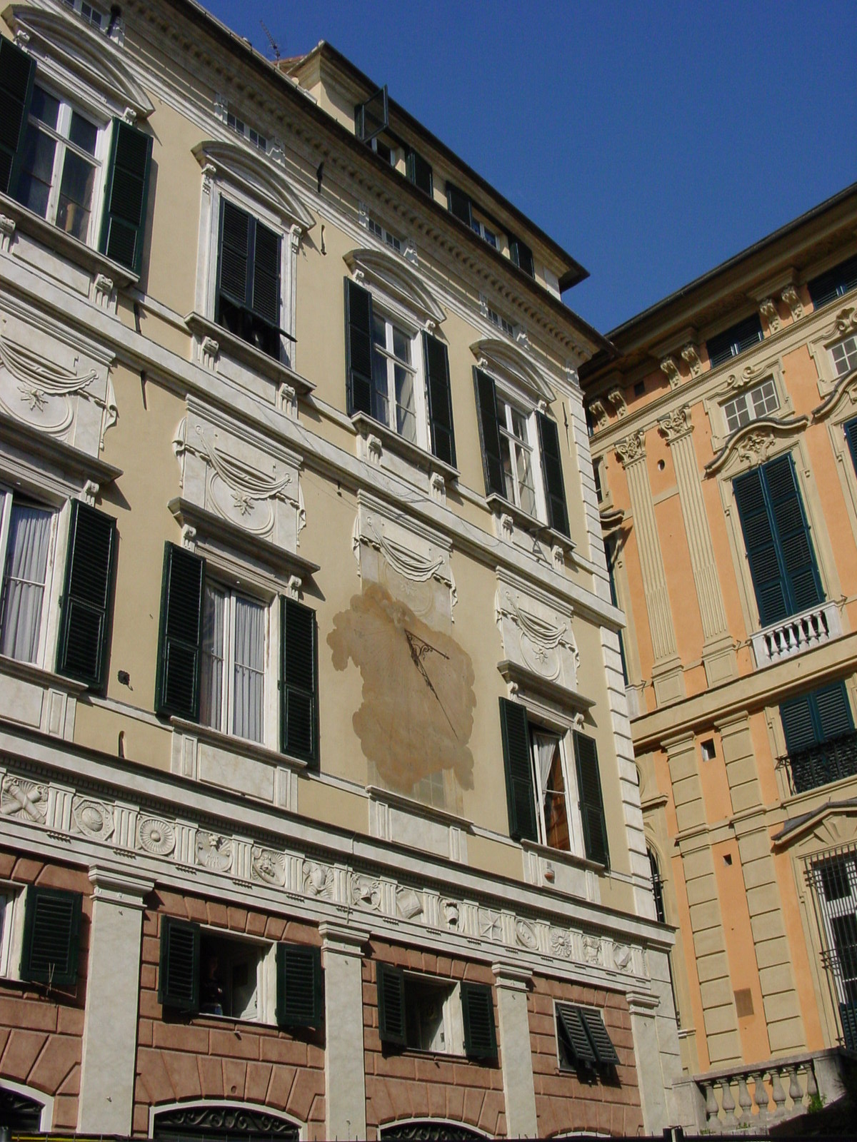
|
|
|
|
|
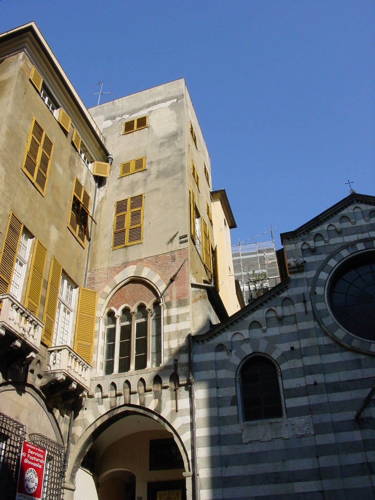
| Piazza della Meridiana, Genoa. | Sundial in Piazza della Meridiana, Genoa. | Palazzo Spinola, 16th c mansion once owned by the Spinola family, now an example of how the Genoese nobility lived in the 16-18th centuries. | Piazza di San Matteo and Chiesa di San Matteo, the church of the Doria family, the family long associated with Genoaĺs history. | Entrance to Chiesa di San Matteo (1125), Genoa. |
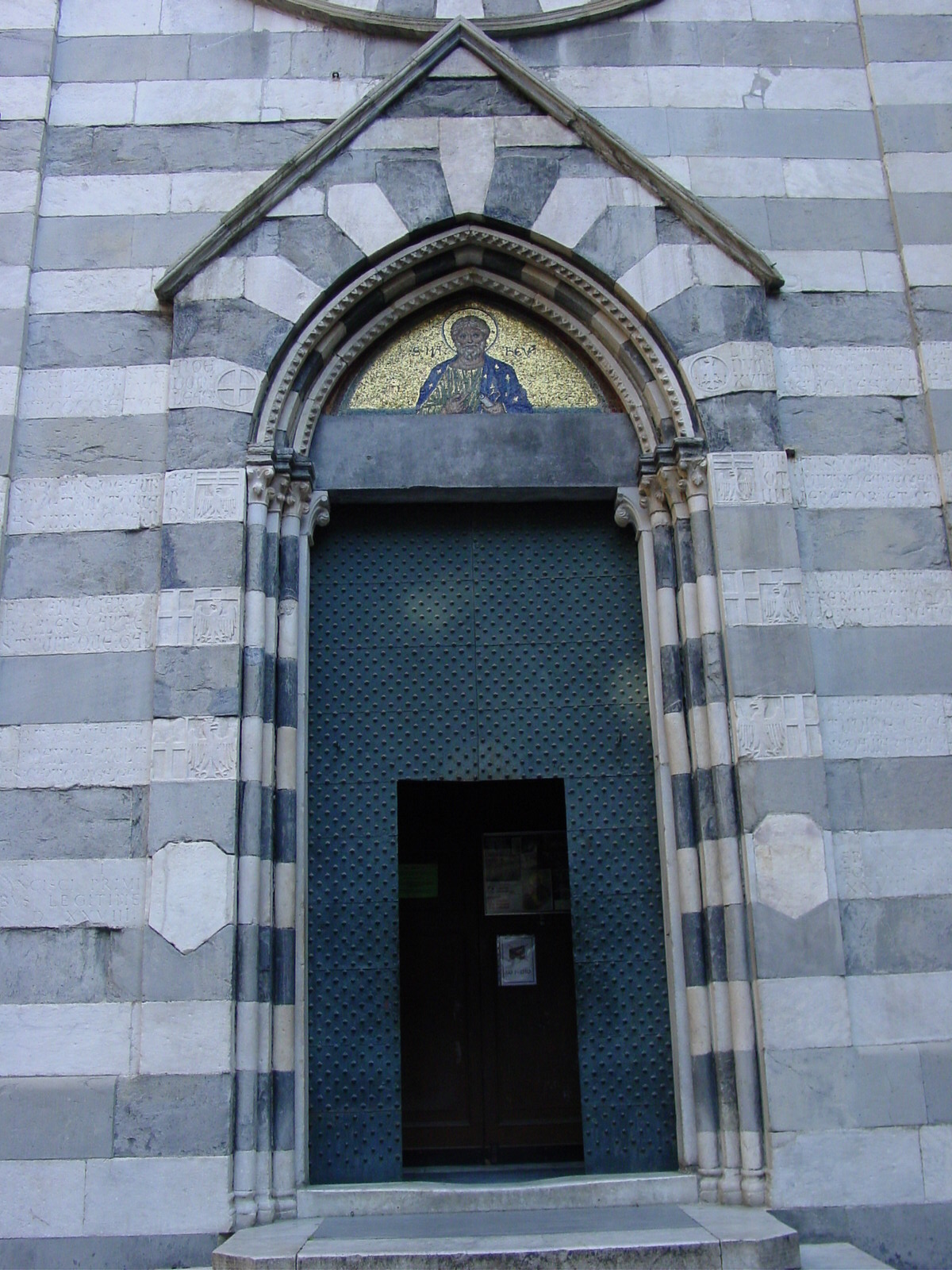
Il Duomo, Cattedrale di San Lorenzo, Genoa
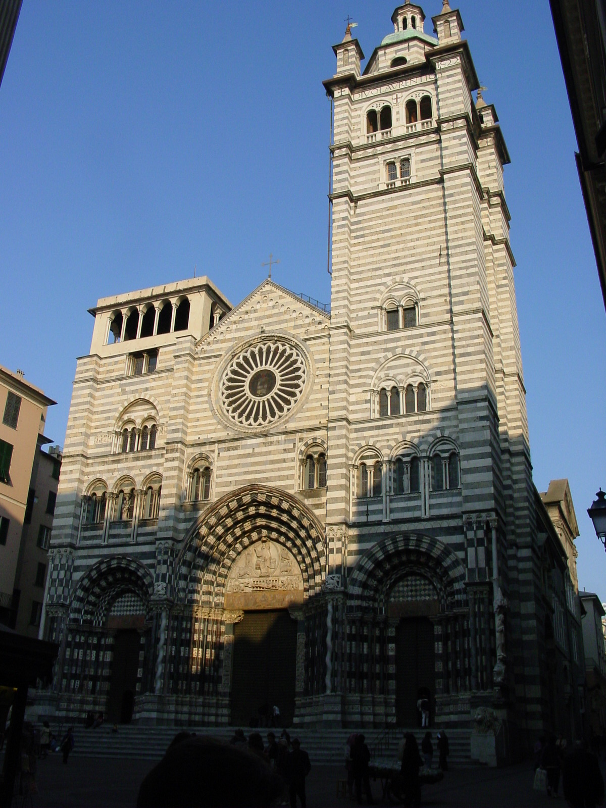
|
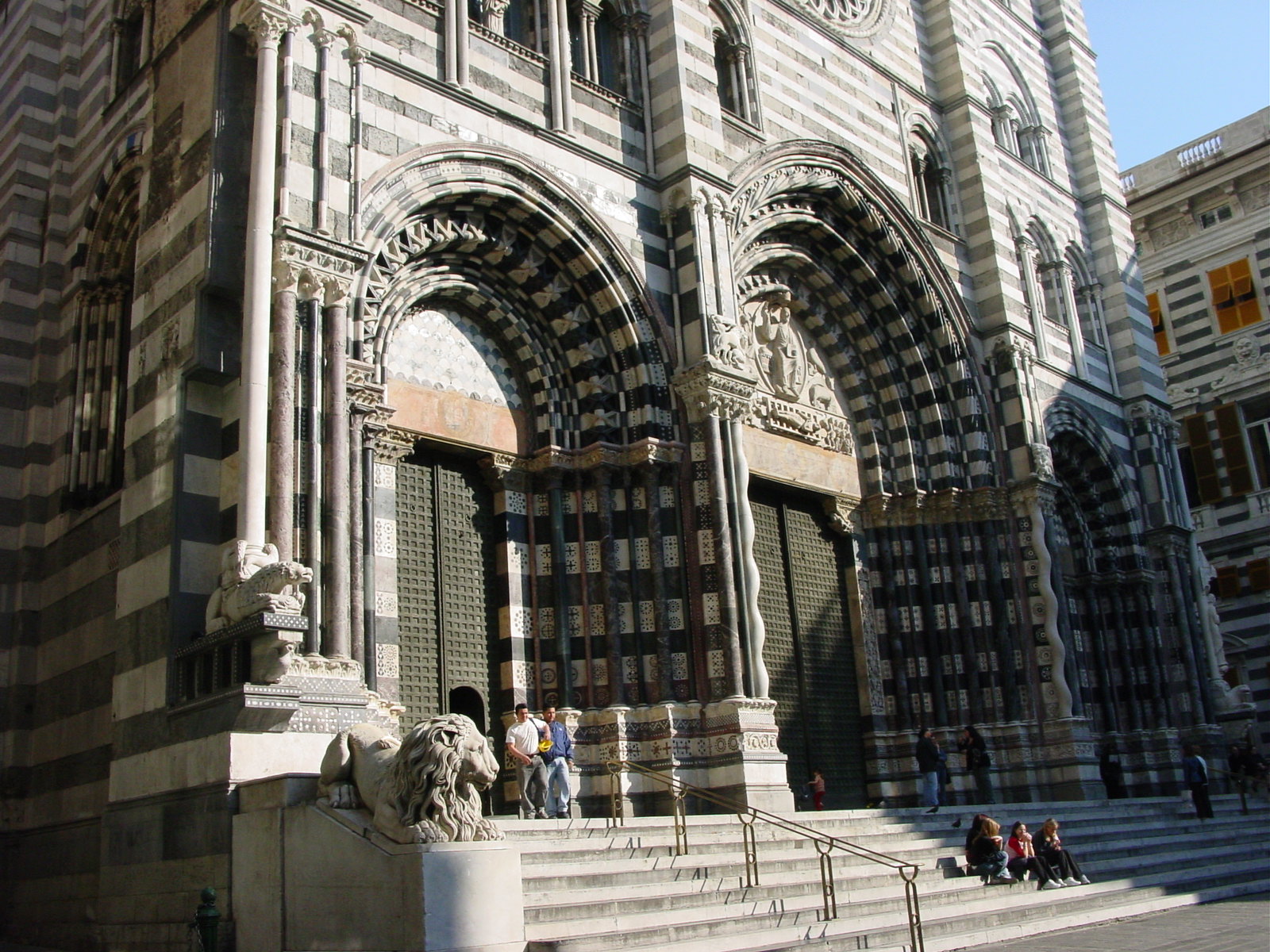
|
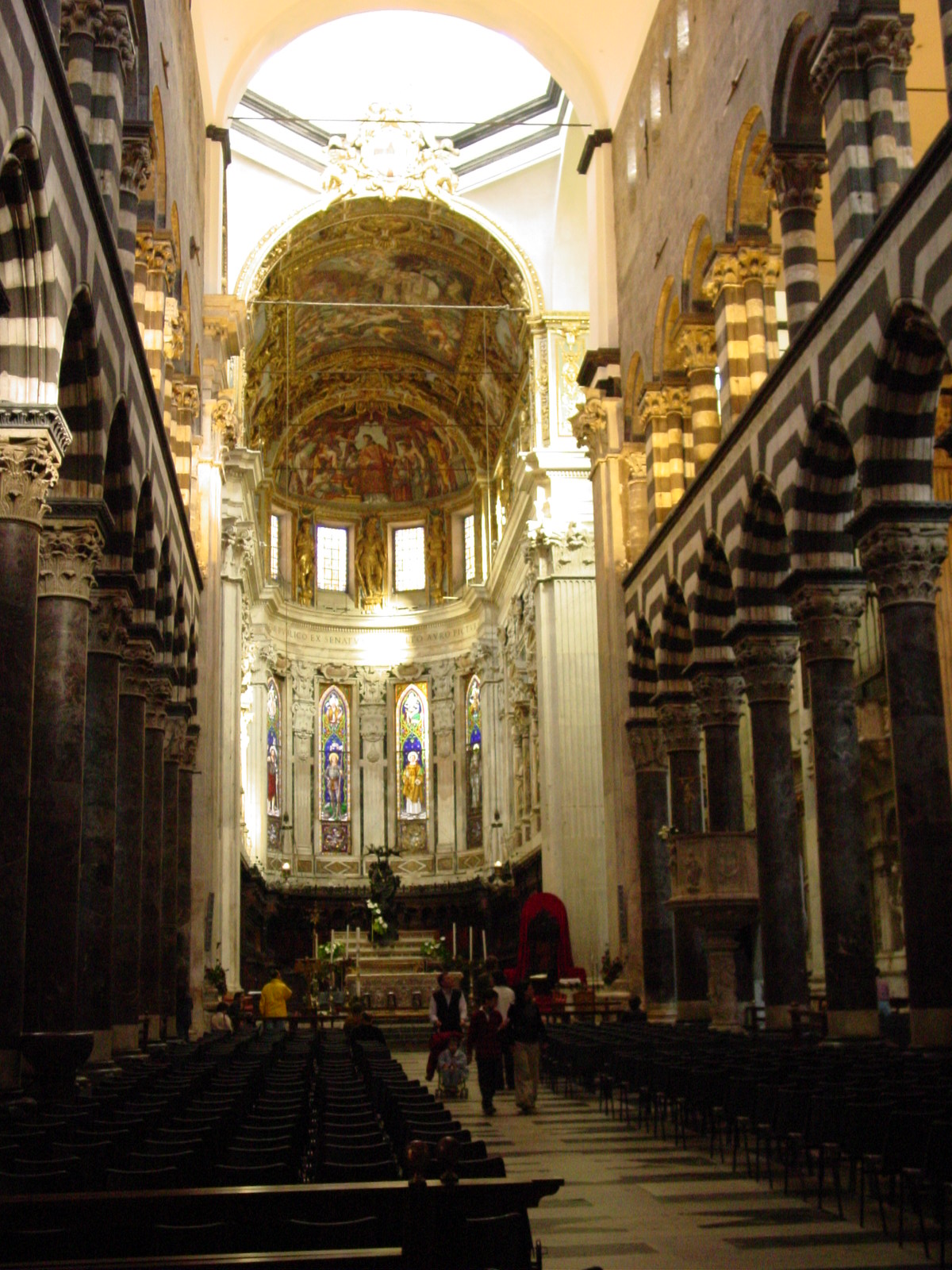
|
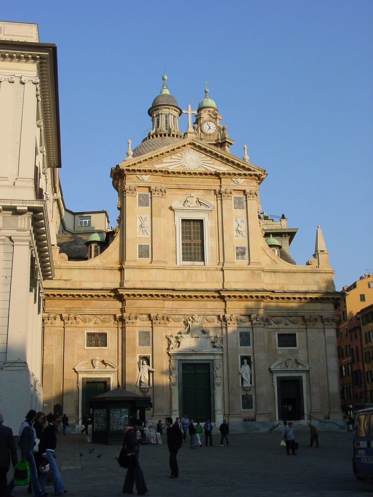
|
| Cattedrale di San Lorenzo, Genoa, built from 1118, with two bell towers (one unfinished) in 16th century. | Cattedrale di San Lorenzo, distinct by Genoese black-and-white striped Gothic marble fašade. Luisa pointed out that the black marble is actually thinner in height than the white, to give the impression of equal spacing when viewed by the eyeĺs interpretation. Most impressive. | Inside San Lorenzo. To the left is a museum (not shown), where we saw the relics of St John the Baptist and other church treasuries and relics (Il Tesoro di San Lorenzo). | Chiesa del Gesu (Jesuit Church). On the outside (shown here), plain, but the inside was a stunning (and rather over the top) 16th-century Baroque adorned with Reni and Rubens artwork, and then some... |
More views of Genoaĺs history and present
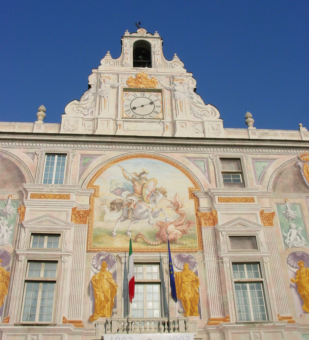
|
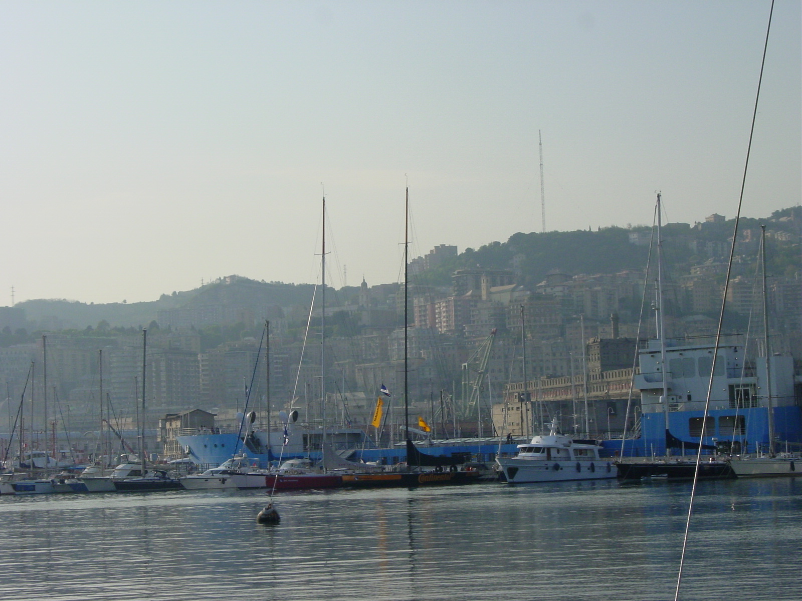
|
|
| Palazzo San Giorgio, present-day port authority, built in 1260, used to be a prison in the latter 13th century where Marco Polo had been an inmate. | Port of Genoa, still active, although this area is primarily personal boats. Industrial ports are further north-west of the city. | Update: 3/5/05 Filippo Noceti stumbled upon this page and email me. He pointed out a correction! Graci Previously I thought this was a House along Via Lorenzo. It is actually the Church of St Peter (San Pietro in Banchi), where 'in banchi' means 'in stalls' where the bankers could work their trades. From 'banchi' comes the name Banca for 'bank.' |
|
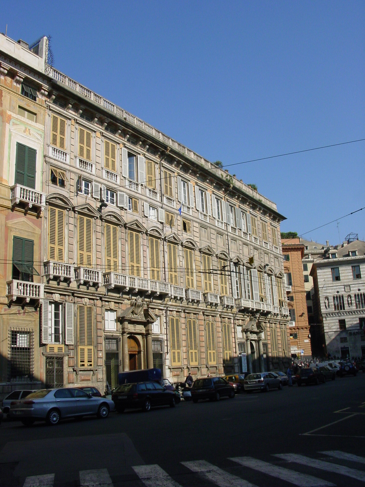
|
|
| Looking towards Porta Soprana (city gate) from Piazza Giacomo Matteoti, the only remaining section of the cityĺs 12th century defensive walls. | Palazzo Ducale (Ducal Palace), Genoa, neoclassical fašade, once the seat of the city rules, and now a museum. | Piazza de Ferrari, with banks & fountain, neoclassical (19th century) architecture. |
We ended our day back in Arenzano enjoying a late night pizza downtown. In Italy, the pizzas remind me of Lidos in Hackensack. I had two pizzas on my visit to Italy, one "well-done" and the other "regular," and I realized I like them "well-done" when the crust is slightly burned to give it a crispy texture. Italian pizzas are personal size (10 inch diameter or so), with a thin crust and a tomato base with mozzarella and chosen toppings, usually eaten with beer (not wine).
24 April 2003 (Day 7)
Geography: Arenzano (Liguria) -> Lucca (Tuscany) -> Pisa (Tuscany)
Mileage: Unknown (Luisaĺs car)
One of the smartest decisions on this trip was to park the Bentley in Arenzano and go off to explore Italy in Luisaĺs tiny car, for Italian streets are narrow, winding and filled with cars so that itĺs best to be small to maneuver quickly to react to the dynamic traffic. Also, there are loads of scooters which weave into and out of the traffic, so you need to be wary in all dimensions. Plus, with Luisa at the wheel, we got a taste of what itĺs like to "drive Italian," involving lots of hand motions and unheard, yet audible (within the car) expressions. This is why perhaps Italians are among the healthiest and long-lived peoples, for they know how to express themselves, rather than hold it all in. All in all, it was an interesting way to tour to country, Italian-way. :)
As we drove through the region of Liguria, what struck me most about the Ligurian countryside were the terraced-hills, forming this zigzag view of the sloping hillsides. Perhaps it is to avoid soil erosion, but it certainly looked strange as since most of the terraces were just plain grass (no crops) and the formation would be unsuitable for livestock to roam freely along the hillsides.
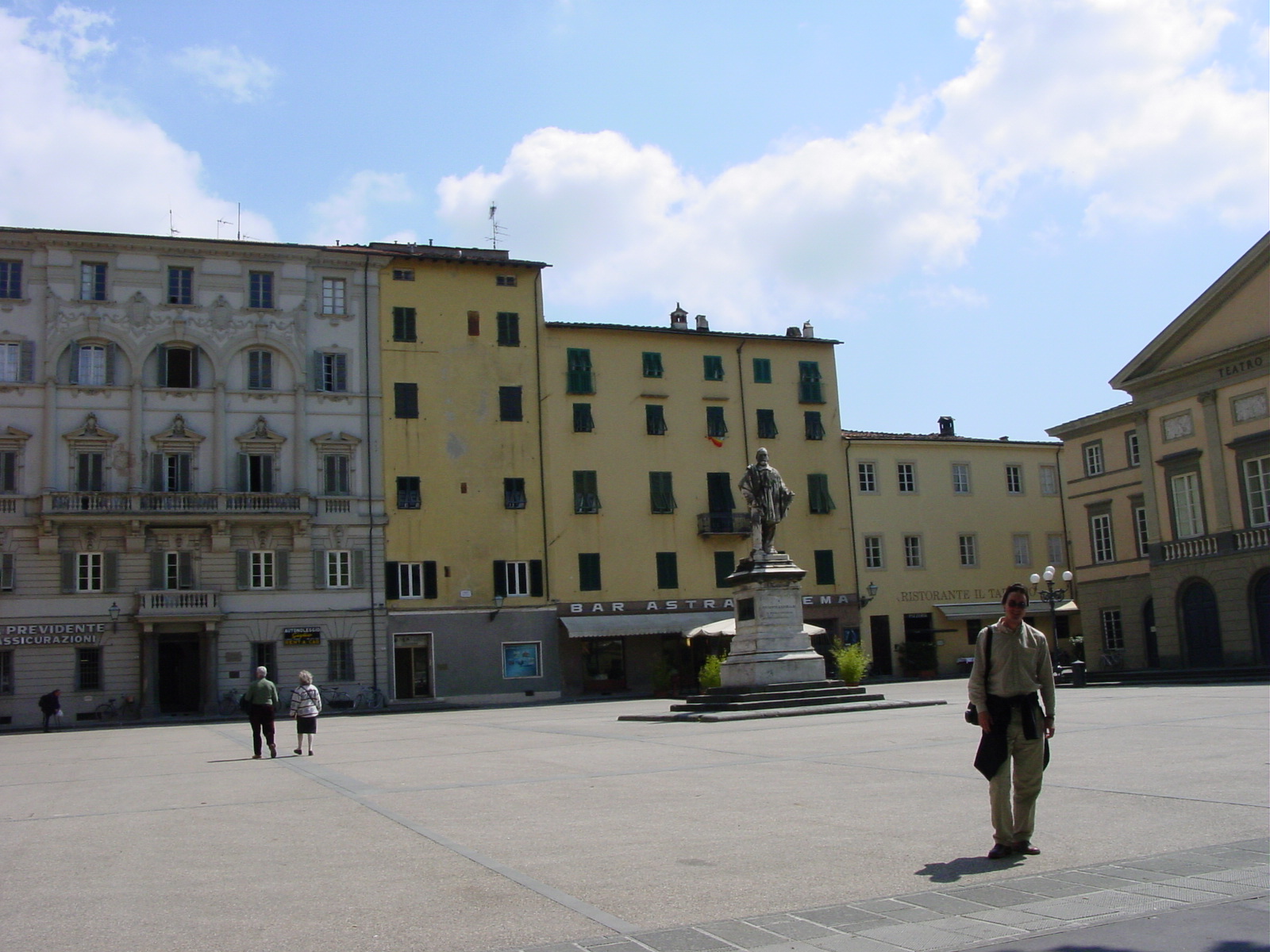
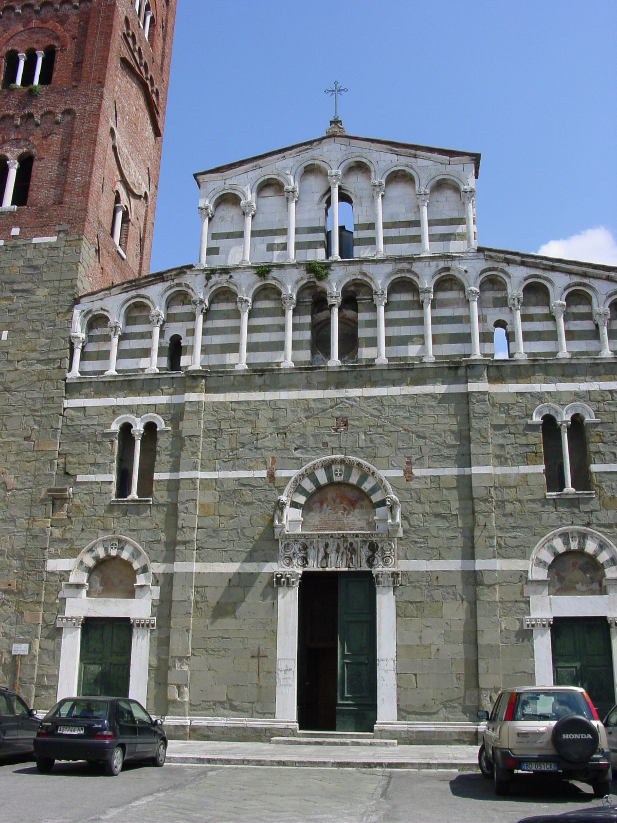
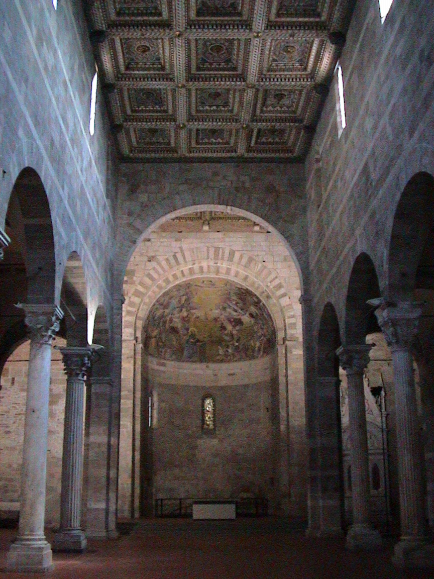
We made our way into Tuscany (Toscana), a region known for architecture, great collections of art, and beautiful rolling hillsides and countryside where Cypress trees grow and best-known wines are cultivated. Our first stop was the picturesque totally enclosed walled (although late walls, dated 17th century) city of Lucca, originally founded as a Roman colony in 180 BC and known for its silk trade well into the 12th century. I have further read that Lucca remained a peaceful independent republic for almost 500 years until Napoleon, who in 1805, created a new principality and placed a member of his family in control over Lucca. I had wondered why the main piazza in Lucca was named Piazza Napoleone. As we wandered the streets of Lucca, I was overwhelmed by the many wonderfully preserved 11th-12th century churches, whose facades exemplified the quality of the nearby Apuane Alpsĺ marble.
Look like snow in Tuscany? Actually, these are the foothills of the Apuane Alps, by the town of Carrara, seen as we drove from Genoa (Liguria coastal region) towards Lucca (Tuscany region). These are limestone formations and the quarries of white marble that cover the hills. This white marble had been used by Michelangelo for many of his masterpieces, and it is said he actually traveled personally (!) to the quarry in Carrara to select his blocks of stone. In the cities we were to visit, many of the facades of the Chiesas and Duomos would be in Tuscan marble, white, green, and pink. Amazing!
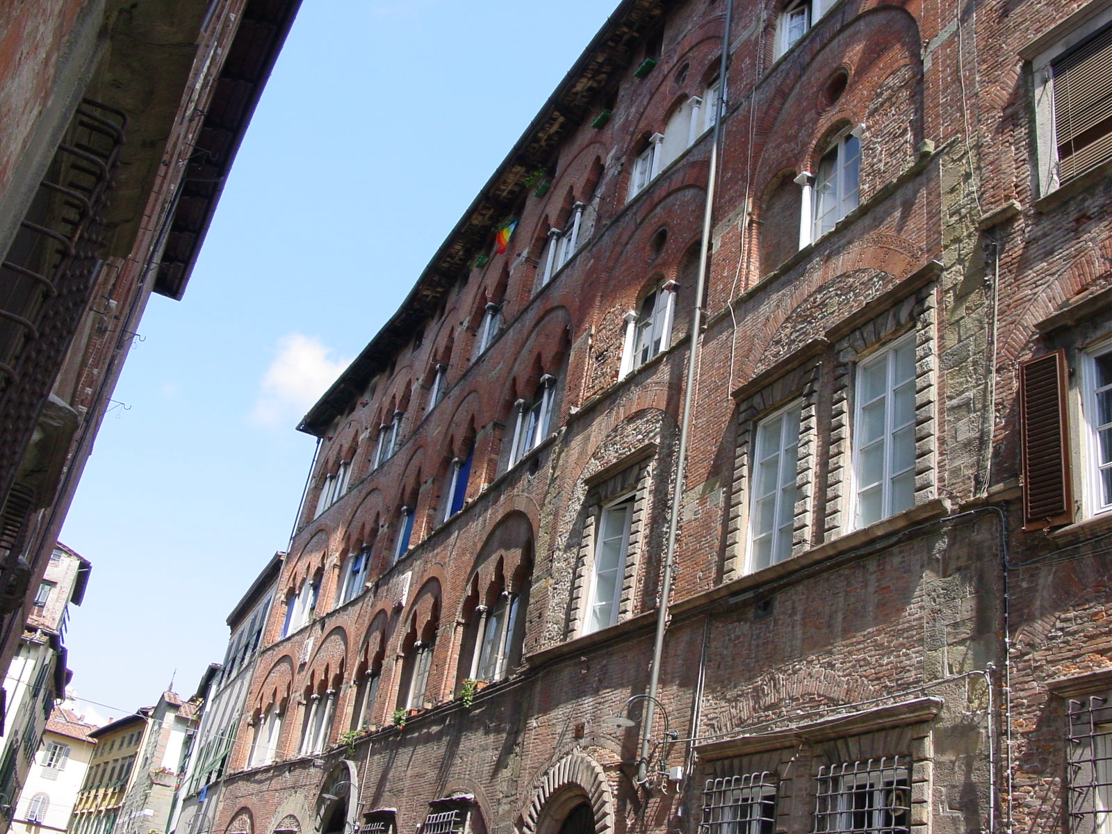
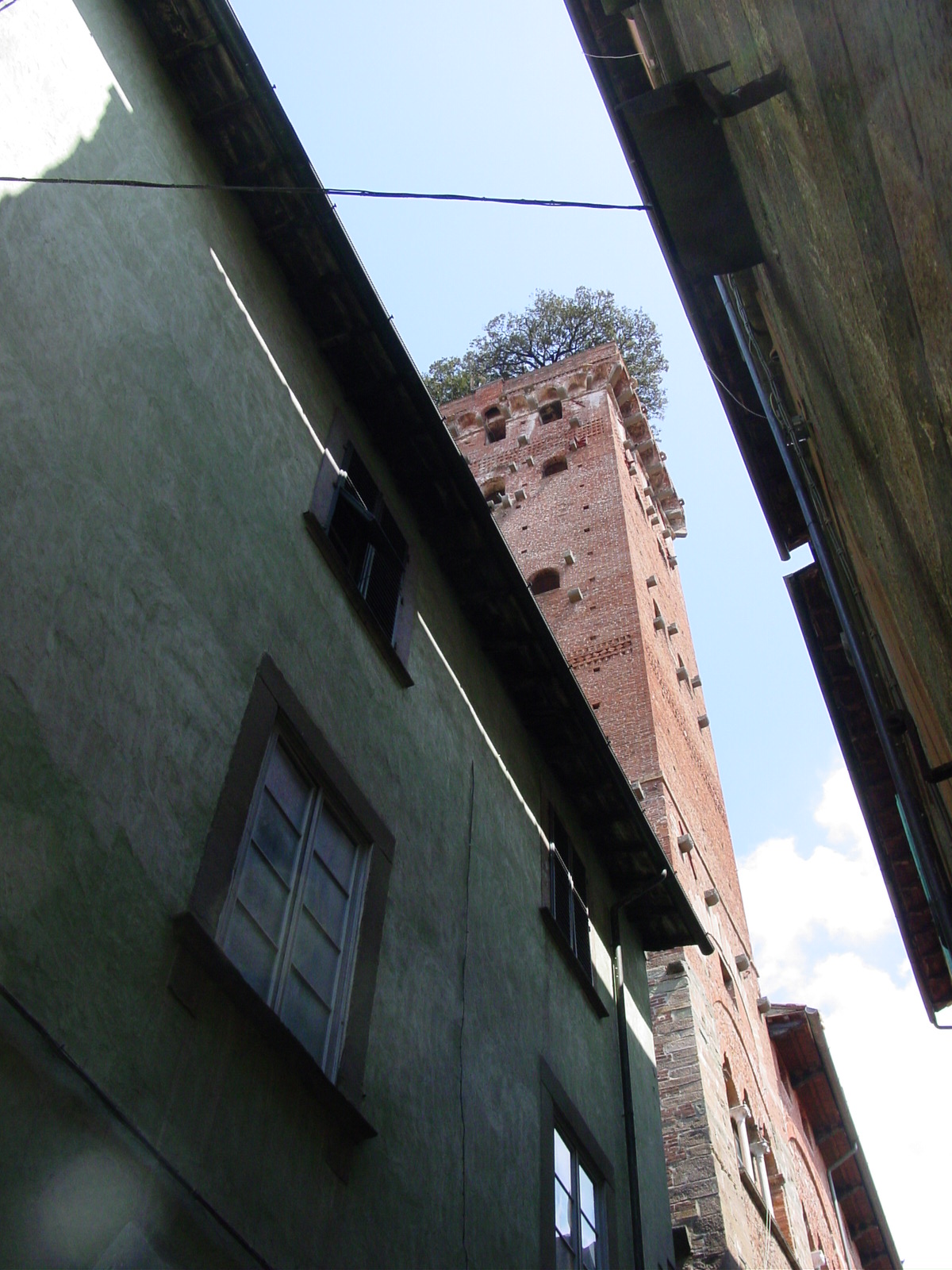
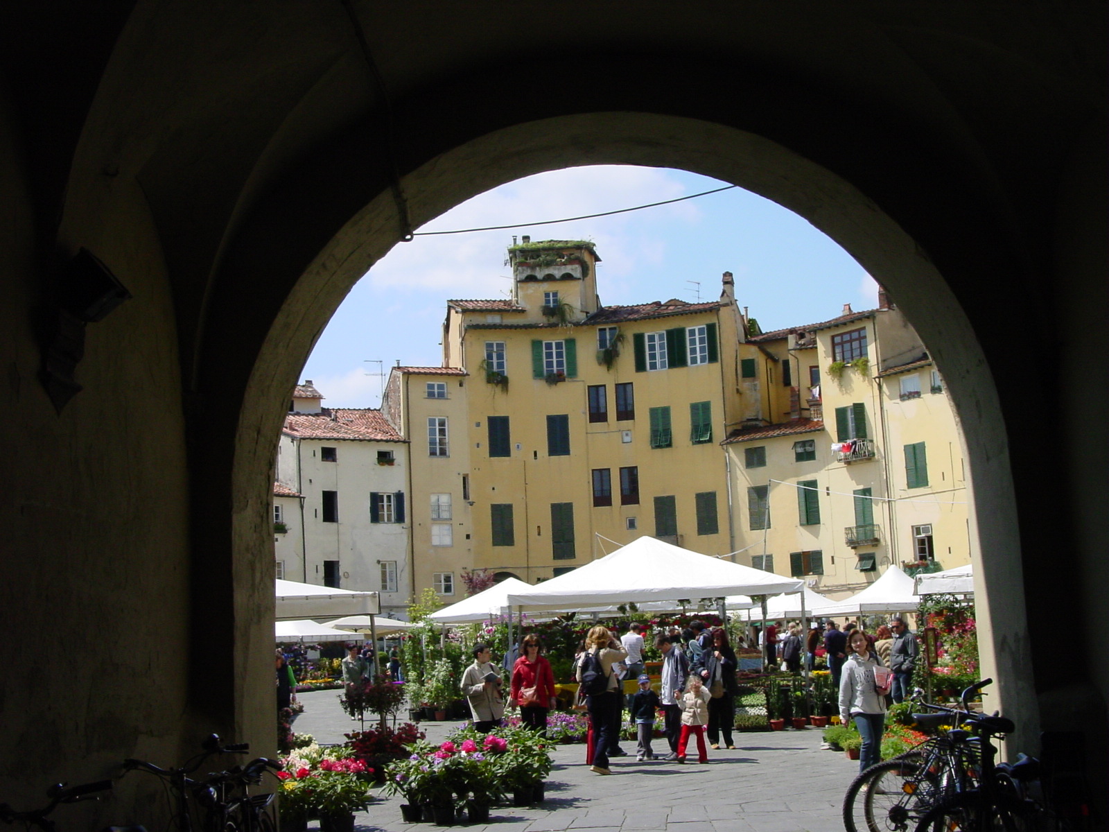
Piazzas of Lucca
|
|
|
|
|
| Piazza del Giglio, Lucca, with the theatre on the right where the Lucca-born composer Puccini often has his works performed. | Corso Guinigi, a street in Lucca where the rich used to live, named after the 15th century Lord of Lucca, Paolo Guinigi. The architecture is mixed-style. | View of Torre Guinigi, Lucca, with a tree sprouting from the tops. | View of Piazza Anfiteatro, an oval shaped "square" which has been built on the remains of a Roman amphitheatre (2nd century BC). | Piazza Anfiteatro, now a vegetable and floral market, where we had lunch. The charm of the uneven circle of houses of irregular heights was a site to be seen. |
Chiesas of Lucca
|
|
|
|
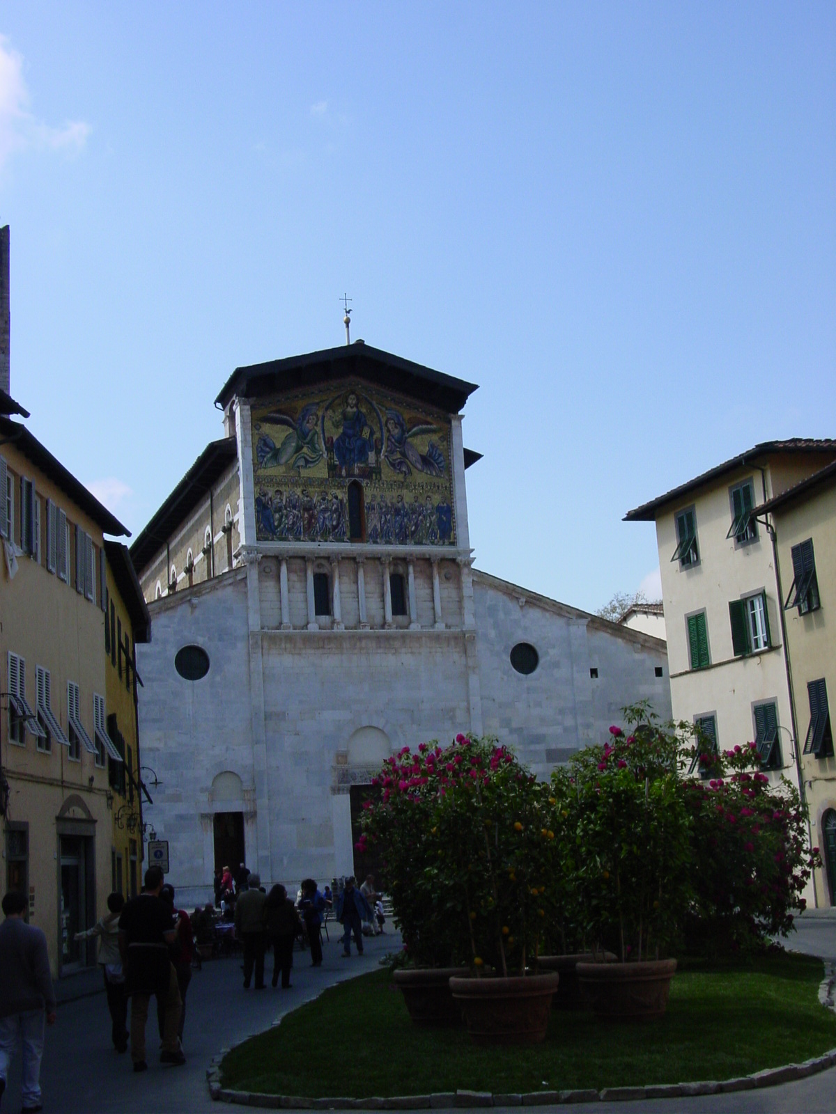
| Piazza San Pietro Somaldi, Lucca. | Inside Piazza San Pietro Somaldi, Lucca. | Chiesa di San Frediano, featuring a restored 13th century mosaic, Pisan- Romanesque style. | Detail, Chiesa di San Frediano, 13th century mosaic. |
|
|
|
|
| Chiesa di San Giovanni, Lucca. | Chiesa di San Michele in Foro, Lucca, Romanesque church built on the site of its 8th century precursor. | Detail, Chiesa di San Michele in Foro, Lucca, fašade showing Archangel Michael slaying a dragon. | Detail, Chiesa di San Michele in Foro, Lucca, where again as with Il Duomo (see below), the pillars are all unique in Lucca-Pisan style |
Il Duomo, San Martino, Lucca
|
|
|
|
| Piazza San Martino (Cathedral), Lucca. Romanesque style, dates from 11th century. I read they ran out of money and didn't finish. | Details of San Martino, 11th century Lucca-Pisan style facade - look at how each column in the facade is unique! Supposedly each of these columns was carved by a local artisan. |
Piazza San Martino, detail, believed to be by Nicolo
Pisano
Top: Jesus between two angels, below Mary with the 12
apostles; Bottom - depicting everyday life in Tuscany, and zodiac signs Beautiful pink, white and green Tuscan marble. |
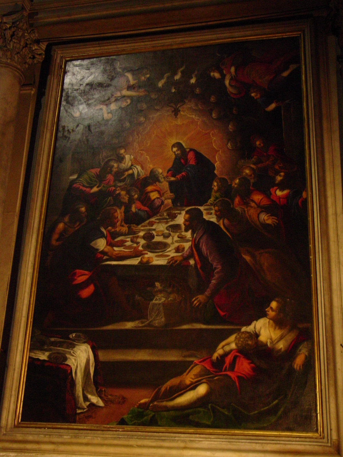
"Last Supper" by Tintoretto, inside San Martino. The interior of this Cathedral was in 14th-15th century Gothic style. |
I realize I will need to define a few terms which I have used in this journal entry when describing types of architecture I experienced in Italy. I have used the term "Romanesque" to refer to a style of buildings constructed between 1050-1200 AD which were supposedly resembling the style of the Roman Empire, where big was better, and the buildings are characterized by thick plain walls, barrel-vaulted roofs, with semi-circles over doorways, above windows, between arches, and the apses at end of churches made semi-circular. Often Romanesque churches would feature mosaics dating from the earlier Byzantine style (400-1000 AD) or the use of fresco (paintings on stone) (1300-1500 AD). In regards to paintings and sculpture, the Romanesque style is said to yield still, static figures.
In comparison, the Gothic period (1200-1400 AD) followed Romanesque when engineers toyed with figuring out how to support large loads by distributing it properly. Gothic buildings are known for many tall pillars and columns, arches, vaulting, tall pointed windows, and lots of decoration (e.g., statues, gargoyles). Gothic buildings would literally seem to "reach the sky." Gothic sculptures and paintings are seen to hold more depth, warmth, color, and character over their Romanesque predecessors.
The Renaissance period (1400-1600 AD) followed Gothic, where artisans experimented with optics and perspective to give illusions of depth and space, and perhaps became more daring. Architecturally-wise, this is was achieved by the design and construction of magnificent large domes in Florence and Rome by Brunelleschi, Bramante, and Buonarroti; and ambitious exquisite facades to palazzos (palaces) in the cities.
Finally, the Baroque period (roughly mid-1600s-1700 AD) when frivolous excesses were in fashion, from complex shapes and exotic geometry in architecture to exaggerated posses in sculpture to complex ceiling frescos.
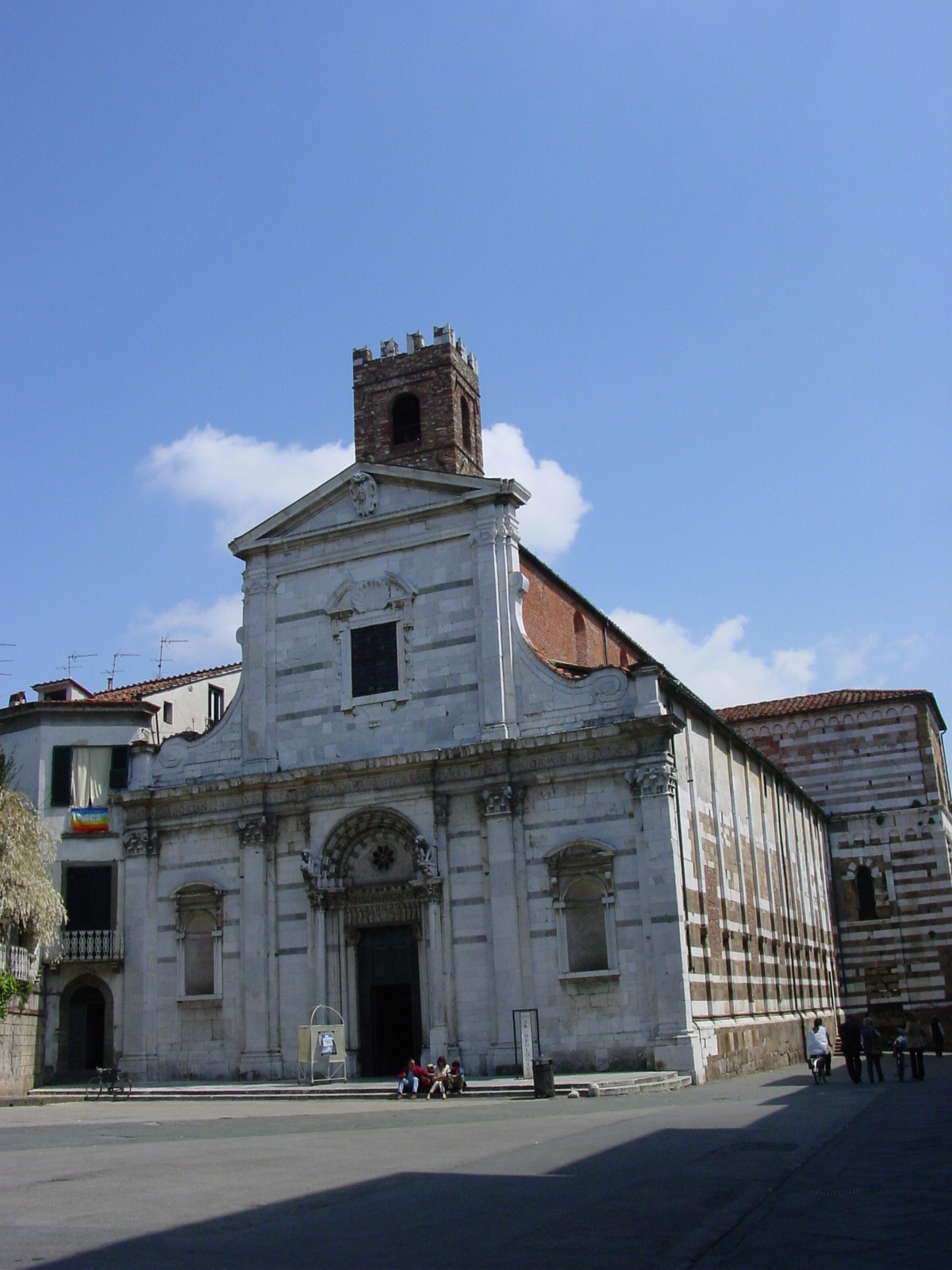
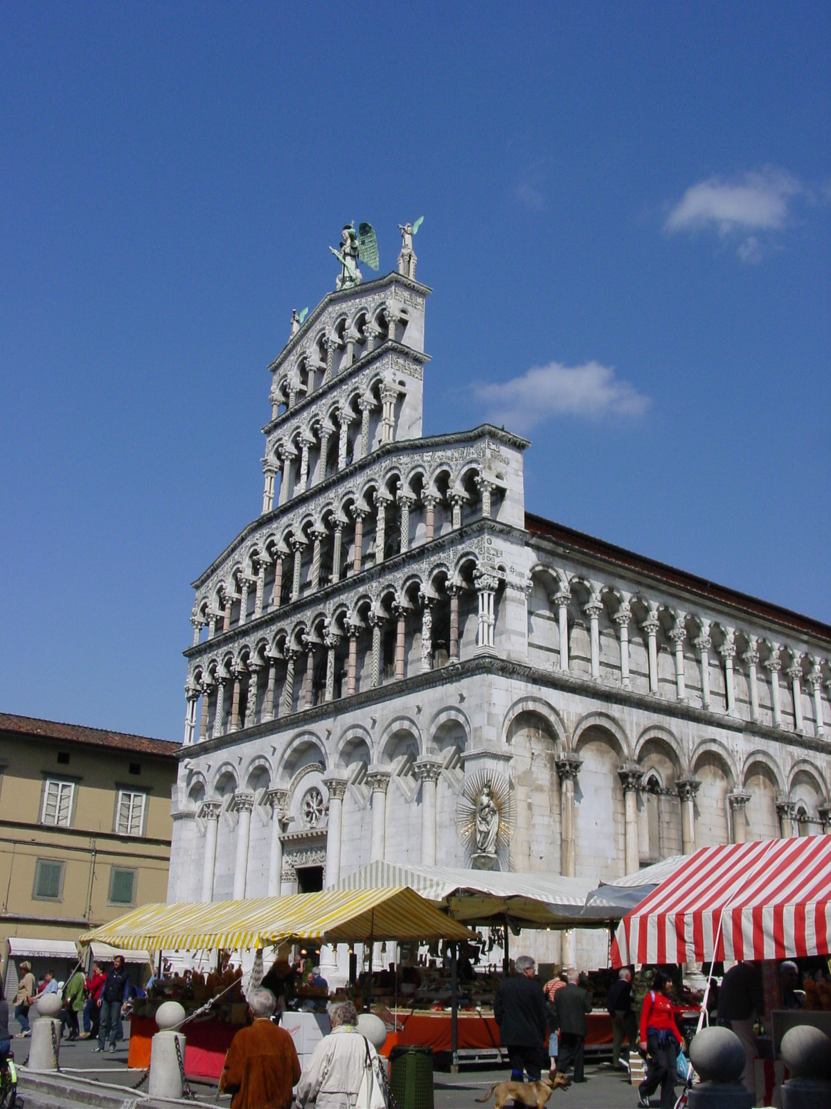
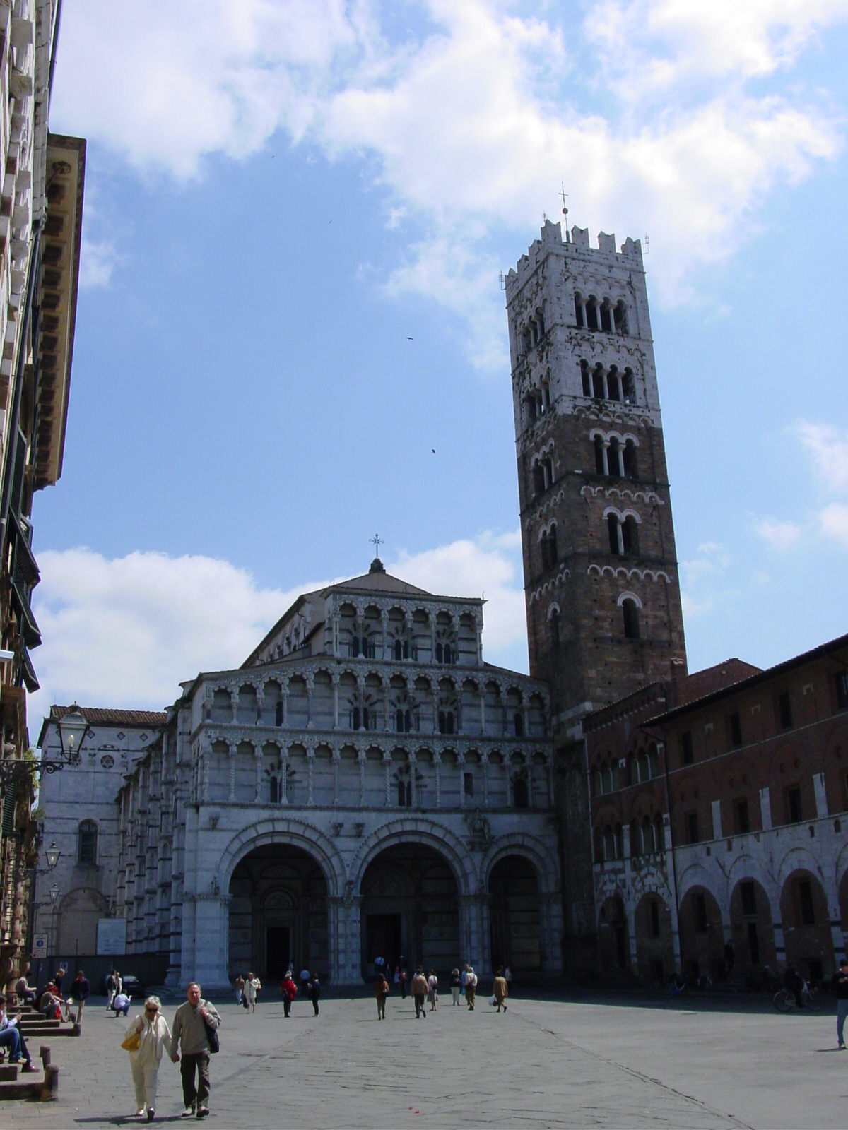
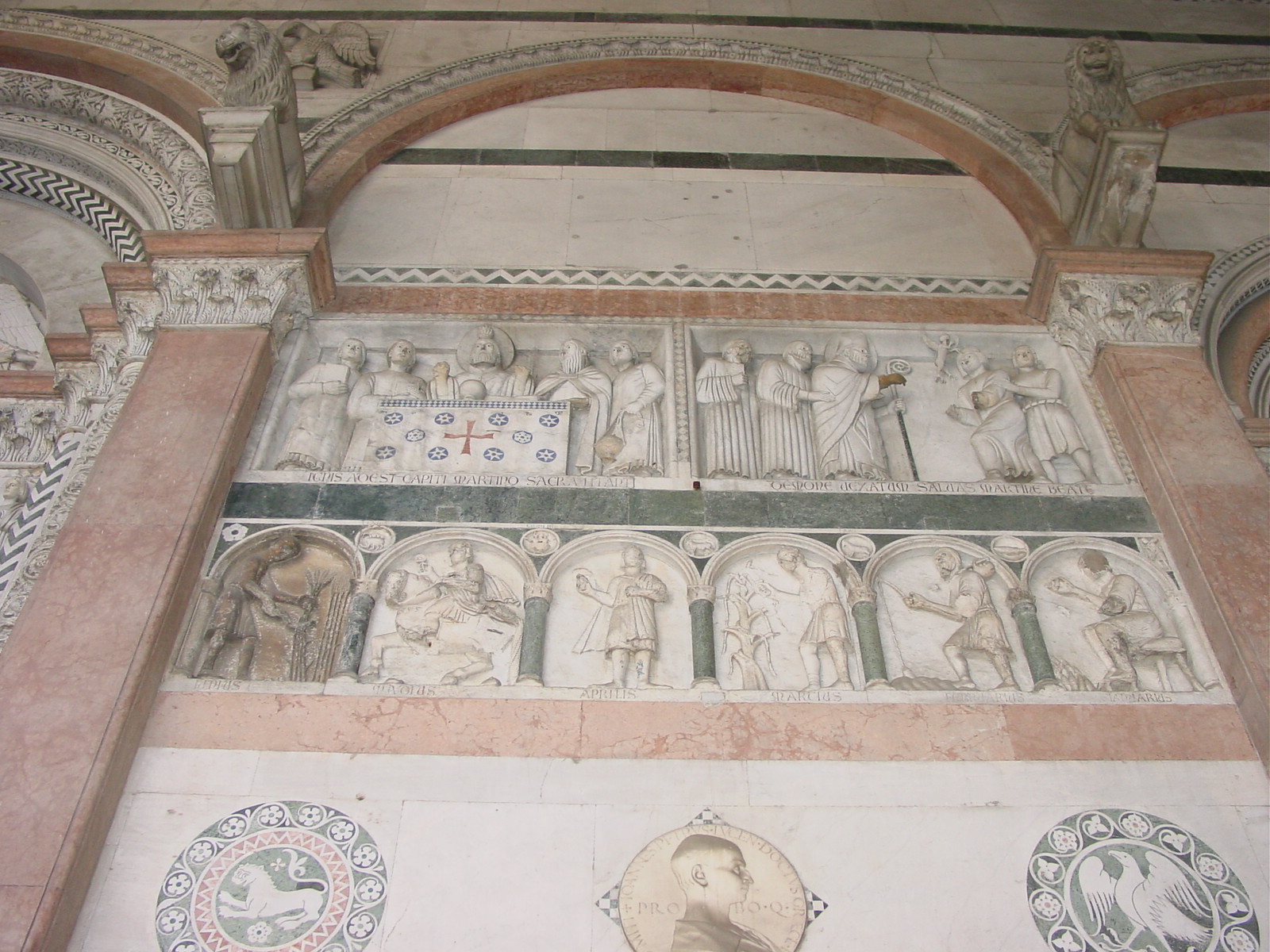
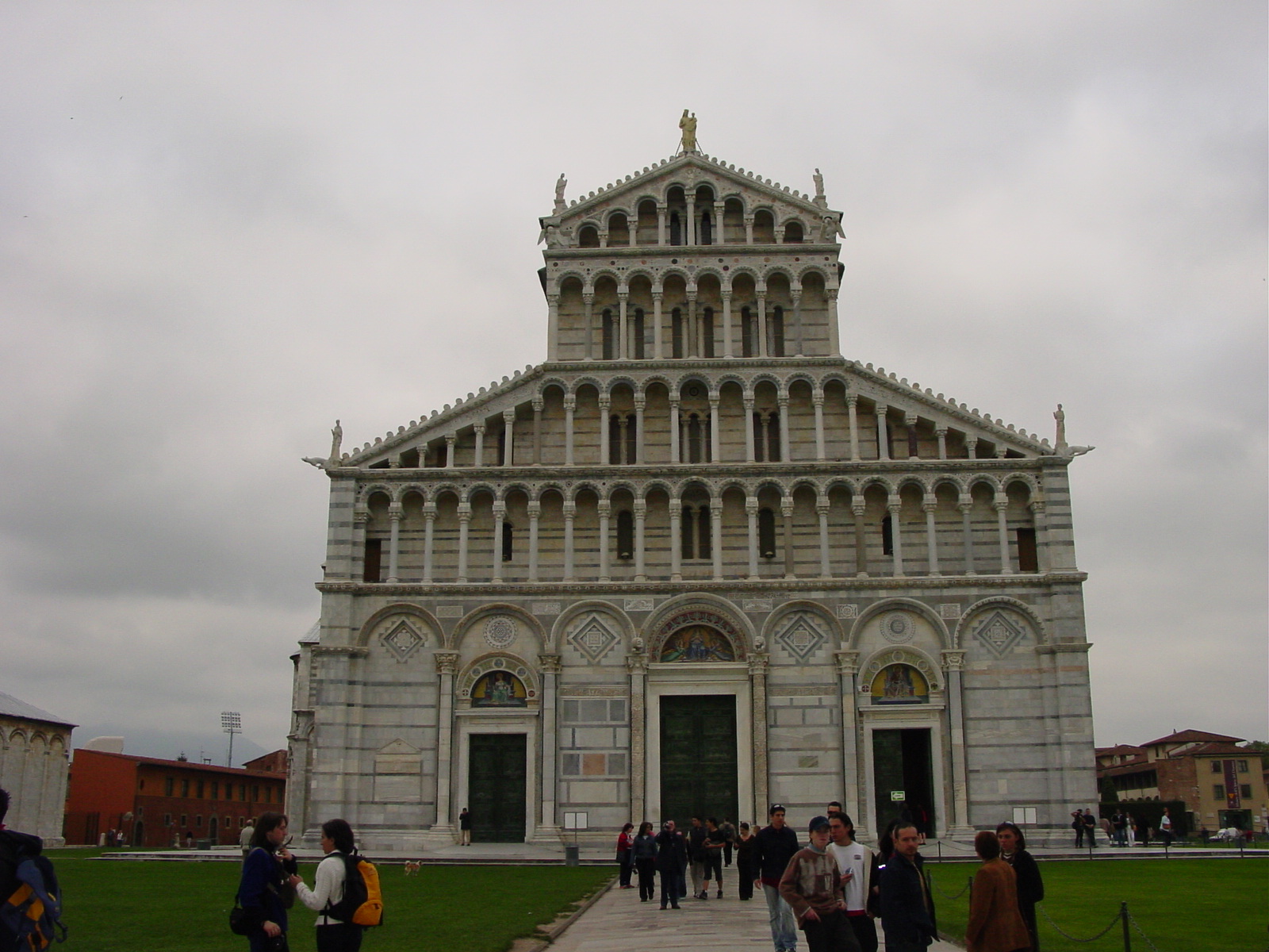
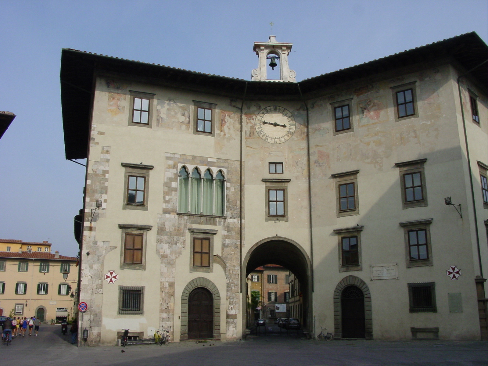
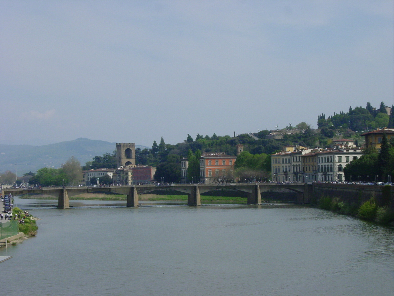
After Lucca, we headed onto Pisa, also in Tuscany, and only a short 12 mile (20 km) drive south. Beautiful Pisa, along the River Arno, actually used to be (up to the 15th century) a great seaport, successfully trading with Spain and North Africa, and a great maritime power that once rivaled Genoa and Venice. But now, the sea has receded and the current Pisa is set a calm roughly 12 miles (20 km) from the sea, and today, Pisaĺs fame is drawn from the Leaning Tower (Torre Pendente) and being the birthplace of Galileo Galilei. Pisa also can boast of its world-renown University, established back in 1406.
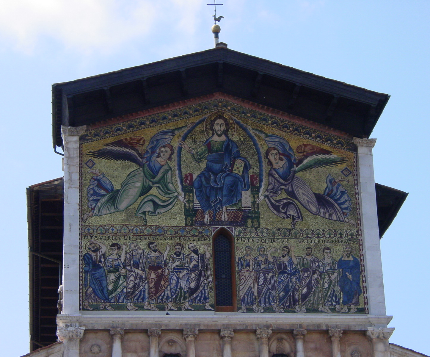
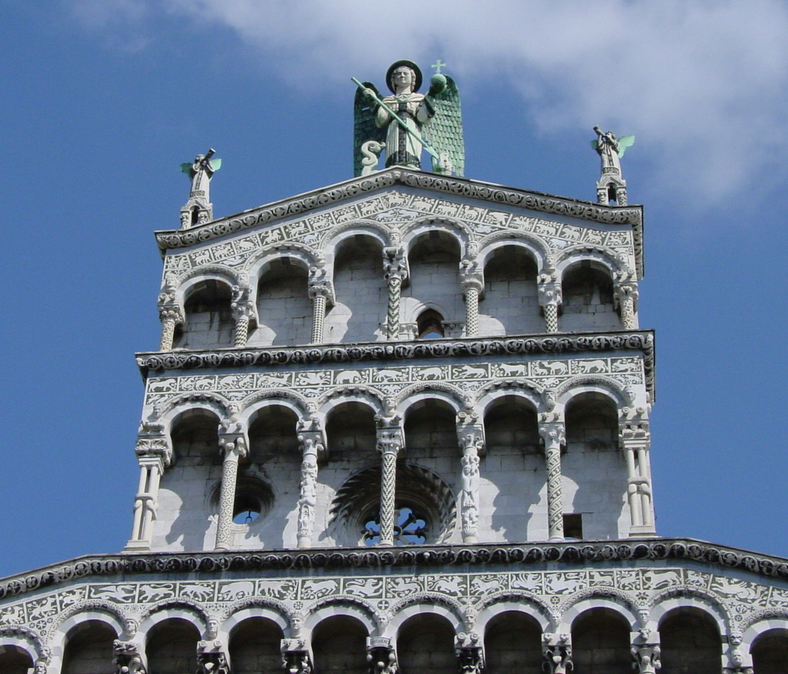
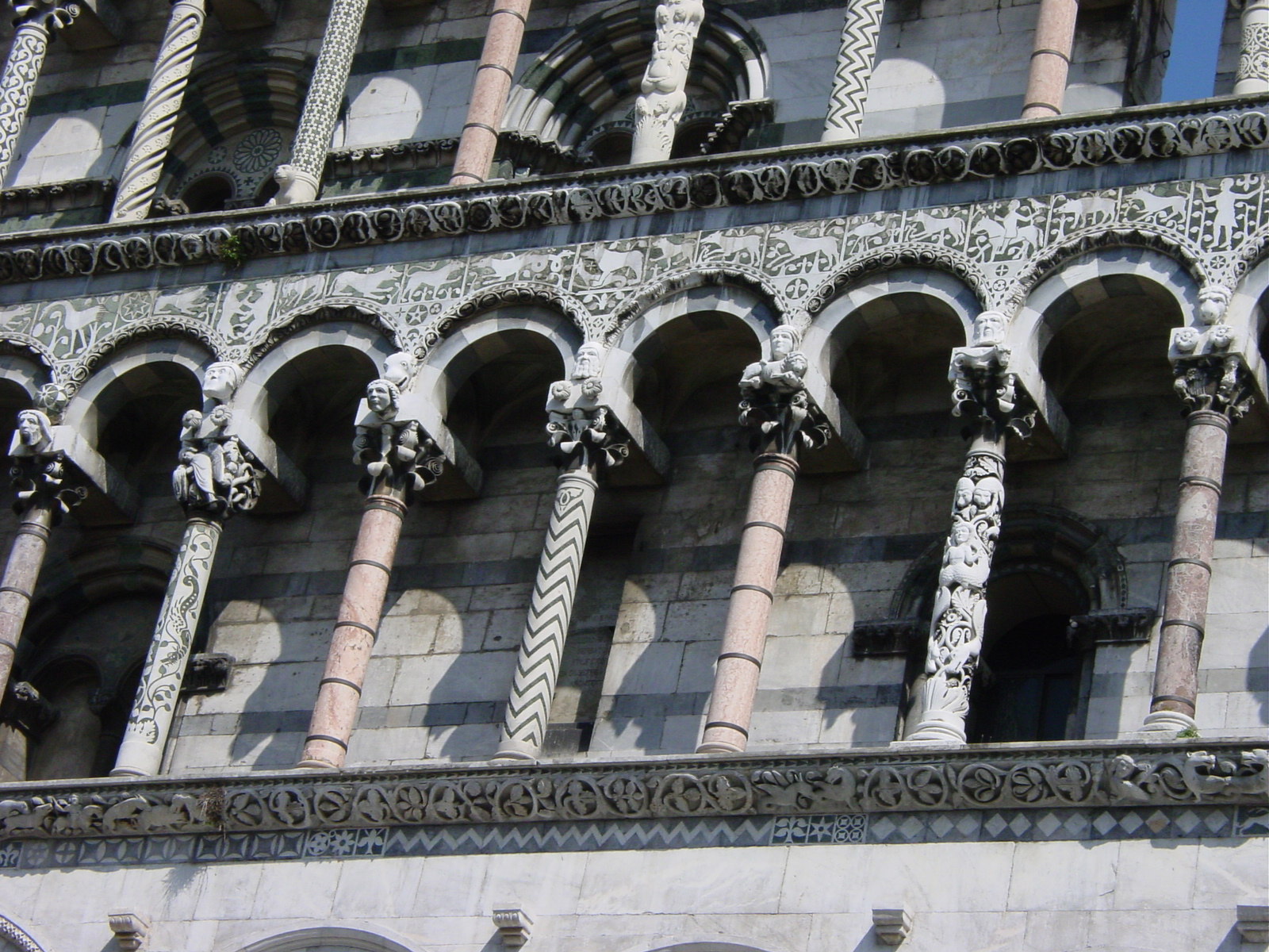
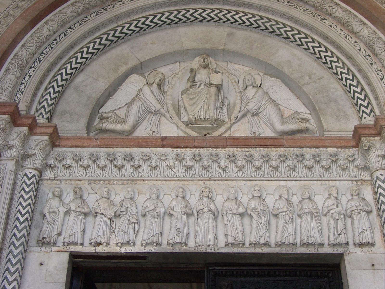
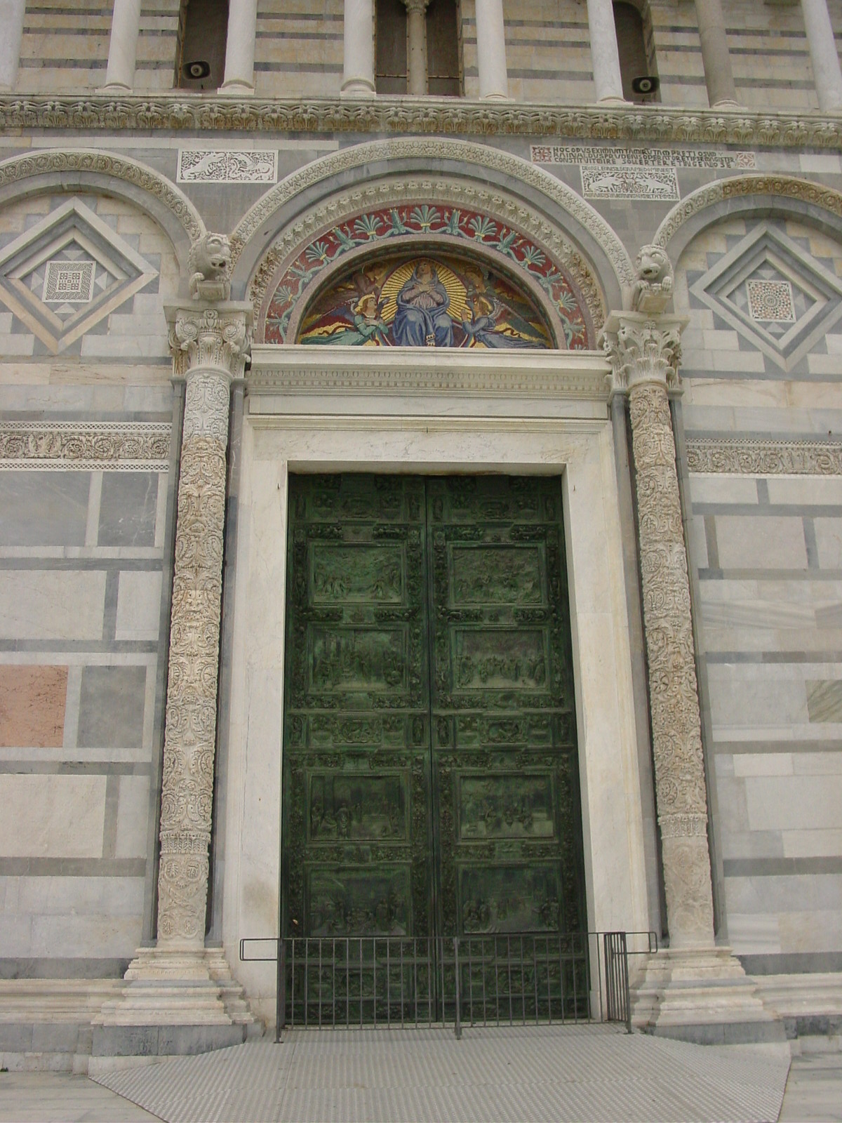
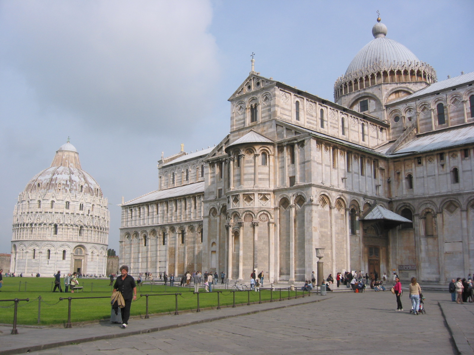
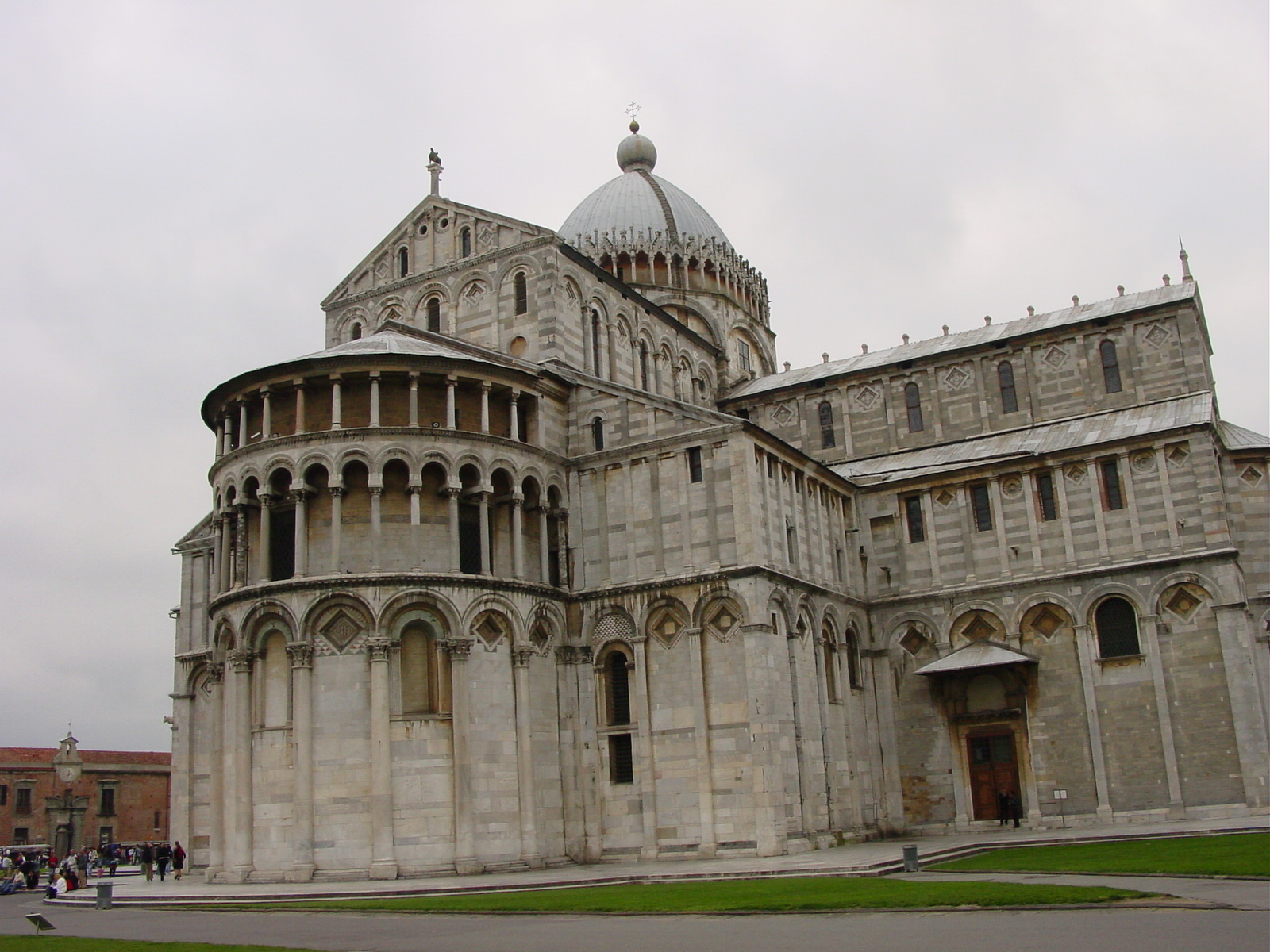
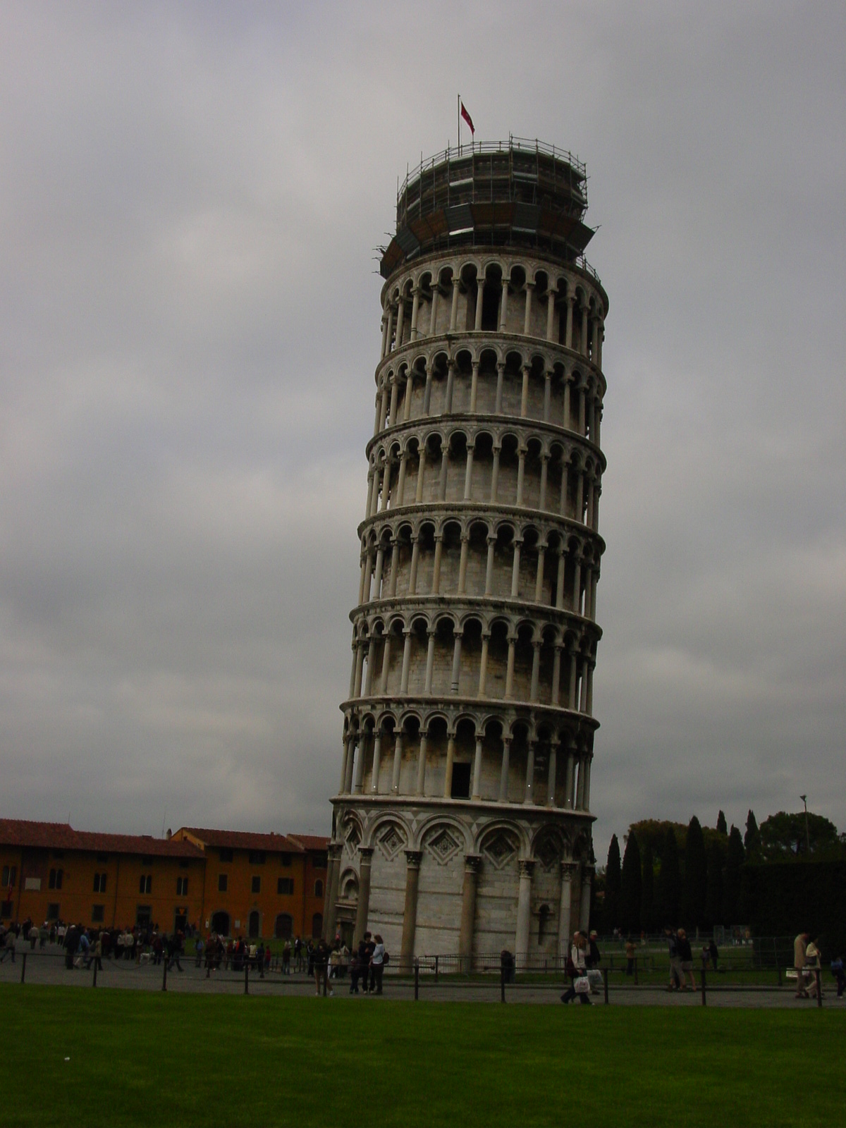
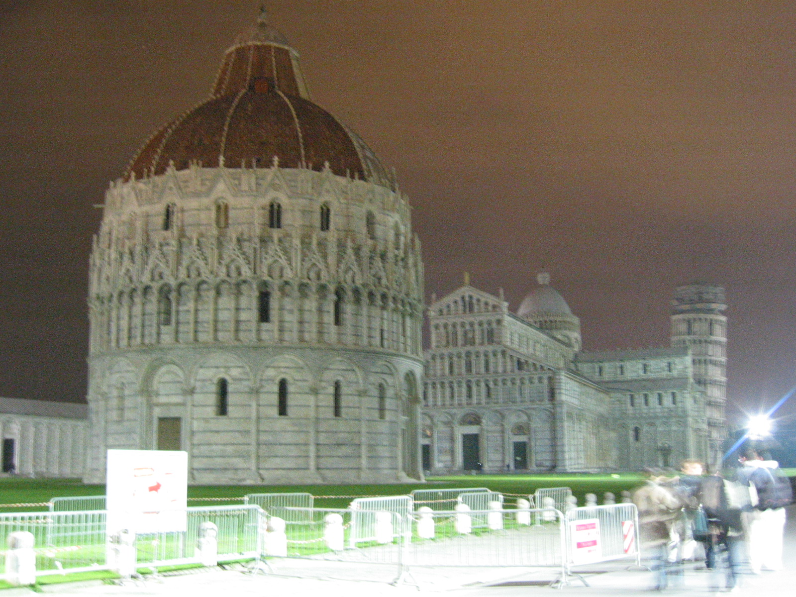
The main attraction in Pisa is Campo dei Miracoli (Miracles Square), boasting a wonderful collection of Pisan-Romanesque buildings in the Cathedral, Baptistry and the Leaning Tower. The stunning white with green marble buildings were a striking contrast the reds, yellows and browns of the rest of the city of architecture, so much so that this amazing square looked terribly out of place. Additionally, the discreteness of the square, with a separate Baptistry and Tower, looked to me as if a giant had come down and broken up the Cathedral into three distinct pieces, absentmindedly tossing them to the ground. Of course, this never happened, but it was a strange thing for me to see a free-standing (and tilted) bell tower separate from the main Cathedral building. This was also the first time I would see a Baptistry, a stand-alone building where public baptisms (cleansings) would be performed before a person would be accepted into the church community. Usually itĺs just a modest baptismal font inside a Cathedral, but I guess the early-Italians just had to be different! :)
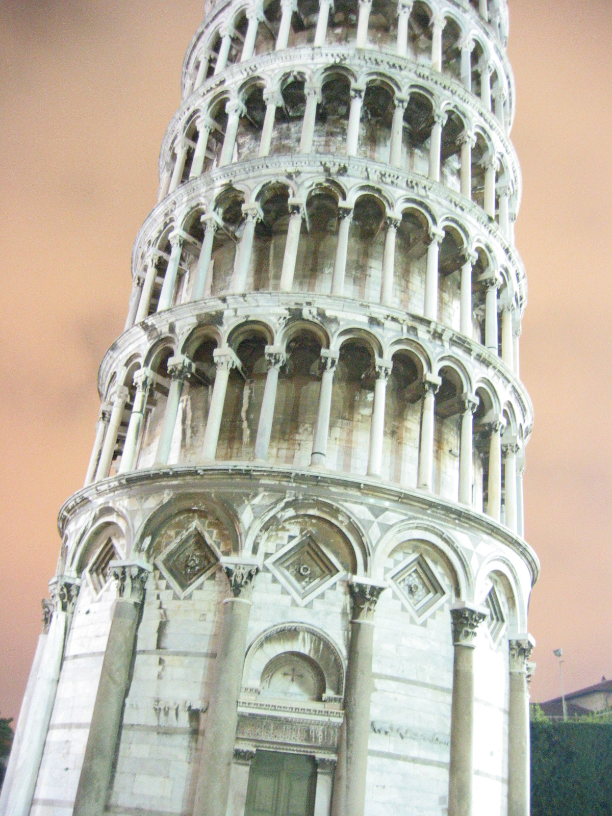
Of course my eyes could not been taken off the Leaning Tower. What an amazing site to behold! I had not realized that the tower was to be the cathedral bell tower (campanile), until it had started to lean after the bottom three tiers had been built. The original architect, Bonanno Pisano, who had started the work in 1173, was not to be deterred and attempted to "straighten" the tower by adding further stories at an opposing angle to compensate for the leaning. This led to the banana-shaped tower as it stands today. The tower was completed in 1350. The Leaning Tower of Pisa was leaning an average of 1 mm every year until 1990 when work began to stop the lean and preserve this amazing structure for future visitors. The current lean is 13.5 feet (4.12 m) off the perpendicular. I was lucky to be able to ascend to the top, for the tower had been closed for the past 12 years. My friend Volodja joined me on this intrepid adventure up the 294 steps, a trip also taken by Galileo who may have used the unusual nature of the tower for gravitation experiments. Volodja he said he felt the tilt as we ascended, whereas I never noticed a thing until at the top I did see the sloped floor, nor did I feel vertigo, as he did. What a jip! We did get to see the lights of Pisa come on as dusk came.
Cathedral and Baptistry of Pisa
|
|
|
|
|
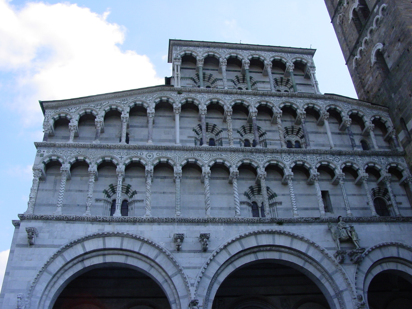
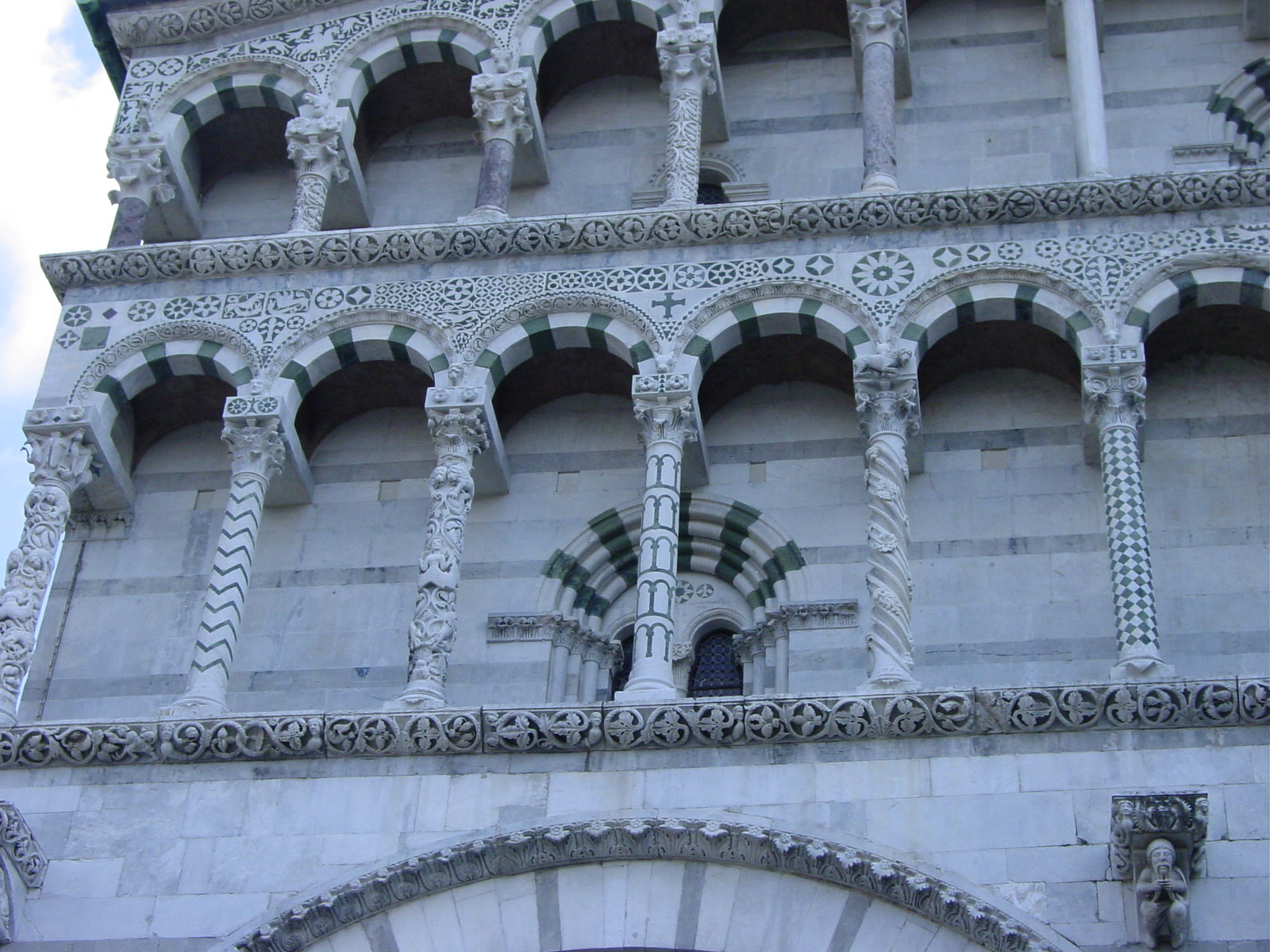
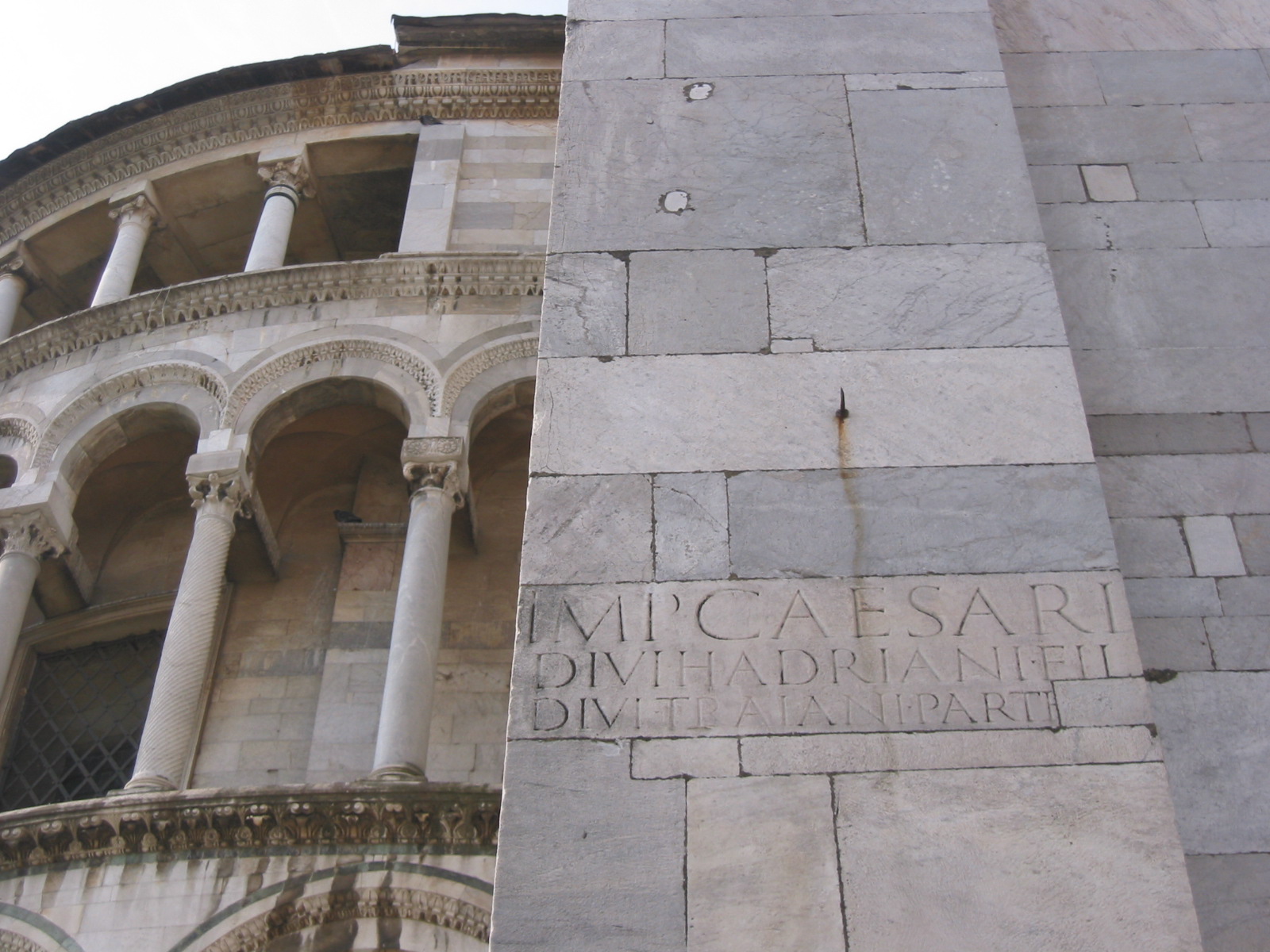
Fašade of the Cathedral in Pisa. Note all columns are the
same, unlike in Lucca. Construction began in 1063 by Buscheto but it would take
several hundred years to complete. Fašade has four tiers of columns.
Interior (not shown) is covered with alternating bands of dark green and cream marble which defines the Pisan-Romanesque style, and which also incorporates Arab and Byzantine (eastern) elements. |
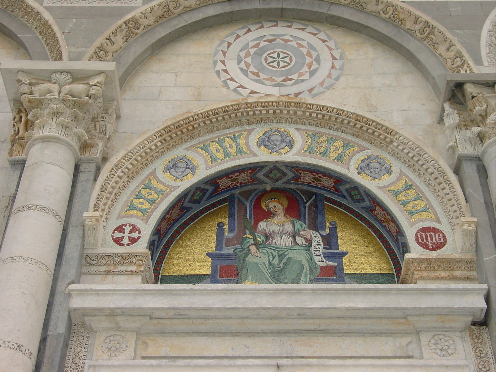
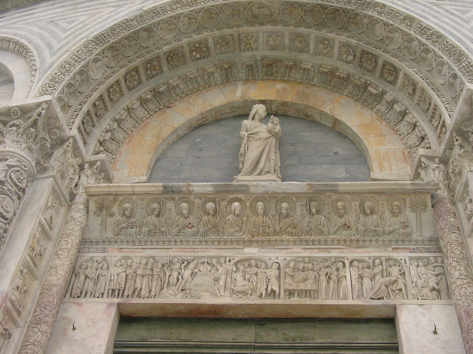
Central bronze fašade doors (1601) of the Cathedral at Pisa, which had replaced wooden originals, which had been destroyed by faire in 1596. Above the doors tells the story of the Virgin Mary. | Detail above (top) front Cathedral fašade door, and (bottom) entrance door to Baptistry, Pisa. | This photo shows the Tuscan marble exquisitely. Here the Baptistry (on the left), a separate round building, built between 1153 until the 14th century, shows a mix of architectural styles (lower is Pisan-Romanesque, upper and dome is Gothic). |
|
|
|
|
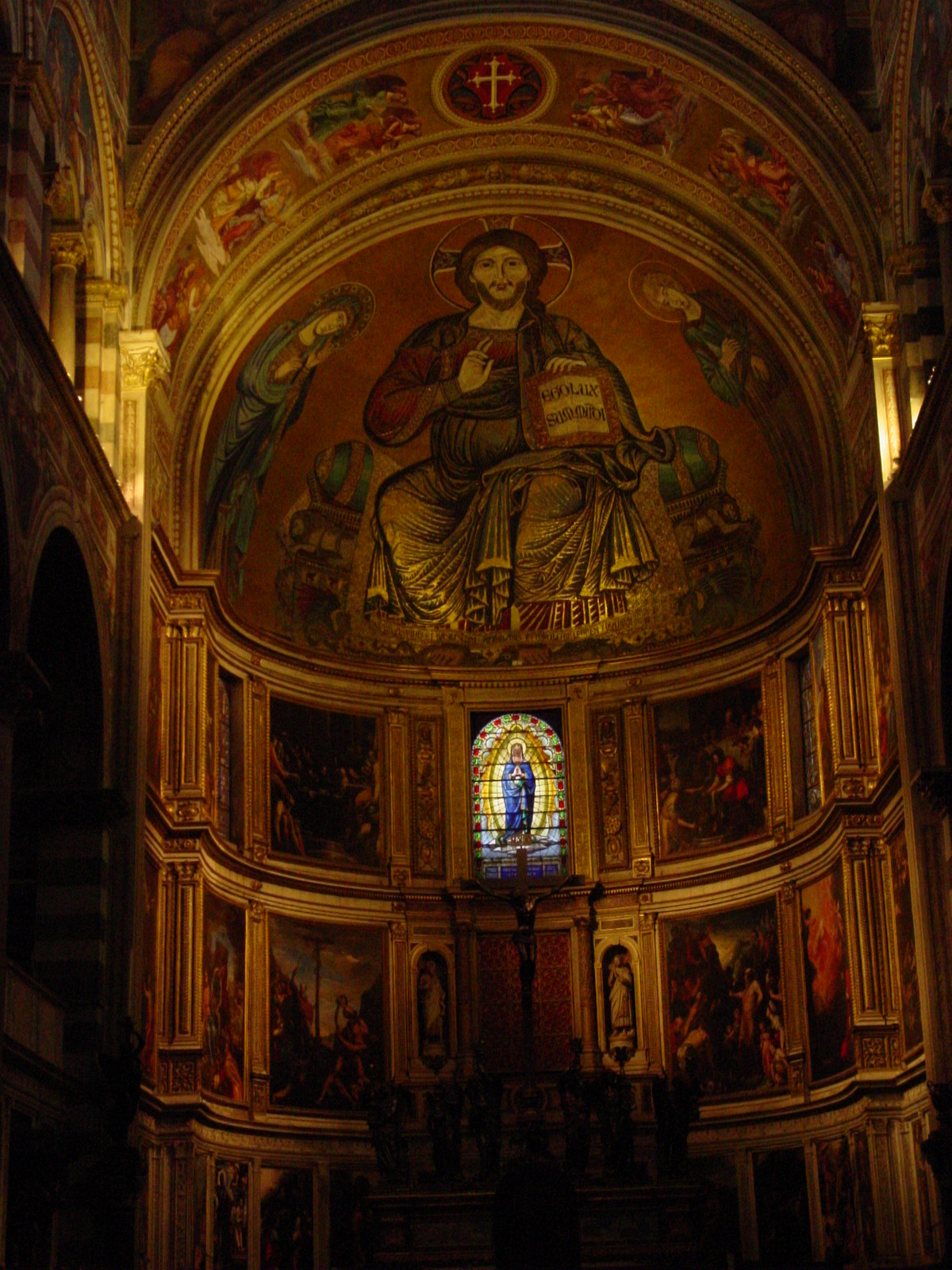
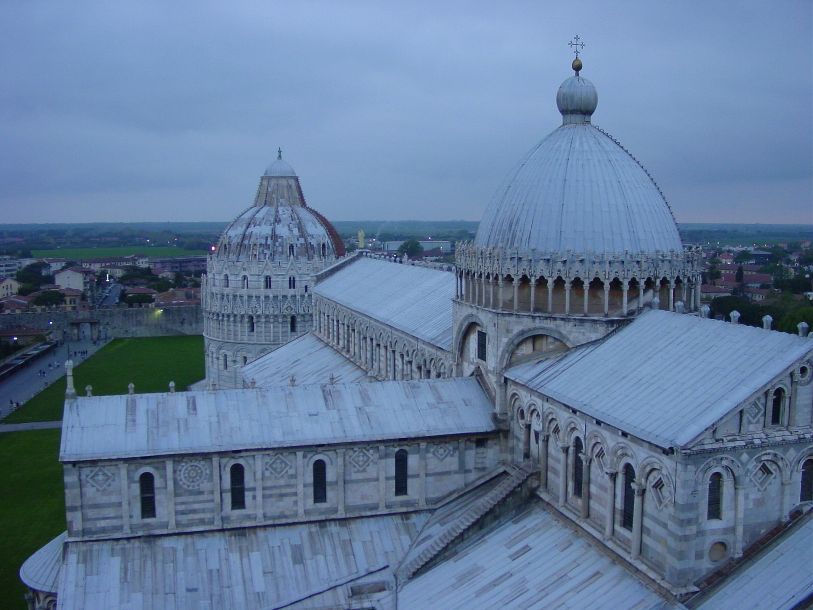
| Outside of the Cathedral at Pisa appeared to be a jigsaw of pieces. This was merely because the Pisans used left over Roman marble to construct the outside. Wouldnĺt you? | Detail of exterior showing ancient Roman marble reused in the construction of Il Duomo. Other bits (not shown) came from tombstones. Amazing jigsaw. | Apse mosaic "Christ in Majesty" by Cimabue (1302). Also inside the Cathedral (not shown) were the remains of the patron saint San Ranieri. | Duomo (Cathedral) and Battistero (Baptistry) seen from Tower of Pisa. |
The Leaning Tower of Pisa
|
|
|
|
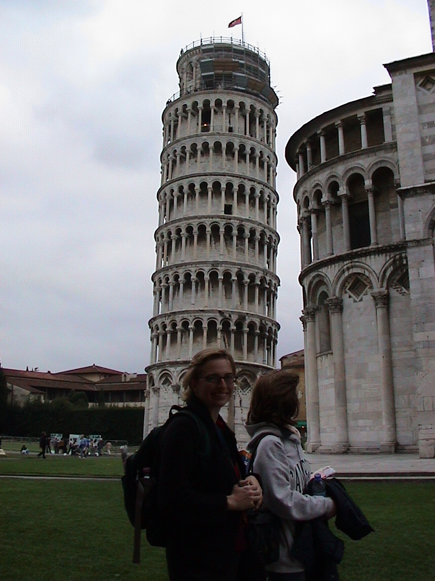
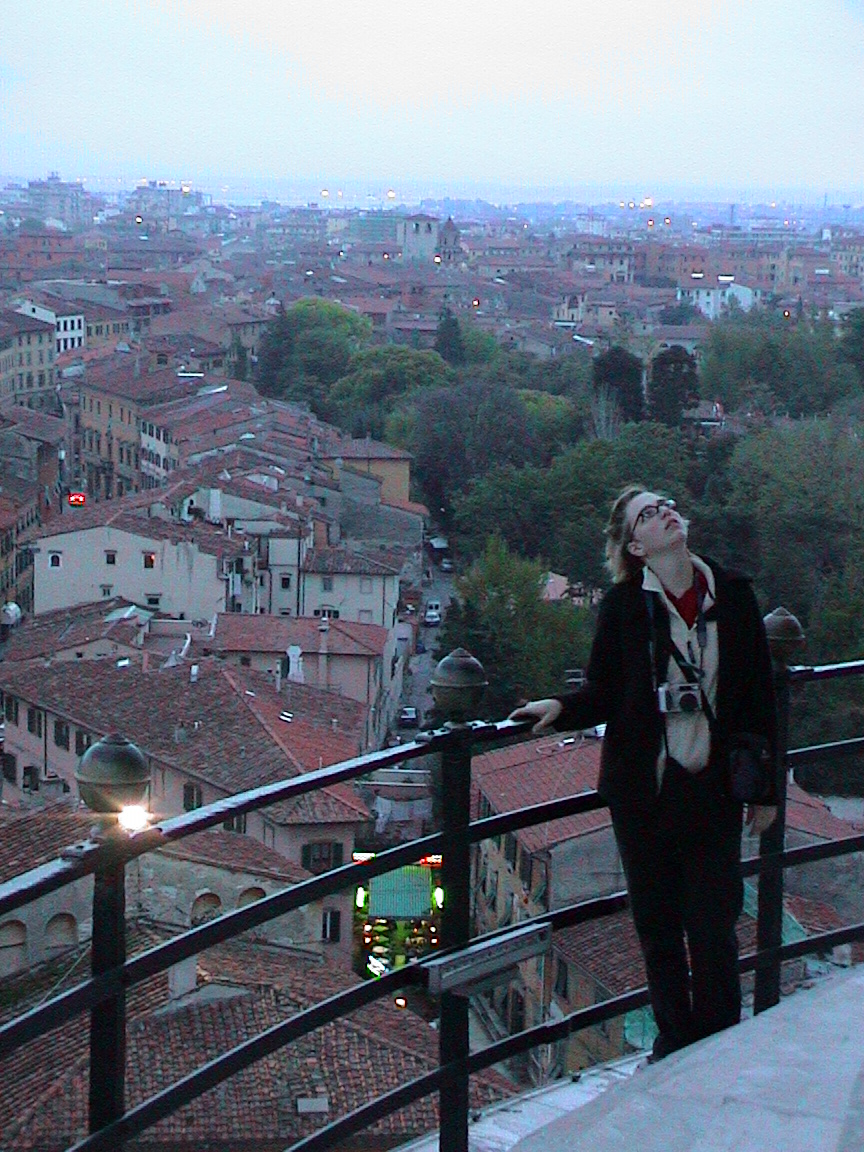
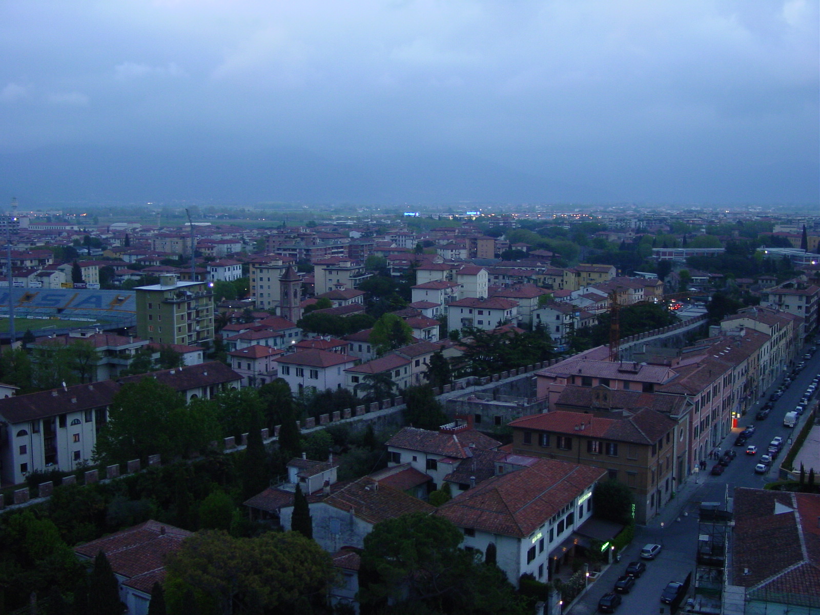
| Kimberly & Luisa at Pisa (photo by Volodja) | The Leaning Tower, showing its tilt. | Kim on the Leaning Tower, landing before the top, trying to ascertain the tilt. (photo by Volodja) | View of Pisa from the tower at dusk. |
Pisa Sightings
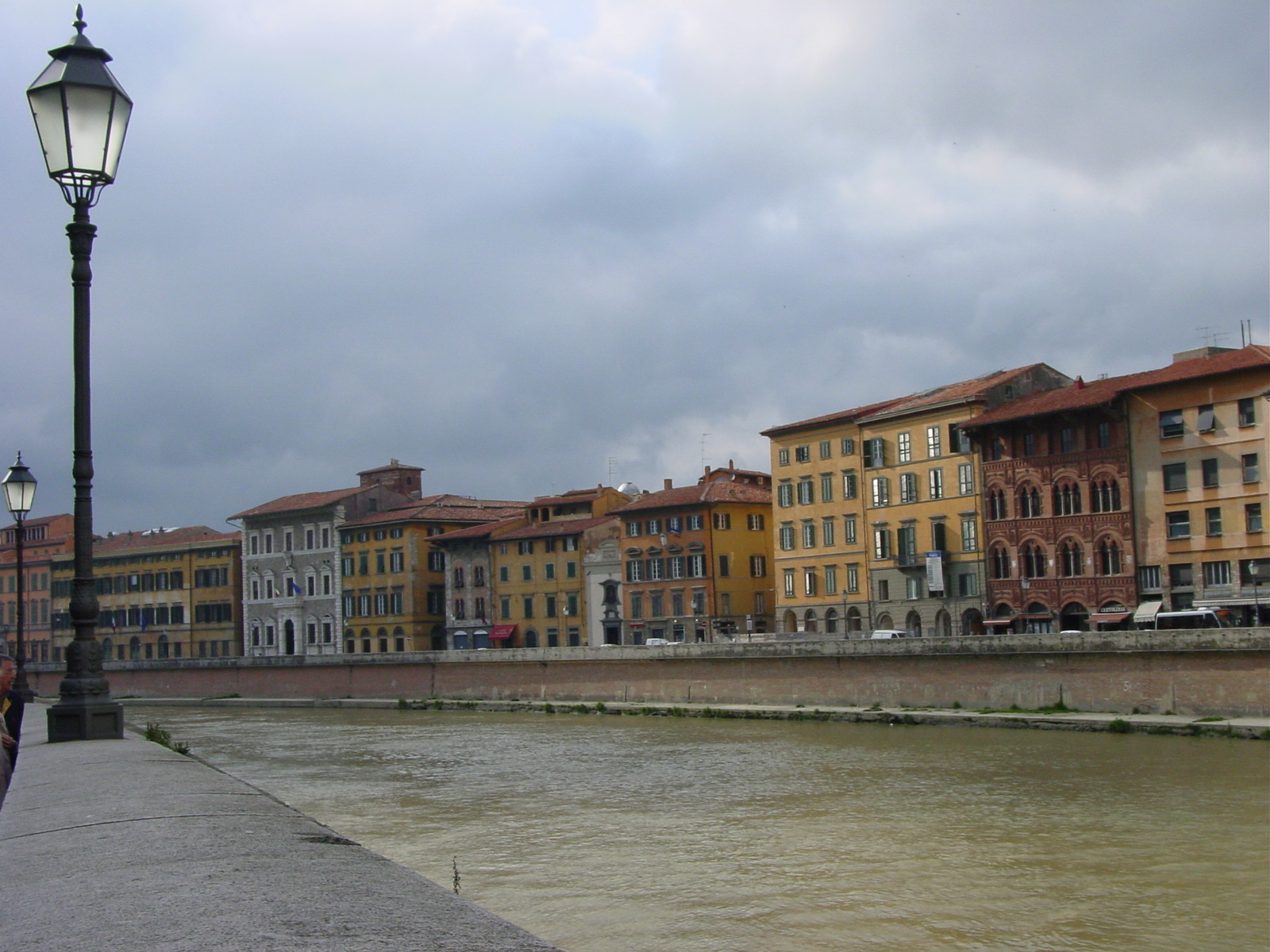
|
|
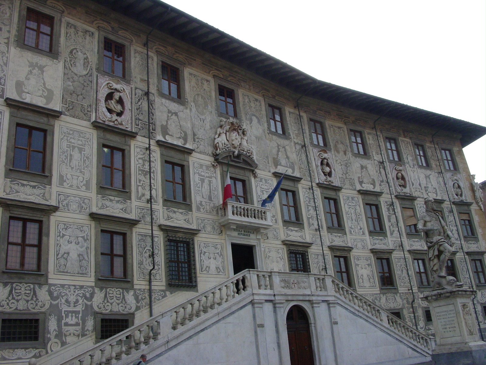
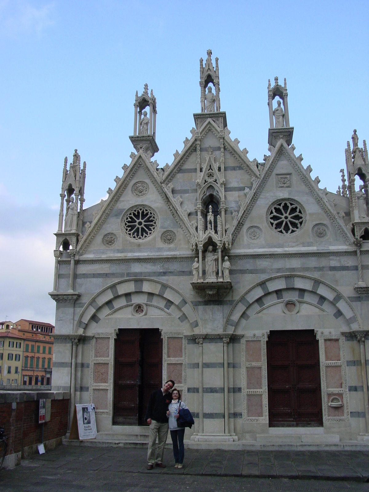
|
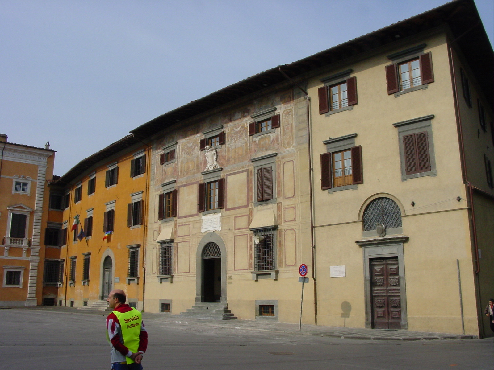
|
|
| River Arno, Pisa | Chiesa della Santa Maria della Spina, along the River Arno, Pisa. | Piazza dei Cavalieri, Pisa, Scuola Normale Superiore (College), founded in 1810 by Napoleon. | Piazza dei Cavalieri, Pisa and Palazzo dell'Orologio. | Piazza dei Cavalieri and Clock Tower, which also had served as a prison in Pisa. |
Pisa by Night
"Pisa by Night," Photos taken by Mukund, long exposures.
My good friend Mukund from Cambridge, was visiting his girlfriend in Naples (southern Italy) over the Easter holidays and by wonderful fortune, was able to join our touring party while we were in Pisa and for our last day in Italy. And he too was intrigued by the Bentley that he offered to replace Luisaĺs position and become part of the return party to the UK, now to be a Brit, Russian and me, the American. We rendezvoused with Mukund at the Pisa train station and enjoyed a late night dinner downtown. The food in Tuscany varied slightly from Ligurian, where bread and olive oil from the region are mainstream. A popular starter is the fettunta (also known as bruschetta). The night we spent in Pisa, I tried a soup common the area, which was made from bread/wheat and very wholesome, followed by a Segundo where the meat is roasted and served with lemon. It was interesting.
25 April 2003 (Day 8)
Geography: Pisa -> Florence -> Arenzano
Mileage: Unknown (Luisaĺs car)
After kipping over in a rather cheap hotel, but one located right smack in the middle of Pisa where you could even seen the leaning tower from the hotel window, Luisa and I wandered through the rest of Pisa to explore more Piazzas, before heading off to Florence (Firenze). After all, we were only 100 miles (160 km) from Florence. And why now, deviate from the "theme" of our trip (a city or country a day!). In hindsight, I would have loved to walked more along the Pisan streets. After a short drive through the rolling Tuscany hills, we emerged to get just a glancing glimpse of the city known as the "Cradle of the Renaissance" and home of Machiavelli (political theorist and dramatist), Michelangelo (artisan) and the Medici (ruling family 15th-16th centuries). After even just glancing at pages and pages of descriptions in my tourbook of the various Piazzas, Palazzos, Chiesas (Churches), and Museums and Galleries, I knew that 3 hours in Firenze would not be enough. They recommend at least (!) a week, maybe more.
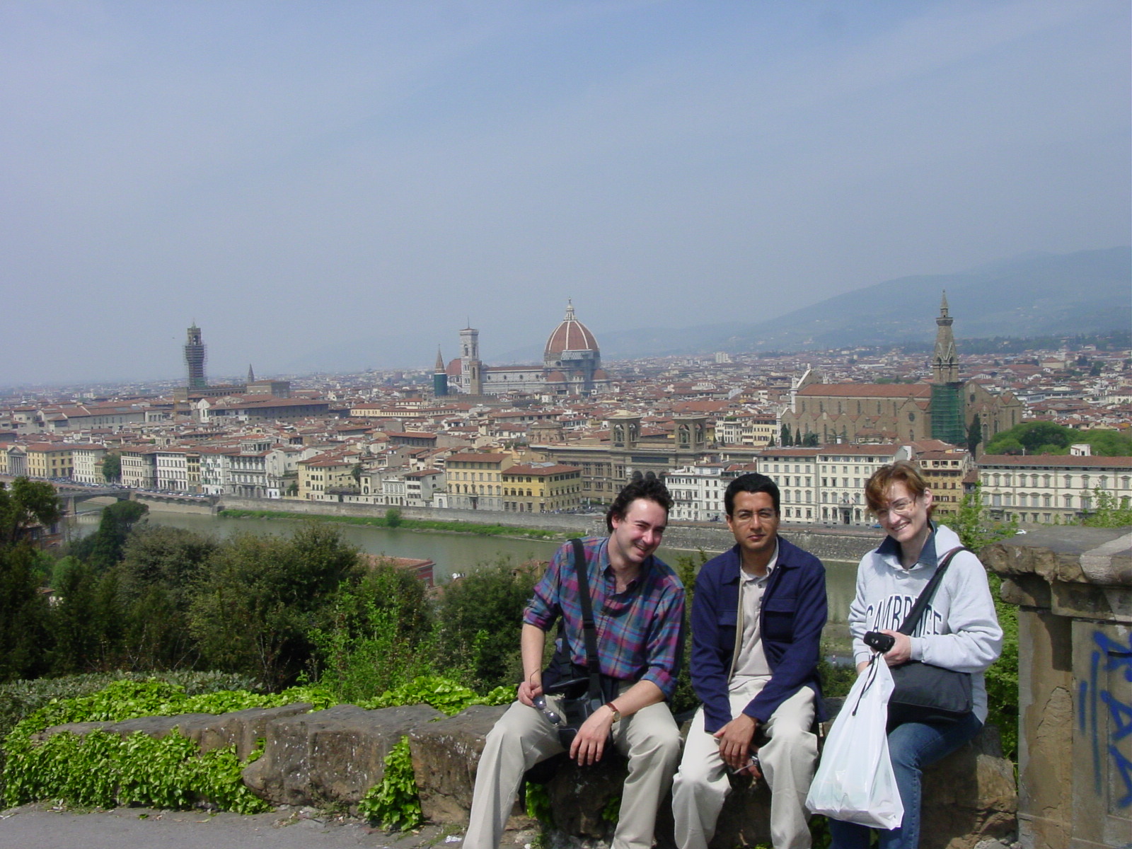
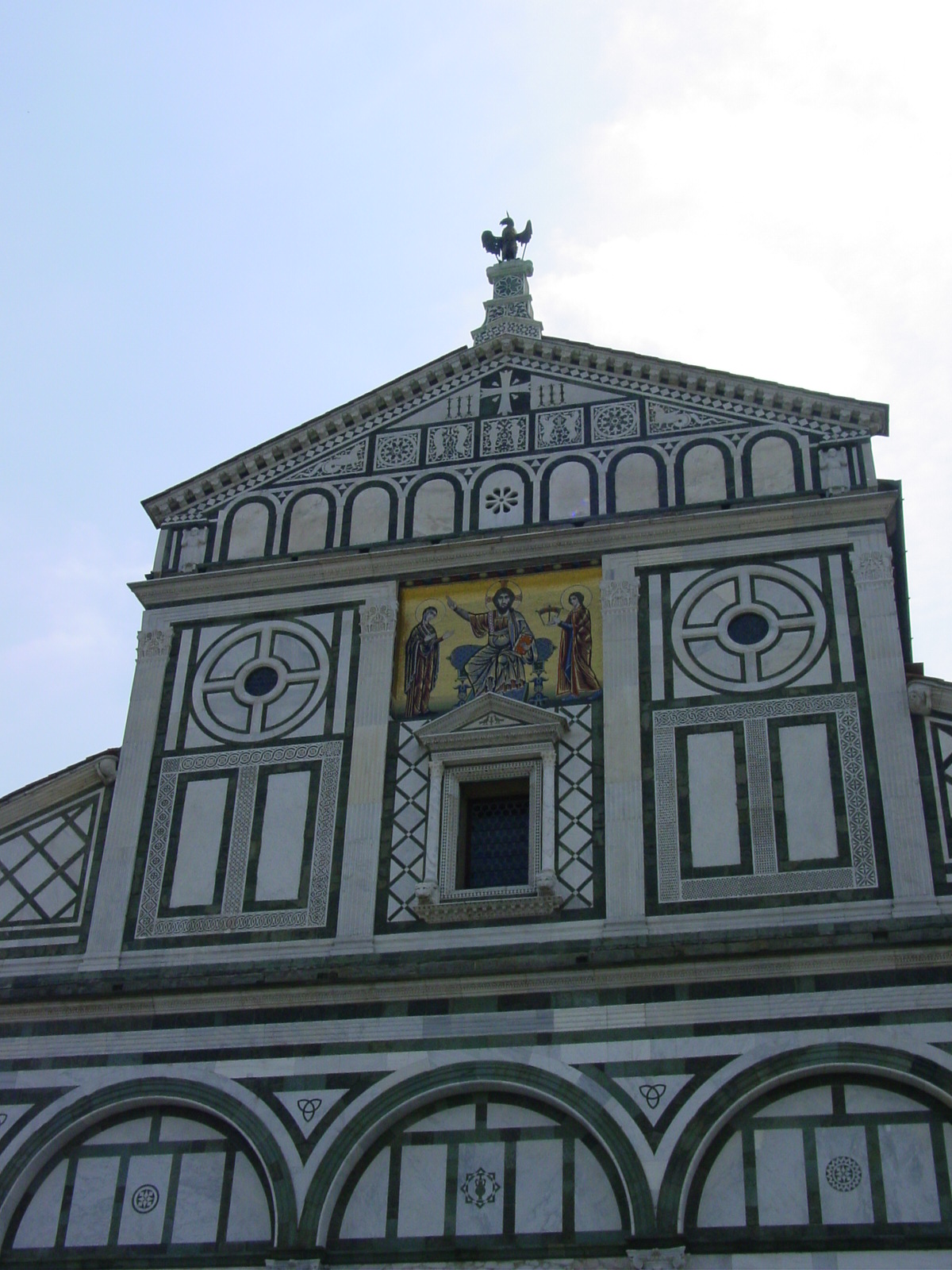
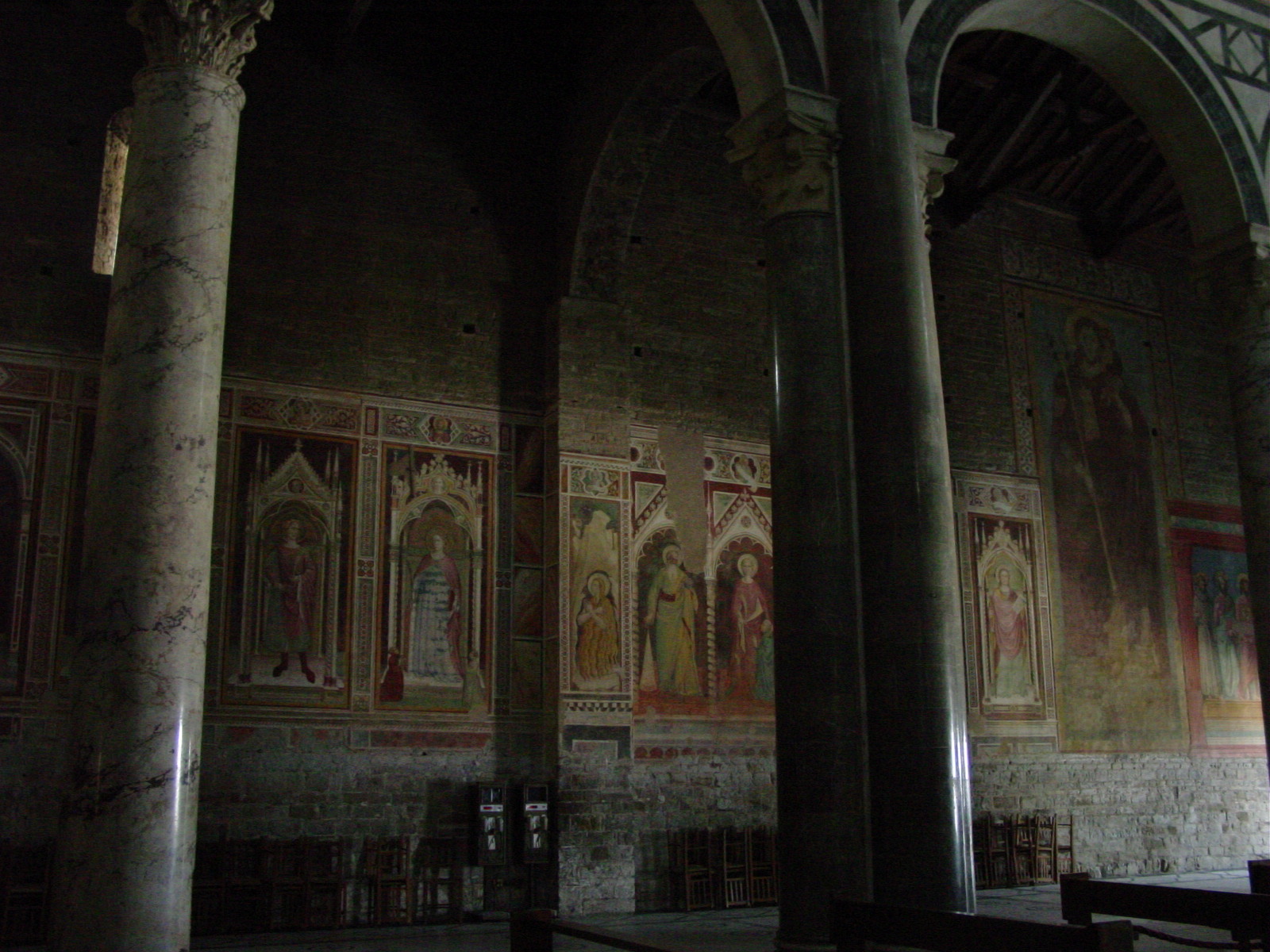
We knew we were in Florence when the traffic started to get bad. Today (25 April) was a holiday in Italy, marking their "Liberation Day" from German Occupation on April 25, 1945, and "everyone" seemed to be visiting Florence. We arrived at the south end of the city and drove up along Viale Michelangelo up to Chiesa di San Minato al Monte (11th century) and to Piazzale Michelangelo where we could get a birdĺs eye view of the city. We next walked inside Chiesa di San Minato observing the beautiful white and green marble 13th century fašade (front), featuring a mosaic of Christ between his mother, the Virgin Mary, and San Minato.
After parking near the train station, we grabbed some lunch near the 13-14th century Chiesa di Santa Maria Novella, and walked across the River Arno by way of Ponte Vecchio, the oldest surviving bridge (1345) in the city. Shops along this bridge were originally occupied by blacksmiths, butchers, and tanners, who were evicted in 1593 by Duke Ferdinando I (Luisa told us that the Duke found such business to be "too smelly") and were replaced by goldsmiths and jewelers, who still own the shops today. Along the bridge, there was a special passageway above the buildings aligning Ponte Vecchio, called the Vasari Corridor. This was designed to allow the Medici to move from Palazzo Vecchio to Palazzo Pitti without having to mix with the public. Ah, the life!
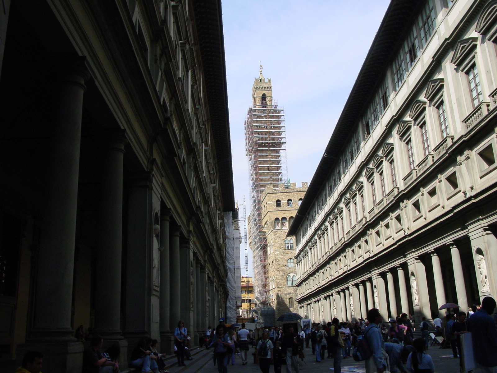
We then strolled outside the Uffizi (1560-80), a suite of offices designed for Duke Cosimo Medici I's administration. Now it is a gallery, actually the oldest art gallery in the world. We did not have time to wander inside, which in itself I am told would take a day. Street performers and statues of famous Italians throughout the centuries surrounded the courtyard.
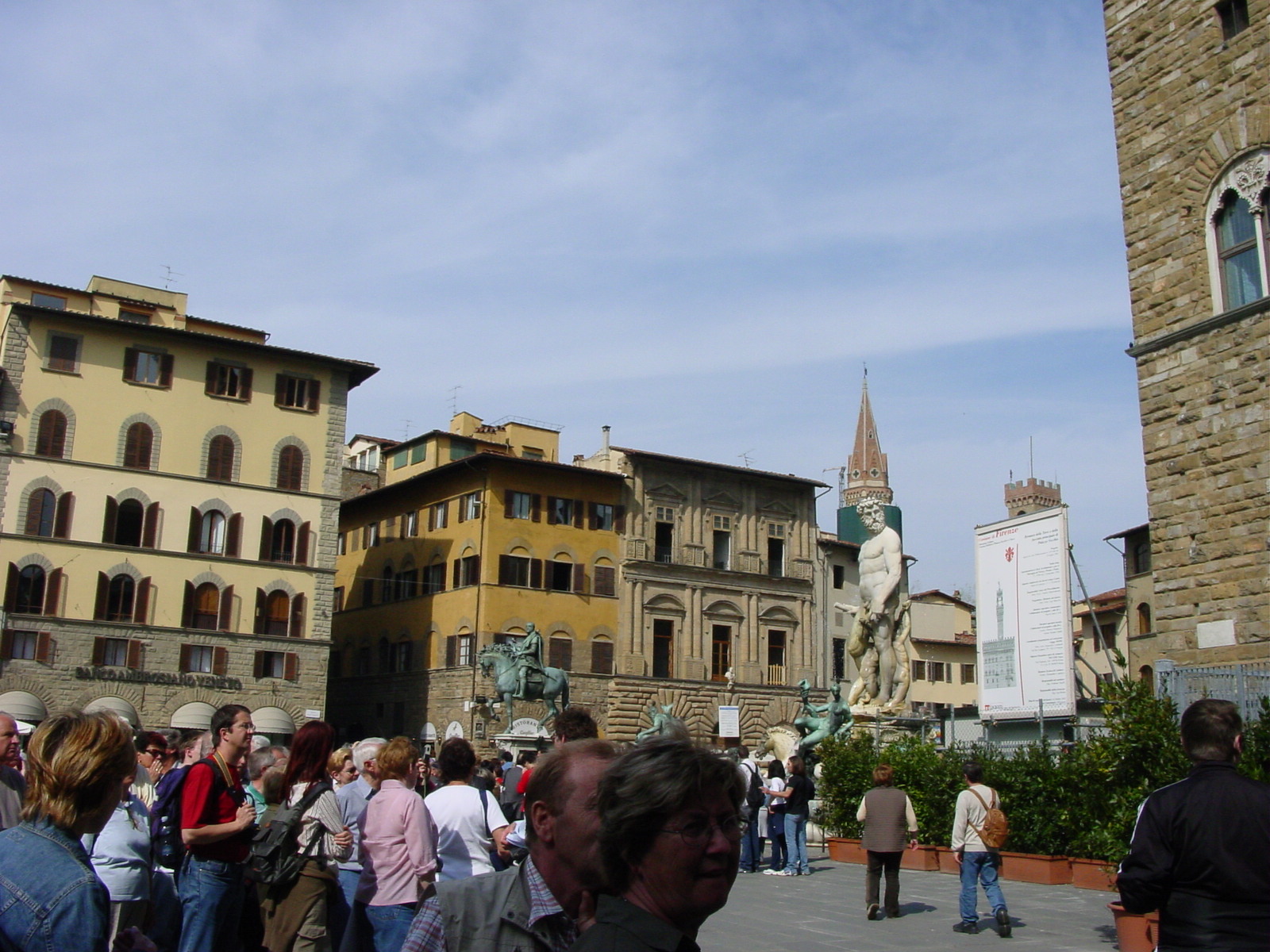
After rushing by the Uffizi, we walked towards the famous Piazza della Signoria, where many famous statutes including Ammannati's Neptune, Michelangelo's David (copy since 1873), Cellini's Perseus (original), and Giambologna's "The Rape of the Sabine Women" (original) can be found. Sadly, the 13-14th century Palazzo Vecchio (palace-fortress with tower) was under scaffolding and supportive structures surrounded the statues, so I could not take in its austere presence properly. I also realized I need to do lots of reading up on Renaissance sculptors for in the Piazza della Signoria there is also a covered arcade, known as the Loggia dei Lanzi, where several famous sculptures are housed. The place was teeming with people so I was unable to get a close look at this interesting collection, supposedly well-known to any Florentine visitor.
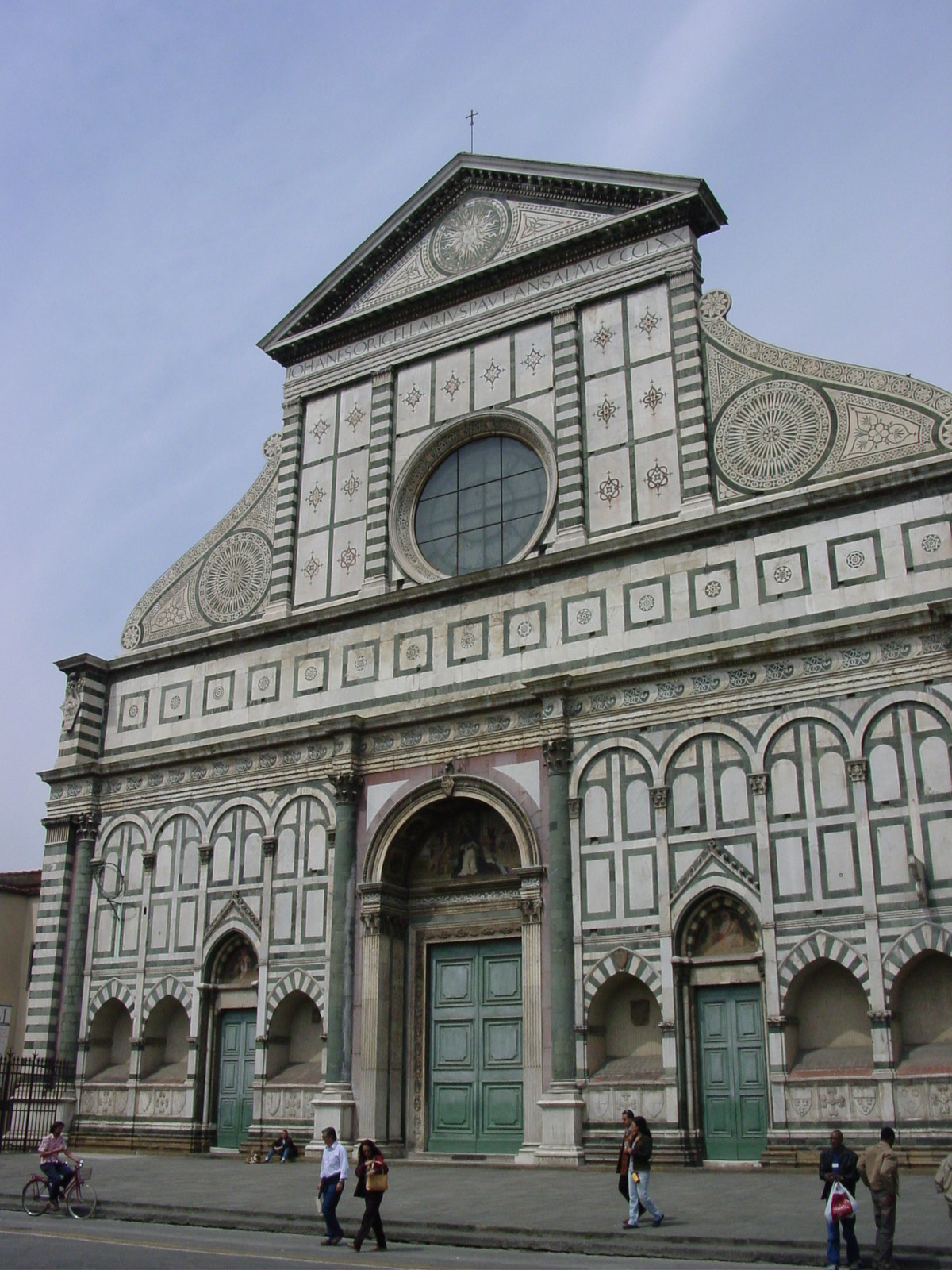
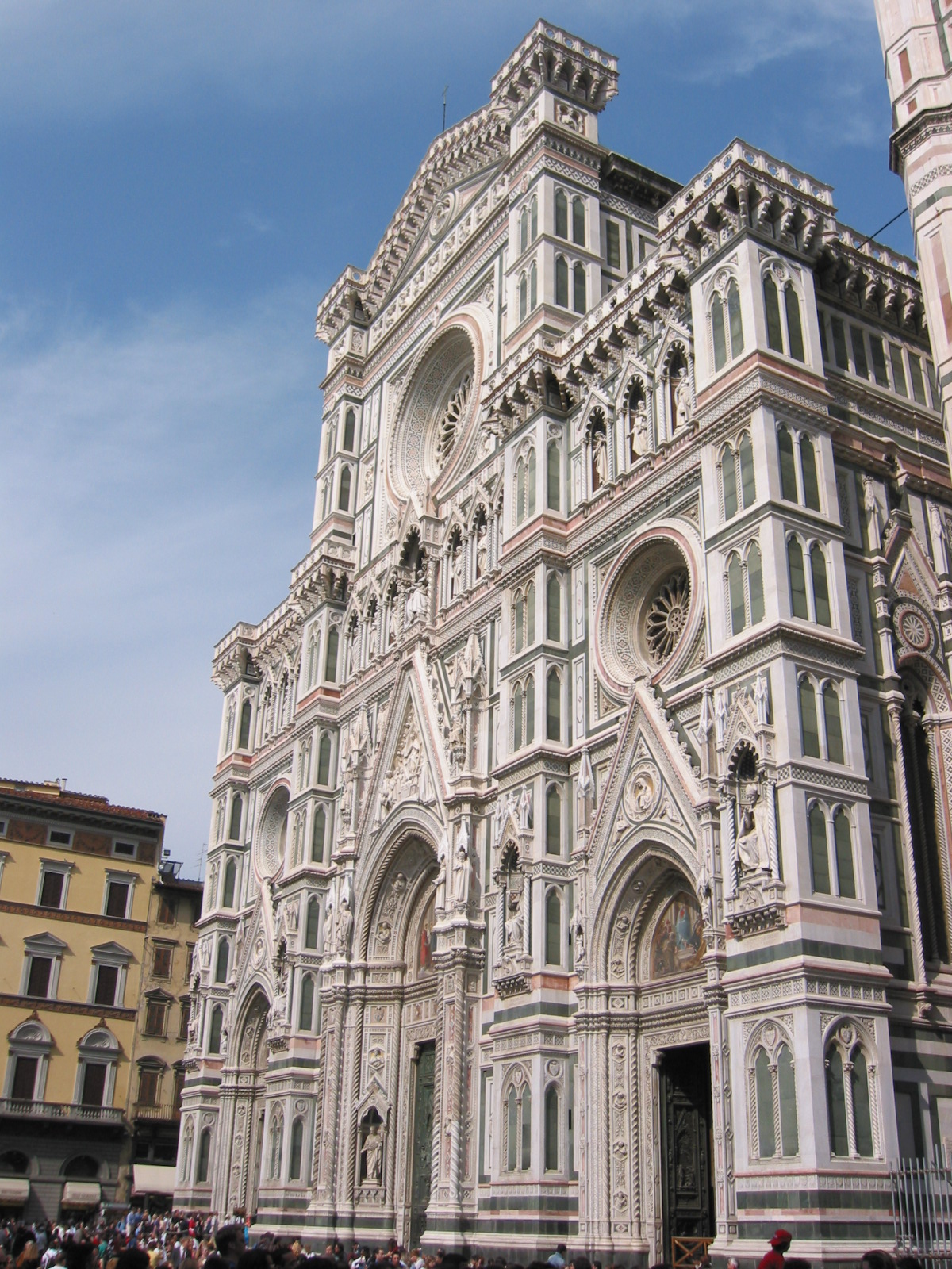
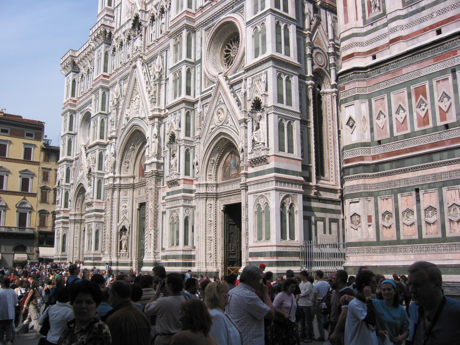
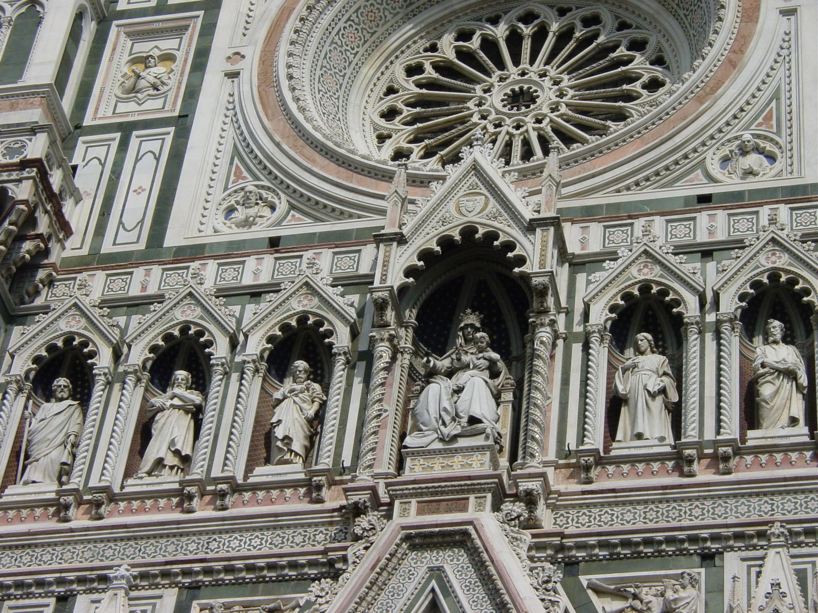
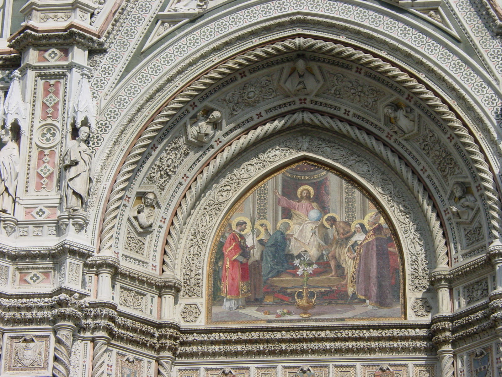
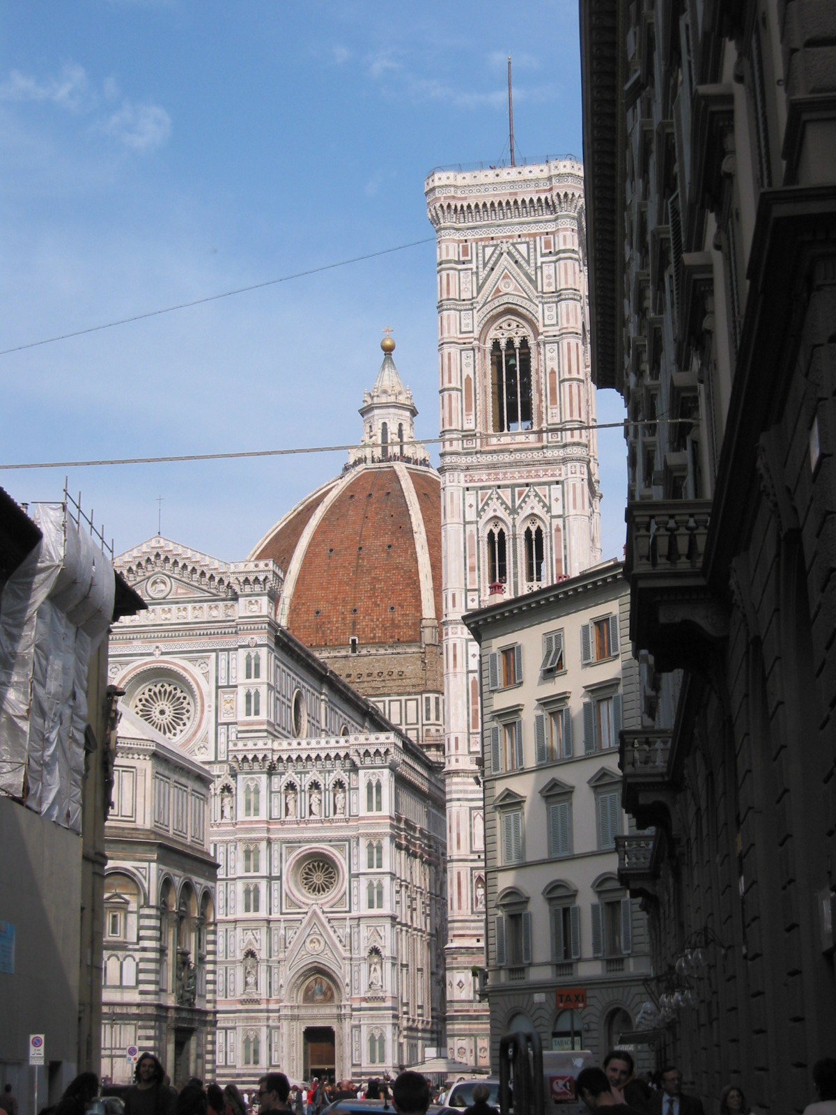
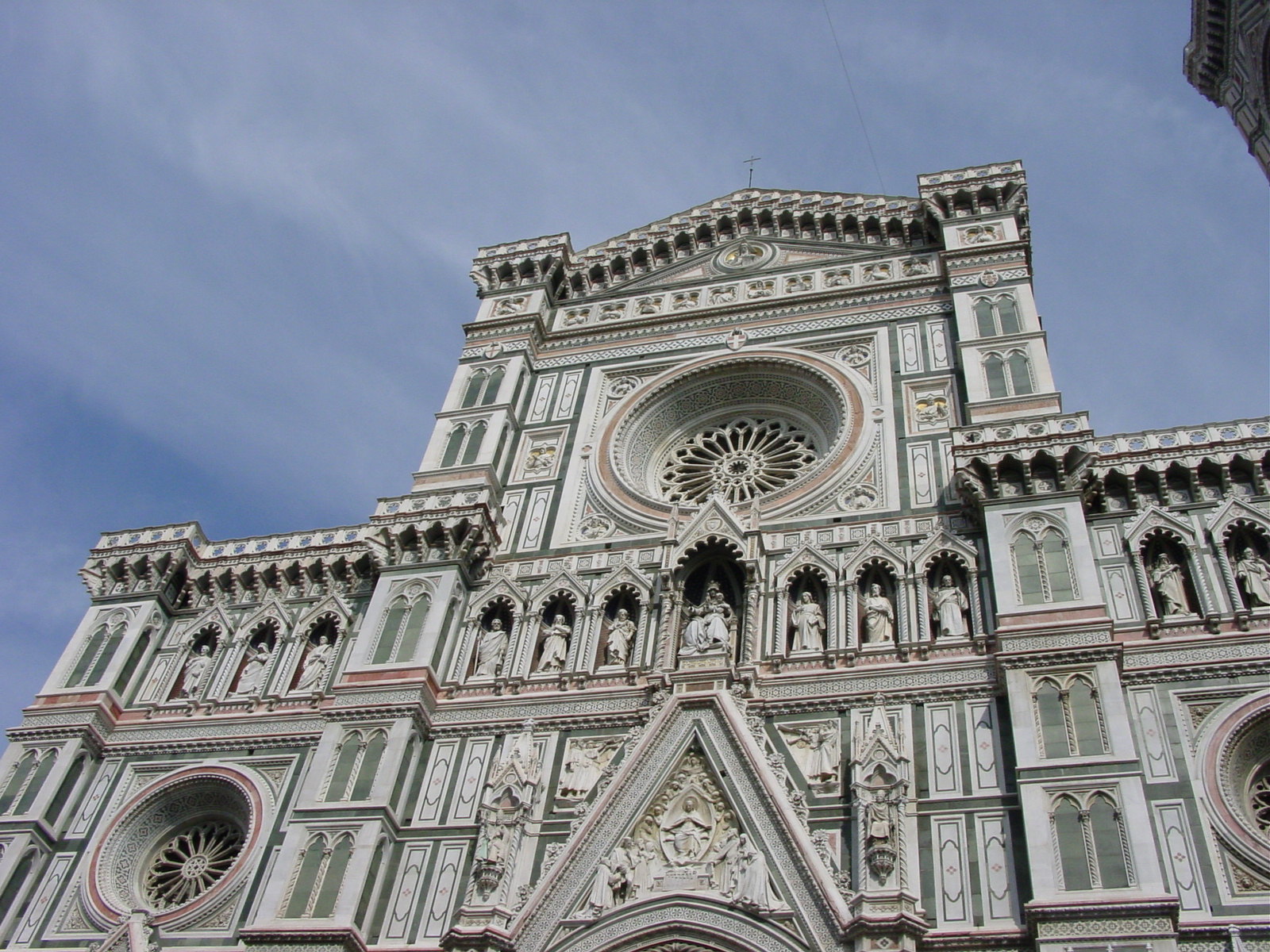
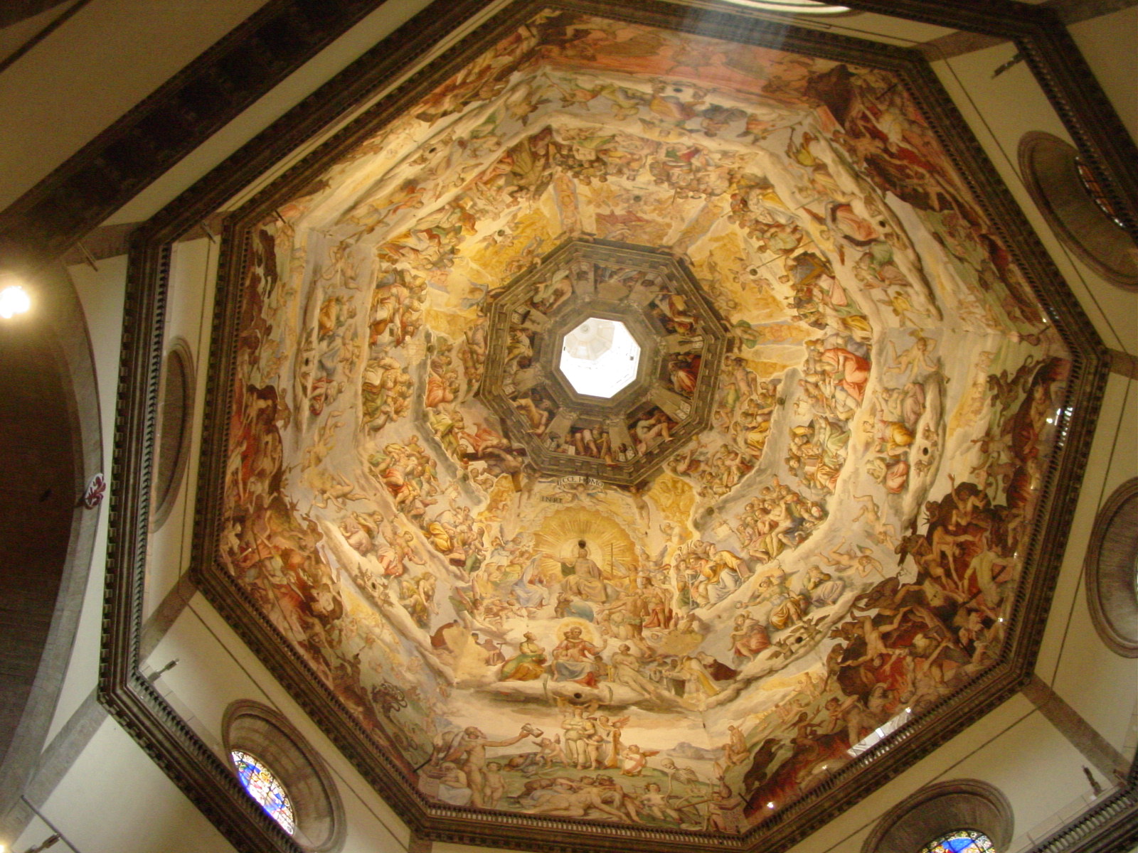
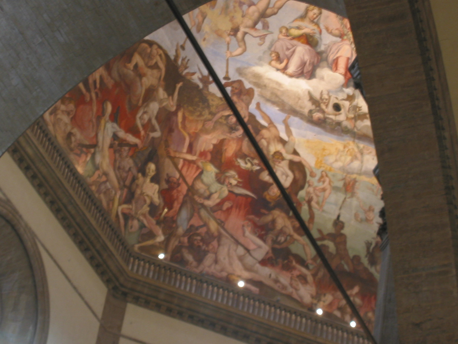
And finally, we dashed to Il Duomo, the Cathedral, dedicated to Santa Maria del Fiore. It was so majestic and stunning, that it was hard to capture in a single photo. The cathedral is the tallest building in Florence at 296 ft (99 m), with its belfry (campanile) standing only 20 feet (6 m) shorter than the dome. The outside, designed by Giotto in 1334, and completed in 1359, 22 years after his death, was an awesome mixture of white, green and pink Tuscan marble. The world famous dome, was designed and built by Brunelleschi in 1420-1434, being the largest dome ever constructed without scaffolding, true Renaissance style. We were able to walk inside Il Duomo and view the beautiful "Last Judgment" frescos inside the dome, by Vasari and Zuccari from 1572-1579.
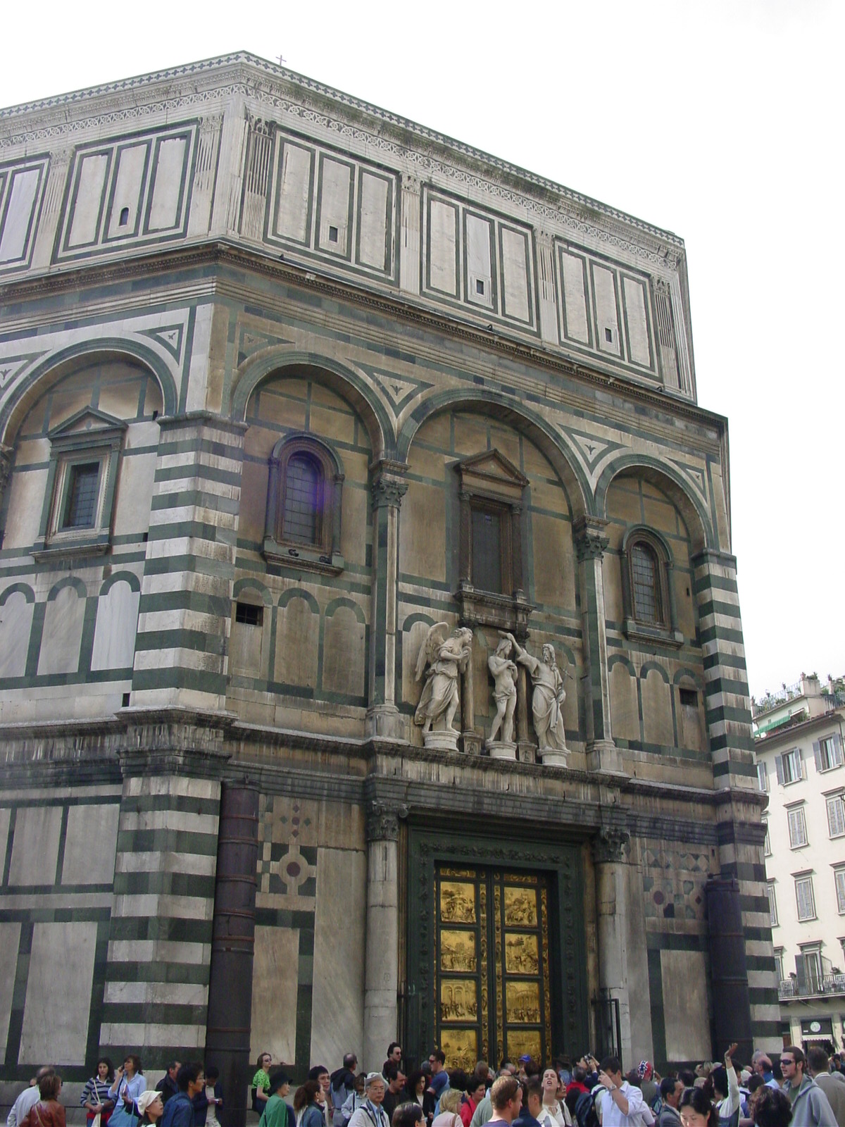
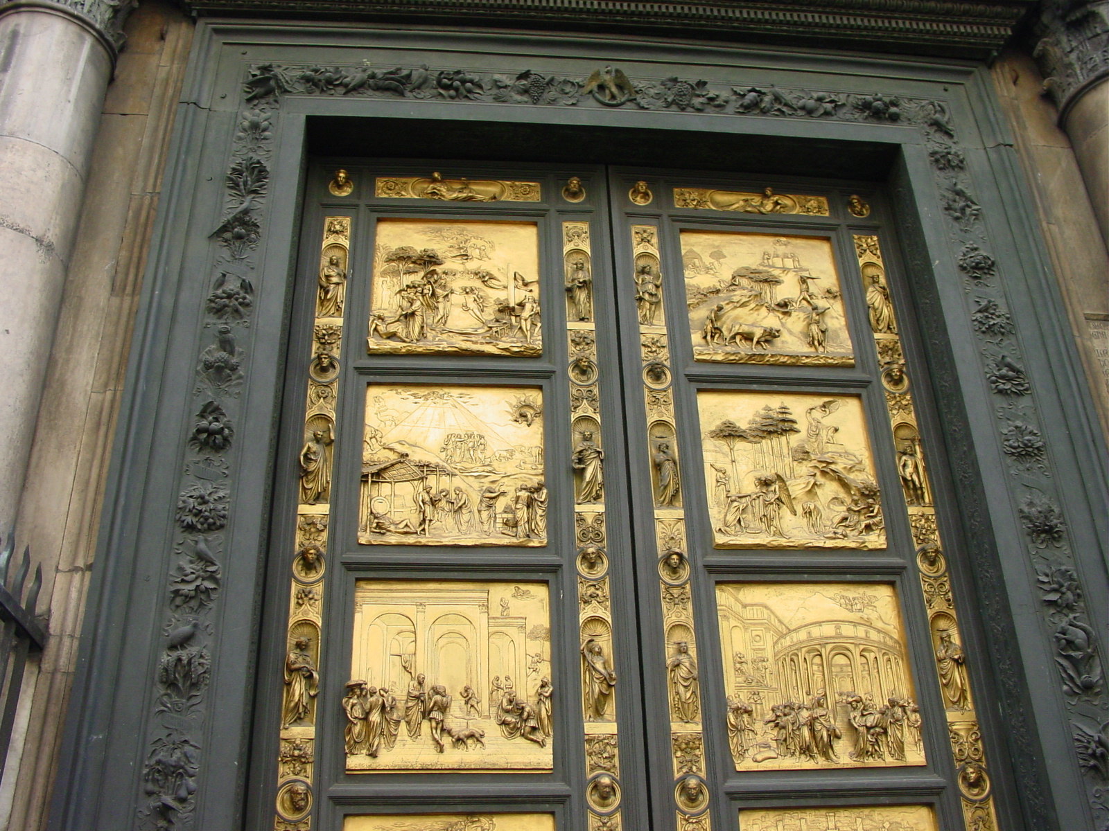
Opposite the Cathedral was the Baptistry, an octagonal building (unlike the round one at Pisa), being one of Florenceĺs oldest buildings, dating from the 4th century, although the current appearance dates from the 11-13th centuries. Stunning are the bronze doors and 13th century mosaics in the dome (we sadly did not have time to go inside to see the dome personally... next time). Famous Florentines, including Dante, were baptized here. Even Luisa's sister as Luisaĺs motherĺs family is from Florence. The east doors of the Baptistry that face the Cathedral are known as "Gates of Paradise" (1424-52) and made by Ghiberti. The south doors are decorated by works by Andrea Pisano in 1336 depicting the life of John the Baptist, a common theme for most Baptistries.
And then it was time to say goodbye to Florence, only to have me return again!
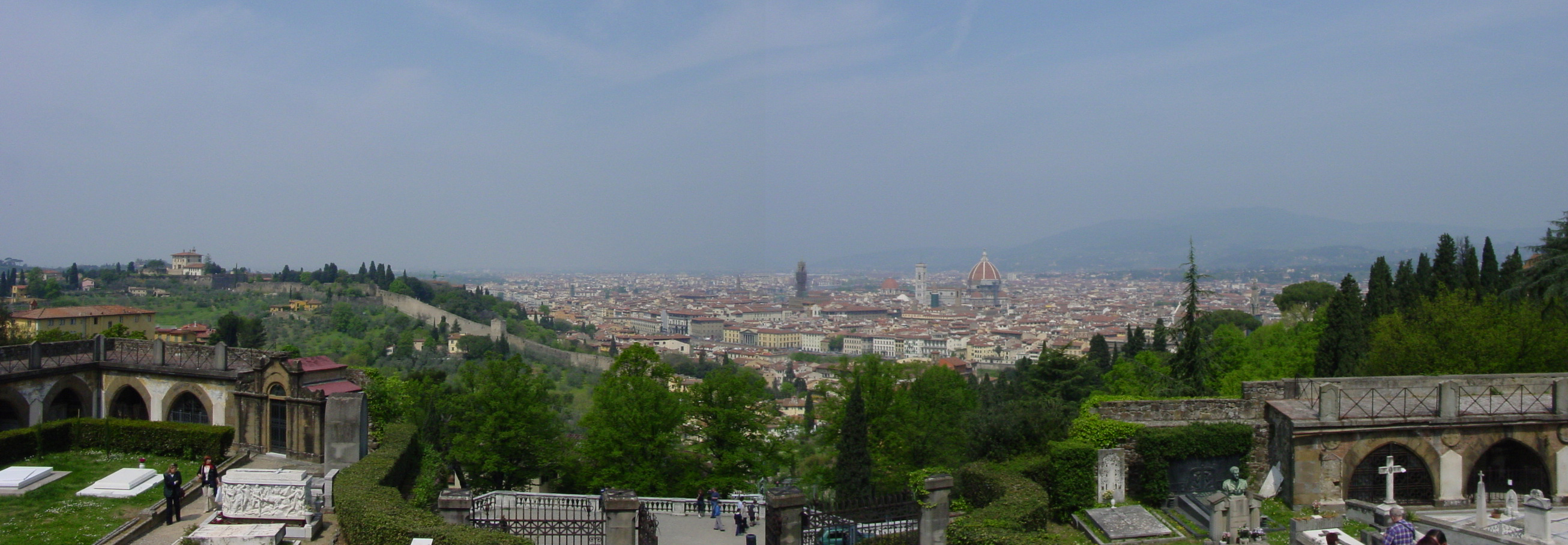
Florence, viewed from San Miniato al Monte
A Taste of Firenze
|
|
|
| Volodja, Mukund and Luisa in Florence | Headquarters of the Arte della Lana (Wool Guild), Florence (14th century) | River Arno, viewed from Ponte Vecchio |
Chiesas of Florence
|
|
|
| Chiesa di San Miniato al Monte, facade, Florence, example of Tuscan Romanesque and 13th century mosaic. | Inside, Chiesa di San Miniato, frescos from 13th-15th centuries, Florence. | Chiesa di Santa Maria Novella, Florence, built by Dominicans between 1246 and 1357. The fašade, shown here was remodeled between 1456 and 1470. |
Piazza della Signoria, Florence
|
|
|
|
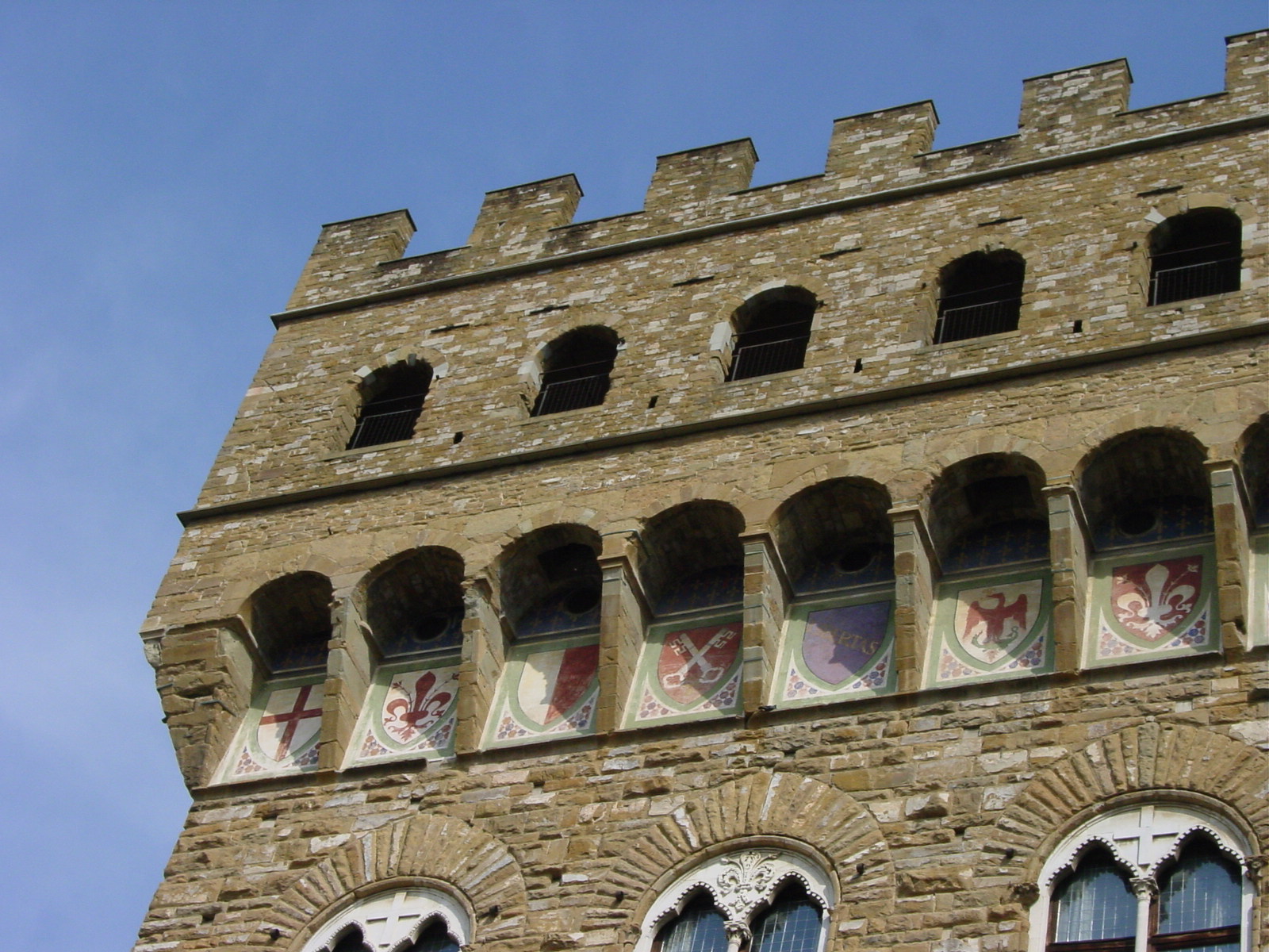
| View of Piazza della Signoria from Piazza degli Uffizi (Uffizi Gallery), Florence. | Piazza della Signoria, Florence. | Another view of Piazza della Signoria, Florence, showing Ammannati's Fountain of Neptune, sculpted between 1563-1575, next to Palazzo Vecchio. | Piazza della Signoria, detail of Palazzo Vecchio showing the arms of the different regions of Italy. I was able to recognize Genoa (red cross on white) and Florence (red fleur-di-lies on white). |
Il Duomo and Baptistry, Florence
|
|
|
|
| The Cathedral dedicated to Santa Maria del Fiore, Florence. (photo by Mukund) | Detail, Il Duomo, Florence, fašade, made of Carrara white, Prato green, and Maremma pink marble. | Statues of Mary and Apostles above main doors to the Cathedral, Florence. | Detail above left door, Cathedral, Florence. |
|
|
|
|
| Duomo, viewed to see Belfry. | Above the three portals are statues of the 12 Apostles and Mary. | Il Duomo, inside dome, designed by Brunelleschi, built between 1420-1434 left bare, "Last Judgment" frescos added by Vasri and Zuccari between 1572-1579. Right photo by Mukund. | |
|
|
|
|
| 11-13th century octagonal (unlike Pisa) Baptistry in Florence. | Eastern doors of the Baptistry, showing "Gates of Paradise" by Lorenzo Ghiberti in 1425. | Detail on "Gates of Paradise" on Baptistry east doors, Florence. The episode of Moses receiving the Ten Commandments on Mount Sinai. (Photo by Mukund) | |
26 April 2003 (Day 9)
Geography: Arenzano, Italy -> Monte Blanc Tunnel, Italy/France -> swing by Geneva (stay in France) -> Dijon, France -> Rheims, France
Mileage: 558 miles (898 km)
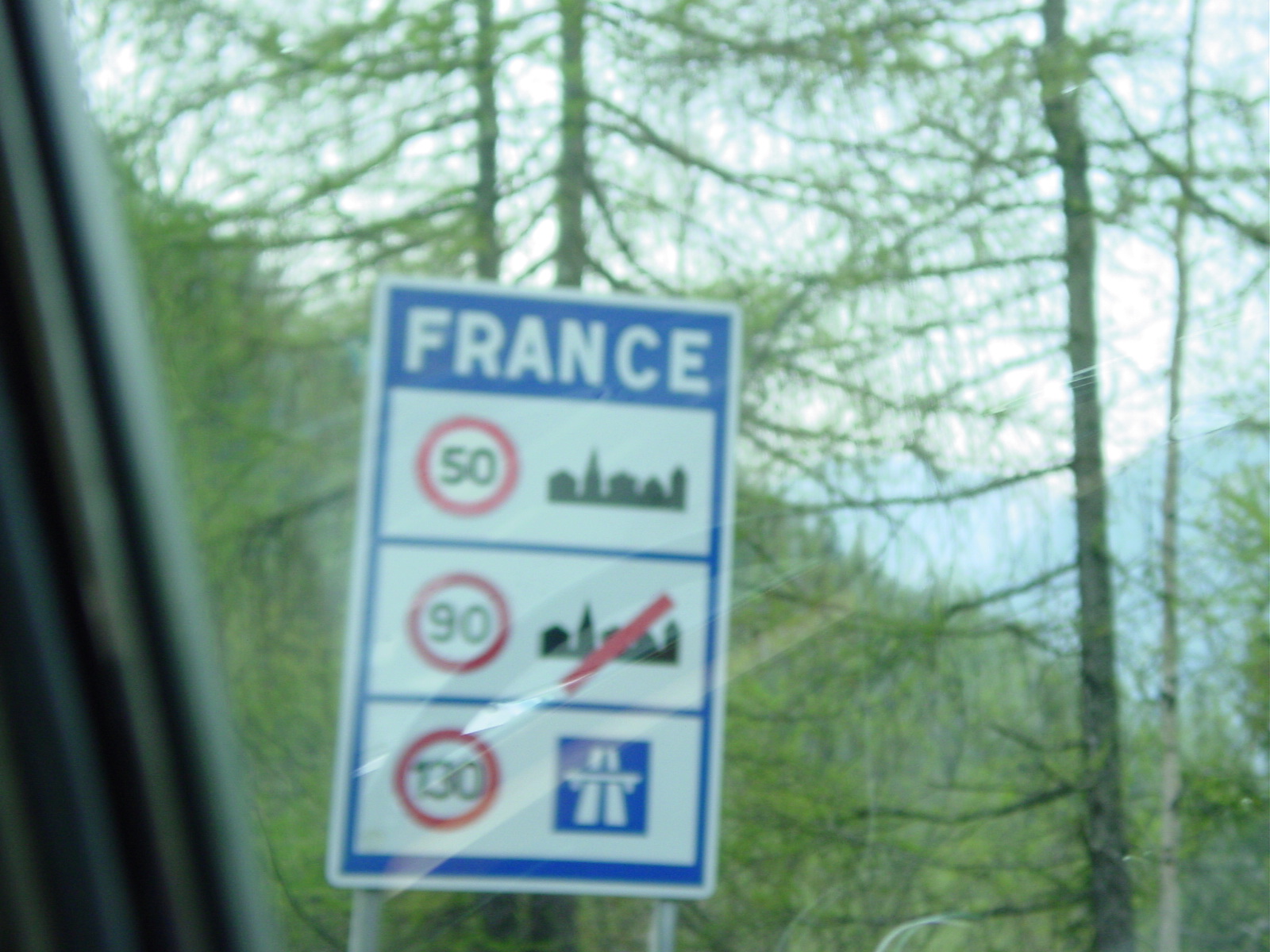
Adieu to Italy, but not goodbye. After giving our regards to Luisa and her family, Mukund, Volodja and I set off for the quick route back to England via France. The bad weather had finally caught up with us, as this day was spent driving in the rain. We crossed into France via the Mont Blanc tunnel, slightly shorter than St Gotthardĺs Tunnel, after saying adieu to the snow-capped Alps once again. We passed through Champagne country, but alas, after dark. We ended our day in Rheims.
27 April 2003 (Day 10)
Geography: Rheims -> Calais, France -> Ferry to Dover, UK -> Wanstead, London, UK
Mileage: 258 miles (415 km) plus ferry crossing distance (approximately 25 miles (40 km))
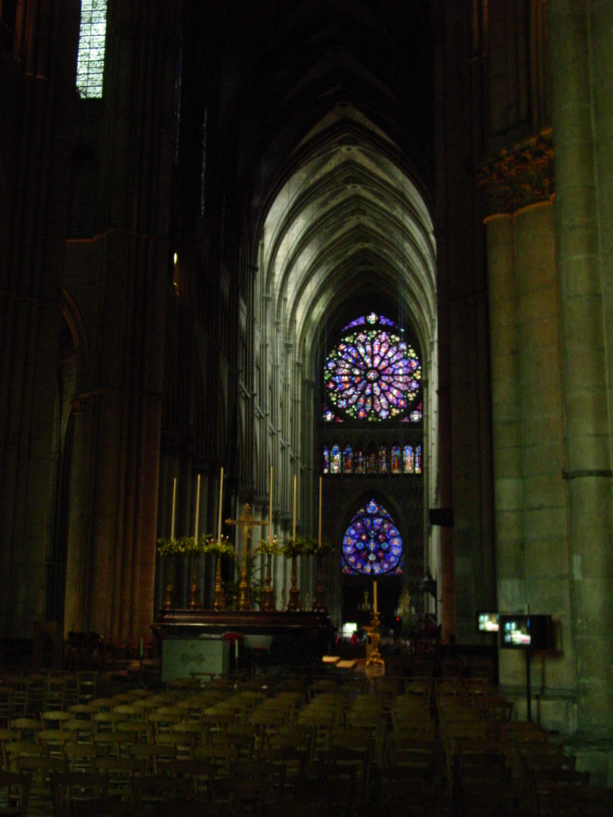
Before returning to drive the final leg of our journey, Mukund, Volodja and I ventured downtown Rheims to view the Gothic 13th century-style Cathedral of "Our Lady of Rheims." What a stark difference between this tall and dark cathedral to the ones in Romanesque style in Italy.
Rheims, France at a Glance
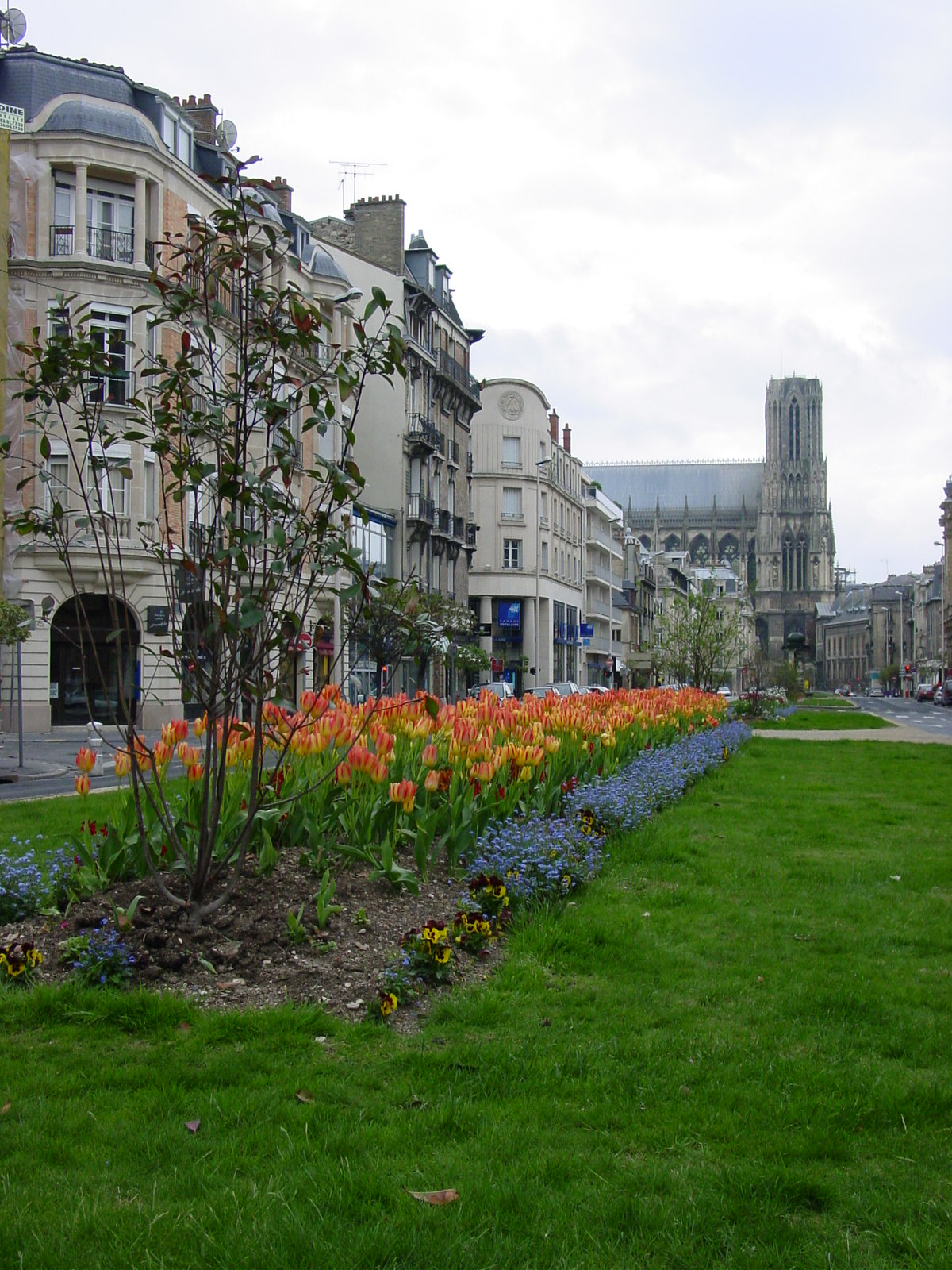
|
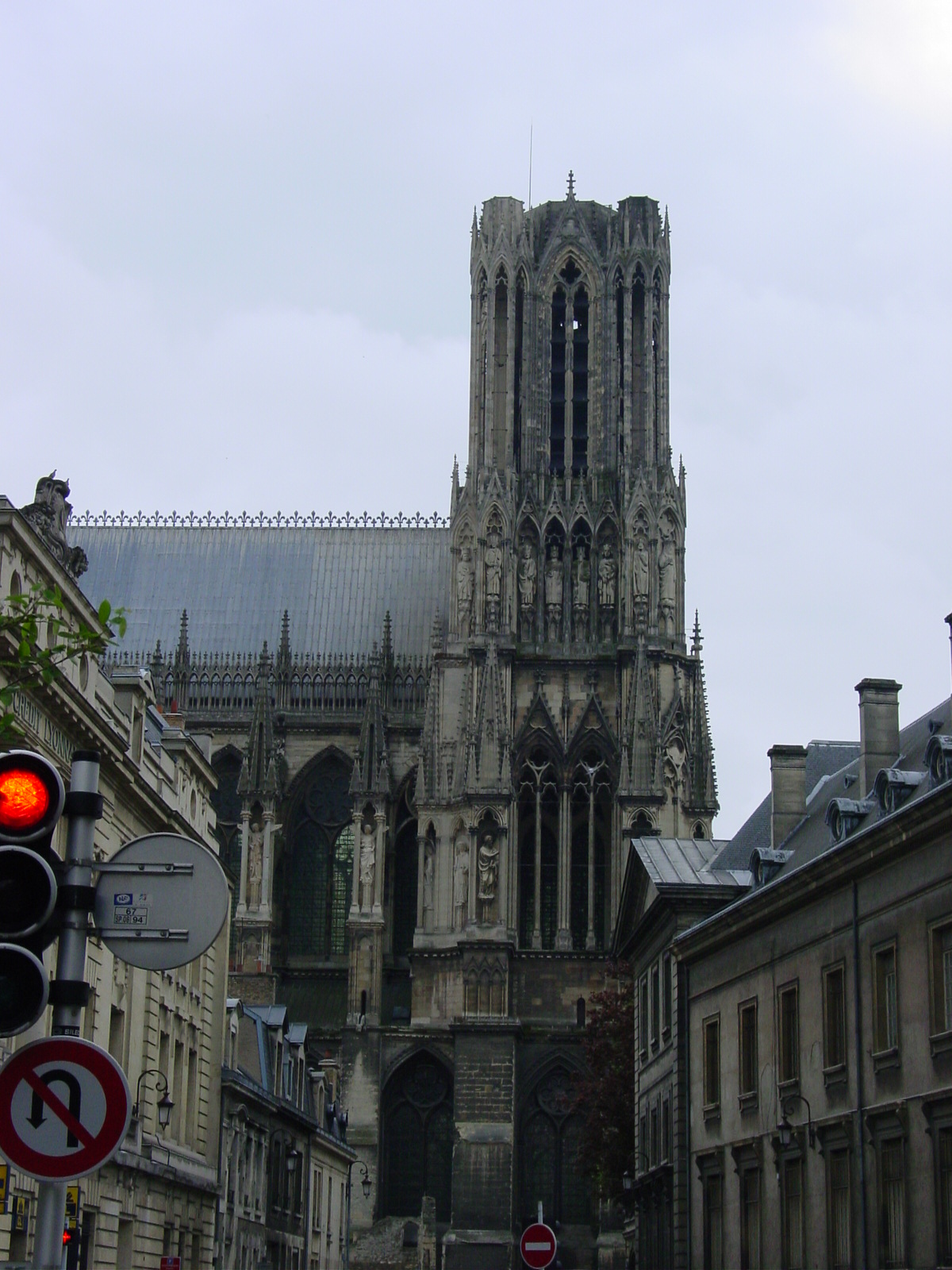
|
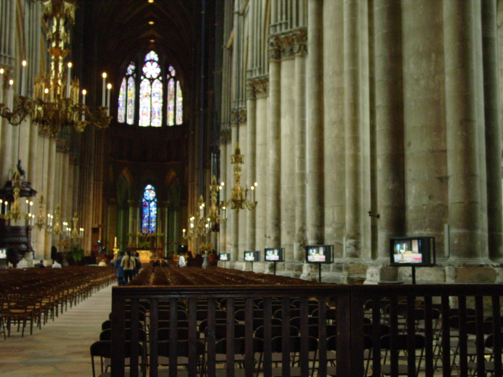
|
|
| Flowers along the Promenade, Rheims, France, with the Cathedral in the distance. | Our Lady of Rheims | I could not resist. Televisions in a Catholic Church? Well, no one can complain of not getting a view. | Wonderful tall sky-reaching Gothic arches, Cathedral Rheims. |
As we crossed back to England at Dover, the passport control chap got a big smile at our Bentley and the three of us, and decided to let me back into the country. My passport is stamped Heathrow and Dover on April 16 and 27, 2003, respectively. So I entered Britain twice, but somehow I never left! And my friends do attest, I have left part of my heart in Cambridge, UK. Is the other part in San Francisco? Only time will tell...
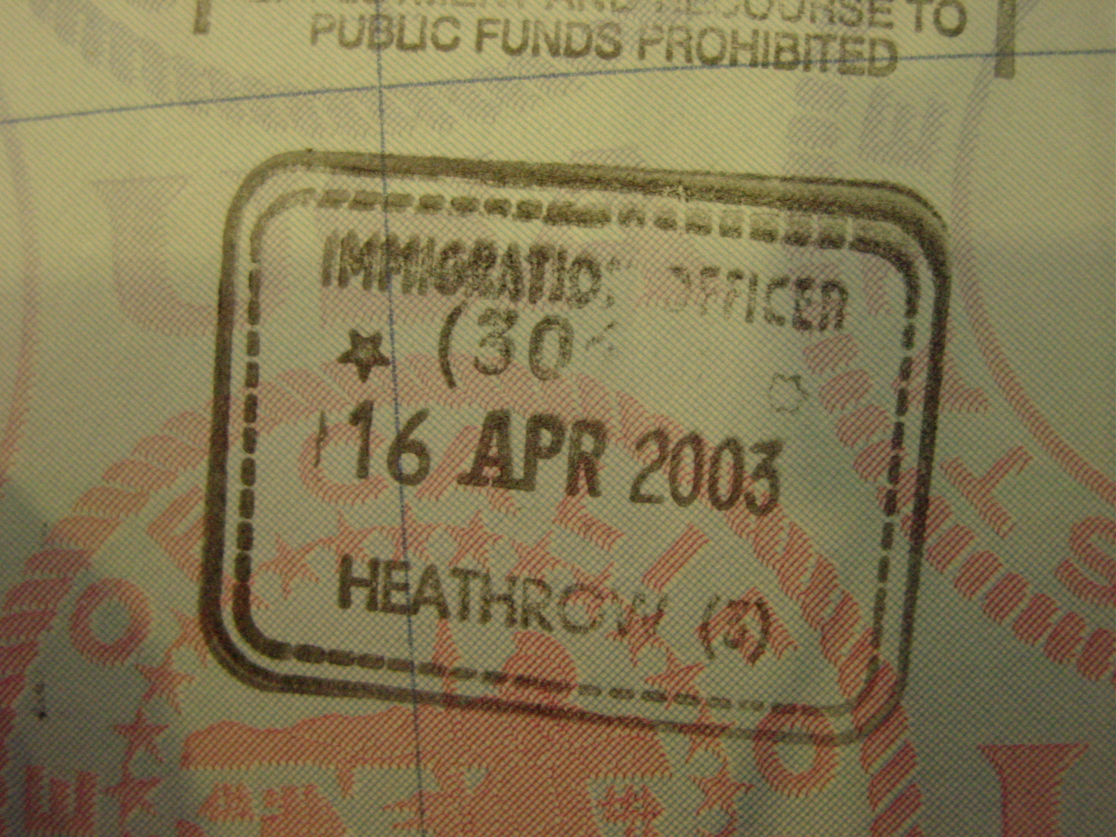
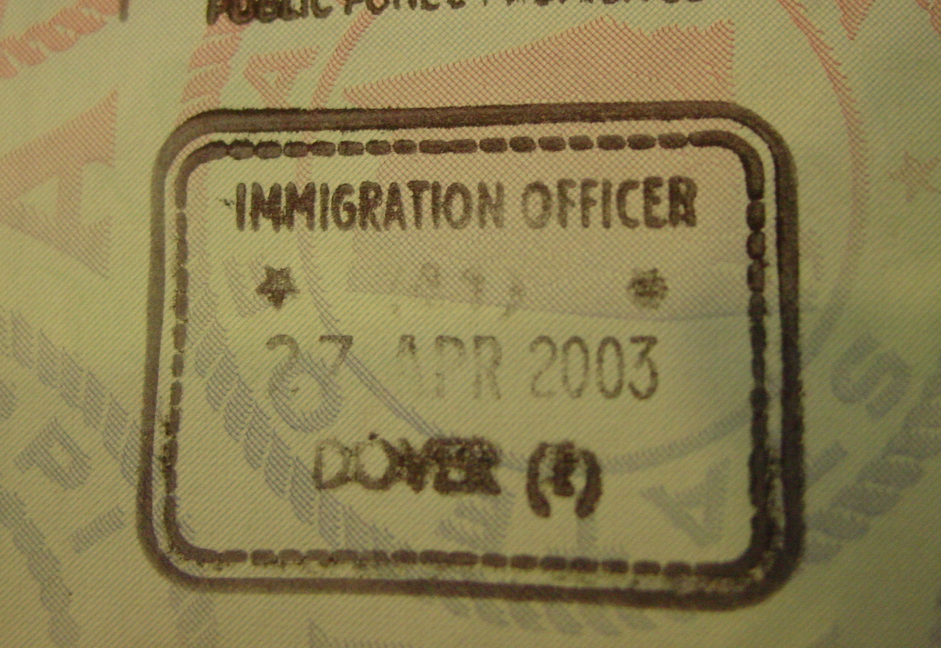
Kimĺs passport is full of foolery! I re-entered Britain via Dover, an unusual place to enter, without acknowledgment of exit.
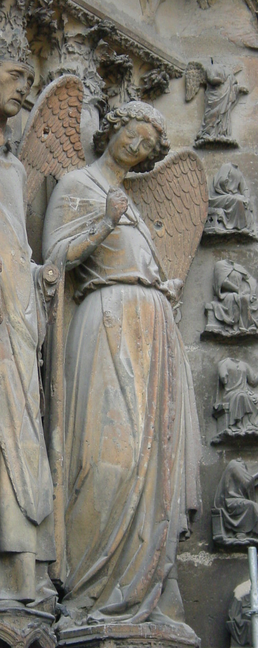
A smile of goodbye from the angel outside the Cathedral at Rheims
The End of the Trip, Or Rather, the Beginning, to be clichÚ...
After dropping off Mukund at Stratford to catch a coach back to Cambridge, I returned to Wanstead to go over the journey, recalibrate my thoughts, and then traveled onto Cambridge the next day to relax and reflect on the wonderful and different types of language, food, transport, architecture, art, style, lifestyle, that I had witnessed in six diversely rich countries. I certainly got my "taste" of Europe, and I certainly do intend to return.
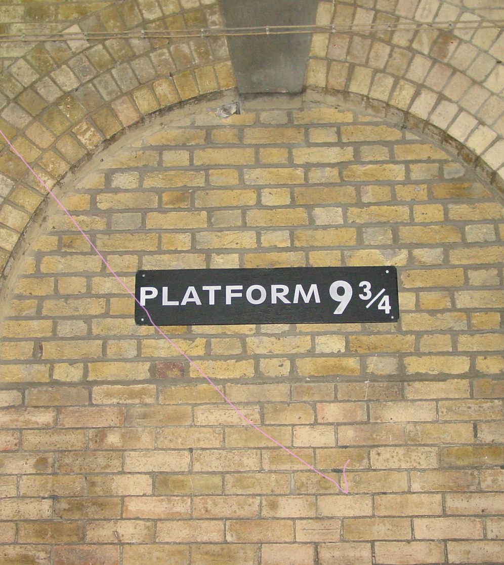
And then... I vanished (back to Califonia), Potter-esque! (photo by me from Kings Cross Station, London) The Brits have a lovely sense of humour...
Photos by Kimberly Ennico, unless noted.