Category Archives: Travel

Trying to break into the Weddell Sea, sadly, no luck

dsc03057_1

63d 36m 25.6s S, 56d 45m 08.5s W (WP092)

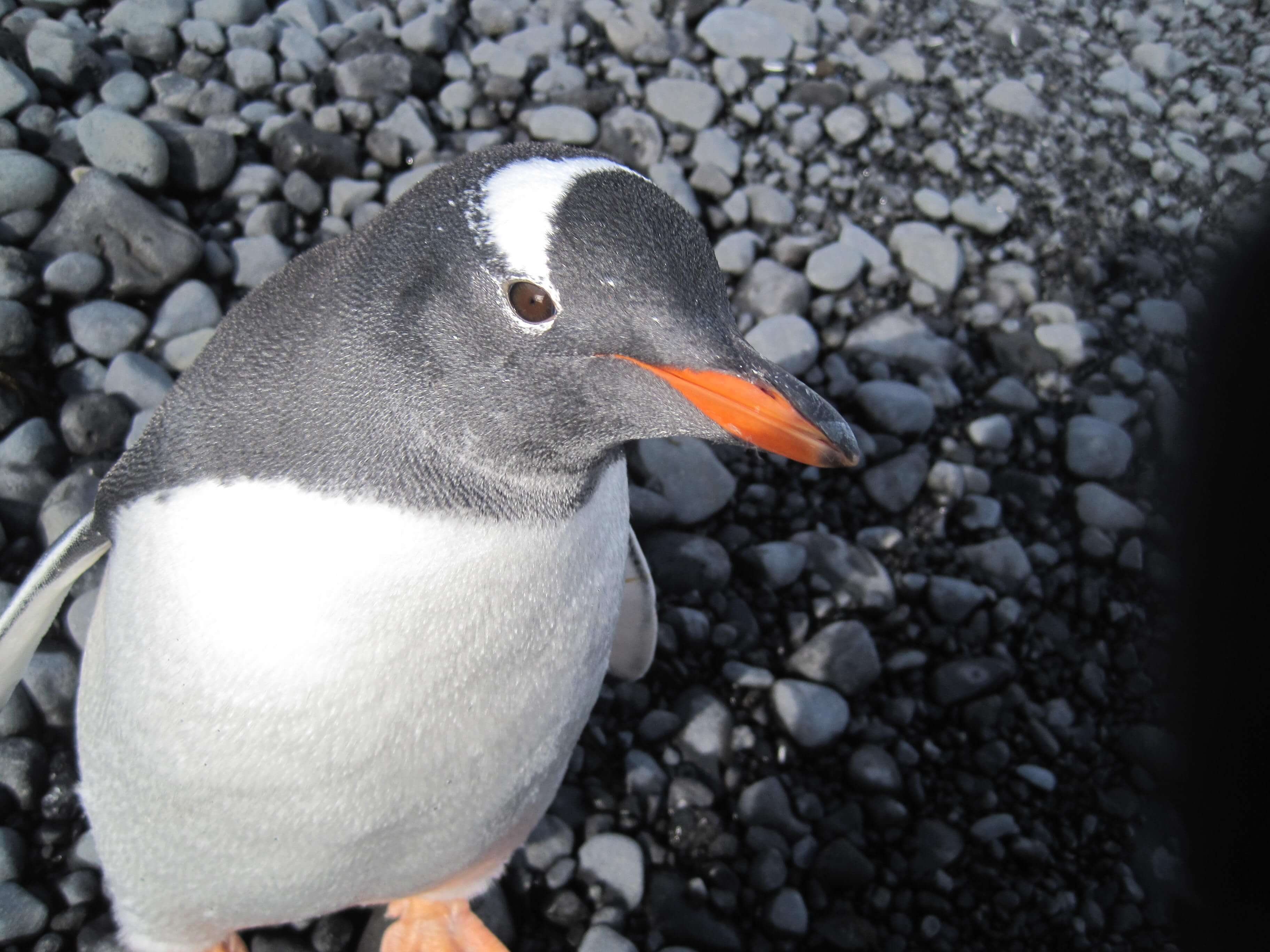
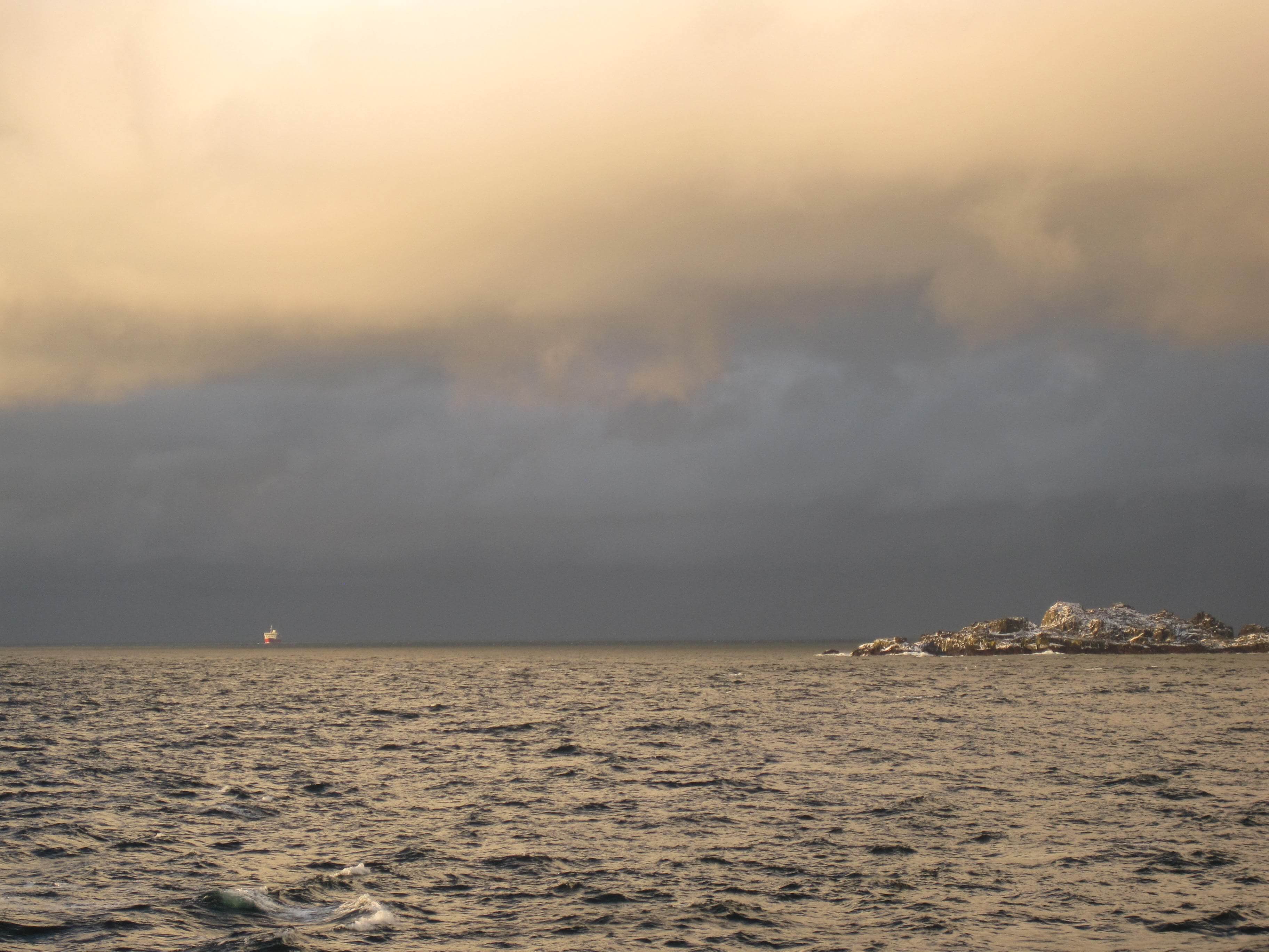
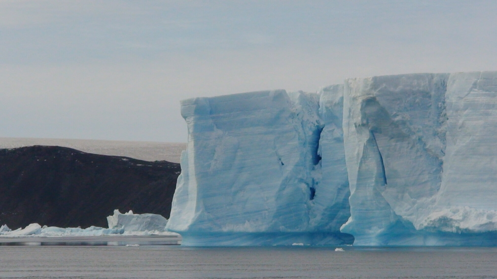
At this point in the journey, it was clear a course change last night prevented us from reaching Elephant Island. I was disappointed. With the change in weather, it was hoped we were going to reach Devil’s Island in the Weddell  Sea, but the pack ice had come in and prevented passage. So in consolation, we did a tour of the local bay where I got a glimpse of “sea ice” which forms only when the salt water freezes, a much lower point than the typical icebergs, which are frozen fresh water from glaciers on the continent. We had some neat “tabular icebergs” (100s of meters in length) that were on their own journey to the sea. It was fun to see a leopard seal and crab-eater seals sitting atop these tabular icebergs, another part of their lifecycle when the ice is their home.

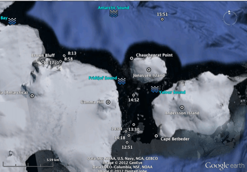
After a tour, the Polar Pioneer tried to sail between Tabarin and Anderson Island but had trouble with the ice. Tried a third time to get to Paulet Island via the Erebus and Terror Gulf, but got turned back. A final course correction to bring us east was made by dinner time and I had to say goodbye to the Weddell Sea. Another thing I had just gotten a glimpse of, but was held back.

feb20_zoomam
Waypoints of the Brown Bluff & Weddell Sea activities
(time stamps shown for local time UTC-3hrs)

Brown Bluff, Gentoo Penguins, Fur Seals, Snow Petrels

img_0587_1

63d 31m 16.9s S, 56d 52m 57.4s W (WP087)

Donned in our wellies, we embarked on our first landing on the Antarctic Peninsula, a place called Brown Bluff, due to an outcropping of exposed granite with a brown hue. It’s the home of two types of penguins, the Gentoo (easily spotted by their distinct white patch behind the eye and red-orange beak & feet) and Adelie (my favourite by far, with their full black heads and blue ringed eyes). There was apparently a lone Chinstrap penguin but I did not see him.

We all got instruction on how to interact with the wildlife and to always make sure we don’t place ourselves between the animals and the sea, which is their home & safety. Keeping a safe distance from the curious Gentoos did not last long when they started to come up to us and peck at our boots & bags and exchange the same curiosity as us. We spent some time just observing a variety of “penguin behaviour” be it feeding chicks, to sunbathing, to swimming, to climbing snow-packed hills, to tummy-sliding, to stealing rocks from other penguins, to chasing someone else’s hungry chick. Seals on the beach, mainly fur seals, added to the dynamics with their grunts and slanted looks for us apparently disturbing their sleep. A snow petrel chick was ensconced away under the rocks.

The 360 degree scenery with snow capped granite peaks, black volcanic beach, and chunks of ice in the surrounding sea, really was amazing.

Land Spotted in South Atlantic Ocean (South Shetland Islands)

img_0544_1

62d 01m 52.9s S, 60d 03m 21.6s W

About 9 nautical miles to the south, we spotted land! It was not Antarctica, but rather the South Shetland Islands, which in themselves have amazing variety. I enjoyed being up on deck sketching the shapes as they emerged out of the mist. We had been racing a storm which provided some amazing scenery at sunset.

Our trajectory was down the English Strait between Roberts and Greenwich Islands. We had some snow fall on the ship as we headed into the Bransfield Strait towards sunset. Another day at sea, but landfall tomorrow (Feb 20) was promised.

Departing the Beagle Channel

dsc03022_1

54d 55m 55.1s S, 67d 08m 29.2s W (WP081)

Sailing due East out through the Beagle Channel, our journey to the South Atlantic Ocean and the Antarctic Ocean began. A local pilot, based in Ushuaia, steers the boats that depart from or return to Ushuaia, so the first five hours of our trip were at the helm of such a man. The Polar Pioneer traveled an average of 12 knots during this leg. The goings were calm, the scenery was magnificent with Argentina to our North & East and Chile to our South & West, and Magellanic Penguins could be seen swimming in the strait with Cormorants flying in low formation.

Tierra del Fuego

img_0488_1

54d 51m 18.9s S, 68d 34m 34.8s W (WP074)

The second half of our trip would bring us to the Land of Fire, Tierra del Fuego, named as such by the 18th/19th c European explorers who stumbled up on the native peoples (Yaghan/Yamana & Selk’nam) who consistently kept their fires alight (even in their canoes) for warmth in such a chilly climate. Ushuaia would be our port of departure for the Antarctic Peninsula, and is the southern most city in South America. Only Port Williams (Chile) can boast as being the southern most town in South America.

We enjoyed our sojourn to the Tierra del Fuego National Park where the Nothofagus forest (niru & lenga) really captured my attention and love. Apparently this type of forest is restricted to the southern most parts of Chile & Argentina, Tasmania and South Africa, where it has a common ancestor when those lands were part of Gondwana and the later Pangaea supercontinent. With shallow roots, long lifetimes, and dry climates, the forest had incredible amounts of decaying wood, which we were later learning was essentially for providing nutrients to the living trees. Two types of fungus were rampant, one on the trunks and one more like the mistletoe variety perched between branches. Both had been commented on by Charles Darwin which he visited these parts on the HMS Beagle’s 2nd voyage (command by Captain FitzRoy) from December 1832 to summer of 1833.